The 8 Most Amazing Peaks in La Paz
Best mountain peaks in La Paz are found within the Cordillera Real, a segment of the Andes Mountains that encircles the city. This region is characterized by its high-altitude, snow-capped peaks and diverse terrain. Many of these mountains hold cultural significance, revered as protective spirits by local communities. The landscape offers a range of experiences, from panoramic viewpoints to challenging high-altitude climbs.
Best mountain peaks in La Paz
- The most popular mountain peaks is Pico Austria Summit, a summit that offers panoramic views of the Cordillera Real, including Condoriri, Huayna Potosí, and turquoise blue lagoons. The climb is technically easy, but acclimatization is recommended due to the high altitude.
- Another must-see spot is Cerro Calvario, a viewpoint with beautiful views down to Copacabana and Lake Titicaca. The climb is strenuous but offers rewarding vistas, especially at sunset.
- Visitors also love Huayna Potosí (6,088 m), a prominent, glaciated mountain peak with a height of 6088 m in the Cordillera Real. The views from the summit are extensive, potentially including Lake Titicaca, the city of La Paz, and other significant summits like Illimani.
- La Paz is known for its diverse mountain peaks, including high-altitude summits, scenic viewpoints, and challenging climbs. Visitors can explore a variety of natural monuments and mountain passes across the region.
- The mountain peaks in La Paz are appreciated by the komoot community, with 8 highlights and 31 photos shared by users.
Last updated: July 6, 2026
Pico Austria Summit
Highlight • Summit
Translated by Google •
Tip by

Cerro Calvario
Highlight • Viewpoint
Translated by Google •
Tip by

Sign up now to discover places like this
Get recommendations on the best single tracks, peaks, & plenty of other exciting outdoor places.
Sign up for free
Huayna Potosí (6,088 m)
Highlight • Summit
Not surprisingly, on the mountain 20 bolivianos (about 4 euros) are raised at a checkpoint.
Translated by Google •
Tip by

Paso Chacoti (5150 m)
Highlight • Mountain Pass
Translated by Google •
Tip by
Cerro Palla Khasa Summit
Highlight • Summit
Translated by Google •
Tip by

Cerro Tikani
Highlight • Summit
Translated by Google •
Tip by

Penitentes Field on Huayna Potosí Glacier
Highlight • Natural Monument
Translated by Google •
Tip by
View of Copacabana and Lake Titicaca from Cerro San Sebastián
Highlight • Viewpoint
Translated by Google •
Tip by
Start today with a free account
Your next adventure awaits.
Login or Signup

Other adventures in La Paz

Tips from the Community

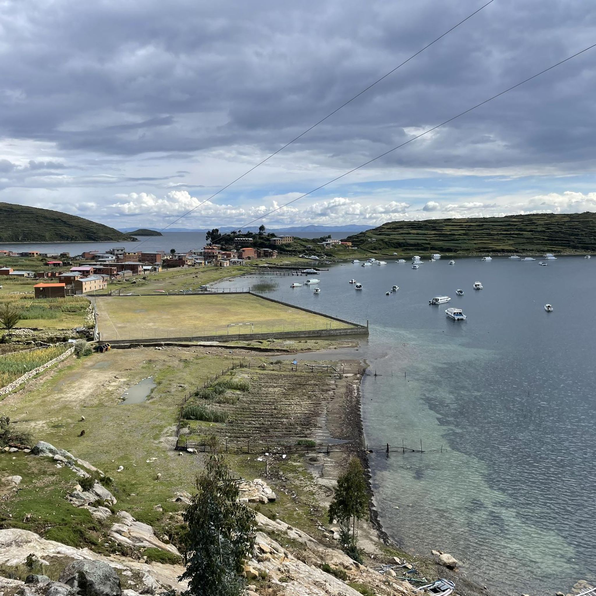
Cerro Tikani, at 3,936 meters, is the highest point in the northern part of the island. The climb is somewhat challenging due to the altitude, but the view from up here is impressive.
1
0
The Way of the Cross was built on this hill in the 1950s when the government decided that Copacabana should have more to offer its thousands of pilgrims than just the Basilica of the Virgin Mary.
2
0

On the way to the summit of Huayna Potosí there is a field of penitential rice on the glacier at this point. As a rule, you can easily pass it on a well-trodden path without having direct contact with it. It looks very nice.
1
0
The 5327 m high Pico Austria is a beautiful panoramic peak in the Cordillera Real. From there, if the weather is clear, you can visit Condoriri and its wings and glaciers, Huayna Potosí and some turquoise blue lagoons. The climb is technically easy, but you should definitely acclimatise in advance as the height should not be underestimated. You have to pay 20 Bs for entry to the national park (as of 10/2023), which will be collected in the park by local rangers.
2
0
The pass, at an altitude of 5152 m, lies between the Carro Jallayco and the Pico Austria. Paths lead here from the south from the Laguna Chiar Khota and from the north-west from the Juri Khota lagoon. The further climb to Pico Austria runs towards the south-west.
2
0
The 4194 m high Cerro San Sebastián is located in the southeast of the small Bolivian seaside town of Copacabana and can be easily seen from the city through the antennas set up. From here you have a great view over the city, Lake Titicaca and the surrounding area. The climb is not technically demanding; it is so developed that you can easily drive up in an off-road vehicle. However, if you are not well acclimatized, you should still take it a little slower due to the altitude. Sun protection is also strongly recommended, as there is hardly any shade due to the lack of vegetation.
2
0
Very impressive mountain at just over 6000 m in the Cordiella Real. The climb is largely uncomplicated, but should not be underestimated because of the altitude. The view over the mountain range is stunning. It is advisable to set off very early, as the mountain is very well known as the closest 6000m peak to La Paz. On the descent you can take in the impressive glacier landscape a little more and take more time for it. The 20 Bolivianos fee was not collected from us and I did not see a checkpoint on the mountain (as of 10/2023)
2
0

One of the most magical and challenging places to climb in Bolivia
0
0
Frequently Asked Questions
Which mountain peaks near La Paz are suitable for beginners or offer easier climbs?
For those seeking a high-altitude experience without extreme technical demands, Mururata (5,871 m) is a good option, generally considered less technically difficult than its neighbors. Huayna Potosí (6,088 m) is also often cited as one of the most accessible 6,000-meter peaks globally, though it still requires good physical fitness and acclimatization. Additionally, the climb to Pico Austria Summit (5,327 m) is technically easy, offering stunning panoramic views.
What are some of the most challenging mountain peaks to climb in the La Paz region?
The La Paz region offers several challenging climbs for experienced mountaineers. Illimani (6,438 m), the highest in the Cordillera Real, presents a technically demanding ascent with glacier travel and high-altitude exposure. Ancohuma (6,427 m) is another significant challenge, requiring good fitness and mountain experience. The Condoriri Massif, particularly its highest point Cabeza del Condor (5,648 m), offers technical climbing with steep ice corridors.
Which mountain peaks offer the best panoramic views in the La Paz area?
Many peaks provide breathtaking views. From Pico Austria Summit, you can see the Condoriri range, Huayna Potosí, and turquoise lagoons. Cerro Calvario offers beautiful vistas down to Copacabana and Lake Titicaca, especially at sunset. The summit of Huayna Potosí (6,088 m) provides extensive views that can include Lake Titicaca, the city of La Paz, and other significant summits like Illimani.
Do any mountain peaks in the La Paz region have cultural or historical significance?
Yes, several peaks hold deep cultural significance. Illimani (6,438 m) is an iconic symbol of La Paz, revered as an "Apu" or protective spirit by the Aymara people. Mururata (5,871 m) is also steeped in local folklore, with legends explaining its distinctive flat top.
What kind of hiking trails can I find around the mountain peaks in La Paz?
The region offers a variety of hiking experiences. You can find trails leading to panoramic viewpoints like Pico Austria Summit, which is a popular day hike. For more extensive treks, the Condoriri Massif region is renowned for its diverse terrain and opportunities for multi-day excursions. Many routes involve high-altitude trekking through stunning Andean landscapes, often with base camps near glacial lagoons.
What outdoor activities are available near the mountain peaks in La Paz?
Beyond climbing and trekking, the La Paz region offers various outdoor activities. You can find numerous mountain hikes, including challenging loops around Huayna Potosí (6,088 m) and Pico Austria Summit. There are also running trails, such as the Chincana Ruins loop on Isla del Sol, and road cycling routes that explore the scenic landscapes around La Paz.
Is there an entry fee for accessing mountain areas or national parks near La Paz?
Yes, some areas require an entry fee. For instance, when visiting the area around Pico Austria Summit, you might need to pay an entry fee to the national park, which is typically collected by local rangers. Similarly, a fee may be collected at checkpoints for popular climbing destinations like Huayna Potosí (6,088 m).
What is the best time of year to climb or hike the mountain peaks near La Paz?
The dry season, typically from May to September, is generally considered the best time for climbing and hiking in the Cordillera Real. During these months, the weather is more stable with clearer skies and less precipitation, offering better visibility and safer conditions for high-altitude activities. However, temperatures can still be very cold, especially at higher elevations.
What unique natural features can be observed on the mountain peaks in La Paz?
The Cordillera Real is home to stunning natural features. You can witness massive, snow-capped massifs like Illimani, extensive glaciers with impressive crevasses and icicles, such as the Penitentes Field on Huayna Potosí Glacier, and numerous turquoise glacial lagoons. The region also offers diverse terrain, from mixed ice and rock gullies to knife-edge ridges.
Are there any family-friendly mountain activities or viewpoints near La Paz?
While many peaks involve high altitudes and challenging conditions, some viewpoints offer more accessible experiences. Cerro Calvario, though a strenuous climb, provides rewarding views over Copacabana and Lake Titicaca. For a less demanding experience, exploring the lower sections of valleys leading to the major peaks can offer scenic walks and opportunities to enjoy the Andean landscape.
What do visitors enjoy most about the mountain peaks in La Paz?
Visitors frequently praise the stunning panoramic views, especially from summits like Pico Austria Summit and Huayna Potosí (6,088 m), which can extend to Lake Titicaca and the Amazon Basin. The impressive glacial landscapes, the sense of accomplishment from high-altitude climbs, and the cultural significance of peaks like Illimani also contribute to a memorable experience. The sheer beauty and grandeur of the Cordillera Real are consistently highlighted.
How does the difficulty of climbing Illimani compare to Huayna Potosí?
Illimani (6,438 m) is generally considered significantly more technically demanding than Huayna Potosí (6,088 m). While Huayna Potosí is often called one of the most accessible 6,000-meter peaks, Illimani requires more advanced mountaineering skills, including extensive glacier travel and navigating more complex terrain. Both require excellent physical fitness and proper acclimatization due to their high altitudes.
Most popular attractions in La Paz

Get inspired with the komoot mobile app


