The best running trails in Joseph D. Grant County Park
4.3
(3)
194
runners
17
runs
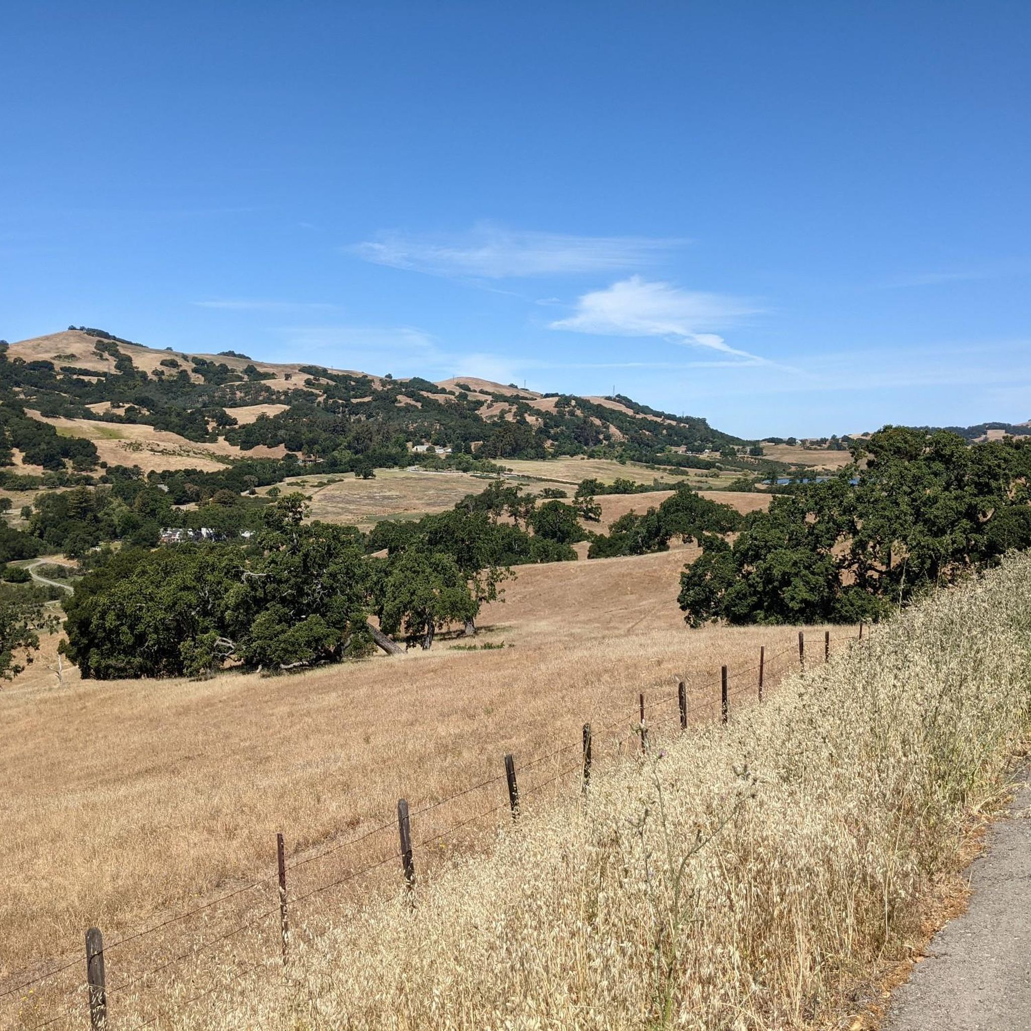
Jogging in Joseph D. Grant County Park offers access to an extensive trail system across 10,882 acres in the east foothills of the Santa Clara Valley. The terrain features expansive grasslands, majestic oak trees, and rolling hills, with elevations ranging from gentle slopes to significant climbs. Joggers can explore diverse landscapes, including dirt roads and singletrack paths, alongside natural features like Grant Lake. The park's topography, shaped by the Calaveras Fault, provides varied running experiences.
Best jogging routes in Joseph D. Grant County Park
- The most popular jogging route is Canada de Pala and Halls Valley Loop, a 11.0 miles (17.7 km) trail that takes 2 hours 22 minutes to complete. This difficult route features significant elevation gain through varied park landscapes.
- Another top favourite among local runners is Yerba Buena, Canada de Pala, and Los Huecos Loop, a difficult 6.8 miles (11.0 km) path. This route traverses rolling hills and offers views of the park's natural features.
- Local runners also love the Canada de Pala and Bonhoff Loop Trail, a 5.0 miles (8.0 km) trail leading through expansive grasslands and oak woodlands, often completed in about 1 hour 2 minutes.
- Jogging in Joseph D. Grant County Park is defined by expansive grasslands, majestic oak trees, and rolling hills. The park's network offers options for different ability levels, from moderate loops to challenging routes with substantial elevation.
- The routes in Joseph D. Grant County Park are highly rated by the komoot community with an average score of 4.5 stars from a few reviews. More than 100 runners have used komoot to explore Joseph D. Grant County Park's varied terrain.
Last updated: July 7, 2026
5.0
(1)
7
runners
17.7km
02:23
530m
530m
Hard run. Very good fitness required. Mostly paved surfaces. Suitable for all skill levels.
3
runners
11.0km
01:32
400m
400m
Hard run. Very good fitness required. Mostly paved surfaces. Suitable for all skill levels.

Sign up for free
7.99km
01:02
270m
270m
Moderate run. Good fitness required. Mostly paved surfaces. Suitable for all skill levels.
12.0km
01:29
380m
380m
Hard run. Very good fitness required. Mostly paved surfaces. Suitable for all skill levels.
7.78km
00:55
160m
160m
Moderate run. Good fitness required. Mostly paved surfaces. Suitable for all skill levels.
Get access to more routes and recommendations from other explorers.
Sign up for free
Already have an account?
Our route recommendations are based on thousands of hikes, rides, and runs completed by other people on komoot.
Start today with a free account
Your next adventure awaits.
Login or Signup
Popular around Joseph D. Grant County Park
Tips from the Community

Manzanita Trail is a scenic trail with decently challenging hills to mix things up. The trail is hard packed dirt that is rough in some spots and can get muddy after it rains, but is pretty fast in the dry with some trail runners on.
0
0
Antler Peak, located in the Joseph D Grant County Park, stands at a max elevation of 2,999 feet. From the top, you can see the beautiful Santa Clara Valley and Mt. Hamilton vistas! There are wild boar and bobcats in the area, so keep your kids and/or animals close.
0
0
Grant Lake is a large body of water located in Joseph D. Grant County Park. This 10,882 acre park is home to a variety of topography, rich natural resources, and of course this stunning lake that adds to the overall beauty.
0
0

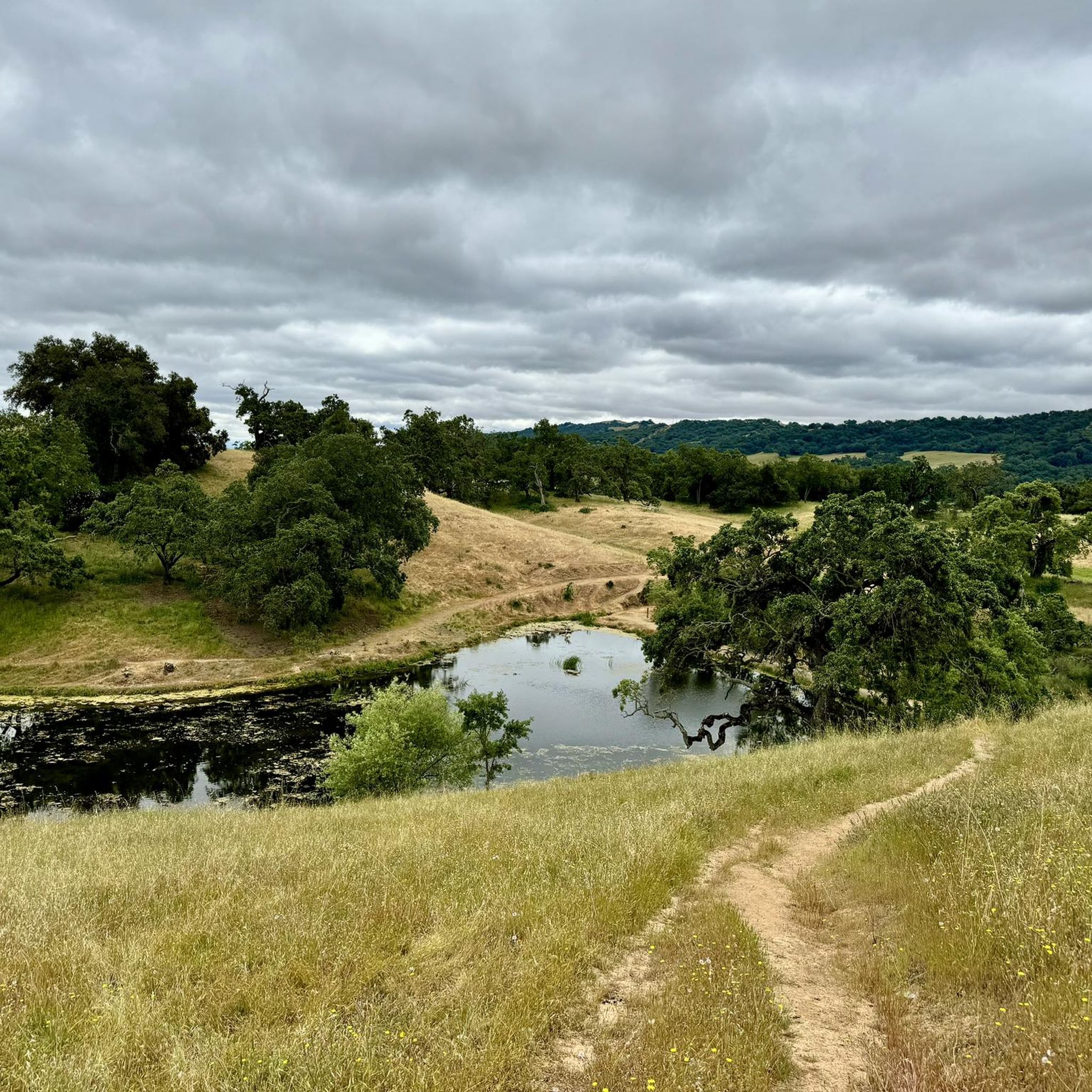
Hotel Trail is a wide dirt trail that eventually connects to the Foothill Trail. This is a really popular path for hikers, runners, and cyclists, so you can expect to see others while out on your hike. The trail spends a lot of time winding through open fields and even passes a small pond.
0
0
The Dutch Flats Trail at this point has stunning views of Silicon Valley and a nice bench to sit down and enjoy the sunset as the sun illuminates the adjacent mountain peaks.
0
0

Grant Lake is the biggest lake in the Joseph D. Grant County Park and is surrounded by rolling hills and lush landscapes. The lake offers a peaceful retreat for nature enthusiasts and is a great spot to go for a short (or longer) hike.
0
0

If you want to get close to the shores of Grant Lake take Bernal Trail. When you reach the end of Bernal Trail, make a pause and let the beauty of the lake sink in.
1
0

Frequently Asked Questions
How many running routes are available in Joseph D. Grant County Park?
Joseph D. Grant County Park offers a wide selection of running routes, with over a dozen documented tours on komoot. The park itself boasts an extensive network of 51 to 52 miles of trails, ensuring plenty of options for runners of all levels.
Are there easy jogging trails for beginners or casual runners?
Yes, Joseph D. Grant County Park has several easy jogging trails. Out of the routes listed on komoot, 7 are classified as easy, providing gentle slopes and less challenging terrain perfect for a relaxed run or for those new to trail running.
What kind of terrain can I expect on the running trails?
The park's terrain is quite diverse, ranging from mostly paved surfaces to challenging routes with significant elevation gains. You'll find dirt roads, singletrack paths, and wide dirt trails. The landscape features expansive grasslands, majestic oak trees, and rolling hills, with some trails offering over 1000 feet of elevation gain.
Are there any circular running routes in Joseph D. Grant County Park?
Yes, many of the running routes in Joseph D. Grant County Park are circular, allowing you to start and end at the same point. For example, the Canada de Pala and Bonhoff Loop Trail is a moderate 5-mile loop through grasslands and oak woodlands.
What natural features or landmarks can I see while running in the park?
Runners can enjoy a variety of natural features and landmarks. The park is home to McCreery Lake and other smaller ponds, surrounded by rolling hills and lush scenery. From vista points like Antler Peak, you can get panoramic views of Mount Hamilton, the Santa Clara Valley, and the wider Bay Area. The historic Grant Ranch House is also an attraction within the park.
Can I bring my dog on the running trails?
Joseph D. Grant County Park is generally dog-friendly, but it's always best to check the specific trail regulations before heading out. Dogs are typically allowed on leash on most trails, making it a great place to enjoy a run with your canine companion.
Are there challenging running routes for experienced runners?
Absolutely. For experienced runners seeking a challenge, the park offers several difficult routes with substantial elevation gains. An example is the Dairy, Dutch Flat and Brush Trail Loop, which covers nearly 12 kilometers with significant climbing, providing a demanding workout amidst scenic landscapes.
What kind of wildlife might I encounter on the trails?
Joseph D. Grant County Park is rich in wildlife. While running, you might spot deer, wild turkeys, bobcats, and even wild boar. The diverse habitats, including grasslands and oak woodlands, support a variety of species, making for an engaging natural experience.
Where can I park when visiting Joseph D. Grant County Park for a run?
The park provides ample parking facilities at various trailheads and access points. It's advisable to check the park's official website or specific route descriptions for the most convenient parking areas for your chosen running trail.
What do other runners say about jogging in Joseph D. Grant County Park?
The running routes in Joseph D. Grant County Park are highly rated by the komoot community, with an average score of 4.5 stars. Runners often praise the diverse terrain, the extensive trail network, and the beautiful natural scenery, including the expansive grasslands and majestic oak trees.
Are there any family-friendly running options in the park?
Yes, the park's extensive trail system includes options suitable for families. While some routes are challenging, the presence of easy and moderate trails means families can find suitable paths for a leisurely jog or walk. The park also offers amenities like shaded picnic areas.
Is there a route that offers scenic views of the Bay Area?
Many trails within Joseph D. Grant County Park provide stunning panoramic views. From higher elevations, such as Antler Peak, runners can enjoy expansive vistas of Mount Hamilton, the Santa Clara Valley, and the broader Bay Area, making for a rewarding running experience.
Most popular routes in Joseph D. Grant County Park
Most popular attractions in Joseph D. Grant County Park

Get inspired with the komoot mobile app


Explore more
Browse the best Running Trails & Routes in other regions.
