The best walks and hikes in Joseph D. Grant County Park
4.5
(33)
597
hikers
16
hikes
If you've ever tried planning a hiking trip to Joseph D. Grant County Park, you know how quickly the sheer number of trails can become overwhelming. With so many options, it's tough to figure out which routes are genuinely worth your time and effort, and which are just filler. That's where we come in. Our komoot community has explored, mapped, and reviewed these trails, and we've distilled all that local knowledge into a curated shortlist, saving you the guesswork.
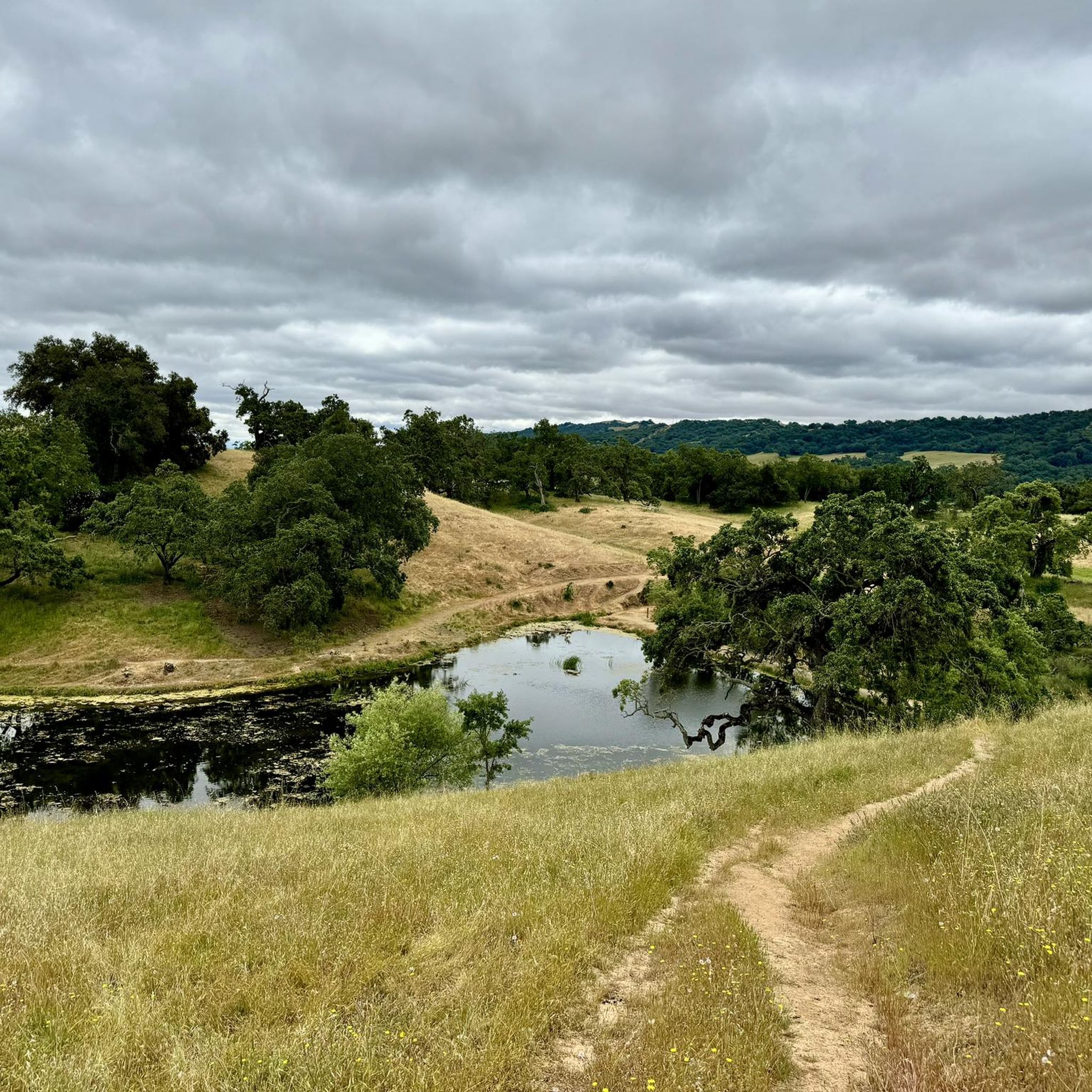
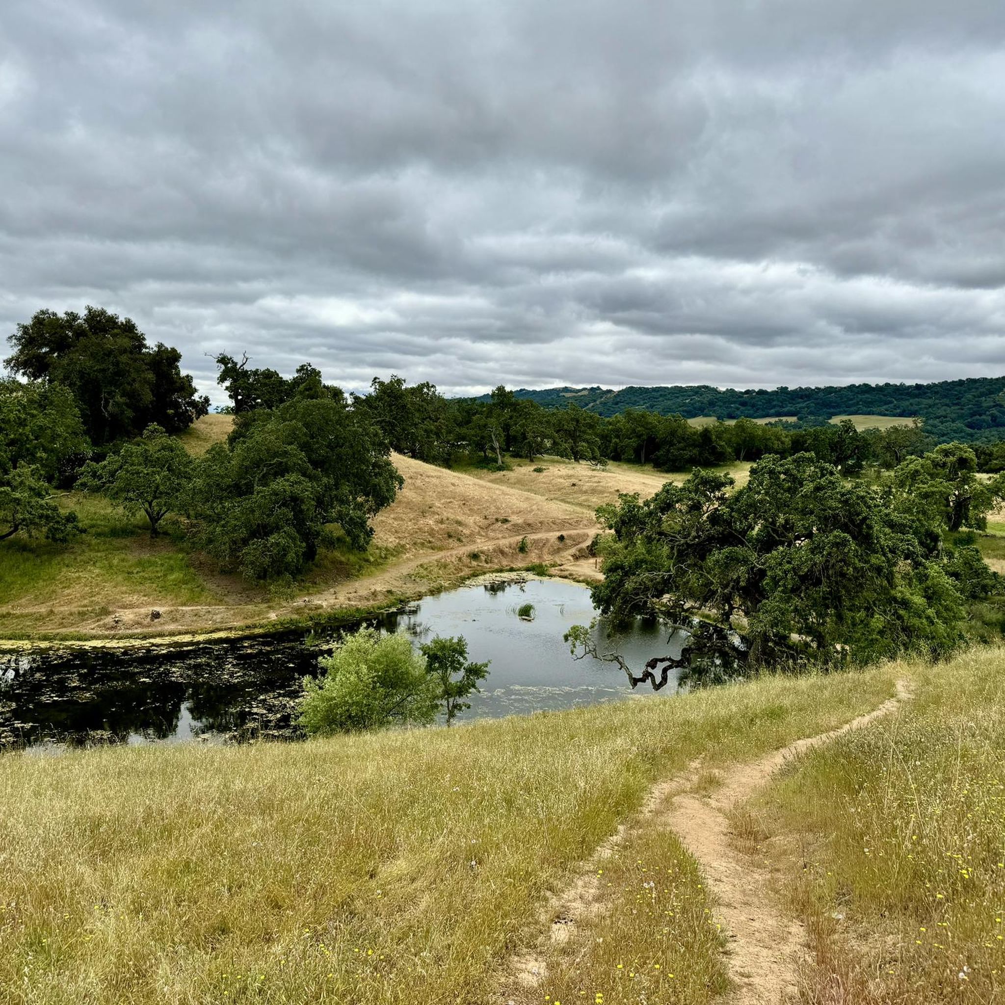
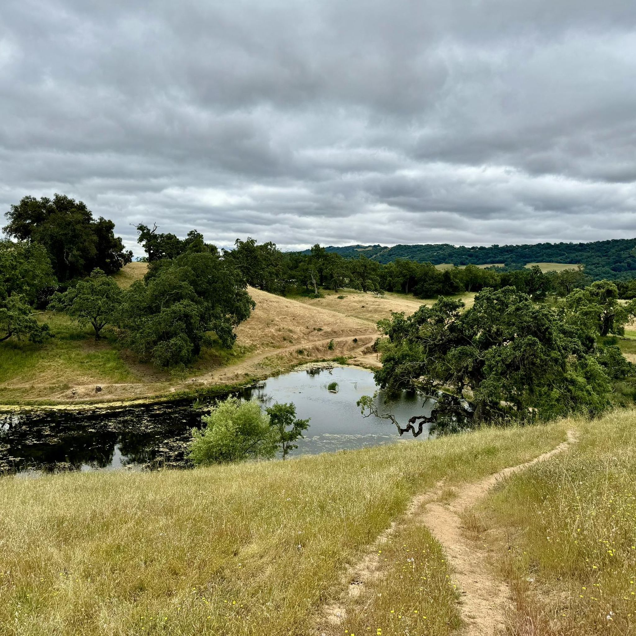
Hiking in Joseph D. Grant County Park truly feels like stepping into a classic California landscape. Expect rolling green hills, expansive grasslands, and majestic oak woodlands, all set against the backdrop of the Diablo Range. The terrain varies significantly, from gentle paths around lakes to sustained climbs that reward you with outstanding views across the Santa Clara Valley. With elevations ranging from 1,400 feet to over 2,985 feet, there's a route for every energy level, from easy strolls to demanding full-day adventures.
For a gentle introduction to the park's beauty, we'd start with the Grant and McCreery Lake Loop, an easy 2.0 miles (3.2 km) that's perfect for families or a relaxed afternoon. If you're ready for a more substantial challenge and want to earn those panoramic views, the Halls Valley to Washburn Loop is a fantastic moderate option at 8.8 miles (14.2 km) with a steady climb. With over 400 hikers having already used komoot to explore Joseph D. Grant County Park, you're in good company.
Last updated: May 10, 2026
5.0
(1)
8
hikers
14.2km
04:22
530m
530m
The Halls Valley to Washburn Loop in Joseph D. Grant County Park offers a diverse hiking experience, winding through oak-dotted grasslands, thin woods, and open meadows. You'll encounter wide fire road-width paths that transition into sustained climbs, leading to spectacular panoramic views of the Bay Area, including the Santa Cruz Mountains and the distant Monterey Peninsula. The route also passes by Grant Lake and ascends to Antler Point, providing a journey through varied and engaging terrain.
This moderate 8.8-mile (14.2 km) hike involves a significant 1733 feet (528 metres) of elevation gain, typically requiring about 4 hours and 22 minutes to complete. Parking is available at Joseph D. Grant County Park, but consider an early start, especially on weekends, to secure a spot. Be aware that sections can be muddy during the rainy season, so check current trail conditions before heading out. Carrying sufficient water is essential, particularly during warmer months.
Beyond the scenic views, the area is rich in wildlife, with sightings of deer, coyotes, and various bird species common. You might even spot grazing cattle or wild boar. This trail is a notable option for those seeking a substantial workout combined with expansive vistas, making it a popular choice among local hiking routes for its blend of challenge and natural beauty.
5
hikers
8.85km
02:32
200m
200m
The Dutch Flat and Dairy Trails offer a diverse hiking experience, transitioning from wooded ascents to open, grassy ridges with expansive views. You'll start on a wide dirt path, climbing through forests before reaching a grassy ridge top where you can see the Diablo Range, Mt. Hamilton, Grant Lake, and the entire Santa Clara Valley, including San Jose. The route then descends through wooded areas, passing small ponds, and continues through grassy meadows, showcasing hills that are green in spring and golden in summer and fall.
This moderate 5.5-mile (8.9 km) hike involves a significant initial climb of 672 feet (205 metres) over about 1.25 miles, followed by shorter ascents and descents, taking approximately 2 hours and 31 minutes. The trails are generally open from 8 am to sunset, and dogs are often permitted, though leashing may be required. An early morning start is recommended to enjoy cooler weather and increase your chances of spotting wildlife like deer.
These trails are notable for their panoramic vistas and the journey through varied ecosystems, from dense woods to open grasslands. They are a key part of the Joseph D. Grant County Park hiking area, providing a rewarding experience for those seeking a moderate workout with stunning Bay Area views. The combination of the Dutch Flat and Dairy Trails creates an integrated hike that highlights the natural beauty of Santa Clara County.

Sign up for free
3
hikers
3.21km
00:54
70m
70m
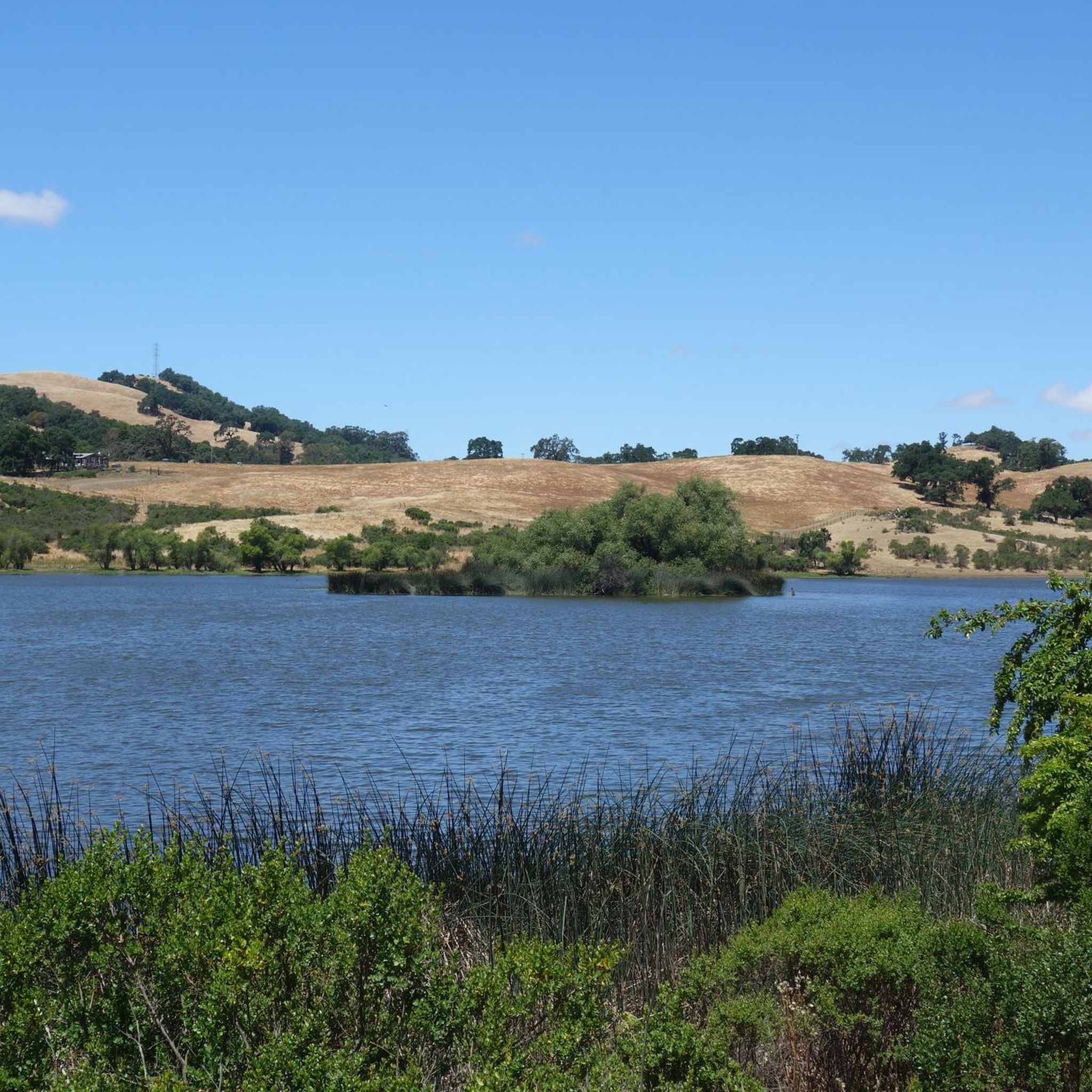
The Grant and McCreery Lake Loop offers a charming, easy hike through Joseph D. Grant County Park, perfect for a quick nature fix. This 2.0-mile (3.2 km) route takes about 54 minutes to complete, featuring a gentle 224 feet (68 metres) of elevation gain as it meanders past two scenic lakes. You'll traverse oak woodlands and open grasslands, enjoying views of Grant Lake and McCreery Lake, with opportunities to spot local wildlife like birds and turtles.
Planning your visit is straightforward, with free parking available at the Grant Lake trailhead. Keep in mind that the main park entrance may have a $6 fee. If you're hiking after winter or spring rains, be prepared for potentially wet sections around McCreery Lake, as a submerged spillway can sometimes make parts of the trail impassable. Due to limited shade in some areas, especially near McCreery Lake, consider visiting during cooler months or bringing ample water in warmer weather.
This family-friendly loop is a notable gem for wildlife observation close to an urban area, making it an excellent choice for those seeking an accessible outdoor experience. The diverse habitats provided by the two lakes contribute to a rich ecosystem, allowing for sightings of various bird species, deer, and other small animals. It's a great way to introduce children to nature or simply enjoy a peaceful stroll amidst varied scenery.
1
hikers
32.2km
09:23
940m
780m
The Grant Ranch and Antler Point Extended Loop offers a demanding 20.0-mile (32.2 km) hike that immerses you in a surprisingly remote wilderness setting, despite its proximity to urban areas. You will journey through expansive oak woodlands and open meadows, with the reward of panoramic views of the Santa Clara Valley, the South Bay, and Mount Hamilton from high points like Antler Point. With 3070 feet (936 metres) of elevation gain and an estimated duration of 9 hours and 22 minutes, this route is a true test of endurance.
Be prepared for a strenuous day, as the trail features significant elevation changes and steep sections, with some grades exceeding 30%. Trails like Los Huecos and Foothill are known for their loose gravel, making descents particularly challenging. This difficult route requires careful planning and a good level of fitness, so ensure you carry enough water and supplies for the entire duration.
What makes this loop stand out is its combination of challenging terrain and diverse scenery, from grassy ridges in Halls Valley to the expansive vistas from treeless high elevations. Keep an eye out for wildlife such as wild boar and bobcats, adding to the remote feel. It is an excellent choice for experienced hikers seeking a long, rewarding day with sweeping Bay Area views.
1
hikers
14.3km
04:15
440m
440m
The Hotel Trail to Yerba Buena Trail Loop offers a classic Joseph D. Grant County Park experience, winding through oak-studded grassy hills and open fire roads. You'll encounter varied terrain, from potentially overgrown sections on the Hotel Trail to the exposed upper reaches of the Yerba Buena Trail, all while enjoying sweeping views of the Diablo Range and distant landmarks like the San Francisco Bay and Santa Cruz Mountains. Keep an eye out for McCreery Lake, a peaceful spot often frequented by turtles and birds, adding a touch of natural charm to your journey.
This moderately challenging hike covers 8.9 miles (14.3 km) with a significant 1450 feet (442 metres) of elevation gain, typically requiring about 4 hours and 15 minutes. The Yerba Buena Trail segment includes a sustained climb with an average grade of 10.5% for over a mile, so be prepared for a good workout. While specific parking details aren't provided, plan to arrive early, especially on weekends, to secure a spot at the trailhead within Joseph D. Grant County Park.
This loop is a fantastic way to experience the natural beauty and expansive vistas of the Diablo Range. The presence of grazing cows along the Hotel Trail adds to the pastoral feel, reflecting the land's history. From various viewpoints, you can even spot the historic Lick Observatory, connecting your hike to the region's scientific heritage. It's a rewarding route for those seeking a substantial day hike with diverse scenery and a good physical challenge.
Get access to more routes and recommendations from other explorers.
Sign up for free
Already have an account?
Our route recommendations are based on thousands of hikes, rides, and runs completed by other people on komoot.
Start today with a free account
Your next adventure awaits.
Login or Signup
Tips from the Community

Joseph D. Grant County Park offers runners expansive trails through rolling hills, oak woodlands, and open meadows. With varied terrain and peaceful surroundings, it’s perfect for long-distance runs or hill training. Early morning runs here provide cool temperatures and a chance to spot local wildlife.
0
0

Antler Peak, located in the Joseph D Grant County Park, stands at a max elevation of 2,999 feet. From the top, you can see the beautiful Santa Clara Valley and Mt. Hamilton vistas! There are wild boar and bobcats in the area, so keep your kids and/or animals close.
0
0

The Joseph D. Grant County Park is the largest country park in the Santa Clara area of California. Joseph was the wealthy son of a merchant who bought this land after the Mexican land grant. The Santa Clara County purchased the land in 1975 and created the park.
0
0

McCreery Lake is a little lake located in the Joseph D. Grant County Park. There are various trails leading along the lake and thanks to the multiple connecting trails in the park, you can shorten or extend your hike at almost any time. The lake is a popular spot to watch turtles and birds.
0
0

Los Huecos Trail is a doubletrack downhill trail with very steep spots, lots of loose gravel and a funny sign.
1
0

The easy trail around the Southeast side of the lake is a great starting point for excursions into the North of JD Grant Park
0
0
Frequently Asked Questions
What kind of terrain can I expect when hiking in Joseph D. Grant County Park?
Joseph D. Grant County Park features diverse terrain, including rolling green hills, extensive grasslands, and oak woodlands. You'll find a mix of wide fire roads and single-track trails. Elevations range significantly, from about 1,400 feet to over 2,985 feet, offering both gentle strolls and challenging climbs. Be prepared for some exposed sections with little shade, especially during warmer months.
How many hiking trails are available in Joseph D. Grant County Park?
The park offers an extensive trail system with over 50 miles of trails. On komoot, you can find 17 curated hiking routes, catering to various skill levels from easy to difficult.
Are there any family-friendly hiking options in Joseph D. Grant County Park?
Yes, the park has several easy routes suitable for families. For a gentle walk, consider the Bass Lake loop, an easy 3.1-mile trail that offers a pleasant experience around Bass Lake.
Can I bring my dog on the trails in Joseph D. Grant County Park?
Yes, dogs are generally allowed in Joseph D. Grant County Park. They must be kept on a 6-foot leash in most areas. Always check specific trail signage for any restrictions.
What are some notable natural features or landmarks to look out for while hiking?
Hikers can enjoy views of Bass Lake and McCreery Lake. The park is also home to majestic oak trees, seasonal creeks, and offers views towards Mount Hamilton. You might also encounter the historic Pala Seca Cabin, a former hunting lodge.
What is the best time of year to go hiking in Joseph D. Grant County Park?
Spring is an excellent time to visit, as the hills are green, wildflowers are in bloom, and wildlife is active. While hiking is possible year-round, be aware that summers can be hot with exposed sections, and winters can bring cooler, wetter conditions.
Are there any challenging hikes for experienced hikers?
Yes, the park offers more strenuous routes for experienced hikers. For example, the Grant Lake – Nice view on Grant Lake loop from Evergreen is a difficult 11.1-mile trail with significant elevation changes, providing a good workout and rewarding views.
Are there any circular hiking routes in the park?
Yes, many of the trails in Joseph D. Grant County Park are designed as loops. A popular moderate option is the Grant Lake – Bernal Trail - Grant Lake loop from Evergreen, which is 7.0 miles long and offers scenic views of Grant Lake.
What kind of wildlife might I see in Joseph D. Grant County Park?
The park's remote location and diverse habitats support a variety of wildlife. You might spot deer, bobcats, coyotes, and wild boars. It's also a great spot for birdwatching, with resident Bald Eagles, burrowing owls, and Western pond turtles.
What do other hikers enjoy most about Joseph D. Grant County Park?
The area is highly rated by the komoot community, with an average score of 4.5 stars from 30 reviews. Hikers often praise the park's varied terrain, extensive trail system, and the opportunity to experience rolling hills and oak woodlands.
Are there any longer hiking routes for those seeking an extended adventure?
For a longer hike, consider the Grant Ranch and Rosegarden – Grant Lake loop from Joseph D. Grant County Park. This moderate 10.1-mile trail leads through varied terrain near Grant Lake and typically takes about 5 hours to complete.
Most popular routes in Joseph D. Grant County Park
Most popular attractions in Joseph D. Grant County Park

Get inspired with the komoot mobile app


Explore more
Browse the best Hikes in other regions.
