Top 7 Mountain Passes around Brighton
Mountain passes near Brighton UK are characterized by the elevated routes and viewpoints found within the South Downs National Park, which borders the city. While not traditional mountain passes, these locations offer significant height and panoramic views across the chalk downland. The area provides opportunities for outdoor activities such as walking, cycling, and exploring historical sites. These elevated routes serve as key features of the local landscape.
Best mountain passes around Brighton
- The most popular mountain passes is Big Cottonwood…
Last updated: September 29, 2026
Catherine Pass
Highlight • Mountain Pass
Tip by

Big Cottonwood Climb
Highlight (Segment) • Climb
Tip by

Sign up now to discover places like this
Get recommendations on the best single tracks, peaks, & plenty of other exciting outdoor places.
Guardsman Pass
Highlight (Segment) • Mountain Pass
Tip by
Empire Pass Climb from Midway
Highlight (Segment) • Climb
Tip by

Start today with a free account
Your next adventure awaits.

Tips from the Community

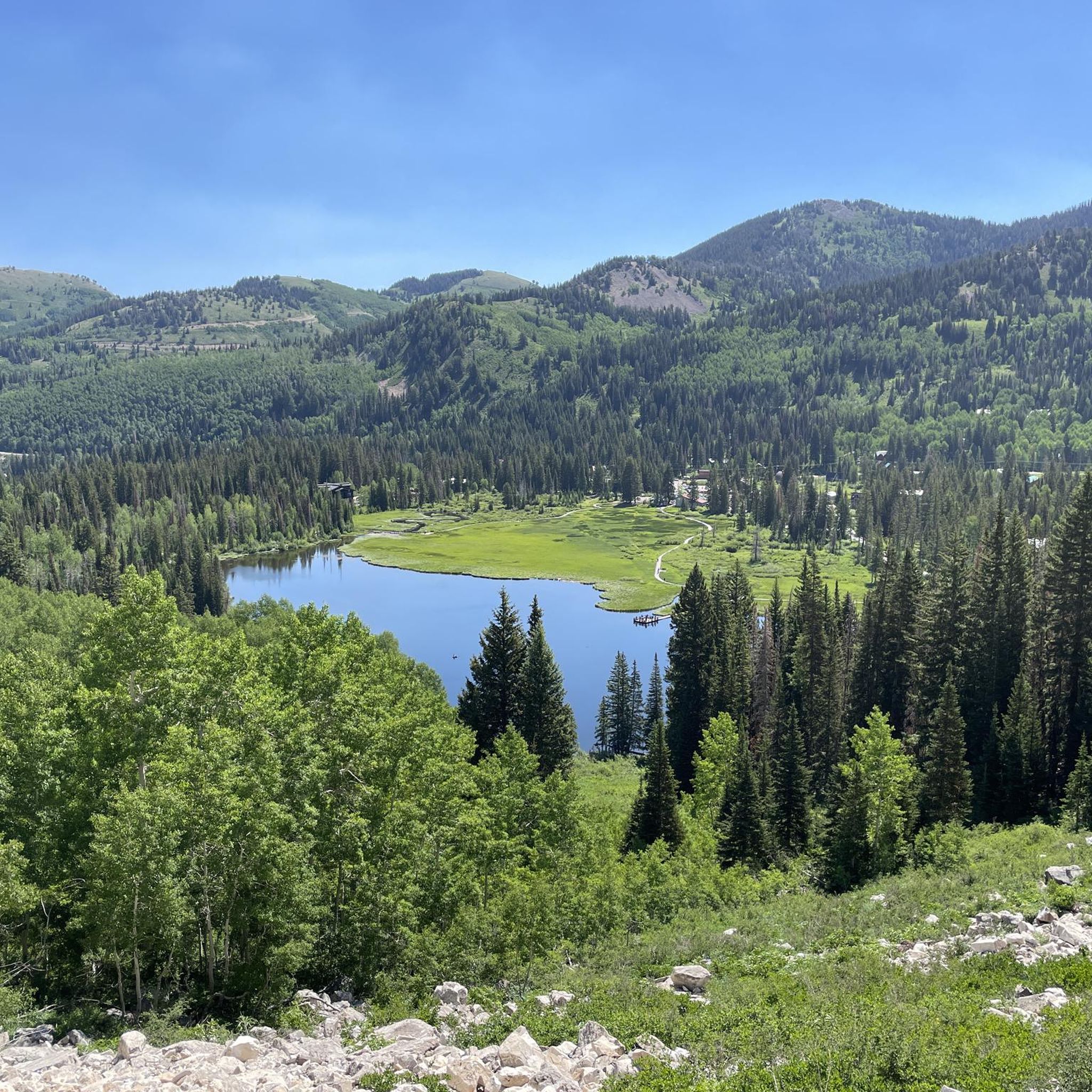
Climbing Empire Pass westwards from Midway on the Guardsman Pass Scenic Backway offers a challenging but scenic ascent into Utah's Wasatch Mountains. Prepare for approximately 11-12 miles of sustained climbing, gaining over 3,000ft to reach the 8,740ft summit. The main climb averages around 5-6%, but features steeper sections, particularly on the initial winding climb out of Midway and in the final push towards the pass, where gradients can reach 8-10%. Along the way you'll enjoy the transition from aspen forests to stunning alpine meadows as you approach the top.
0
0

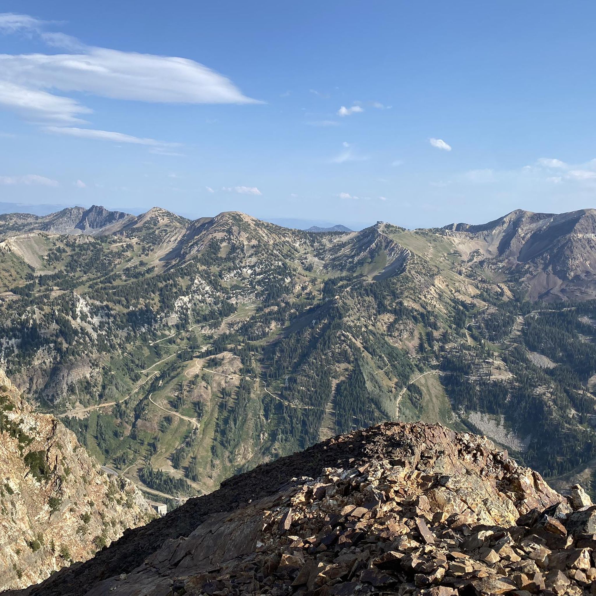
This challenging climb begins in the picturesque Big Cottonwood Canyon, a stunning alpine valley nestled in the Wasatch Range, and ascends toward Guardsman Pass. The early stretch features a gentle grade, but as you progress, the road becomes steeper with tight, twisting corners that offer breathtaking views of the surrounding canyon. As you near the top, the scenery intensifies, revealing dramatic mountain vistas, with the climb culminating at Guardsman Pass, where the panorama stretches across the valley. The descent is equally thrilling but requires caution due to sharp turns and the potential for hikers or parked cars along the road.
0
0
This challenging 8.8-mile climb begins with a moderate ascent and gradually steepens as you approach the summit, surrounded by dense forests of aspen trees. The route winds through lush, green terrain, offering glimpses of rugged mountain slopes and rocky outcrops as you gain elevation. As you near the top, the trees part to reveal stunning panoramic views of the high-altitude mountains, with the summit at Guardsman Pass offering a breathtaking perspective of the surrounding landscape.
0
0

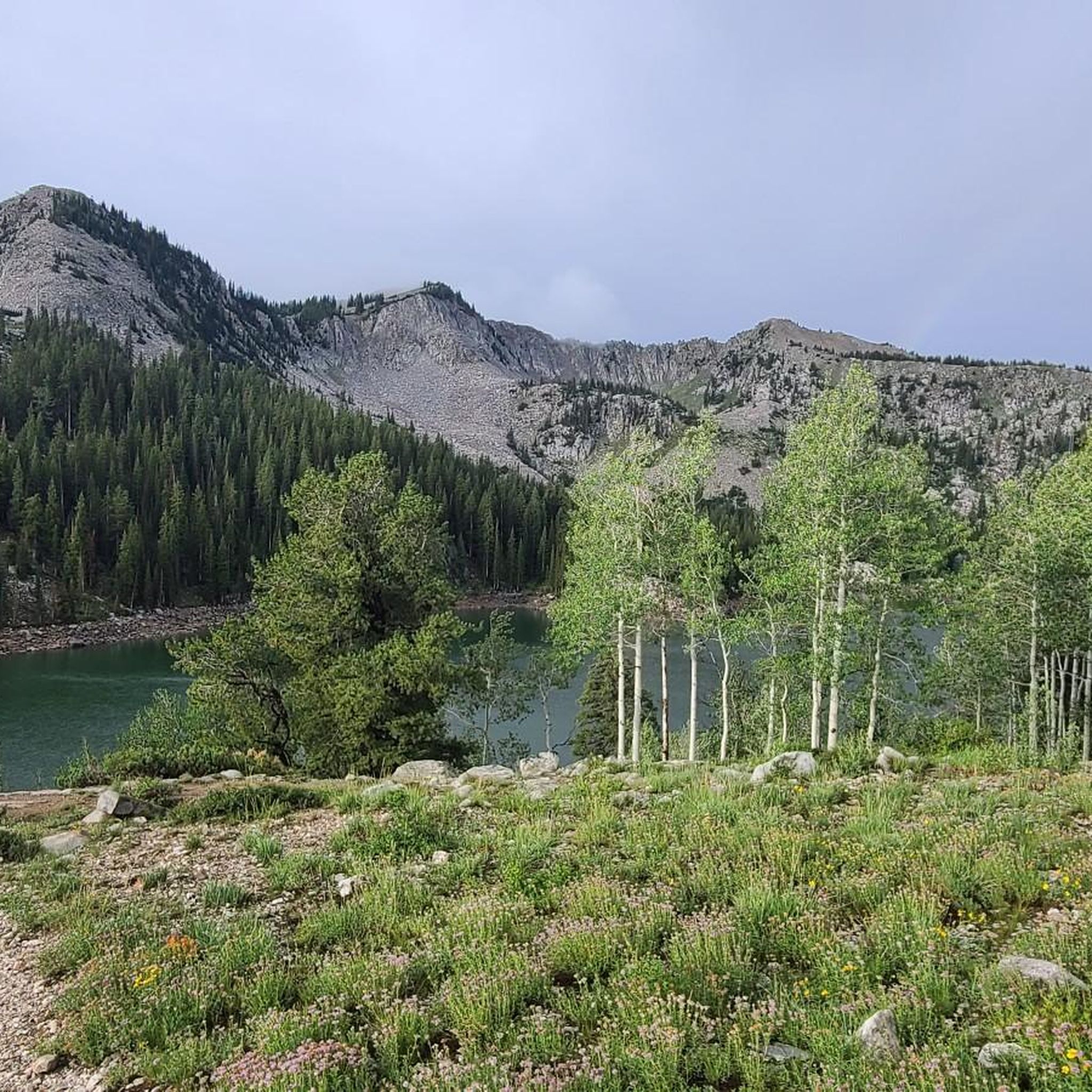
wonderful views over the lakes of Brighton, and many peaks near and far
0
0

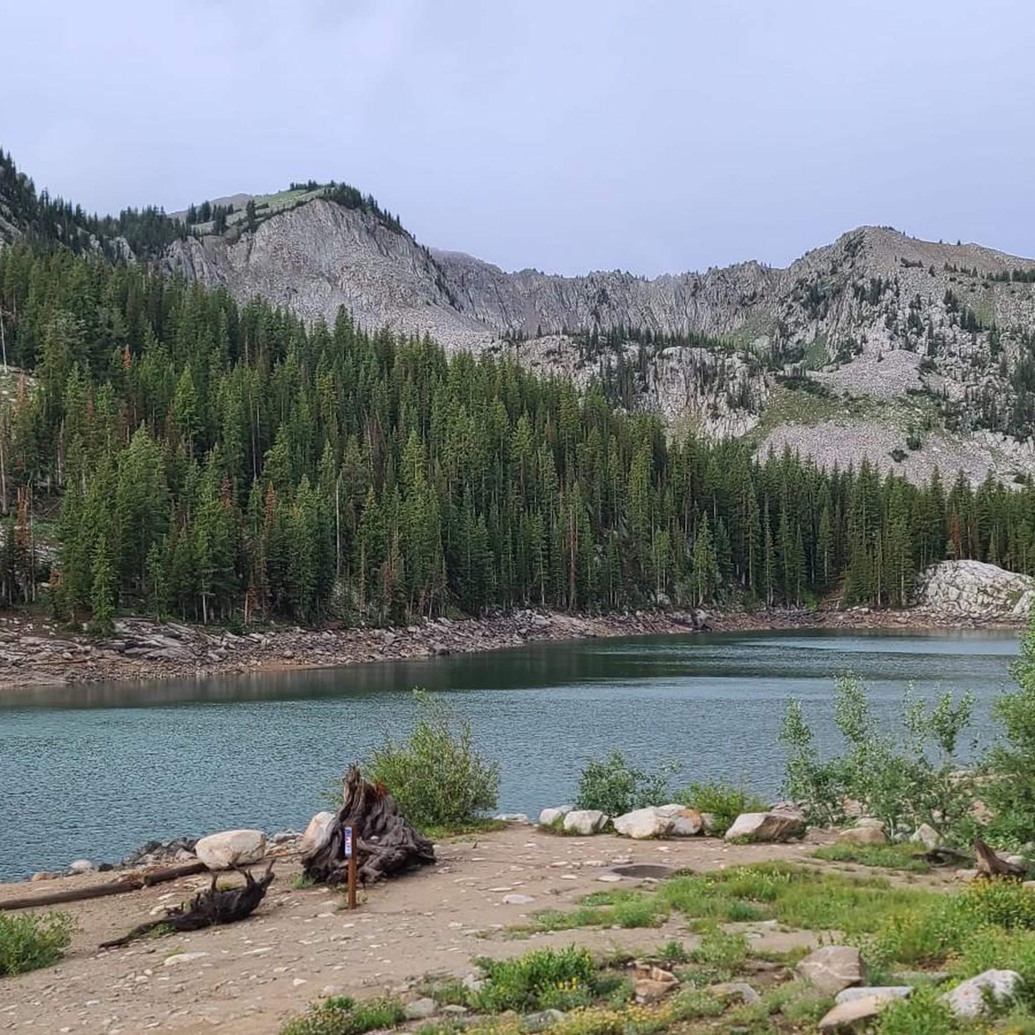
At 10,220 feet in elevation, Catherine Pass offers great views down over Lake Catherine, the last of the three lakes along this trail. If you want even more incredible views, continue your run onto one of the ridges to the south, then turn east to visit either Sunset Divide (Sunset Pass) or the peak of the same name.
1
0

Catherine Pass reaches up to 10,220 feet and offers unobstructed views of the basins on both sides of the ridge. The pass is most often hiked by those wanted to see alpine wildflowers. The pass is climbed from both sides, but it is most popularly hiked in tandem with Catherine Lake.
0
0
Frequently Asked Questions
What are the main elevated routes or viewpoints near Brighton?
While Brighton doesn't have traditional mountain passes, the South Downs National Park offers significant elevated routes and viewpoints. The most prominent are Devil's Dyke and Ditchling Beacon, both offering panoramic views and opportunities for outdoor activities.
What makes Devil's Dyke a popular spot to visit?
Devil's Dyke is renowned for its breathtaking panoramic views over the Weald and south towards Brighton and the sea. It features the UK's longest, deepest, and widest 'dry valley,' with geological significance from the last Ice Age. It's also popular for walking, model aircraft flying, and hang gliding, with a pub and restaurant on site. You can learn more about its features and history on Wikipedia or Visit South East England.
What can I expect at Ditchling Beacon?
Ditchling Beacon is the highest point in East Sussex, offering commanding 360-degree views across the South Downs, the Weald, and out to sea. It's an archaeologically important site with Iron Age hill fort remains and is a key point on the South Downs Way. The area is rich in diverse plant life and butterflies, making it ideal for walking, cycling, and horse riding. The steep road to the summit is also a challenging route for cyclists. Find more information on Wikipedia.
Are there parking facilities at Devil's Dyke and Ditchling Beacon?
Yes, both Devil's Dyke and Ditchling Beacon have parking available. At Devil's Dyke, there is a National Trust car park. Ditchling Beacon also has parking at the summit, accessible via the road from Ditchling. It's advisable to check local council websites for current parking information and any potential charges.
What outdoor activities can I do near these elevated routes?
The South Downs National Park, home to Devil's Dyke and Ditchling Beacon, is excellent for various outdoor activities. You can enjoy extensive walking and hiking, including sections of the South Downs Way. Cycling is also very popular, especially the challenging climb to Ditchling Beacon. Horse riding and model aircraft flying are also common. For more cycling options, explore the Cycling around Brighton guide, or for running, check out the Running Trails around Brighton guide.
Are these locations suitable for families?
Yes, both Devil's Dyke and Ditchling Beacon offer family-friendly experiences. Devil's Dyke has open spaces for children to play, and relatively easy walking paths. Ditchling Beacon also provides open grassland and paths suitable for family walks, with stunning views that can be enjoyed by all ages. Remember to bring appropriate gear for varying weather conditions.
What historical significance do Devil's Dyke and Ditchling Beacon hold?
Devil's Dyke features the ramparts of an Iron Age hill fort and remains of a Victorian funfair, alongside local folklore about its formation. Ditchling Beacon also has remains of an Iron Age hill fort and was historically used as a warning beacon, playing a role in communication during times of threat. Both sites offer a glimpse into the region's ancient past.
Can I access Devil's Dyke or Ditchling Beacon by public transport from Brighton?
Yes, public transport options are available. Devil's Dyke is accessible by bus services from Brighton, particularly during peak seasons. Ditchling Beacon can also be reached, though options might be less direct. It's recommended to check local bus schedules (e.g., Brighton & Hove Buses) for the most up-to-date routes and timings to plan your visit.
What is the best time of year to visit these elevated viewpoints?
The best time to visit Devil's Dyke and Ditchling Beacon is generally during spring, summer, and early autumn (April to October) when the weather is milder and the views are clearest. Spring brings wildflowers, and summer offers long daylight hours. However, these spots can be beautiful in winter too, especially on crisp, clear days, though they can be exposed to strong winds.
Are there facilities like cafes or pubs near Devil's Dyke and Ditchling Beacon?
Yes, Devil's Dyke has a pub and restaurant directly on site, offering refreshments and meals with a view. Near Ditchling Beacon, while there isn't a facility directly at the summit, the nearby village of Ditchling offers cafes and pubs. It's a good idea to check opening times in advance, especially outside of peak season.
Are dogs allowed on the trails around Devil's Dyke and Ditchling Beacon?
Yes, both Devil's Dyke and Ditchling Beacon are very dog-friendly, with many trails suitable for walks with your canine companion. However, it's important to keep dogs under control, especially around livestock (sheep often graze on the Downs) and to clean up after them. Always check for any specific local signage regarding dog restrictions.
What kind of nature and wildlife can I see at Ditchling Beacon?
Ditchling Beacon is characterized by its open chalk grassland, which is a habitat for diverse plant life, including various wildflowers. It's particularly known for its butterflies, such as the vibrant Chalkhill Blue. You'll also frequently see sheep grazing on the slopes, helping to maintain the unique ecosystem of the Downs.
Most popular routes around Brighton
Most popular attractions around Brighton

Get inspired with the komoot mobile app


Explore more
See even more epic mountain passes by checking out these guides around Brighton:
