The best cycling routes around Monêtier-Allemont
4.4
(56)
828
riders
44
rides
Touring cycling around Monêtier-Allemont navigates a landscape characterized by river valleys, canal paths, and surrounding hills. The region features a mix of agricultural land and more elevated terrain, offering varied gradients for cyclists. Routes often follow watercourses, providing relatively flat sections, while others ascend into the foothills, presenting more challenging climbs. The area's diverse terrain includes wild valleys, mid-mountains, and cultivated orchards.
Best touring cycling routes around Monêtier-Allemont
- The most popular touring cycling route is Tour of Montagne d'Aujour,…
Last updated: July 8, 2026
5.0
(6)
104
riders
55.9km
03:52
1,050m
1,060m
Experience the challenging Tour of Montagne d'Aujour, a difficult 34.7-mile touring cycling route with panoramic views.
4.0
(1)
29
riders
Moderate bike ride. Good fitness required. Mostly paved surfaces. Suitable for all skill levels.

Sign up for free
4.7
(6)
52
riders
36.7km
02:17
390m
390m
Moderate bike ride. Good fitness required. Mostly paved surfaces. Suitable for all skill levels.
4.5
(2)
17
riders
32.9km
02:09
450m
460m
Hard bike ride. Very good fitness required. Mostly paved surfaces. Suitable for all skill levels.
24
riders
45.0km
02:41
320m
320m
Moderate bike ride. Good fitness required. Mostly paved surfaces. Suitable for all skill levels.
Get access to more routes and recommendations from other explorers.
Sign up for free
Already have an account?
Our route recommendations are based on thousands of hikes, rides, and runs completed by other people on komoot.
Start today with a free account
Your next adventure awaits.
Login or Signup

Tips from the Community

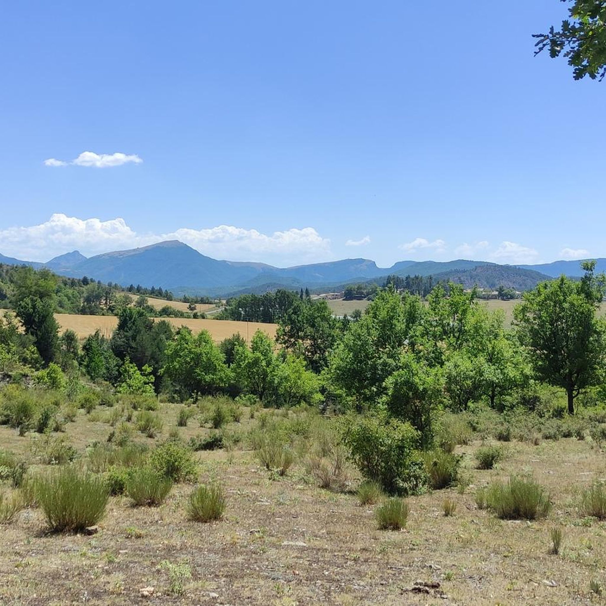
The Col d'Espreaux is a climb located in the Hautes-Alpes region. This climb is 12.2 km long, with a total elevation gain of 585 m. The Col d'Espreaux has an average gradient of 4.8%.
8
0
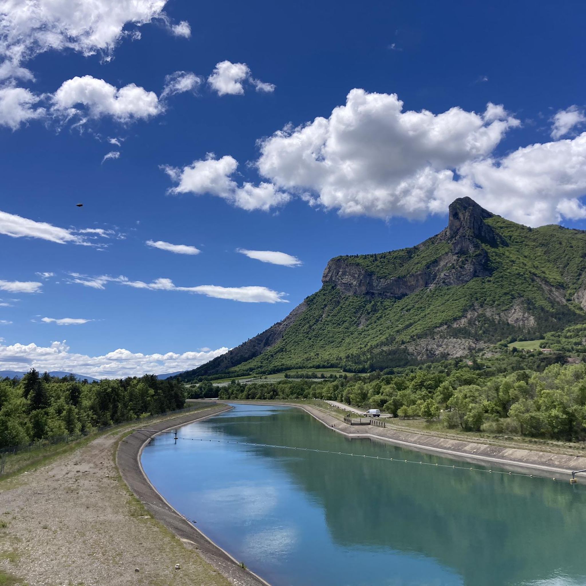
The Col de Faye is a mountain pass in the Southern Alps, located in the department of Hautes-Alpes at an altitude of approximately 922 to 924 meters. It connects the Buëch valley to the Durance valley — between the municipalities of Savournon and Ventavon — via the departmental road D21.
15
0
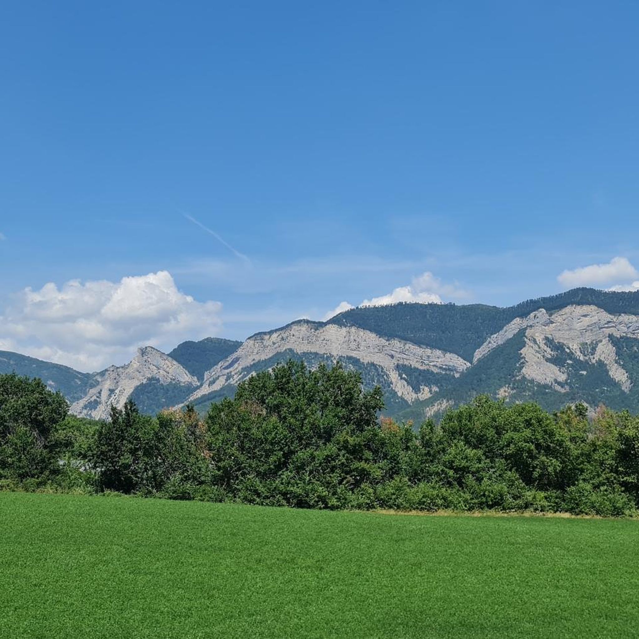
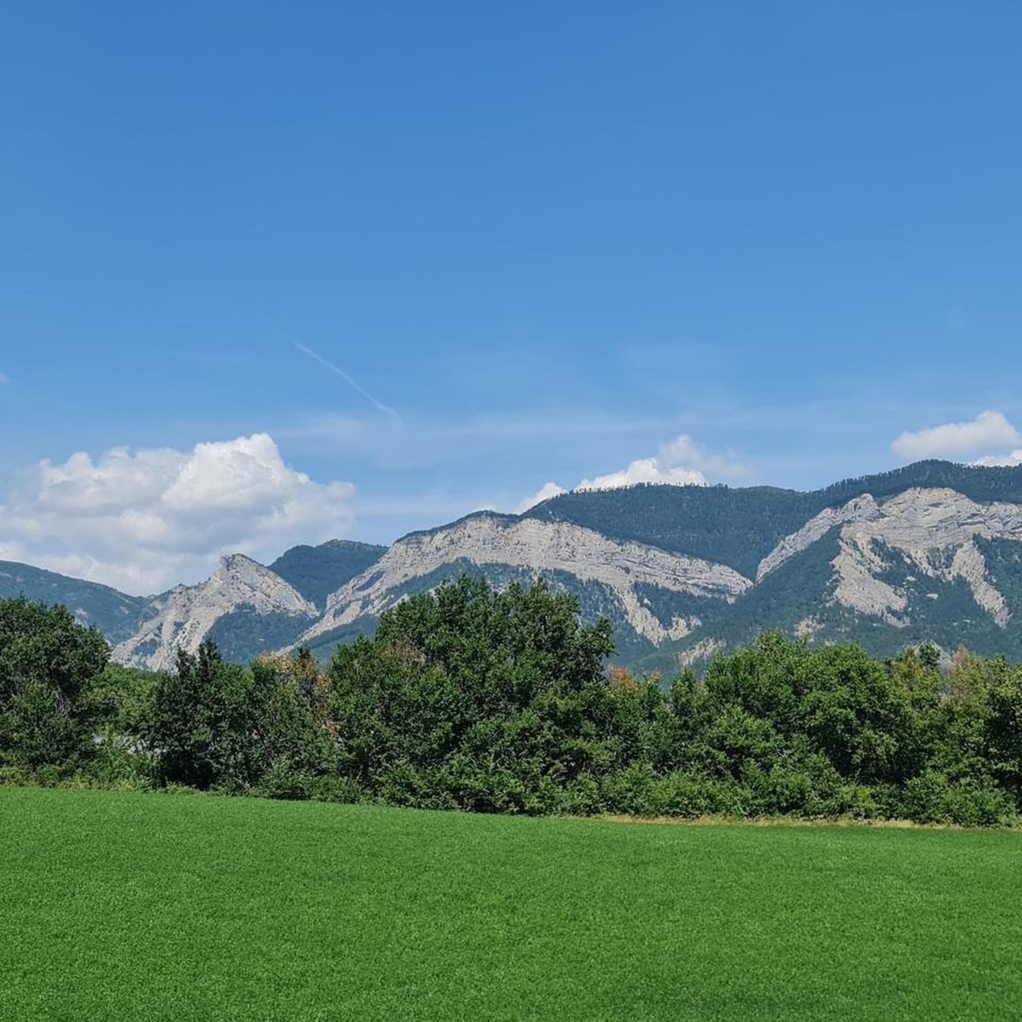
The view of Aujour (Montagne de l’Aujour) is one of the most spectacular panoramas in the area between the Alpes-de-Haute-Provence and the Sisteron area: a long limestone ridge that dominates valleys, hills and, on clear days, opens up to the Prealps and the Durance basin.
14
0
Passage through wonderful orchards.
16
0


Frequently Asked Questions
How many touring cycling routes are available around Monêtier-Allemont?
There are over 45 touring cycling routes around Monêtier-Allemont, offering a diverse range of experiences from gentle canal paths to more challenging ascents into the foothills.
Are there easy touring bike trails suitable for beginners in Monêtier-Allemont?
Yes, Monêtier-Allemont offers 5 easy touring cycling routes. These often follow river valleys and canal paths, providing relatively flat sections ideal for beginners or those seeking a relaxed ride. One such route is the Tallard Castle – EDF Canal Cycle Path loop from Claret, which is rated as moderate but features accessible sections.
What kind of terrain can I expect on touring bike routes in Monêtier-Allemont?
The region features a mix of agricultural land, river valleys, and canal paths, alongside more elevated terrain in the surrounding hills. You'll find routes with relatively flat sections along watercourses, as well as others that ascend into the foothills, presenting more challenging climbs.
Are there any challenging touring bike trails for experienced cyclists?
Absolutely. Monêtier-Allemont has 26 difficult touring cycling routes. These often involve significant elevation gain through mountainous terrain. A prime example is the Tour of Montagne d'Aujour, which covers 34.7 miles (55.9 km) with over 1000 meters of ascent.
What are the typical durations for touring bike routes in this area?
Route durations vary significantly based on distance and elevation. For instance, the EDF Canal Cycle Path – Along the EDF Canal loop from Lardier et Valença - Le Plan Canal EDF, a 37.6 miles (60.5 km) moderate trail, typically takes around 3 hours 37 minutes. More challenging routes, like the EDF Canal Cycle Path – Col de Grêle loop from La Saulce, can take closer to 3 hours 15 minutes for 31.9 miles (51.3 km).
Are there any circular touring bike routes around Monêtier-Allemont?
Yes, many of the touring cycling routes in Monêtier-Allemont are designed as loops, allowing you to start and finish at the same point. Examples include the EDF Canal Cycle Path – Along the EDF Canal loop from Lardier et Valença - Le Plan Canal EDF and the Along the EDF Canal – EDF Canal Cycle Path loop from Claret.
What can I see along the touring cycling routes in Monêtier-Allemont?
The routes often pass by interesting natural and historical landmarks. You might encounter mountain passes like Espréaux Pass or Col de Grele, and historical sites such as Clausonne Abbey. The region's landscape itself, with its river valleys and canals, offers scenic views.
What is the best season for touring cycling in Monêtier-Allemont?
While touring cycling is possible for much of the year, late spring, summer, and early autumn generally offer the most favorable conditions. During these seasons, the weather is typically mild, and the routes are clear, making for a more enjoyable experience. Summer provides longer daylight hours, ideal for longer tours.
What do other touring cyclists enjoy the most about touring cycling in Monêtier-Allemont?
The area is highly rated by the komoot community, with an average score of 4.4 stars from over 40 reviews. Reviewers often praise the varied terrain, which offers both gentle canal-side rides and challenging climbs, as well as the scenic beauty of the river valleys and surrounding hills.
Are there any specific viewpoints or scenic spots along the routes?
Many routes offer panoramic views, especially those that ascend into the higher elevations. Passes like Espréaux Pass and Faye Pass are known for their vistas. The routes along the EDF Canal also provide picturesque stretches through the valleys.
Is parking available near the touring cycling routes?
While specific parking details vary by starting point, many towns and villages in the Monêtier-Allemont region, such as La Saulce or Claret, offer public parking facilities that can serve as convenient starting points for your touring cycling adventures.
Most popular routes around Monêtier-Allemont
Most popular attractions around Monêtier-Allemont

Get inspired with the komoot mobile app


Explore more
Browse the best Cycling routes in other regions.
