The best hikes from bus stations in Coyhaique
4.3
(121)
1,489
hikers
1
hike
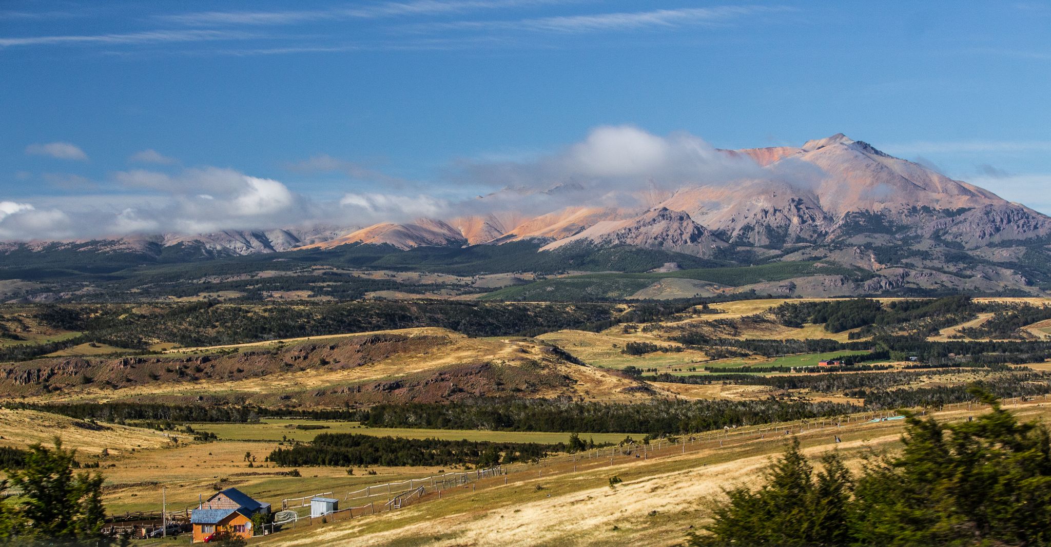
Hiking trails accessible by public transport from Coyhaique bus terminal lead through diverse Patagonian landscapes. The region is characterized by the Patagonian Mountain Range, featuring snow-capped peaks and rugged cliffs, alongside extensive native forests. Numerous glacial lakes and rivers, such as the Ibáñez River, are integral to the terrain. This area offers a range of elevations and natural features for outdoor exploration.
Best bus station hiking trails in Coyhaique
- The most popular bus station hiking route is Villa Cerro Castillo…
Last updated: July 7, 2026
4.8
(43)
559
hikers
22.2km
08:02
1,240m
1,240m
Hard hike. Very good fitness required. Easily-accessible paths. Suitable for all skill levels.
3.3
(6)
40
hikers
7.97km
02:13
130m
130m
Moderate hike. Good fitness required. Easily-accessible paths. Suitable for all skill levels.

Sign up for free
12
hikers
9.71km
02:38
130m
130m
Moderate hike. Good fitness required. Easily-accessible paths. Suitable for all skill levels.
Our route recommendations are based on thousands of hikes, rides, and runs completed by other people on komoot.
Start today with a free account
Your next adventure awaits.
Login or Signup


Tips from the Community

Here is a second checkpoint for the ticket. And the view is awesome.
0
0

Admission to the Painted Hands National Monument currently costs 3 euros per person. If you also want to visit the museum in the old school, you will have to pay another euro.
0
0

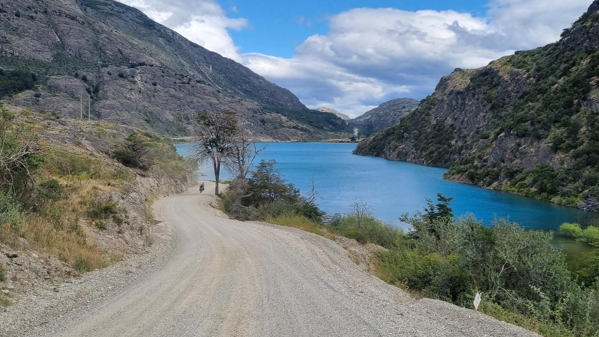
The Ibáñez River is a watercourse that flows in the Aysén Region of General Carlos Ibáñez del Campo and is one of the most important sources of the Baker River basin to which it joins through Lake General Carrera. The river is born in a snowdrift that detaches to the SE from the glaciers surrounding the Hudson Volcano, whose waters are affected by the eruptions of the Andean heart. In the Andean heart, it limits to the north with the Aysén River basin, in particular with the basin. of the Huemules (Simpson) River (which will give life to the Simpson River further north). It initially runs in a SE direction for 30 km, then east for another 30 km to change its lower course again in a SE direction for 28 km, thus achieving a total length of 88 km.[2]: 559 Its drainage area limits to the north with those of the Blanco River (West), to the south with those of the Murta River and its main tributary is the Manso estuary, an outfall of Lake Lapparent and other minor ones. On the left side it receives the minor courses Riacillos, Nieve, Parado. In the lower course, it receives no less than six streams per band, some of them with names: Estero del Bosque, Estero Limpio, Chorrillo, Peñascos. These on their left flank. On the right, the Claro estuary. It flows into Bahía Ibáñez of Lake General Carrera, where the lake port and the town of Puerto Ingeniero Ibáñez are located.
1
0

Villa Cerro Castillo offers exceptional hikes to discover its iconic mountain and glacier. It is also here that we find the first cave of the hands. A prehistoric shelter with some beautiful hand painted on its walls. When you return from one or other of your excursions, have dinner at the bus restaurant located near the campsite.
1
0

It's worth taking a day's rest in villa Cerro Castillo. Horse tracking to the Cerro Castllo glacier is offered. Obedient and patient horses trudge steeply and dustily uphill (volcanic dust) for two hours, then continue hiking along a mountain path to the glacier.
0
1

From this point it is possible to appreciate both Villa Cerro Castillo and the surrounding mountains.
2
0
Villa Cerro Castillo is a small town: it is located along the Carretera Austral. In Villa Cerro Castillo you can find both restaurants and guesthouses. Spectacular hiking trails start from Villa Cerro Castillo.
1
0
Frequently Asked Questions
How many hiking trails are accessible directly from bus stations in the Coyhaique area?
There are three distinct hiking routes available directly from bus stations in the Coyhaique region, offering car-free adventures. These include a challenging loop to Laguna Cerro Castillo, a moderate loop exploring the Ibáñez River and Wall of the Hands, and another moderate loop around Villa Cerro Castillo.
What types of terrain and difficulty levels can I expect on bus-accessible hikes near Coyhaique?
The bus-accessible hikes near Coyhaique offer a range of terrain and difficulty. You can find moderate routes, such as the Ibáñez River – Wall of the Hands loop, which covers about 7.9 km. For a more challenging adventure, the Villa Cerro Castillo – View of Laguna Cerro Castillo loop is a difficult 22.2 km route with significant elevation gain, taking you through rugged Patagonian landscapes.
Are there any circular hiking routes accessible by bus from Coyhaique?
Yes, all three routes highlighted in this guide are circular, allowing you to start and end your hike at the same point, which is convenient when relying on public transport. For example, the Villa Cerro Castillo loop is a moderate 9.7 km circular trail.
What natural features or landmarks can I see along these bus-accessible trails?
These trails offer stunning Patagonian scenery. The challenging Villa Cerro Castillo – View of Laguna Cerro Castillo loop provides spectacular views of the iconic Cerro Castillo and its glacial lake. The Ibáñez River – Wall of the Hands loop takes you along the picturesque Ibáñez River and past ancient rock art. The region is known for its majestic mountains, expansive forests, and pristine lakes and rivers.
What do other hikers say about the bus-accessible trails in Coyhaique?
The komoot community highly rates the hiking experiences in the Coyhaique region, with an average score of 4.3 out of 5 stars from over 100 ratings. Hikers often praise the dramatic Patagonian landscapes, the sense of wilderness, and the rewarding views, especially around Cerro Castillo.
Are there any family-friendly hiking options accessible by bus near Coyhaique?
While the routes listed in this guide are rated moderate to difficult, the region around Coyhaique offers other family-friendly options. For example, Reserva Nacional Río Simpson, accessible by public transport from Coyhaique, features lush forests and crystal-clear rivers, with trails like Sendero Las Piedras known for stunning waterfalls, which are generally suitable for families.
What is the best time of year for hiking near Coyhaique's bus stations?
The best time for hiking in the Coyhaique region is generally during the Patagonian summer and autumn, from November to April. During these months, you'll experience milder weather, longer daylight hours, and more stable trail conditions, making it ideal for exploring the mountains and forests.
What should I bring for a hike on these bus-accessible trails?
Given the varied Patagonian weather, it's essential to be prepared. Bring layers of clothing, including waterproof and windproof outer shells, sturdy hiking boots, sufficient water and snacks, sun protection, and a map or GPS device. For longer or more challenging routes, consider trekking poles and emergency supplies.
Are there places to eat or stay near the Coyhaique bus station after a hike?
Yes, the city of Coyhaique itself, where the main bus terminal is located, offers various amenities. You can find cafes like Cafe Peregrino Coyhaique, restaurants, and accommodation options within walking distance or a short ride from the bus station.
What are some other points of interest in Coyhaique that I can visit?
Beyond the trails, Coyhaique offers several points of interest. You can explore the central Plaza de Armas de Coyhaique, visit the Cerro Mackay Summit for panoramic views, or wander through the unique Welcome to the Coyhaique jungle area. The city serves as a great base for exploring the wider Aysén region.
Are permits required for hiking in the national parks or reserves near Coyhaique?
Yes, permits or entrance fees are typically required for accessing national parks and reserves in Chile, such as Cerro Castillo National Park, Reserva Nacional Coyhaique, and Reserva Nacional Río Simpson. It's advisable to check the official CONAF (Corporación Nacional Forestal) website or local visitor centers for the most current information on entry requirements and fees before your visit.
Most popular routes in Coyhaique
Most popular attractions in Coyhaique

Get inspired with the komoot mobile app


Explore more
Browse the best Hikes in other regions.
