The best hikes from bus stations in Urubamba
4.5
(24)
360
hikers
3
hikes
Bus station hiking trails in Urubamba offer access to the Sacred Valley of the Incas, characterized by the winding Urubamba River, fertile valley floors, and the surrounding Andes Mountains. The region features diverse ecosystems, from Andean countryside to scenic forests, with elevations around 9,416 feet (2,870 meters). Hikers can explore a mix of natural landscapes and ancient Inca archaeological sites.
Best bus station hiking trails in Urubamba
- The most popular bus station hiking route is Cusco Cathedral – Sacsayhuamán loop…
Last updated: July 7, 2026
5.0
(5)
144
hikers
1.92km
00:38
90m
90m
Easy hike. Great for any fitness level. Easily-accessible paths. Suitable for all skill levels.
4.5
(11)
106
hikers
6.59km
02:04
230m
230m
Moderate hike. Good fitness required. Easily-accessible paths. Suitable for all skill levels.

Sign up for free
4.0
(1)
14
hikers
9.46km
02:34
130m
130m
Moderate hike. Good fitness required. Easily-accessible paths. Suitable for all skill levels.
20
hikers
6.77km
02:05
250m
250m
Moderate hike. Good fitness required. Easily-accessible paths. Suitable for all skill levels.
4.7
(3)
13
hikers
9.69km
02:53
290m
290m
Moderate hike. Good fitness required. Easily-accessible paths. Suitable for all skill levels.
Our route recommendations are based on thousands of hikes, rides, and runs completed by other people on komoot.
Start today with a free account
Your next adventure awaits.
Login or Signup
Popular around Urubamba
Other adventures in Urubamba

Tips from the Community

The Temple of the Sun is one of the most impressive relics of the Inca culture and was built in honor of the sun god Inti. It was the spiritual and religious center of the Inca Empire. Today, the Qoricancha stands as a symbolic example of the fusion of Inca building culture and Spanish colonial architecture. The Qoricancha housed not only the Temple of the Sun, but also other sacred shrines for other deities. (Temple of the Moon Goddess, the Temple of Lightning, the Temple of the Rainbow, the Temple of Water, and others. All temples were clad in gold and adorned with precious stones. The Spaniards plundered the treasures and partially destroyed the temple to build a monastery on it. The monastery was repeatedly damaged by several earthquakes, but the walls of the Inca temple have remained undamaged, which speaks to the exceptional architecture. Even today, 15 monks still live here.
1
0
Even if you are no longer allowed to photograph inside the cathedral today (or precisely because of that), visiting it is a must for anyone visiting Cusco. Countless altars in various architectural styles and materials, the different patron saints, the silver monstrance, and of course the entire architecture are admirable. The supporting walls of the nave are built from stones of a nearby Inca temple. After an earthquake, the cathedral's roof was destroyed and rebuilt in the Gothic style.
1
0
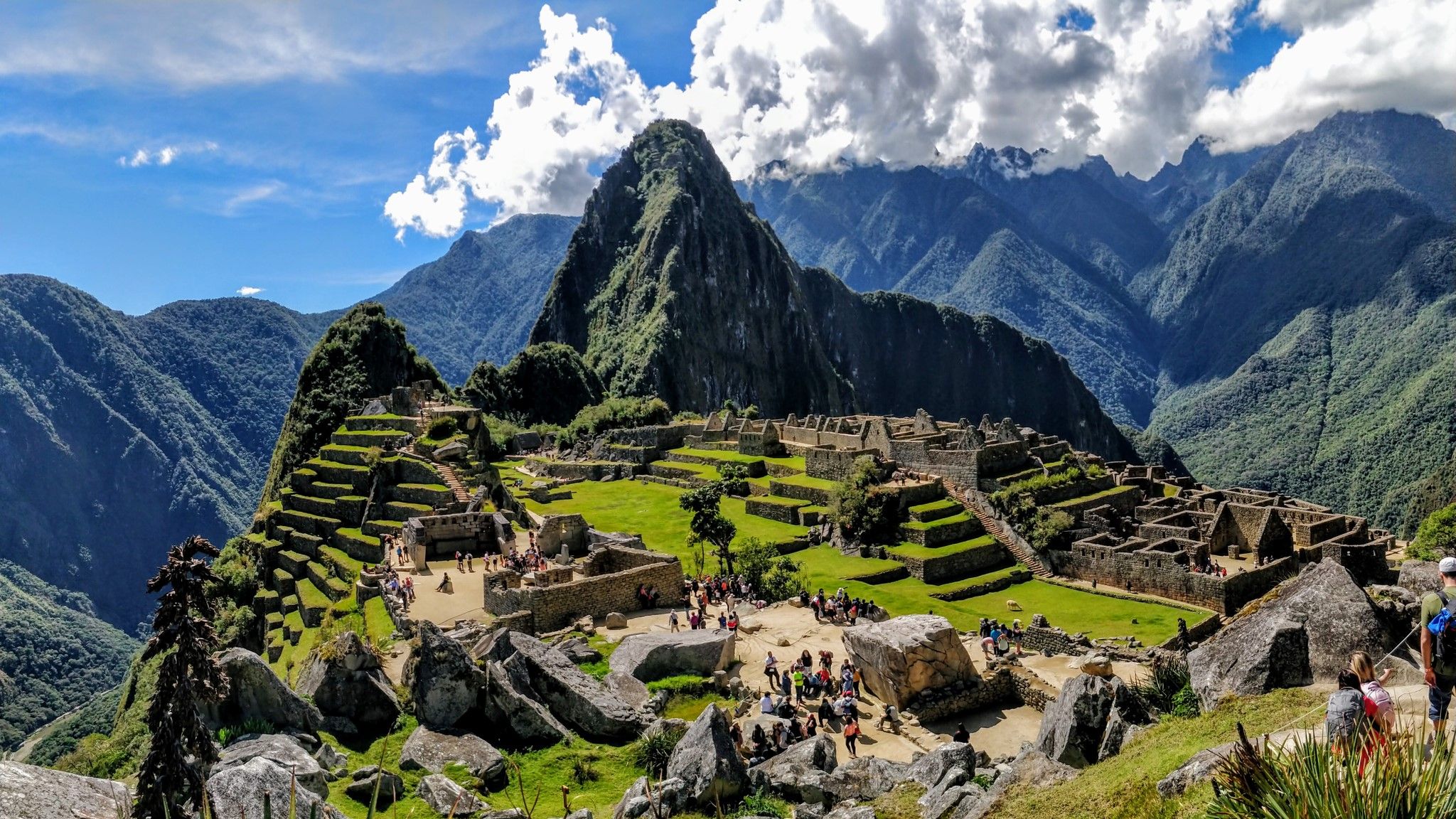
Those who don't want to take the bus to Aguas Calientes can also get back on foot in one and a half to two hours. But beware, there are irregular steps, partly steeply downhill, and in wet weather it can become slippery. In addition, you should take precautions against mosquito bites.
1
0

It's the highest viewpoint. You can pass it from the trail, but otherwise the climb is worth it.
0
0

Ah, this is a fascinating glimpse into the incredible stonework of Sacsayhuamán (sometimes spelled Saksaywaman)! This impressive site is located on the northern outskirts of Cusco, Peru, and it was once a citadel complex of the Inca Empire. What makes Sacsayhuamán so remarkable, and what you're seeing a close-up of, is the massive scale and the astonishing precision of its stonework. The walls are constructed from enormous, irregularly shaped boulders, some weighing hundreds of tons. What's truly mind-boggling is how these stones were fitted together with such incredible accuracy that you can't even slip a piece of paper between them – all without the use of mortar! The purpose of Sacsayhuamán is still debated by historians and archaeologists. While it clearly had a military function due to its strategic location overlooking Cusco, it also likely served important ceremonial and religious purposes. The complex features plazas, towers, and other structures that suggest a multifaceted role in Inca society. The Spanish conquistadors were awestruck by the scale and sophistication of Sacsayhuamán. They dismantled parts of it to use the stones for their own constructions in Cusco, yet a significant portion of the original complex still stands today, a testament to the ingenuity and engineering prowess of the Inca civilization. The image you shared really highlights the intricate and almost unbelievable way these colossal stones were shaped and interlocked. It's a powerful reminder of the advanced skills and knowledge of the Inca people. Is there anything else you'd like to know about Sacsayhuamán?
1
0
Sacsayhuamán, a large Inca fortress overlooking Cuzco, Peru; from a hilltop 230m above the city. It was built in 15th Century AD, during reign of Pachacuti Inca Yupanqui. Built with stones that were up to more than 8.2m tall and weighed many tons, and with zigzag walls more than 305m in length, Sacsayhuamán is a feat of human engineering, the story of whose construction has caused much discussion among archaeologists. In construction of Sacsayhuamán, stones were laid together without the use of mortar, and they seem to be immovable by nature. Although earthquakes have laid waste to many more modern buildings in the locality, Inca site itself has remained unshaken by any of tremors. The purpose for which Sacsayhuamán was built is uncertain. The walls and original towers seem clearly defensive in nature. The site also incorporates a large plaza surrounded by terraces, and it is thought that this area may have been used for ceremonies. In addition, it is thought that there were temples in complex. In 2008, archaeologists uncovered the ruins of a pre-Inca temple and roadway at site’s periphery.
1
0

The Chinkanas (from Quechua "chinkana"; place where one gets lost) or also called labyrinths, are mysterious caves built on limestone; it is not known if the Incas or a previous civilization did this, or how or for what purpose it was built.
4
0
How times change. This used to be a place to take a break, everyone had their snack with them and took their lunch break or afternoon nap here. It was a place to relax. But in recent years the number of visitors has increased so much that more and more areas have been closed or regulated. I like to remember this wonderful time when we could still enjoy this amazing view without any time restrictions.
0
0
Frequently Asked Questions
How many bus station hiking trails are available in Urubamba?
While this guide focuses on the concept of bus station accessible hikes, the Urubamba region itself offers a vast network of trails. The komoot community has mapped numerous routes, with a few specifically highlighted for their ease of access from public transport points. In total, there are over 39 highlights and many more routes to discover in the area.
What is the best time of year to hike from Urubamba's bus stations?
The dry season, which runs from May to October, is ideal for hiking in Urubamba. During these months, you can expect clear blue skies and pleasant weather, perfect for exploring the trails and visiting archaeological sites without the interruption of heavy rains.
Are there any easy, family-friendly hikes accessible from Urubamba bus stations?
Yes, Urubamba offers several options suitable for families. Many trails along the fertile valley floor or those leading to viewpoints like Mirador Tantanmarka are relatively easy. These routes provide a great way to experience the region's beauty without strenuous climbs, often passing through local villages and offering glimpses into daily life.
Can I find circular hiking routes starting from bus stops in Urubamba?
The Sacred Valley is well-suited for creating circular routes, even when starting from public transport hubs. Many trails connect villages and archaeological sites, allowing you to plan loops that bring you back to a different bus stop or the original starting point. This offers flexibility and diverse scenery on a single outing.
What kind of natural landscapes will I encounter on bus station hikes in Urubamba?
Urubamba's bus station hikes immerse you in diverse Andean landscapes. You'll experience the lush, fertile plains of the Urubamba River valley, with towering mountains like Chicón and Verónica as a dramatic backdrop. Some trails lead to serene spots like the Perolniyoc Waterfall or offer views of the winding river, showcasing the region's rich natural beauty.
Are there any historical or archaeological sites I can visit on a hike from a bus station?
Absolutely! The Urubamba region is rich in Inca history. Many trails accessible from public transport can lead you to incredible sites. For instance, you can hike to the fascinating Maras Salt Mines or the unique agricultural terraces of Moray. Other notable sites include the Ollantaytambo Ruins and the less-visited Raqaypata Ruins near Perolniyoc Waterfall.
What do other hikers say about the bus station trails in Urubamba?
The komoot community highly rates the hiking experience in Urubamba, with an average score of 4.07 out of 5 stars. Reviewers often praise the stunning mountain views, the cultural immersion offered by visiting ancient sites, and the convenience of accessing trails directly from public transport, making for memorable and car-free adventures.
Are there any viewpoints or scenic overlooks accessible from Urubamba bus stops?
Yes, several trails offer magnificent panoramic views of the Sacred Valley. A relatively easy hike directly from Urubamba can take you to Mirador Tantanmarka, providing breathtaking vistas after about a 45-minute climb. Other routes, especially those ascending to sites like Saywa Archaeological Park, offer expansive 360-degree views of the surrounding Andes.
What should I know about the altitude when hiking in Urubamba?
Urubamba is situated at an elevation of approximately 2,870 meters (9,416 feet) above sea level. This makes it a good base for acclimatization before attempting higher altitude treks. It's always advisable to take it easy on your first day, stay hydrated, and be aware of your body's response to the altitude.
Can I find trails that lead to waterfalls or lagoons from Urubamba bus stations?
Yes, the region features beautiful natural water features. The Perolniyoc Waterfall, for example, is a stunning natural attraction that can be reached via a scenic trail, offering a refreshing destination for a hike. While less common directly from bus stations, some longer treks might lead to serene lagoons like Juchuycocha.
Are there any specific highlights or points of interest along these bus-accessible routes?
Beyond the major archaeological sites, many routes offer unique points of interest. You might pass through traditional Andean villages, see local agricultural practices, or discover sacred sites like Ñaupa Iglesia, known for its ancient altar and unique energy. The Maras Salt Mines are a particularly striking man-made wonder to explore.
Most popular attractions in Urubamba

Get inspired with the komoot mobile app


