The best running trails in Urubamba
4.0
(5)
135
runners
3
runs
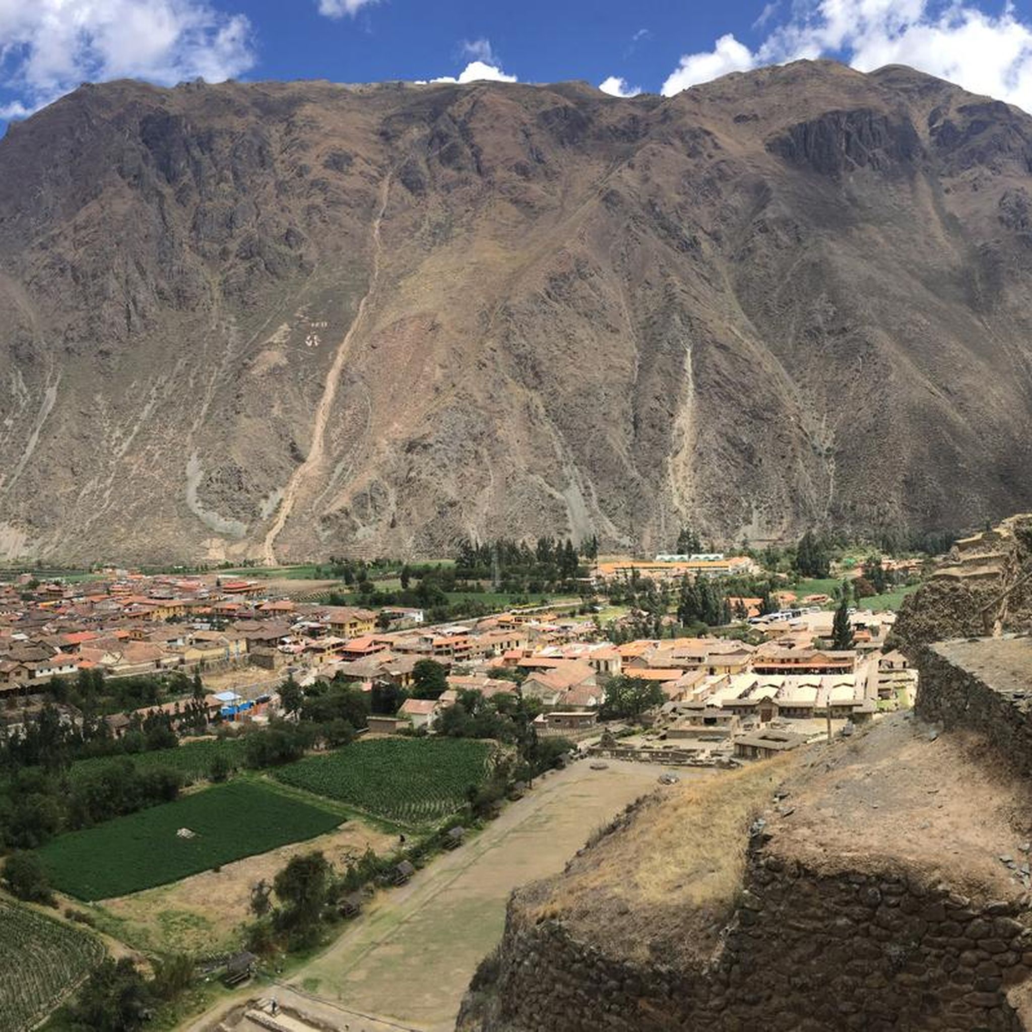
Jogging routes in Urubamba offer diverse terrain within Peru's Sacred Valley, characterized by towering Andean mountains, lush valleys, and the winding Urubamba River. The region features a mild climate and moderate altitude, providing a comfortable environment for running. Existing trails, often used for hiking, can be adapted for jogging, ranging from moderate paths to more challenging ascents. These routes frequently incorporate natural features and archaeological sites, providing varied scenery for runners.
Best jogging routes in Urubamba
- The most popular jogging…
Last updated: July 10, 2026
4.0
(1)
39
runners
7.96km
00:55
240m
240m
Moderate run. Good fitness required. Mostly paved surfaces. Suitable for all skill levels.
38
runners
11.7km
01:35
570m
570m
Hard run. Very good fitness required. Mostly paved surfaces. Suitable for all skill levels.

Sign up for free
5.0
(1)
11
runners
16.3km
02:05
470m
470m
Hard run. Very good fitness required. Mostly paved surfaces. Suitable for all skill levels.
3.0
(2)
12
runners
19.0km
02:16
530m
530m
Hard run. Very good fitness required. Mostly paved surfaces. Suitable for all skill levels.
16
runners
4.15km
01:18
580m
580m
Hard run. Very good fitness required. Sure-footedness, sturdy shoes and alpine experience required.
30
runners
13.9km
02:10
810m
810m
Hard run. Very good fitness required. Sure-footedness, sturdy shoes and alpine experience required.
3
runners
4.42km
00:37
230m
230m
Moderate run. Good fitness required. Mostly paved surfaces. Suitable for all skill levels.
Our route recommendations are based on thousands of hikes, rides, and runs completed by other people on komoot.
Start today with a free account
Your next adventure awaits.
Login or Signup
Other adventures in Urubamba

Tips from the Community

Those who are not fit should not undertake the ascent and descent in bad weather. It's a good 600 meters of elevation gain, mostly on steps. And slippery downhill, especially when wet.
0
0

The Temple of the Sun is one of the most impressive relics of the Inca culture and was built in honor of the sun god Inti. It was the spiritual and religious center of the Inca Empire. Today, the Qoricancha stands as a symbolic example of the fusion of Inca building culture and Spanish colonial architecture. The Qoricancha housed not only the Temple of the Sun, but also other sacred shrines for other deities. (Temple of the Moon Goddess, the Temple of Lightning, the Temple of the Rainbow, the Temple of Water, and others. All temples were clad in gold and adorned with precious stones. The Spaniards plundered the treasures and partially destroyed the temple to build a monastery on it. The monastery was repeatedly damaged by several earthquakes, but the walls of the Inca temple have remained undamaged, which speaks to the exceptional architecture. Even today, 15 monks still live here.
1
0

It's the highest viewpoint. You can pass it from the trail, but otherwise the climb is worth it.
0
0

The archaeological site of Tambomachay was a place dedicated to water worship and served as a resting place for the Inca nobility. Even today, this archaeological site impresses all visitors with its complex hydraulic engineering.
3
0
How times change. This used to be a place to take a break, everyone had their snack with them and took their lunch break or afternoon nap here. It was a place to relax. But in recent years the number of visitors has increased so much that more and more areas have been closed or regulated. I like to remember this wonderful time when we could still enjoy this amazing view without any time restrictions.
0
0

A small but impressive facility.
1
0

A Quechua legend says about the effect of the three small watercourses: If you drink from the watercourse on the bottom right, you will become younger; if you drink from the watercourse on the bottom left, you will have twins; and the upper watercourse is said to have a blessing.
0
0

already crazy when you stand in front of it
1
0
Frequently Asked Questions
How many running routes are available in Urubamba?
Urubamba offers a diverse selection of running routes, with over 7 options detailed in this guide. These routes traverse the stunning landscapes of Peru's Sacred Valley, providing varied terrain for all levels of runners.
What kind of terrain can I expect on jogging trails in Urubamba?
Jogging trails in Urubamba feature diverse terrain, from moderate paths to more challenging ascents through mountainous areas. You'll encounter routes with significant elevation changes, offering a good workout amidst the majestic Andean peaks and lush valleys. For example, the Montaña Huayna Picchu loop from Machu Picchu involves considerable climbing.
Are there any family-friendly running paths in Urubamba?
While many routes in Urubamba involve moderate to difficult terrain, the region's natural beauty and existing trails can be adapted for family outings. Shorter, less strenuous sections of trails or runs around the Plaza de Armas in Urubamba town offer a pleasant experience for families. Always check the route details for specific difficulty levels.
What natural features or landmarks can I see while running in Urubamba?
Urubamba's running routes are rich with natural beauty and historical sites. You can enjoy views of the towering Andean mountains, the winding Urubamba River, and lush valleys. Many trails pass by significant archaeological sites like the ancient Inca agricultural terraces of Moray and Maras. The Saqsaywaman loop from San Pedro offers views of ancient Incan sites, and the Cristo Blanco loop from Cuzco provides a significant viewpoint overlooking the city. You might also encounter the beautiful Maras Salt Mines or the impressive Machu Picchu on longer, more challenging routes.
What is the best season for jogging in Urubamba?
Urubamba enjoys a temperate and warm climate year-round, with average temperatures around 11ºC. The dry season, from May to September, offers sunny days and clear skies, making it ideal for outdoor activities like jogging without sudden weather changes. This period provides the most comfortable conditions for exploring the trails.
Are there any circular running routes in the Urubamba area?
Yes, several circular running routes are available. For instance, the Saqsaywaman loop from San Pedro is a popular 5.0-mile (8.0 km) circular trail. Another option is the Montaña Huayna Picchu loop from Machu Picchu, which is a longer 7.1-mile (11.5 km) loop through mountainous terrain.
What do other runners enjoy most about jogging in Urubamba?
The running routes in Urubamba are highly rated by the komoot community, with an average score of 4.0 stars from over 5 reviews. Runners often praise the stunning Andean mountain views, the unique experience of running near ancient Incan sites, and the diverse terrain that offers both challenging climbs and scenic paths.
Are there any routes that pass by the Perolniyoc Waterfall?
While not explicitly listed as a jogging route in this guide, the Perolniyoc Waterfall is a notable natural feature in the region. It's accessible via a walk through scenic landscapes, which could be adapted for a jog, allowing you to experience this beautiful 100-meter waterfall surrounded by lush vegetation.
What are some longer, more challenging running options in Urubamba?
For those seeking a more challenging run, routes like the Saqsaywaman – Tambomachay Water Temple loop from San Pedro cover approximately 11.8 miles (19.0 km) with significant elevation changes. Another demanding option is the White Christ – Qurikancha loop from San Pedro, spanning about 10.1 miles (16.3 km).
Are there any running routes that offer views of Machu Picchu?
Yes, some of the more challenging routes provide incredible views related to Machu Picchu. The Montaña Huayna Picchu loop from Machu Picchu and the Montaña Machupicchu loop from Machu Picchu are both difficult trails that lead through mountainous terrain, offering unparalleled perspectives of the iconic site and its surroundings.
Can I find places to eat or drink near the running trails in Urubamba?
Urubamba town, with its central Plaza de Armas, offers various cafes and shops. While specific establishments aren't listed directly on the trails, many routes start or end near populated areas, making it convenient to find refreshments before or after your run. The town itself is a hub for amenities.
Most popular attractions in Urubamba

Get inspired with the komoot mobile app


Didn’t find what you were looking for?
Check out more Running Trails & Routes throughout Urubamba below and find the perfect route in your destination.
Explore more
Browse the best Running Trails & Routes in other regions.
