The best gravel rides in Forêt Des Combots D'Ansoine
4.6
(13)
138
riders
13
rides
Gravel biking in Forêt Des Combots D'Ansoine offers a network of routes primarily characterized by coastal paths and seaside loops. The region is rooted on one of Charente-Maritime's longest coastal dunes, creating a dynamic interface between sandy beaches and wooded areas. This dunal and forested environment provides diverse habitats, including dunes, forest, and ponds. The terrain features relatively low elevation gains, with the highest points typically under 200 meters, making for accessible riding.
Best gravel bike trails in Forêt Des…
Last updated: October 20, 2026
5.0
(2)
1
riders
14.4km
00:50
80m
80m
Easy gravel ride. Great for any fitness level. Mostly paved surfaces. Suitable for all skill levels.
5.0
(1)
4
riders
15.1km
00:49
100m
100m
Easy gravel ride. Great for any fitness level. Mostly paved surfaces. Suitable for all skill levels.

5.0
(1)
2
riders
Easy gravel ride. Great for any fitness level. Mostly paved surfaces. Suitable for all skill levels.
3
riders
29.1km
01:49
110m
110m
Easy gravel ride. Great for any fitness level. Mostly paved surfaces. Suitable for all skill levels.
5
riders
43.1km
02:34
150m
150m
Moderate gravel ride. Good fitness required. Mostly paved surfaces. Suitable for all skill levels.
Get access to more routes and recommendations from other explorers.
Already have an account?
Our route recommendations are based on thousands of hikes, rides, and runs completed by other people on komoot.
Start today with a free account
Your next adventure awaits.

Tips from the Community

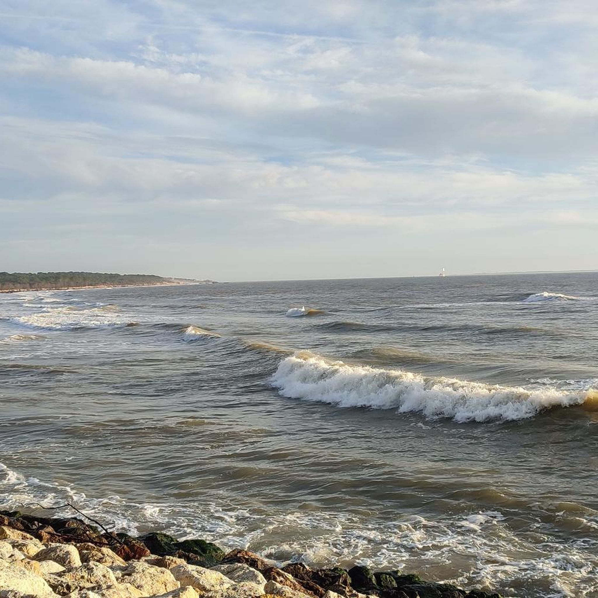
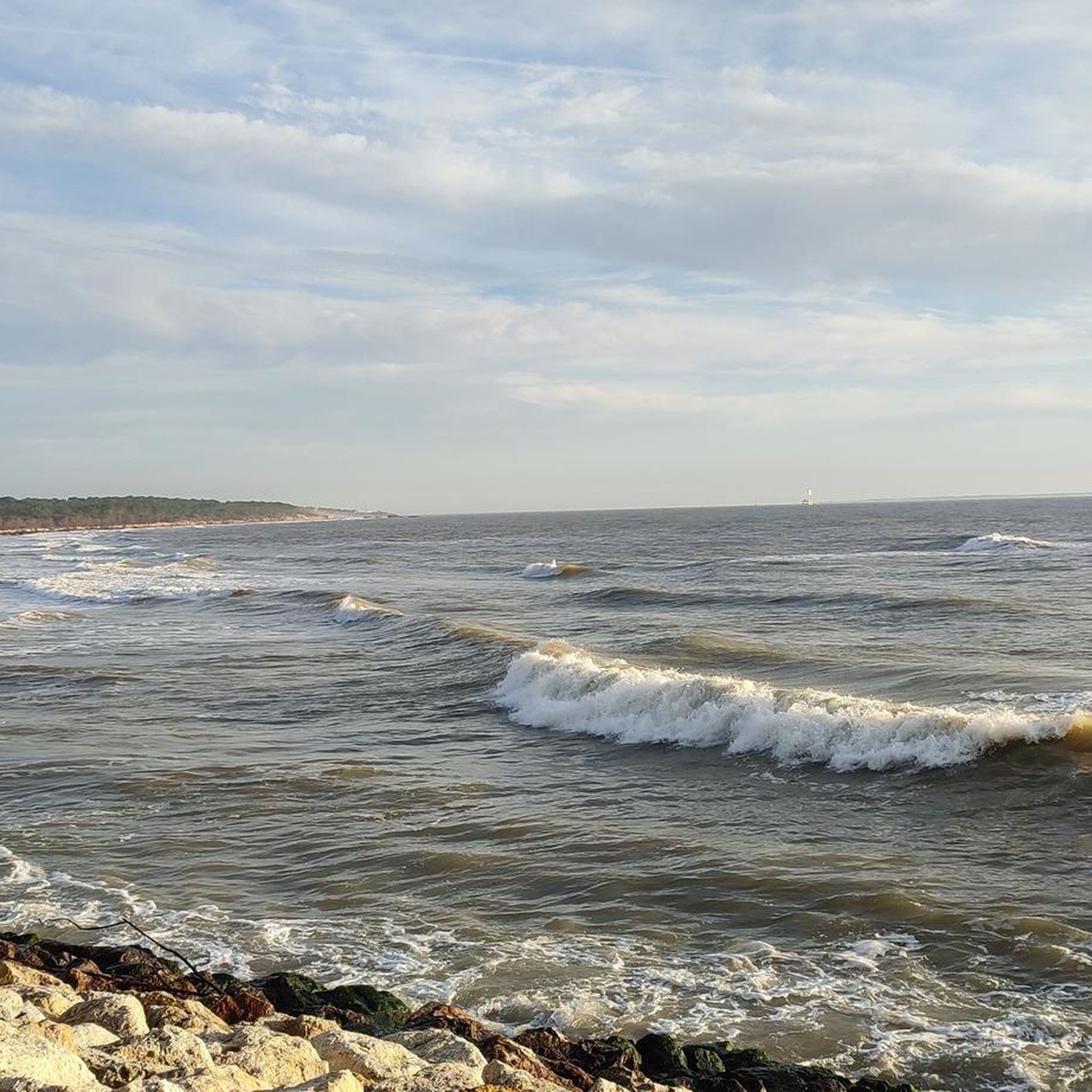
This viewpoint, located near the port of La Palmyre, offers a magnificent panorama of the Atlantic Ocean. It is an ideal place to take a break and enjoy the landscape, between the sea, boats, and surrounding nature. The atmosphere is particularly pleasant, especially at sunrise or sunset, when the colors illuminate the coast. A must-stop during a bike or mountain bike ride on the Charente coast.
2
0
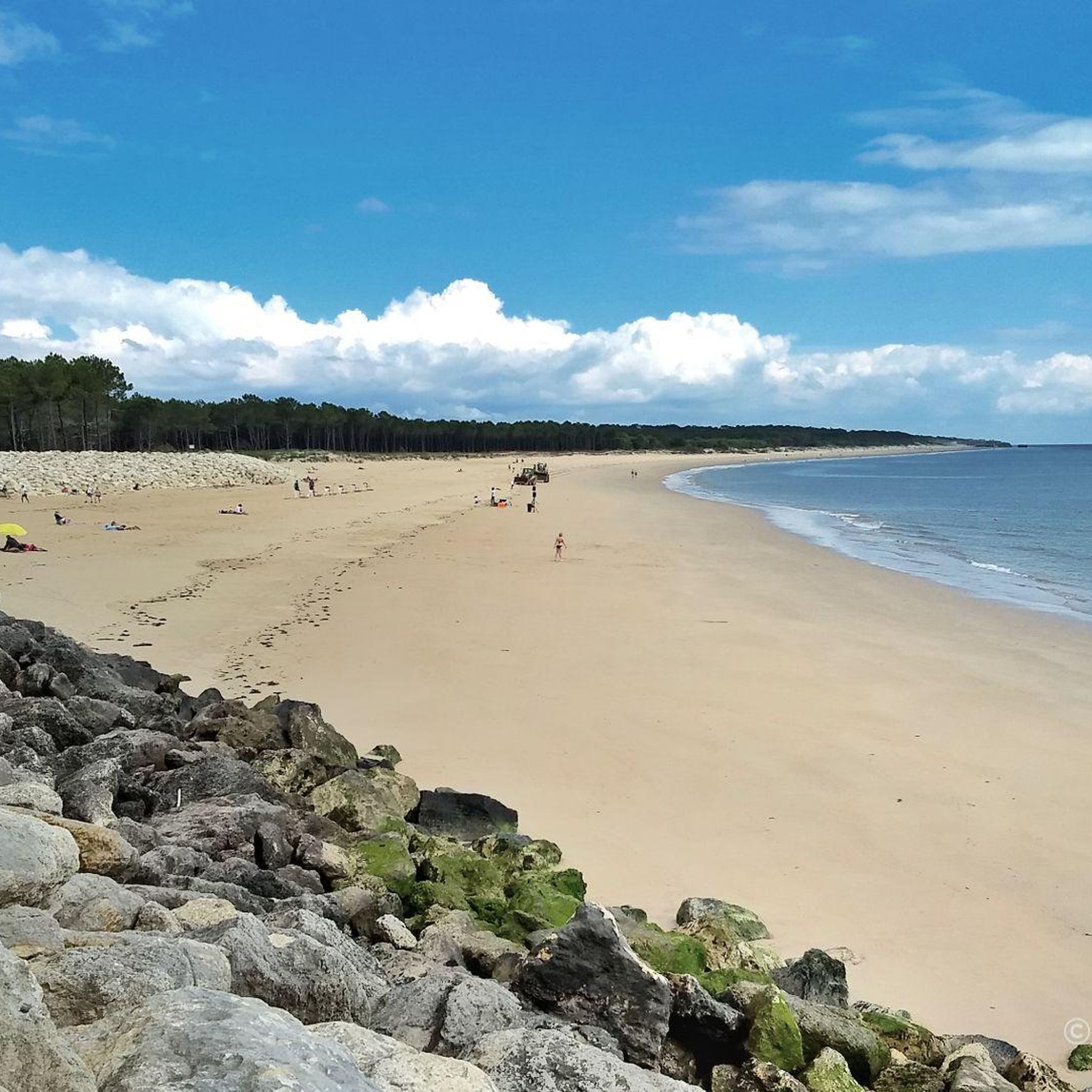
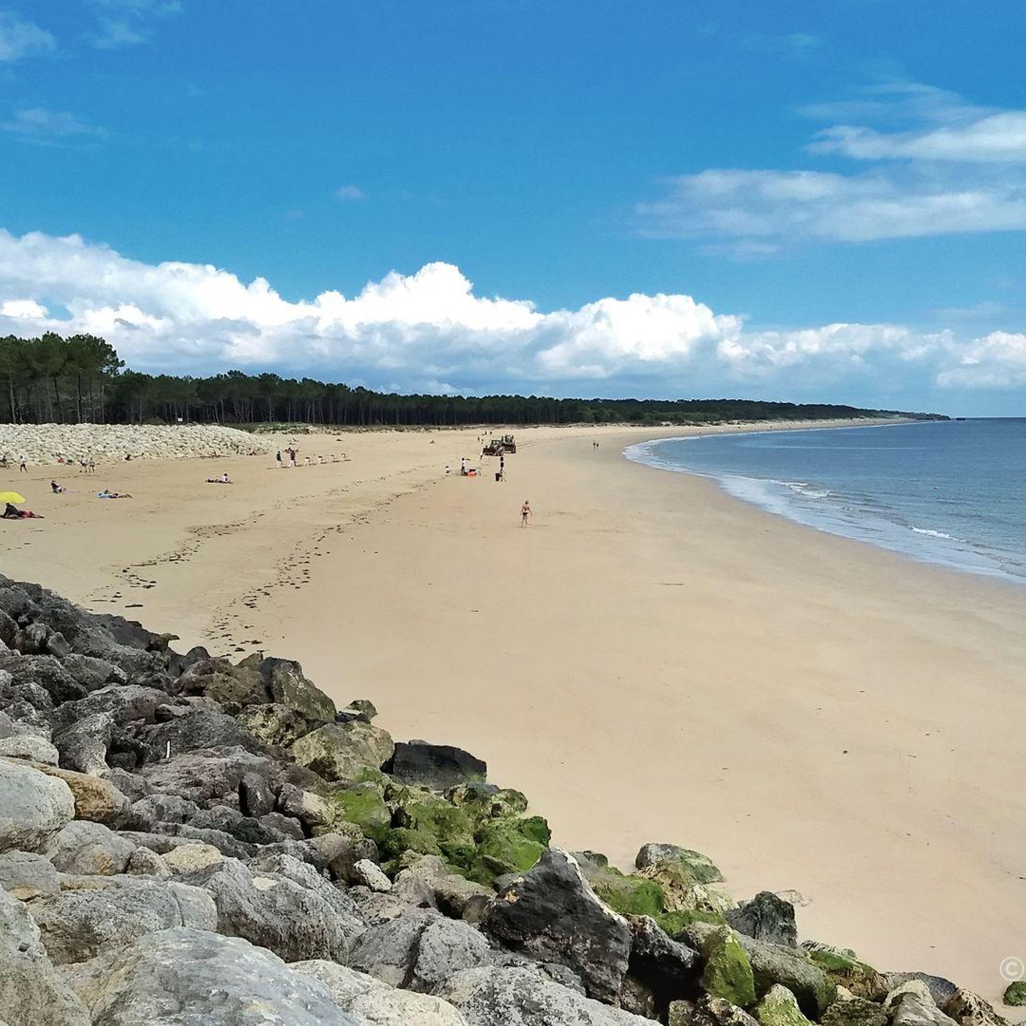
La plage de la Grande Côte is one of the most beautiful sites in Saint-Palais-sur-Mer. Lined with dunes and forest, it offers a vast panorama of the Atlantic Ocean as well as a breathtaking view of the Coubre lighthouse and, on a clear day, of the island of Oléron. Easily accessible by bike or mountain bike, it is an ideal place to take a break, admire the landscape, enjoy the sea air and immortalize this exceptional setting.
2
0
L'Embellie beach is a real must-see on the coast. This spot offers an exceptional natural setting with an unobstructed view of the island of Oléron, ideal for a break during a mountain bike or bike ride. Between the ocean, the dunes, and the fine sand, the panorama is magnificent in all seasons. A perfect place to enjoy the calm, admire the landscape, and take a few photos before continuing the route.
1
0
Beautiful view, I recommend it
2
0

It was formed during the 19th century following the disappearance of the island of Armote. Its richness in coastal biotopes makes it one of the largest natural sites in Charente-Maritime. Its formation is due to the confrontation between the Atlantic currents sweeping the coasts and the currents of the Gironde flowing into the ocean. The marine current, heavily loaded with sand, slows down as it passes Pointe de la Coubre, which allows the sand to be deposited massively around and in Bonne-Anse. The bay is thus in perpetual evolution, so much so that the site could become an inland lake. The extent of the dune environments is remarkable.
0
0

The carrelets of Saint-Palais-sur-Mer are among the most emblematic elements of the Charente coastline. Their history blends traditional fishing, tourist development, and local heritage. 🐟 Origin of the carrelets Originally, the word "carrelet" referred to a square fishing net used since the 17th century. A precise description can be found as early as 1769, in the writings of the scholar Henri-Louis Duhamel du Monceau, who mentioned this type of fishing on the Saintonge coast. 👉 At that time, these were not yet the current huts, but simply a net operated from rudimentary structures. ⚓ Artisanal fishing structures The first local carrelets were simple wooden platforms, built by the fishermen themselves to stand above the water. They were mainly used to catch shrimp, fish, and crabs near the shore, without going out to sea. 👉 It was a family and coastal fishery, less dangerous than sea fishing. 🏖️ 19th – early 20th century: transition to a leisure activity At the turn of the 20th century, with the rise of seaside resorts like Saint-Palais, the carrelets evolved. Holidaymakers and notable figures adopted this practice: construction of fixed jetties, appearance of huts on stilts. The carrelets then became places for relaxation as much as for fishing. 👉 They already contributed to the postcard image of the coast. 🪵 After 1945: democratization and multiplication After the Second World War, the number of carrelets increased sharply. They became a symbol of popular leisure and conviviality. The transition was gradually made from a means of subsistence to a recreational activity. 🌊 Storms and reconstruction The carrelets are fragile in the face of storms: 1999: massive destruction (up to 90% in some areas) 2010 (Xynthia storm): new damage Many have been rebuilt identically, respecting tradition. 🏛️ Today: protected heritage In Charente-Maritime, there are about 400 carrelets. They are: integrated into the public maritime domain allocated by administrative authorization (often renewed every 5 years) Since 2018, they have been recognized as cultural heritage of the department. 👉 In Saint-Palais, they can be observed in particular: at Pont du Diable at the conche du Concié at the Puits de l’Auture
0
0
The puits de l’Auture is an emblematic natural site located in Puits de l’Auture, north of the commune of Saint-Palais-sur-Mer. Its name often intrigues, and its history blends geology, local traditions, and maritime observation. 🌊 Origin and formation The puits de l’Auture is not a man-made well, but a natural formation: It is a cavity carved into the limestone rock by marine erosion. Under the effect of waves and infiltrations, the rock gradually collapsed, forming a sort of vertical chasm open to the sea. During strong swells or tides, water rushes in violently, creating spectacular eddies. 📜 Origin of the name The term “Auture” probably comes from Old French or the local dialect: It could derive from “hauteur” (height) or “autre” (other), evoking a high or separate place. Another hypothesis suggests a deformation of an old word related to a natural cavity or opening. No completely certain origin has been formally established, which adds to the mystery of the place. ⚓ Local historical role The site has had several uses or functions over time: 👀 Observation point Located on the rocky cornice, it served as a natural observation post to monitor the sea. Locals and fishermen could spot boats, storms, or dangers. 🎣 Fishing activities As elsewhere on the coast of Royan, particularly near the famous carrelets (fishing huts on stilts), the area was frequented by fishermen. The rocks around the well allowed for shore fishing or line fishing. 🌿 A remarkable natural site Today, the puits de l’Auture is mainly: A popular walking spot along the coastal path. A listed site for its landscape and geological interest. A remarkable viewpoint over the Atlantic Ocean, especially at sunset. ⚠️ Caution The site remains fragile and potentially dangerous: Unstable cliffs Powerful waves during storms It is advisable to stay on the marked trails.
0
0

The tides are constantly changing the landscape.
0
0
Frequently Asked Questions
How many gravel bike trails are available in Forêt Des Combots D'Ansoine?
There are over 45 gravel bike trails in Forêt Des Combots D'Ansoine, offering a wide range of options for different skill levels. The komoot community has explored more than 500 gravel biking tours in the area.
Are there easy gravel bike trails suitable for beginners or families?
Yes, Forêt Des Combots D'Ansoine offers several easy gravel bike trails. A great option for a relaxed ride with scenic seaside views is the Côte sauvage – Seaside loop from Saint-Palais-sur-Mer, which is 14.3 miles (23.1 km) long and features relatively low elevation gain.
What kind of terrain can I expect on gravel bike trails in Forêt Des Combots D'Ansoine?
The gravel bike trails in Forêt Des Combots D'Ansoine are primarily characterized by coastal paths and seaside loops. You'll find relatively low elevation gains, with the highest points typically under 200 meters, making for accessible riding. The landscape includes stretches along the "Côte sauvage" (Wild Coast), offering views of the Atlantic and connecting various coastal towns and beaches.
Are there any longer gravel bike routes for experienced riders?
For those looking for a longer ride, the Port of Marennes – Marennes Beach loop from Luna Park is a moderate 41.8 miles (67.2 km) trail. It offers a substantial distance to explore the coastal environment.
What are some interesting landmarks or attractions I can see along the gravel trails?
Along the gravel trails, you can explore several points of interest. The Côte sauvage itself offers stunning natural beauty. You might also encounter historical sites like the German Bunkers of La Grande Côte. The Combots d'Ansoine Forest provides a change of scenery from the coast.
What do other gravel bikers say about the trails in Forêt Des Combots D'Ansoine?
The area is highly rated by the komoot community, with an average score of 4.6 stars from over 60 reviews. Reviewers often praise the unique blend of maritime environments and forested sections, as well as the accessible nature of the coastal paths and seaside loops.
Are there any circular gravel bike routes in the region?
Yes, many of the gravel bike trails in Forêt Des Combots D'Ansoine are designed as loops. For example, the Promenade des Deux Phares – Côte sauvage loop from Vaux-sur-Mer is a 23.0 miles (37.0 km) circular trail that takes you through diverse coastal landscapes.
Is there parking available near the gravel bike trailheads?
Given the popularity of coastal areas and the presence of various towns and beaches, you can generally find parking options near the starting points of many trails, especially in towns like Saint-Augustin, Saint-Palais-sur-Mer, and Vaux-sur-Mer. Specific parking availability may vary by trailhead.
What is the best season for gravel biking in Forêt Des Combots D'Ansoine?
Due to its coastal location, Forêt Des Combots D'Ansoine is enjoyable for gravel biking across many seasons. Spring and autumn offer pleasant temperatures and fewer crowds, while summer is ideal for combining rides with beach visits. Winter can also be suitable, though checking local weather conditions is always advisable.
Are there any cafes or places to eat near the gravel bike trails?
Yes, given the trails often connect coastal towns and beaches, you'll find various amenities. For instance, you might come across a Burger Food Truck by the Beach, and many towns along the routes will offer cafes and restaurants.
Can I find moderate difficulty gravel bike trails in Forêt Des Combots D'Ansoine?
Absolutely. The region offers 23 moderate gravel bike trails. A popular choice is the Wild Coast of La Tremblade – Ronce-les-Bains mountain bike circuit loop from Saint-Augustin, a 31.2 miles (50.2 km) route that explores the wild coast and provides a good challenge without excessive elevation.
Are there any trails that offer a mix of coastal and forested sections?
Many routes in Forêt Des Combots D'Ansoine offer this blend. The region's landscape often features forested sections near the coast. For example, the Côte sauvage – Promenade des Deux Phares loop from Luna Park provides a diverse experience, traversing both the wild coast and areas with more vegetation.
Most popular routes in Forêt Des Combots D'Ansoine
Most popular attractions in Forêt Des Combots D'Ansoine

Get inspired with the komoot mobile app


Explore more
Browse the best Gravel rides in other regions.
