The best walks and hikes in Forêt Des Combots D'Ansoine
4.6
(644)
7,300
hikers
34
hikes
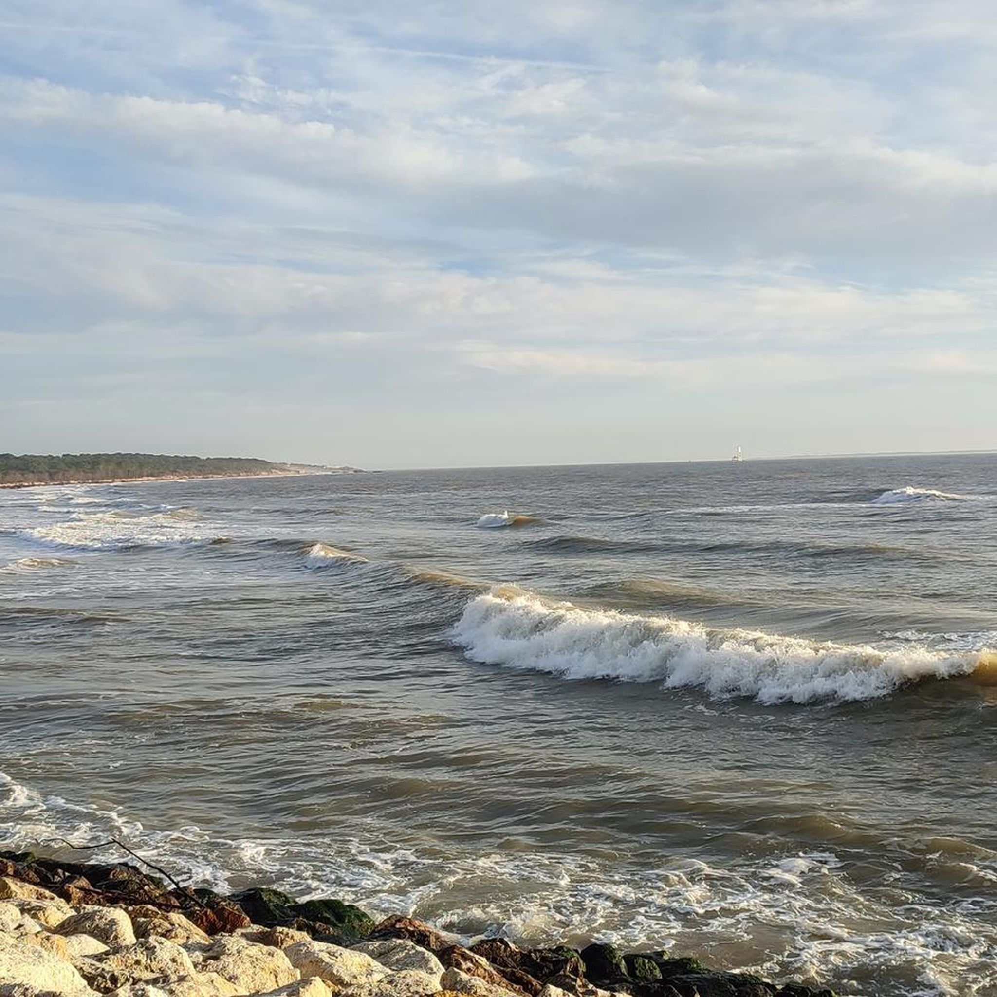
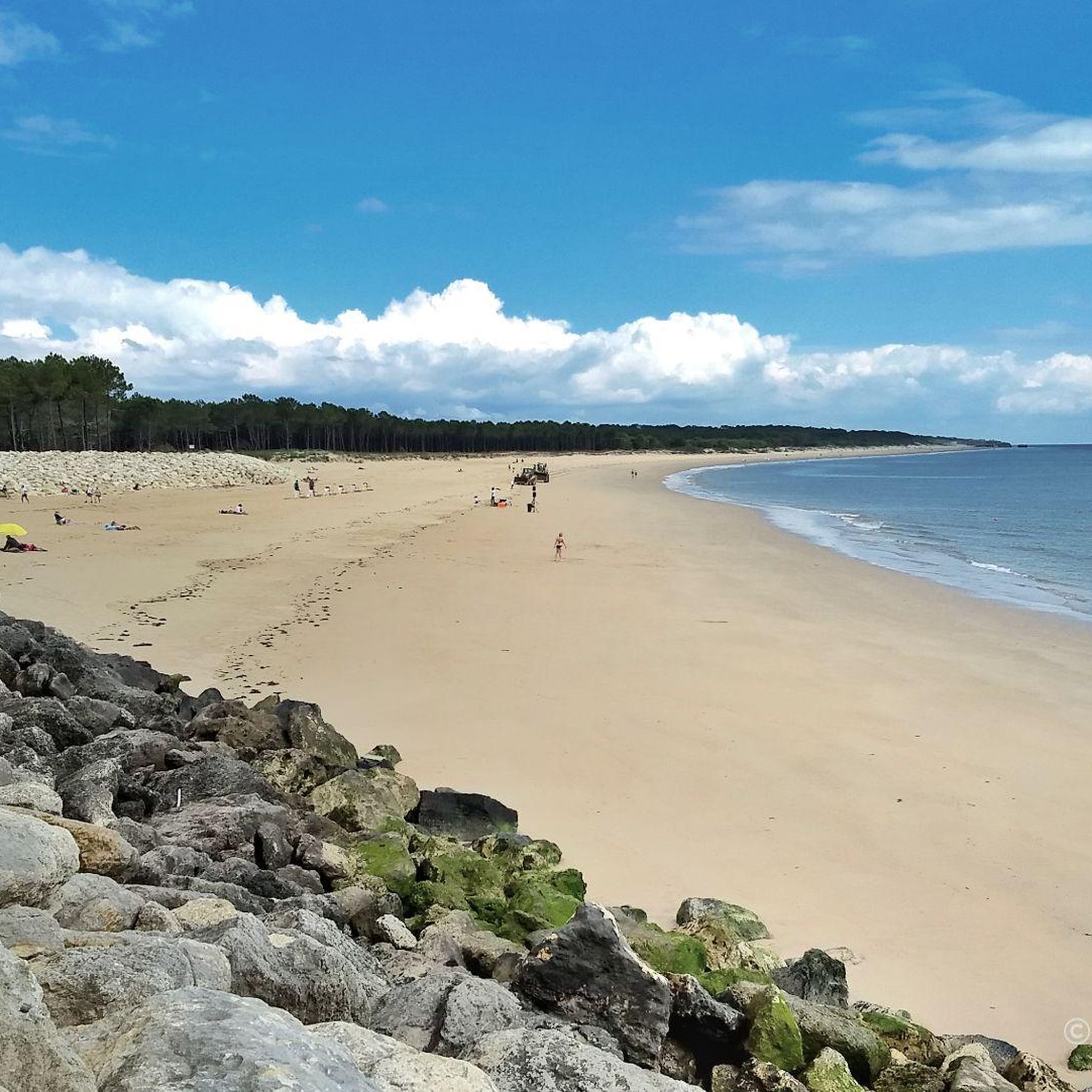
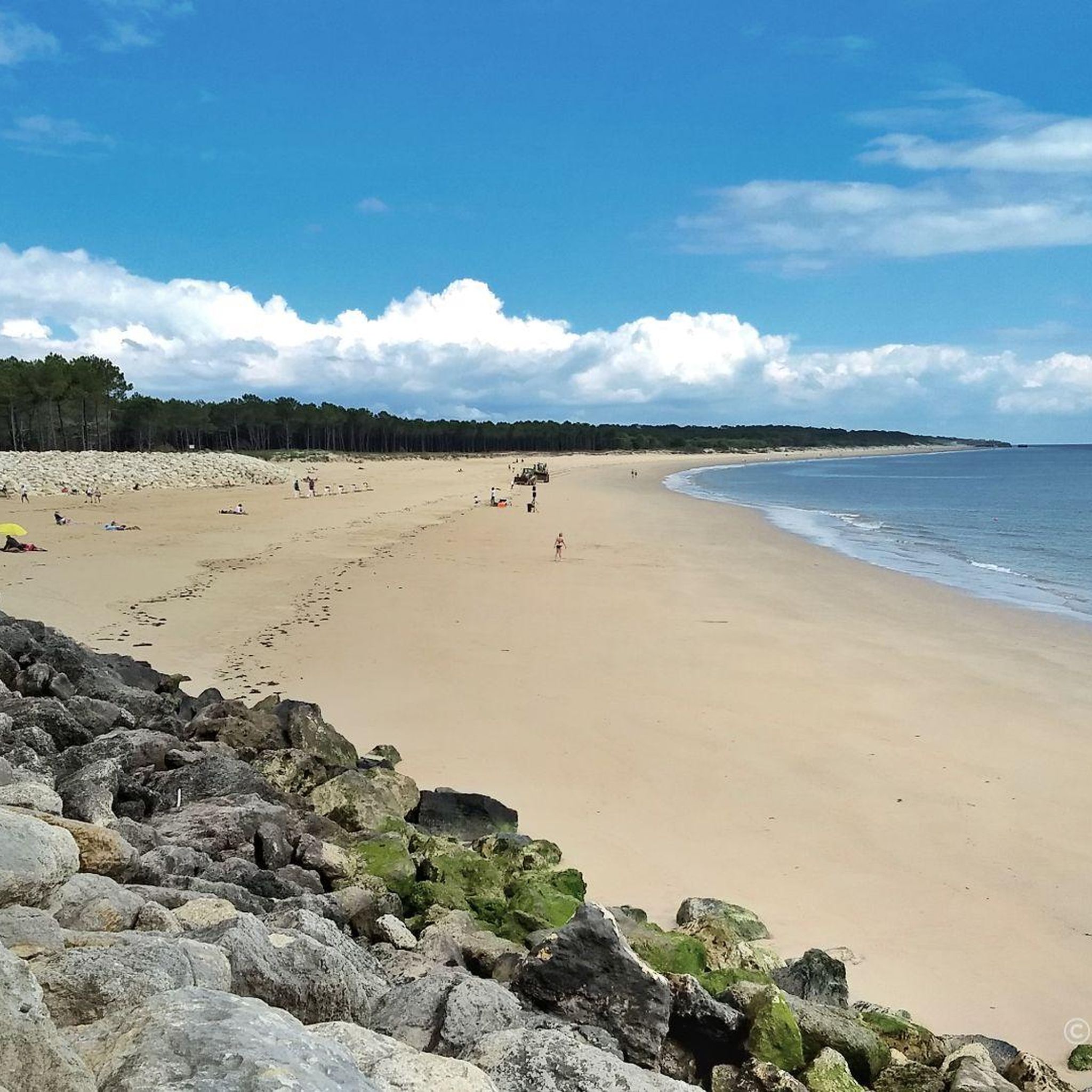
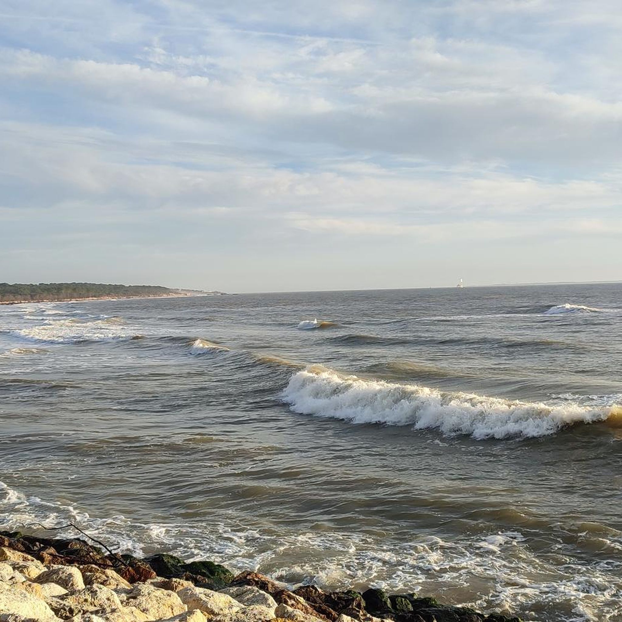
Hiking in Forêt Des Combots D'Ansoine offers diverse trails across a natural reserve situated on the Arvert peninsula. The landscape features a blend of coastal dunes, protected forest primarily composed of maritime pines and holm oaks, and bordering marshes. The area is rooted in a vast limestone plateau, providing varied terrain for outdoor activities.
Best hiking trails in Forêt Des Combots D'Ansoine
- The most popular hiking route is La Grande Côte Customs Trail, an easy 2.8 miles (4.5 km)…
Last updated: October 10, 2026
4.0
(1)
14
hikers
4.53km
01:09
20m
20m
Easy hike. Great for any fitness level. Easily-accessible paths. Suitable for all skill levels.
4.6
(25)
253
hikers
Moderate hike. Good fitness required. Easily-accessible paths. Suitable for all skill levels.

4.8
(20)
101
hikers
Moderate hike. Good fitness required. Easily-accessible paths. Suitable for all skill levels.
5.0
(5)
24
hikers
Moderate hike. Good fitness required. Easily-accessible paths. Suitable for all skill levels.
4.7
(3)
43
hikers
Easy hike. Great for any fitness level. Easily-accessible paths. Suitable for all skill levels.
Get access to more routes and recommendations from other explorers.
Already have an account?
Our route recommendations are based on thousands of hikes, rides, and runs completed by other people on komoot.
Start today with a free account
Your next adventure awaits.
Tips from the Community

Located on the commune of St-Palais-sur-Mer, at the tip of Terre-Nègre, it is intended to mark the southern passage of the Gironde estuary and to signal the presence of a dangerous sandbank, the la barre à l'Anglais.
0
0

🏛️ Origin of the market The market of Saint-Palais-sur-Mer appeared at the beginning of the 20th century, at the same time as the tourist development of the commune. 1901: construction of the first covered market on the Place de l’Océan 1913: creation of a second covered market, proof of the resort's rapid growth 👉 At that time, the town (then called Bureau-les-Bains) became a popular destination thanks to sea bathing and the arrival of bourgeois tourism. 🌊 A market linked to the seaside resort The market is part of the village's transformation: - Originally: small fishing and farming village - Late 19th – early 20th century: development of villas and tourism The market then became a central place for local life and supply. It also reflects local productions: / fish and seafood (Marennes-Oléron oysters in particular) / Charentais agricultural products / regional specialties 🔄 Developments in the 20th century 1975: destruction of the old buildings (covered market + function room) Construction of a new, more modern market with redevelopment of the town center 👉 This period corresponds to the modernization of the resort after the war. 🛍️ The market today The current market, still serving the heart of the town: 📍 Covered market of Saint-Palais-sur-Mer It is open all year round in the morning and complemented by an outdoor market. In summer: daily and very lively markets 🎉 Evolution towards tourist entertainment Today, the market is no longer limited to food and is turning towards: - night markets (local produce, crafts, art) - summer events by the sea
0
0
🏰 Interior visit Entering Cordouan means discovering a unique place, halfway between a royal monument and a maritime structure. Here are the main stages of the visit 👇 🚪 1. The base and the guardroom As soon as you enter (accessible at low tide), you step into a massive stone base - Very thick walls to withstand storms - Old technical and storage rooms - Austere atmosphere, typical of a defensive structure at sea ⛪ 2. The royal chapel This is the symbolic heart of the lighthouse, absolutely remarkable. - Dedicated to Notre-Dame de Cordouan - Decorated with marble, sculptures, and elegant vaults - Designed to resemble a palace chapel 👉 This is what gives the lighthouse its nickname "Versailles of the sea". 👑 3. The king's apartments Above the chapel are rooms intended to accommodate the king (even though he never came). - Vaulted and decorated rooms - Fireplaces and period elements - Later used by the lighthouse keepers 🌀 4. The monumental staircase - Approximately 300 steps - Spiral stone staircase - Natural light through narrow openings 👉 The climb is gradual, with several landings allowing you to discover the successive levels. 💡 5. The lantern room You then arrive at the technical part of the lighthouse: - Modern lighting system - Old Fresnel lens (major historical element) - Mechanisms that have evolved over the centuries 🌊 6. The exterior balcony At the top: - Spectacular 360° view of the Gironde estuary and the Atlantic Ocean - Unique sensation of being isolated in the open sea 🧭 What makes the visit unique - Rare blend of royal luxury and maritime engineering - Monument still in operation - Access dependent on tides and weather - Feeling of total isolation, especially at high tide 💡 Tip: The visit usually includes a boat trip from Royan or Le Verdon. You should bring suitable shoes (damp and sometimes slippery ground).
0
0
🏰 Historic The Cordouan lighthouse, located at the entrance to the Gironde estuary, is one of France's most remarkable maritime monuments. Nicknamed "the king of lighthouses" or "the Versailles of the sea," it has a unique history of over 400 years. ⚓ Origins (14th – 16th century) As early as the 14th century, a first rudimentary fire tower existed on the Cordouan plateau to signal dangers to sailors. The estuary was then very dangerous, with numerous shipwrecks, which threatened trade towards Bordeaux. 👑 Construction of the royal lighthouse (1584 – 1611) The current construction began in 1584 under the reign of Henry III, then continued under Henry IV. Architect Louis de Foix designed an exceptional building: * both a lighthouse and a royal prestige monument * richly decorated (chapel, sculptures, apartments) It was completed and lit in 1611. 👉 At that time, it was considered an architectural marvel, sometimes compared to the lighthouse of Alexandria. 🔬 Evolutions and modernization (18th – 19th century) Between 1788 and 1790, engineer Joseph Teulère raised the lighthouse by about 20 meters to improve its visibility. In 1823, the Fresnel lens was installed, a major innovation that revolutionized lighthouse lighting worldwide. 🏛️ Heritage recognition Classified as a historic monument as early as 1862, among the very first in France. Still in operation, it is the oldest French lighthouse still in service. Listed as a UNESCO World Heritage site in 2021, as a masterpiece of maritime architecture. ⚙️ Contemporary era The lighthouse was automated in 2006, but remains maintained and monitored by teams. It is now visited in season and is a major tourist site on the Charente and Gironde coast.
0
0
The Platin beach, located in Saint-Palais-sur-Mer, is one of the most characteristic coastal sites in the region, both for its landscape and its history. 🌊 A site shaped by the sea The Platin beach is distinguished by its limestone cliffs and small coves. This coastline belongs to the Côte Nord de Beauté, between Royan and La Palmyre. The word “Platin” comes from the local dialect and refers to a rocky plateau exposed at low tide. For millennia, marine erosion has sculpted these rocks, creating caves, overhangs, and typical reliefs. 🐟 A traditional activity: fishing and fishing huts As along the entire Charente coast: - Locals practiced shore fishing (shellfish, crustaceans). - Carrelets (fishing huts on stilts) were installed on the rocks or cliffs, emblems of the local landscape. - These structures have now become a heritage and tourist feature. 🪖 A site marked by the Second World War During the Second World War: - The coastline, including the Platin, was integrated into the Atlantic Wall built by the German army. - Bunkers and defensive structures were established on the heights to monitor the Gironde estuary. - Some remains are still visible today, integrated into the landscape. 🏖️ Tourist boom From the end of the 19th century and especially in the 20th century, Saint-Palais-sur-Mer became a popular seaside resort. The Platin beach attracts visitors for: - its wilder setting than the large beaches, - its rocks and coves, - its view of the estuary. Today, it is appreciated for swimming, walking, and photography. 🌿 Today: a natural and heritage site The Platin beach is recognized for: - its preserved environment, - its remarkable geology, - its blend of history and nature. It is one of the emblematic places on the Charente coast, between maritime heritage and historical memory.
0
0
The carrelets of Saint-Palais-sur-Mer are among the most emblematic elements of the Charente coastline. Their history blends traditional fishing, tourist development, and local heritage. 🐟 Origin of the carrelets Originally, the word "carrelet" referred to a square fishing net used since the 17th century. A precise description can be found as early as 1769, in the writings of the scholar Henri-Louis Duhamel du Monceau, who mentioned this type of fishing on the Saintonge coast. 👉 At that time, these were not yet the current huts, but simply a net operated from rudimentary structures. ⚓ Artisanal fishing structures The first local carrelets were simple wooden platforms, built by the fishermen themselves to stand above the water. They were mainly used to catch shrimp, fish, and crabs near the shore, without going out to sea. 👉 It was a family and coastal fishery, less dangerous than sea fishing. 🏖️ 19th – early 20th century: transition to a leisure activity At the turn of the 20th century, with the rise of seaside resorts like Saint-Palais, the carrelets evolved. Holidaymakers and notable figures adopted this practice: construction of fixed jetties, appearance of huts on stilts. The carrelets then became places for relaxation as much as for fishing. 👉 They already contributed to the postcard image of the coast. 🪵 After 1945: democratization and multiplication After the Second World War, the number of carrelets increased sharply. They became a symbol of popular leisure and conviviality. The transition was gradually made from a means of subsistence to a recreational activity. 🌊 Storms and reconstruction The carrelets are fragile in the face of storms: 1999: massive destruction (up to 90% in some areas) 2010 (Xynthia storm): new damage Many have been rebuilt identically, respecting tradition. 🏛️ Today: protected heritage In Charente-Maritime, there are about 400 carrelets. They are: integrated into the public maritime domain allocated by administrative authorization (often renewed every 5 years) Since 2018, they have been recognized as cultural heritage of the department. 👉 In Saint-Palais, they can be observed in particular: at Pont du Diable at the conche du Concié at the Puits de l’Auture
0
0
🌿 Origin of the site (before the park) Originally, the site was not a park but a coastal marsh, called the Rhâ marsh. This marsh was fed by a small stream flowing towards the Bureau beach. It was one of the last natural wetlands in the area. 🏗️ Creation of the leisure park (1980s) May 1980: municipal decision to transform this marsh into a leisure park. Project developed until 1984, with the idea of creating: - a body of water - sports and relaxation facilities (pétanque, mini-golf, table tennis...) 1985 – 1987: development work complete earthworks creation of the artificial lake landscaping September 12, 1987: official inauguration of the park. 🏷️ Park name In 1990, the site was named Parc Raymond Vignes In tribute to Raymond Vignes, mayor of the commune from 1971 to 1989, who initiated the project. 🌳 Recent developments and amenities The park has continued to evolve: 🌿 Tree planting (pines, holm oaks...) to create a shaded environment 🐦 2020: creation of a bird sanctuary (LPO) with over 40 species recorded 🌳 2019: creation of an educational arboretum (≈ 40 tree species) 🏃 Addition of a fitness trail, playground, and school water activities 📍 Current role Today, this park of nearly 16 hectares is: - the main green space in the commune - a walking area around a lake (1.7 km) - a natural space also used for stormwater management
0
0
The puits de l’Auture is an emblematic natural site located in Puits de l’Auture, north of the commune of Saint-Palais-sur-Mer. Its name often intrigues, and its history blends geology, local traditions, and maritime observation. 🌊 Origin and formation The puits de l’Auture is not a man-made well, but a natural formation: It is a cavity carved into the limestone rock by marine erosion. Under the effect of waves and infiltrations, the rock gradually collapsed, forming a sort of vertical chasm open to the sea. During strong swells or tides, water rushes in violently, creating spectacular eddies. 📜 Origin of the name The term “Auture” probably comes from Old French or the local dialect: It could derive from “hauteur” (height) or “autre” (other), evoking a high or separate place. Another hypothesis suggests a deformation of an old word related to a natural cavity or opening. No completely certain origin has been formally established, which adds to the mystery of the place. ⚓ Local historical role The site has had several uses or functions over time: 👀 Observation point Located on the rocky cornice, it served as a natural observation post to monitor the sea. Locals and fishermen could spot boats, storms, or dangers. 🎣 Fishing activities As elsewhere on the coast of Royan, particularly near the famous carrelets (fishing huts on stilts), the area was frequented by fishermen. The rocks around the well allowed for shore fishing or line fishing. 🌿 A remarkable natural site Today, the puits de l’Auture is mainly: A popular walking spot along the coastal path. A listed site for its landscape and geological interest. A remarkable viewpoint over the Atlantic Ocean, especially at sunset. ⚠️ Caution The site remains fragile and potentially dangerous: Unstable cliffs Powerful waves during storms It is advisable to stay on the marked trails.
0
0
Frequently Asked Questions
How many hiking trails are available in Forêt Des Combots D'Ansoine?
Forêt Des Combots D'Ansoine offers a diverse network of over 25 hiking trails. These routes cater to various abilities, with a good mix of easy and moderate paths to explore the region's unique landscape.
What kind of terrain can I expect when hiking in Forêt Des Combots D'Ansoine?
The terrain in Forêt Des Combots D'Ansoine is quite varied, characterized by coastal dunes, protected forests primarily composed of maritime pines and holm oaks, and bordering marshlands. The geological foundation is a vast limestone plateau, but trails are generally well-maintained and accessible, ranging from easy to moderate difficulty.
Are there any easy hiking trails suitable for beginners or families?
Yes, Forêt Des Combots D'Ansoine has several easy trails perfect for beginners or families. An excellent option is the La Grande Côte Customs Trail, which is an easy 4.5 km (2.8 miles) path taking about an hour to complete. Another easy choice is the Auture Well loop from Phare de Terre-Nègre, a shorter 2.65 km route.
Can I bring my dog on the hiking trails in Forêt Des Combots D'Ansoine?
While the region is generally welcoming to dogs, specific rules may apply within the protected areas of Forêt Des Combots D'Ansoine, especially concerning wildlife. It's always best to keep dogs on a leash to protect the local fauna and flora, and to check for any specific signage at trailheads regarding pet policies.
What natural features or landmarks can I discover along the trails?
Hiking in Forêt Des Combots D'Ansoine allows you to discover several interesting features. You can explore the Combots d'Ansoine Forest itself, with its maritime pines and holm oaks. The area also features the Côte sauvage (Wild Coast) and historical sites like the German Bunkers of La Grande Côte. The trails often border the Seudre marshes and the Gironde estuary, offering diverse natural scenery.
Are there any circular hiking routes in the forest?
Yes, many of the trails in Forêt Des Combots D'Ansoine are designed as circular routes, allowing you to start and end at the same point. A popular moderate circular option is the Auture Well – Fisheries or Carrelets loop from Phare de Terre-Nègre, which is 8.6 km (5.3 miles) long. Another is the La Grande Côte Beach – Fishing Huts on Stilts loop from Phare de Terre-Nègre, covering 13.4 km (8.3 miles).
What is the best time of year to go hiking in Forêt Des Combots D'Ansoine?
Forêt Des Combots D'Ansoine can be enjoyed year-round, but spring and autumn offer particularly pleasant conditions with milder temperatures and vibrant natural colors. Summer is also popular, though it can be warmer, making the shaded forest paths a welcome retreat. Winter hiking is possible, but be prepared for cooler, potentially wetter weather.
Is there public transport access to Forêt Des Combots D'Ansoine?
While direct public transport into the heart of the forest might be limited, the broader Royan Atlantique region is accessible. The Vélodyssée (EuroVelo 1), a major cycling route, provides access to the forest from nearby towns like Royan or La Tremblade, offering an alternative way to reach the area.
Where can I park my car when visiting Forêt Des Combots D'Ansoine for a hike?
The Forêt Des Combots D'Ansoine area is well-equipped with parking areas, especially near popular trailheads and access points. It is advisable to look for designated parking zones near the Phare de Terre-Nègre or other main entry points to the forest for convenient access to the marked trails.
What kind of wildlife might I encounter in Forêt Des Combots D'Ansoine?
As a protected natural area, Forêt Des Combots D'Ansoine is home to diverse wildlife. You might spot larger mammals such as deer, roe deer, and wild boars. The forest also supports various protected plant species like prostrate asparagus and marsh orchids, and animal species including the western spadefoot toad, marbled newt, and common noctule bat.
Are there any facilities like restrooms or picnic areas available?
While specific details on restrooms within the forest trails are not always highlighted, the presence of well-maintained marked trails and parking areas suggests that basic visitor facilities are likely available at key access points. Picnic areas are often found in natural parks, providing spots to rest and enjoy the surroundings.
What do other hikers say about their experience in Forêt Des Combots D'Ansoine?
The hiking experience in Forêt Des Combots D'Ansoine is highly rated by the komoot community, with an average score of 4.6 stars from over 300 reviews. Hikers often praise the varied terrain, the blend of coastal and forest scenery, and the well-marked paths that make exploration enjoyable for all ability levels.
What makes Forêt Des Combots D'Ansoine a protected natural area?
Forêt Des Combots D'Ansoine is a protected natural reserve due to its unique blend of coastal features, ancient dunes, and diverse forest ecosystems. It's part of the Natura 2000 network, safeguarding its rich biodiversity, including specific flora and fauna adapted to its challenging conditions. Its classification as a 'protection forest' also highlights its ecological importance.
Most popular routes in Forêt Des Combots D'Ansoine
Most popular attractions in Forêt Des Combots D'Ansoine

Get inspired with the komoot mobile app


Explore more
Browse the best Hikes in other regions.
