The best cycling routes in Andrew Molera State Park
549
riders
5
rides
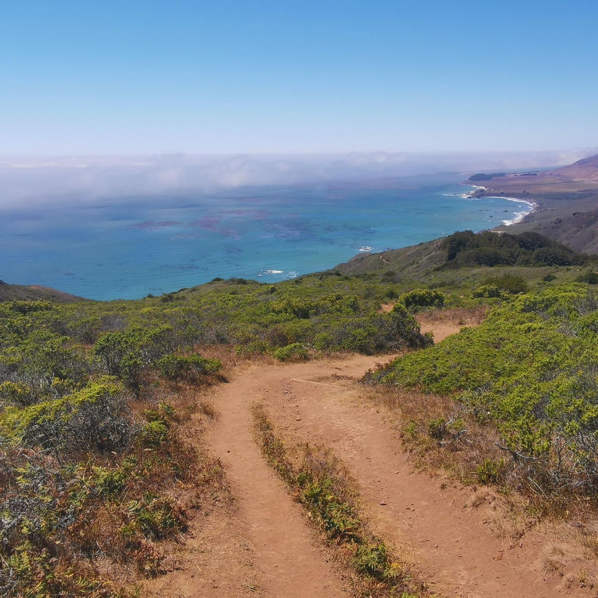
Touring cycling in Andrew Molera State Park offers routes through a diverse coastal landscape. The region is characterized by rugged coastlines, redwood forests, and expansive views of the Pacific Ocean. Routes often feature significant elevation changes, traversing hills and valleys. The terrain includes a mix of paved roads and unpaved sections, suitable for touring bicycles.
Best touring cycling routes in Andrew Molera State Park
- The most popular touring cycling route is Bixby Creek Bridge loop from Big Sur, a 20.7 miles (33.3 km) trail that takes about 4 hours to complete. This route features coastal views and passes by the iconic Bixby Creek Bridge.
- Another top favourite among local touring cyclists is The Esalen Farm loop from Big Sur Village, a difficult 32.4 miles (52.1 km) path. This route offers a challenging ride through varied terrain with significant elevation gain.
- Local touring cyclists also love the Monastery Beach – Bixby Creek Bridge loop from Carmel Valley, a 58.7 miles (94.4 km) trail leading through coastal landscapes and valleys, often completed in about 6 hours 37 minutes.
- Touring cycling in Andrew Molera State Park is defined by dramatic coastal paths, iconic bridges, and challenging climbs through redwood forests. The network offers options for experienced touring cyclists seeking demanding routes.
- The guide includes highly-rated routes that showcase the best of the region's landscape. More than 500 touring cyclists have used komoot to explore Andrew Molera State Park's varied terrain.
Last updated: July 6, 2026
7
riders
Hard bike ride. Very good fitness required. Mostly paved surfaces. Suitable for all skill levels.
6
riders
52.1km
03:51
1,150m
1,150m
Hard bike ride. Very good fitness required. Mostly paved surfaces. Suitable for all skill levels.

Sign up for free
525
riders
94.4km
06:37
1,790m
1,790m
Hard bike ride. Very good fitness required. Mostly paved surfaces. Suitable for all skill levels.
7
riders
Hard bike ride. Very good fitness required. Mostly paved surfaces. Suitable for all skill levels.
4
riders
34.8km
03:53
1,160m
1,160m
The Bixby Creek Bridge Viewpoint 🌉 – Andrew Molera State Park loop from Brazil Ranch offers a challenging touring bicycle experience through Big Sur's varied terrain. You'll traverse the historic Old Coast Road, an unpaved path winding through lush redwood forests, oak groves, and open meadows, often with cattle grazing, before emerging to panoramic ocean views near the iconic Bixby Creek Bridge. This route provides an unplugged glimpse into the region's wild heart, far from the main highway.
This is a difficult 21.6-mile (34.8 km) ride with a substantial 3821 feet (1165 metres) of elevation gain, typically taking around 3 hours and 53 minutes. The Old Coast Road features two significant 1,000-foot ascents, with some grades reaching 10.5% or even 12-15% on chunky gravel sections, so very good fitness is essential. Access points for the Old Coast Road can be found across from Andrew Molera State Park, or near the Brazil Ranch parking area off Highway 1.
What makes this route truly notable is its blend of historical significance and dramatic natural beauty. The Old Coast Road was the original route through Big Sur before Highway 1, offering a unique journey through a less-traveled corridor. It provides exceptional views of the Bixby Bridge from perspectives not accessible by car, immersing you in diverse ecosystems from rugged coastlines to dense forests.
Our route recommendations are based on thousands of hikes, rides, and runs completed by other people on komoot.
Start today with a free account
Your next adventure awaits.
Login or Signup
Popular around Andrew Molera State Park

Tips from the Community

Official viewpoint of the famous Rocky Creek Bridge. It is worth pulling off the road and making the short trip to the viewing platform to take in the wonderful views.
0
0
The Rocky Creek Bridge is a beautiful reinforced‑concrete, open‑spandrel arch bridge finished in 1932. The bridge is one of the highlights along the Pacific Coast Highway.
0
0

The Old Coast Road is a historic dirt path that was the main route between Monterey and Big Sur before Highway 1 was built in the 1930s. It is wide and easy to navigate, with two significant 1,000-foot ascents. Initially established by the Rumsen and Esselen Native Americans, this route provided access to present-day Monterey County's coast. Today, the Old Coast Road is part of the 90-mile stretch of Highway 1 that runs from Carmel to San Simeon and is included in the Big Sur International Marathon route, organized by Runner's World editors.
0
0
This is an excellent, less crowded vantage point of the Bixby Bridge, with the stunning Pacific Ocean in the background. There is a small pull-out here, making it an ideal spot to capture a few obstructed and memorable photos.
0
0

Organic farm supplying food to the Esalen Institute hot springs resort
0
0

California State Route 1 is a beautiful route on the west coast of the USA. The Bixby Bridge is located between Monterey and Los Angeles and is one of the special highlights.
0
0

This is the perfect spot to hop out of the car (there's space to park alongside the road) and take in a strip of pretty, almost-white sand beach. You can also see where the Little Sur River winds down through the sand for the final leg of its journey to the sea.
0
0

A small parking lot on the side of the highway grants views across Bixby Bridge. This bridge is part of California's first scenic highway and was completed in 1932. Its concrete arches match the colors of the coastal cliffs to form an iconic Californian landmark.
0
0
Frequently Asked Questions
How many touring cycling routes are available in Andrew Molera State Park?
There are at least 4 touring cycling routes available in Andrew Molera State Park, as detailed in this guide. These routes are generally challenging and offer diverse coastal and forest landscapes.
Are the touring cycling routes in Andrew Molera State Park suitable for beginners?
The touring cycling routes in Andrew Molera State Park are generally considered difficult, featuring significant elevation changes and varied terrain. They are best suited for experienced touring cyclists looking for a challenging ride.
What are the typical distances and elevation gains for touring cycling routes in Andrew Molera State Park?
Routes in Andrew Molera State Park typically range from approximately 20 to 58 miles (33 to 94 km) in distance. You can expect substantial elevation gains, often exceeding 1,100 meters (3,600 feet) per ride, with some routes climbing nearly 1,800 meters (5,900 feet).
Are there family-friendly touring cycling options in Andrew Molera State Park?
Given the difficult nature and significant elevation changes of the touring cycling routes in Andrew Molera State Park, they are not typically recommended for families with young children or beginner cyclists. The terrain is more suited for experienced riders.
What makes the touring cycling routes in Andrew Molera State Park challenging?
The routes are challenging due to their significant elevation gains, traversing rugged coastal hills and valleys. They often include a mix of paved roads and unpaved sections, requiring good fitness and bike handling skills.
What scenic viewpoints or attractions can I expect to see along the touring cycling routes?
You'll encounter breathtaking coastal views and iconic landmarks. Many routes pass by the famous Bixby Creek Bridge. Other notable points of interest include the Bluffs Trail, Panorama Trail, and various Panoramic Viewpoints offering expansive vistas of the Pacific Ocean and surrounding landscape.
Are there circular touring cycling routes available in Andrew Molera State Park?
Yes, all the featured touring cycling routes in this guide are circular (loop) routes. Examples include the Bixby Creek Bridge loop from Big Sur and the Monastery Beach – Bixby Creek Bridge loop from Carmel Valley.
What is the best time of year for touring cycling in Andrew Molera State Park?
The Big Sur region, including Andrew Molera State Park, generally offers pleasant cycling conditions in spring and fall, with milder temperatures and less fog. Summer can bring coastal fog, while winter may have rain and cooler temperatures. Always check local weather forecasts before heading out.
What essential gear should I bring for touring cycling in Andrew Molera State Park?
Given the challenging terrain and potential for varied weather, it's advisable to bring a touring bicycle suitable for mixed surfaces, plenty of water, snacks, layers of clothing, sun protection, a repair kit, and a fully charged phone with offline maps. Helmets are always recommended.
Are there places to refuel or find refreshments along the touring cycling routes?
While Andrew Molera State Park itself has limited facilities, routes often start or pass near towns like Big Sur Village or Carmel Valley, where you can find cafes and restaurants. It's always a good idea to carry sufficient water and snacks, especially on longer stretches.
What kind of wildlife might I encounter while cycling in Andrew Molera State Park?
Andrew Molera State Park is home to diverse wildlife. Cyclists might spot various bird species, deer, and smaller mammals. Keep an eye out for marine life like sea otters and seals along the coast. Always observe wildlife from a respectful distance.
Where can I park when visiting Andrew Molera State Park for a bike ride?
Andrew Molera State Park has a designated parking area near its entrance. Additional parking may be available in nearby towns or trailheads depending on your chosen route. Always check for parking regulations and fees before your visit.
What do other touring cyclists say about their experience in Andrew Molera State Park?
Over 500 touring cyclists have used komoot to explore Andrew Molera State Park. They often praise the dramatic coastal paths, iconic bridges like Bixby Creek Bridge, and the challenging climbs through redwood forests that define the region's unique cycling experience.
Most popular routes in Andrew Molera State Park
Most popular attractions in Andrew Molera State Park

Get inspired with the komoot mobile app


Explore more
Browse the best Cycling routes in other regions.
