The best running trails in Cotogchoa
61
runners
6
runs
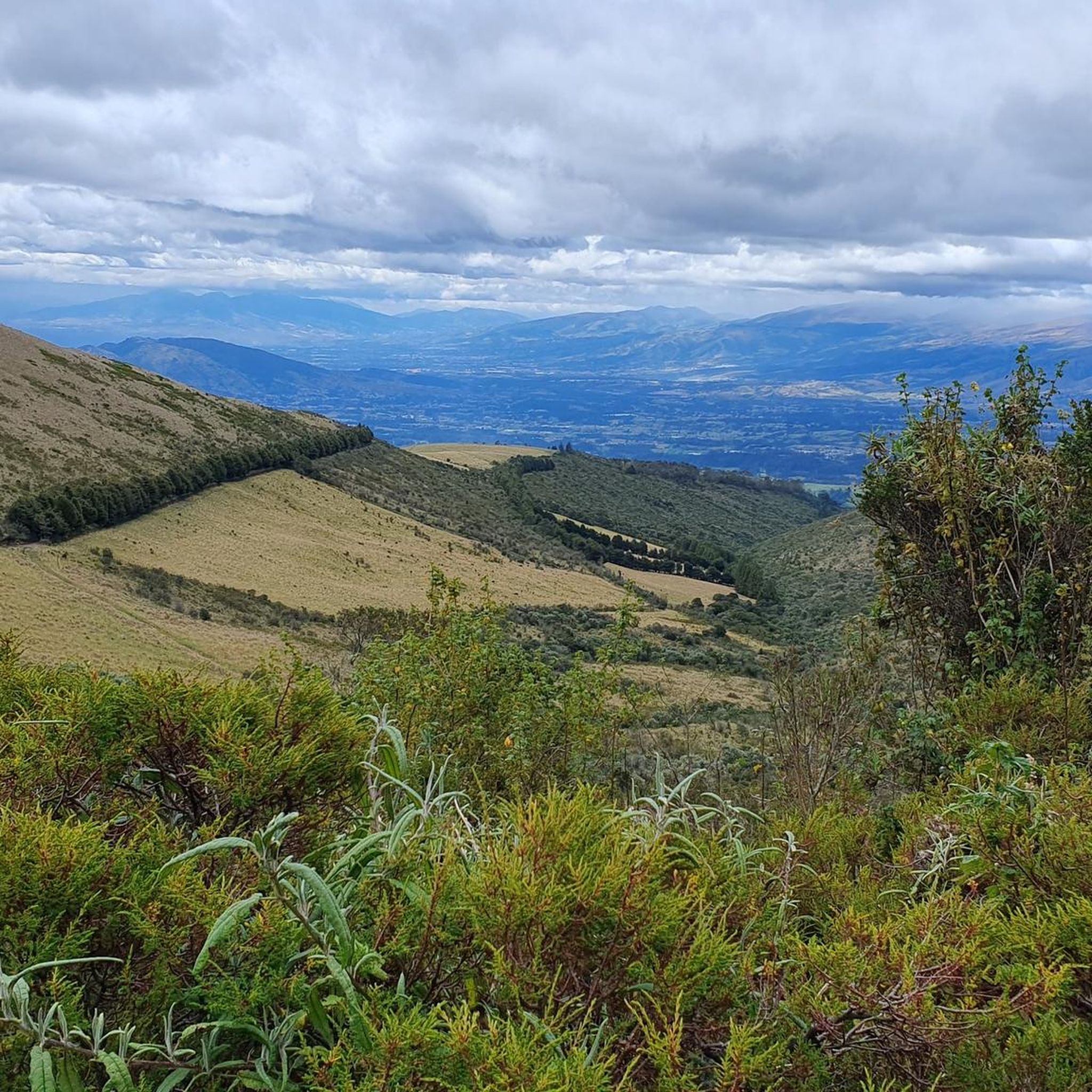
Jogging in Cotogchoa offers diverse landscapes for outdoor activity. The region features a large recreational park, volcanic terrain, and scenic natural attractions like waterfalls. These elements contribute to varied running experiences, from established paths to more challenging trails. The area provides a compelling natural environment for those seeking to explore on foot.
Best jogging routes in Cotogchoa
- The most popular jogging route is Running loop from Sangolqui, a 5.1 miles (8.2 km) trail that takes 51 minutes to complete.…
Last updated: July 11, 2026
19
runners
8.21km
00:51
60m
60m
Moderate run. Good fitness required. Mostly paved surfaces. Suitable for all skill levels.
17
runners
10.6km
01:06
80m
80m
Moderate run. Good fitness required. Mostly paved surfaces. Suitable for all skill levels.

Sign up for free
8
runners
9.32km
00:58
70m
70m
Moderate run. Good fitness required. Mostly paved surfaces. Suitable for all skill levels.
5
runners
11.8km
01:33
420m
420m
Hard run. Very good fitness required. Mostly paved surfaces. Suitable for all skill levels.
7
runners
20.2km
02:45
830m
830m
Hard run. Very good fitness required. Mostly paved surfaces. Suitable for all skill levels.
Our route recommendations are based on thousands of hikes, rides, and runs completed by other people on komoot.
Start today with a free account
Your next adventure awaits.
Login or Signup
Popular around Cotogchoa


Tips from the Community


beautiful place to train 45 uphill 25 downhill...
1
0

excellent route to do in the morning and at night
0
0
bring water and something to eat
0
0
Frequently Asked Questions
How many running routes are available in Cotogchoa?
Cotogchoa features a selection of running routes, with 6 distinct trails documented in this guide. These routes provide varied experiences for joggers of all levels.
Are there running routes suitable for beginners or those looking for an easier run?
Yes, Cotogchoa offers several moderate running paths. For instance, the Running loop from Sangolqui is a moderate 5.1-mile (8.2 km) trail that provides a consistent path for a steady run. Another good option is the Santa Clara loop from Alangasi, a moderate 6.8-mile (10.9 km) path showcasing the area's natural beauty.
What kind of terrain can I expect on the jogging trails in Cotogchoa?
The jogging trails in Cotogchoa offer diverse landscapes, ranging from paths within the largest recreational park in the Valley of Los Chillos to routes traversing volcanic terrain. You can expect a mix of established paths and more natural trails, with some routes featuring significant elevation changes.
Are there any running routes with scenic viewpoints or landmarks?
Absolutely! The region is known for its scenic beauty. The El Mirador loop from San Pedro del Tingo is a challenging 12.5-mile (20.1 km) trail that leads through elevated viewpoints, offering expansive vistas. Additionally, the area near Cotogchoa Park features a viewpoint accessible by the 'stairs of sighs', which can be incorporated into a run for unique inclines and rewards.
Can I find challenging running routes with significant elevation gain in Cotogchoa?
Yes, Cotogchoa has several difficult routes for experienced runners. The El Mirador loop from San Pedro del Tingo, for example, is a 12.5-mile (20.1 km) trail with over 825 meters of elevation gain. Another challenging option is the Running loop from Tanipamba, which covers 11.6 miles (18.6 km) with over 416 meters of ascent.
Are there any circular running routes in Cotogchoa?
Yes, all the running routes highlighted in this guide are circular loops, allowing you to start and finish at the same point. Examples include the Running loop from Alangasi and the Running loop from Sangolqui.
Are the running trails in Cotogchoa suitable for families?
While specific family-friendly routes are not detailed, the presence of Cotogchoa Park, identified as the largest recreational park in the Valley of Los Chillos, suggests areas that could be suitable for family outings and lighter jogs. For longer or more challenging routes, consider the fitness levels of all family members due to varied terrain and elevation.
Are dogs allowed on the jogging trails in Cotogchoa?
The general policy for dogs on trails can vary by specific location, especially in protected areas like the Pasochoa Volcano. While Cotogchoa Park might be more lenient, it's always advisable to check local regulations or signage at trailheads regarding pet policies to ensure a pleasant experience for everyone.
What is the best time of year to go jogging in Cotogchoa?
Cotogchoa's climate is generally mild due to its equatorial location and altitude. However, the region experiences wet and dry seasons. The dry season (typically June to September) often offers clearer skies and more stable weather, which can be ideal for outdoor activities like jogging. During the wet season, trails might be muddier, especially in higher elevations.
Are there any waterfalls along the running routes in Cotogchoa?
Yes, the region is home to natural attractions like the Runahurco Waterfall. While not directly on every route listed, its presence adds to the picturesque scenery and could be a refreshing destination or point of interest to explore in conjunction with a run in the area.
Is there public transport or parking available near the jogging routes?
While specific public transport links to every trailhead are not detailed, Cotogchoa is part of the Rumiñahui Canton, which generally has local transport options. For parking, many recreational areas and trailheads typically offer designated parking spaces. It's recommended to check the starting points of individual routes for specific parking information.
Most popular routes in Cotogchoa

Get inspired with the komoot mobile app


Explore more
Browse the best Running Trails & Routes in other regions.
