The best cycling routes in Cotogchoa
4.8
(11)
138
riders
6
rides
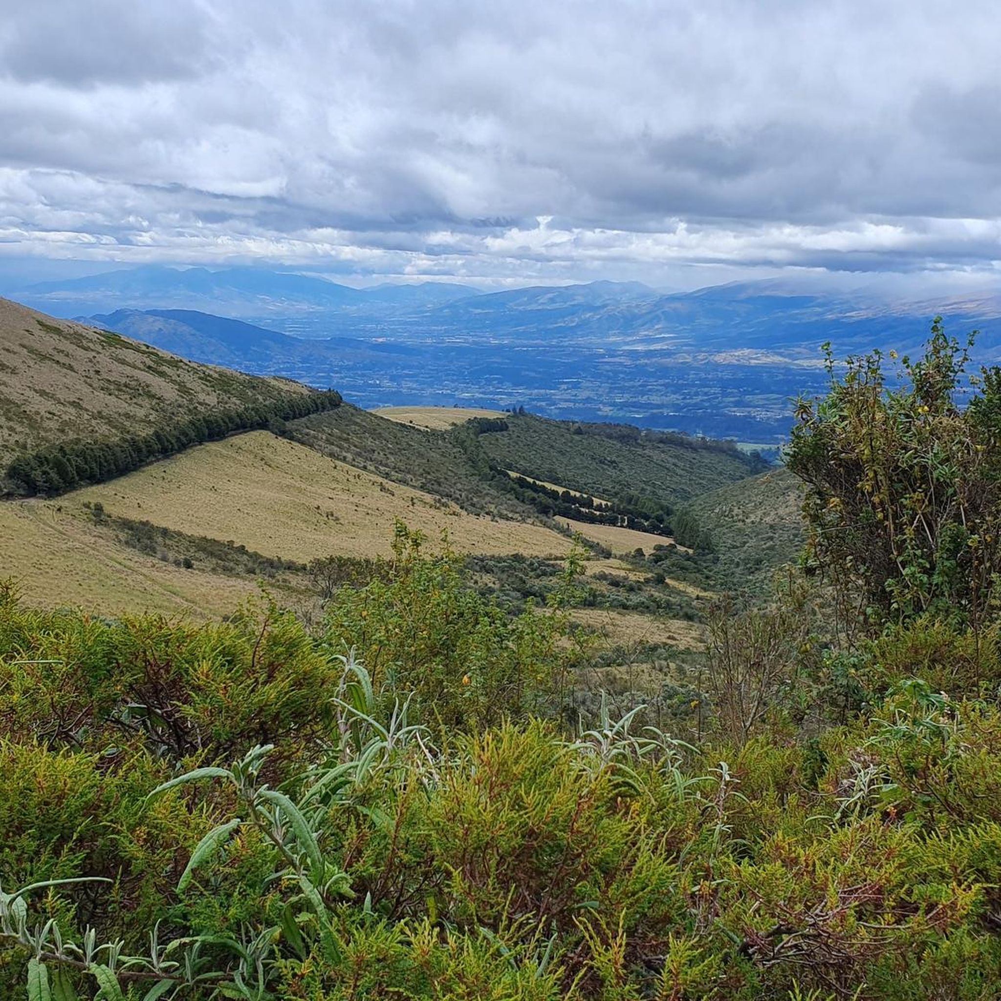
Touring cycling in Cotogchoa, a rural parish in Ecuador's inter-Andean region, features diverse landscapes at an elevation of 2627 meters. The area is characterized by dramatic Andean topography, varied vegetation including aliso and pumamaqui trees, and proximity to significant ecological attractions. Routes often traverse Andean foothills and offer views of surrounding volcanoes.
Best touring cycling routes in Cotogchoa
- The most popular touring cycling route is Salamanca Conjunto loop from Playa Chica 1, a 55.0 miles (88.5 km) trail that…
Last updated: July 11, 2026
5.0
(1)
32
riders
88.5km
06:06
1,510m
1,510m
Hard bike ride. Very good fitness required. Mostly paved surfaces. Suitable for all skill levels.
5.0
(1)
13
riders
40.0km
02:45
610m
610m
Hard bike ride. Very good fitness required. Mostly paved surfaces. Suitable for all skill levels.

Sign up for free
12
riders
80.4km
06:25
1,590m
1,590m
Hard bike ride. Very good fitness required. Mostly paved surfaces. Suitable for all skill levels.
11
riders
89.6km
06:27
1,710m
1,710m
Hard bike ride. Very good fitness required. Mostly paved surfaces. Suitable for all skill levels.
5.0
(1)
6
riders
61.1km
05:01
1,350m
1,350m
Hard bike ride. Very good fitness required. Mostly paved surfaces. Suitable for all skill levels.
Our route recommendations are based on thousands of hikes, rides, and runs completed by other people on komoot.
Start today with a free account
Your next adventure awaits.
Login or Signup


Tips from the Community


Nice place to stay for a night. Can use the kitchen to cook and very hot showers. It is 10 dollars p.p.
0
0
Cobblestone road to Cotopaxi. It is not fun but doable with touring setup.
0
0

No matter whether day or night. The Cotopaxi flashes at any time of the day.
0
0
The northern entrance to the national park. After the formalities at the entrance (entrance fee and passport control), we now go to Cotopaxi. Thank God most of the elevation gain has now been achieved and the condition of the path is noticeably better.
0
0
Camping is also possible!
0
0
Frequently Asked Questions
How challenging are the touring cycling routes in Cotogchoa?
Touring cycling in Cotogchoa is generally considered challenging, with all routes listed in the guide rated as difficult. The terrain features significant elevation gains through varied Andean landscapes, suitable for experienced cyclists looking for endurance challenges. For example, the Salamanca Conjunto loop from Playa Chica 1 covers 55.0 miles (88.5 km) with over 1,500 meters of elevation gain.
What natural features or viewpoints can I expect to see while touring cycling in Cotogchoa?
Cotogchoa offers dramatic Andean topography with diverse vegetation, including aliso, pumamaqui, and quishuar trees. You can enjoy scenic vistas of the parish and the Valley of Los Chillos from the viewpoint accessible via the 'Escaleras de los Suspiros'. On clear days, routes may offer panoramic views of prominent volcanoes like Cotopaxi, Antisana, and Cayambe. The Guesthouse Near Cotopaxi – View of Cotopaxi loop from San Pedro del Tingo is one such route that offers views towards Cotopaxi.
Are there any family-friendly touring cycling routes in Cotogchoa?
The touring cycling routes highlighted in this guide for Cotogchoa are all rated as difficult, featuring significant elevation and distances. While the region offers diverse terrain, these specific routes are more suited for experienced cyclists. For families, the Cotogchoa Park provides green spaces and walking trails, but dedicated easy cycling routes for families are not prominently featured among the touring options here.
When is the best time of year for touring cycling in Cotogchoa?
Cotogchoa is situated in Ecuador's inter-Andean region, which typically experiences two main seasons: a dry season (verano) and a wet season (invierno). The dry season, generally from June to September, often offers more stable weather conditions with less rain, making it ideal for touring cycling. However, the Andean climate can be unpredictable, so it's always advisable to check local forecasts regardless of the season.
What kind of weather should I expect for cycling in Cotogchoa?
Given Cotogchoa's elevation of 2627 meters in the inter-Andean region, you can expect varied Andean weather. Days can be warm, especially in the sun, but temperatures can drop significantly, particularly at higher altitudes or during evenings. Rain showers are possible, especially during the wet season. It's best to prepare for changing conditions, including sun, wind, and potential rain, by dressing in layers.
Are there many circular touring cycling routes in Cotogchoa?
Yes, many of the touring cycling routes in Cotogchoa are designed as loops, allowing you to start and finish at the same point. Examples include the Small Church – Rural View Behind Ilaló loop from Conocoto and the La Carolina Park – Small Church loop from Rio Pita, which offer extensive rides through the region's diverse terrain.
What are some of the more challenging touring cycling routes in Cotogchoa?
All touring cycling routes in Cotogchoa listed in this guide are rated as difficult, offering significant challenges for experienced riders. For instance, the Rural View Behind Ilaló loop from Playa Chica 2 is a demanding 41.5 km route with over 670 meters of elevation gain. These routes traverse varied Andean terrain, providing a rigorous workout and rewarding views.
What do other touring cyclists enjoy the most about touring cycling in Cotogchoa?
The touring cycling routes in Cotogchoa are highly rated by the komoot community, with an average score of 4.8 stars from over 10 reviews. Cyclists often praise the diverse Andean topography, the challenging nature of the rides, and the opportunity to experience the region's natural beauty away from busy main roads. The unique ecosystems and panoramic views are frequently highlighted as rewarding aspects of the tours.
Where can I find parking and trailhead access for touring cycling in Cotogchoa?
While specific parking facilities for each trailhead are not detailed, many routes in Cotogchoa start from accessible points within or near communities like Playa Chica, Conocoto, or Rio Pita. It's advisable to check the starting point of your chosen route on komoot for more precise information on local parking options or public transport connections to the trailhead.
Are there any notable natural attractions or landmarks to visit near the cycling routes?
Yes, the region around Cotogchoa is rich in natural attractions. The Pasochoa Protected Forest Reserve, an extinct volcano, is a significant highlight known for its biodiversity and challenging trails. You might also encounter the hidden Runahurco Waterfall, offering opportunities for ecological walks and nature photography. The Cotogchoa Park itself is a large recreational area with green spaces and walking trails.
Are there places to stop for refreshments or food along the touring cycling routes?
The touring cycling routes in Cotogchoa often pass through or near rural communities and towns. While specific cafes or restaurants are not detailed for every route, you may find local eateries or small shops in these areas to replenish supplies. It's recommended to carry sufficient water and snacks, especially on longer routes, as services might be sparse in more remote sections of the Andean terrain.
Most popular routes in Cotogchoa

Get inspired with the komoot mobile app


Explore more
Browse the best Cycling routes in other regions.
