The best walks and hikes in El Alto
4.3
(6)
38
hikers
1
hike
Hiking in El Alto offers access to a unique high-altitude environment, serving as a gateway to the Cordillera Real of the Bolivian Andes. The region features diverse landscapes, from tranquil ecological reserves with lush vegetation to rugged mountain terrain with snow-capped peaks. Glacial lakes and high-altitude valleys characterize many of the trails, providing varied experiences for hikers. This elevation also provides expansive views of the surrounding mountains and the city of La Paz.
Best hiking trails in El Alto
- The…
Last updated: July 10, 2026
5.0
(3)
20
hikers
21.7km
09:17
960m
960m
Hard hike. Very good fitness required. Sure-footedness, sturdy shoes and alpine experience required.
3.7
(3)
15
hikers
10.5km
03:11
350m
340m
Moderate hike. Good fitness required. Easily-accessible paths. Suitable for all skill levels.

Sign up for free
3
hikers
Hard hike. Good fitness required. Sure-footedness, sturdy shoes and alpine experience required.
Our route recommendations are based on thousands of hikes, rides, and runs completed by other people on komoot.
Start today with a free account
Your next adventure awaits.
Login or Signup
Popular around El Alto
Tips from the Community

I'm planning a trip to Bolivia soon and saw this comment. How can I find more information about staying with this family?
0
0

The five-aisled Catedral Basílica de Nuestra Señora de La Paz, as it is called in full, was built from March 24, 1835 under the direction of Manual Sanahuja and inaugurated in 1925. The consecration took place during the 100th anniversary celebrations of Bolivia's independence.
0
0
The 18th-century Palais Marquis de Villa Verde houses a surprisingly modern museum that showcases the regional peculiarities and unique characteristics of Bolivia's independent cultures.
0
0
During the colonization period, eucalyptus trees grew around Plaza Murillo, which, among other things, surrounded the city's most important drinking water source, the Neptune Fountain. Even then, the square was the center of social life and a popular meeting place for the residents of La Paz.
1
0
The seat of the President of Bolivia has been rebuilt, expanded, remodeled and modernized many times throughout its history. Much of the architecture and interior still dates back to the new building in 1853 and the remodeling in 1923.
0
0

The Metropolitan Cathedral of Our Lady of La Paz is located in Plaza Murillo, next to the Government Palace. It was built in 1835 in neoclassical style; the façade is divided into two bodies; the interior with five portals, the central one flanked by three Corinthian columns. There is also a Museum of Sacred Art. On the left side there is a chapel where the remains of Marshal Andrés de Santa Cruz y Calahumana are kept. Source: https://lapaz.bolivialocal.net/lugar/catedral-metropolitana-nuestra-senora-de-la-paz
0
0
The Palacio Quemado (officially Government Palace), named after a fire in 1875, is the most important presidential palace in the history of Bolivia, and was later replaced by the Casa Grande del Pueblo. It was the headquarters of the Bolivian executive branch and the office of the President of Bolivia during two non-consecutive periods, 1853–2018 and 2019–2020. The building is located on Calle Comercio in front of Plaza Murillo in the city of La Paz, next to the Catedral Metropolitana and diagonally to the left of the Legislative Palace, which houses the Bolivian Parliament. In the last years of the government of Evo Morales (2018–2019), it no longer served as the seat of the executive branch, as it was decided to move the presidential offices to the Casa Grande del Pueblo. It was used again as a presidential headquarters for a short period during the government of Jeanine Áñez (2019–2020). Currently, during the government of Luis Arce, it is used in certain state protocol acts, especially official visits by international leaders and political leaders. Source: https://es.wikipedia.org/wiki/Palacio_Quemado
0
0
Designed by Juan Gutiérrez Paniagua in 1558, Plaza Murillo was named in honor of Bolivian hero Pedro Murillo, a signer of the founding charter of independence who was captured and hanged by Spanish troops in 1810. During the colonial period, Plaza Murillo was the scene of public life, surrounded by beautiful eucalyptus trees and featuring a large statue of Neptune. In addition to being the central square of the Spanish settlement of La Paz, the square was also the city's main source of water, making it the people's favorite meeting place. Plaza Murillo was also the scene of dramatic political struggles, with many pro-independence leaders being killed in or near the plaza. A recent example of this political violence occurred in 1946, when President Gualberto Villarroel was attacked by a group of angry rebels who threw him from a balcony and then hung him from a lamppost in the plaza. Source: https://www.lapazlife.com/places/plaza-murillo/
2
0
Frequently Asked Questions
What kind of terrain and difficulty can I expect on hiking trails around El Alto?
Hiking near El Alto primarily involves high-altitude environments, with trails ranging from moderate to difficult. You'll encounter rugged mountain terrain, significant elevation gains, and the challenges of thin air. Routes often feature glacial lakes and Andean valleys, requiring good physical condition, especially for more strenuous alpine expeditions. For example, the Pico Austria Summit – Laguna Chiar Khota loop is a strenuous route with considerable elevation gain.
What natural features or landmarks can I expect to see while hiking near El Alto?
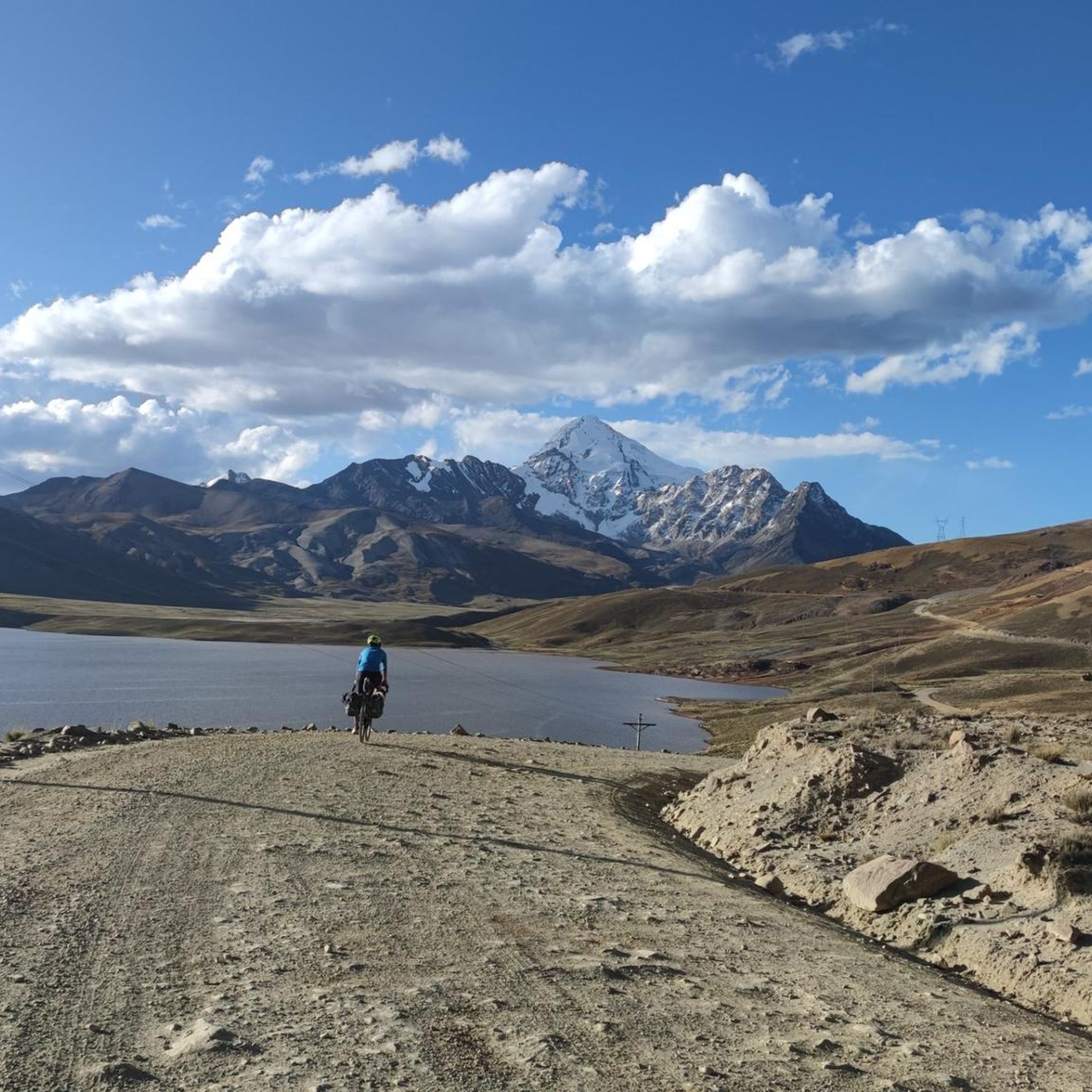
The region offers breathtaking natural beauty. You can explore the tranquil Pura Pura Ecological Reserve with its lush vegetation, or witness the majestic Cordillera Real, featuring snow-capped peaks like Huayna Potosí and Illimani. Many trails lead to stunning glacial lakes such as Laguna Charquini and Laguna Chiar Khota. For instance, the View of Huayna Potosí – View of the Cordillera Real loop offers direct views of Huayna Potosí.
Are there any family-friendly hiking options near El Alto?
While many trails are high-altitude and challenging, some routes are more accessible. The Tuni Village and Laguna Tuni – Tuni Village Homestay loop is a moderate path suitable for various fitness levels, meandering through the beautiful landscapes of the Tuni Condoriri region. It's a good option for families looking for a less strenuous experience.
Are there any circular hiking routes available in the El Alto area?
Yes, several popular routes are designed as loops. Examples include the challenging Pico Austria Summit – Laguna Chiar Khota loop from Estancia Tuni, and the more moderate Tuni Village and Laguna Tuni – Tuni Village Homestay loop from Estancia Tuni. These circular routes allow you to experience diverse scenery without retracing your steps.
What is the best time of year to go hiking in El Alto?
El Alto's high-altitude environment means weather can be unpredictable. Generally, the dry season (May to October) offers clearer skies and more stable conditions, making it ideal for hiking. However, even during this period, be prepared for cold winds and significant temperature drops, especially at higher elevations. Always check local weather forecasts before heading out.
What do other hikers enjoy most about hiking in El Alto?
The area is highly rated by the komoot community, with an average score of 4.8 stars from over 23 reviews. Hikers often praise the spectacular panoramic views of the Cordillera Real, the unique high-altitude experience, and the sense of accomplishment from tackling challenging routes like those leading to Pico Austria or offering views of Huayna Potosí.
Is public transport available to reach trailheads near El Alto?
Access to many trailheads, especially those leading to the Cordillera Real, often requires private transport or organized tours. However, some areas might be accessible via local minibuses or shared taxis from El Alto or La Paz. For specific routes like those originating from Estancia Tuni, arranging transport in advance is advisable.
Are there any permits required for hiking in the El Alto region?
While general hiking in many areas may not require specific permits, accessing certain protected areas, private lands, or undertaking more serious mountaineering expeditions (like summiting Huayna Potosí) might necessitate permits or local guide arrangements. It's always best to inquire locally or with tour operators for the specific route you plan to undertake.
Can I bring my dog on the hiking trails around El Alto?
Policies regarding dogs on trails can vary. While some natural areas might be open to dogs, others, especially ecological reserves or areas with sensitive wildlife, may have restrictions. It's recommended to check with local authorities or tour operators for specific trails to ensure they are dog-friendly before planning your hike.
Are there options for accommodation or places to eat near the hiking areas?
El Alto itself offers various accommodation and dining options. Closer to the more remote trailheads, such as those in the Tuni Condoriri region, you might find more rustic accommodations like homestays or basic refuges. For example, the Tuni Village and Laguna Tuni loop mentions a Tuni Village Homestay, indicating local lodging is available in some areas.
What are some of the more challenging hikes accessible from El Alto?
For experienced hikers, El Alto serves as a gateway to several demanding routes. The Pico Austria Summit – Laguna Chiar Khota loop is a strenuous, high-altitude trek. Additionally, routes like the View of Huayna Potosí – View of the Cordillera Real loop from Refugio Nuevo Llaulini involve significant elevation gain and are rated as difficult.
Most popular routes in El Alto

Get inspired with the komoot mobile app


Explore more
Browse the best Hikes in other regions.
