The best road cycling routes in Mata Nacional Do Urso
4.7
(19)
387
riders
48
rides
Road cycling in Mata Nacional Do Urso is characterized by its extensive network of dedicated paths, particularly the "Ciclovia da Estrada Atlântica," which is Portugal's longest cycling route. The region features vast maritime pine forests, historically planted to stabilize coastal dunes, offering fresh air and scenic views. Cyclists can experience a blend of forest scenery, unique coastal dune ecosystems, and refreshing sea breezes from the Atlantic. The terrain is generally varied, with routes connecting charming beaches and towns, providing diverse…
Last updated: July 8, 2026
19
riders
60.3km
02:37
400m
390m
Moderate road ride. Good fitness required. Mostly well-paved surfaces and easy to ride.
42
riders
Moderate road ride. Good fitness required. Mostly well-paved surfaces and easy to ride.

Sign up for free
5.0
(1)
23
riders
91.9km
04:09
760m
760m
Moderate road ride. Good fitness required. Some segments of this route may be unpaved and difficult to ride.
4.5
(2)
13
riders
Moderate road ride. Good fitness required. Mostly well-paved surfaces and easy to ride.
6
riders
90.9km
04:04
770m
770m
Moderate road ride. Good fitness required. Some segments of this route may be unpaved and difficult to ride.
Get access to more routes and recommendations from other explorers.
Sign up for free
Already have an account?
Our route recommendations are based on thousands of hikes, rides, and runs completed by other people on komoot.
Start today with a free account
Your next adventure awaits.
Login or Signup
Popular around Mata Nacional Do Urso

Tips from the Community

The Torre do Relógio (Clock Tower) of Figueira da Foz is a striking, 23-meter-high landmark in a modernist style on the seafront promenade (Avenida Marginal). It shapes the image of the city beach, which is also known as Praia do Relógio because of it.
3
0

The lighthouse is managed by the National Maritime Authority. Public visits are generally permitted on specific days and at limited times. Opening hours: Traditionally, the lighthouse is open for free visits on Wednesdays in the afternoon (between 2:00 pm and 5:00 pm, local time).
2
0
Function: It is a coastal lighthouse, with a luminous range of 30 nautical miles (approximately 55 km). Landscape: The location is a natural viewpoint of great beauty, much sought after for enjoying the ocean view and the sunset. The surrounding area has pedestrian and cycle paths that connect to other beaches in the region.
1
0
Location: Parish of São Pedro de Moel, Marinha Grande, Portugal. Establishment: Began operating on February 15, 1912. Structure: It has a quadrangular stone tower 32 meters high and an attached building. The exterior and interior are covered with reddish-brown tiles, a unique feature.
1
0
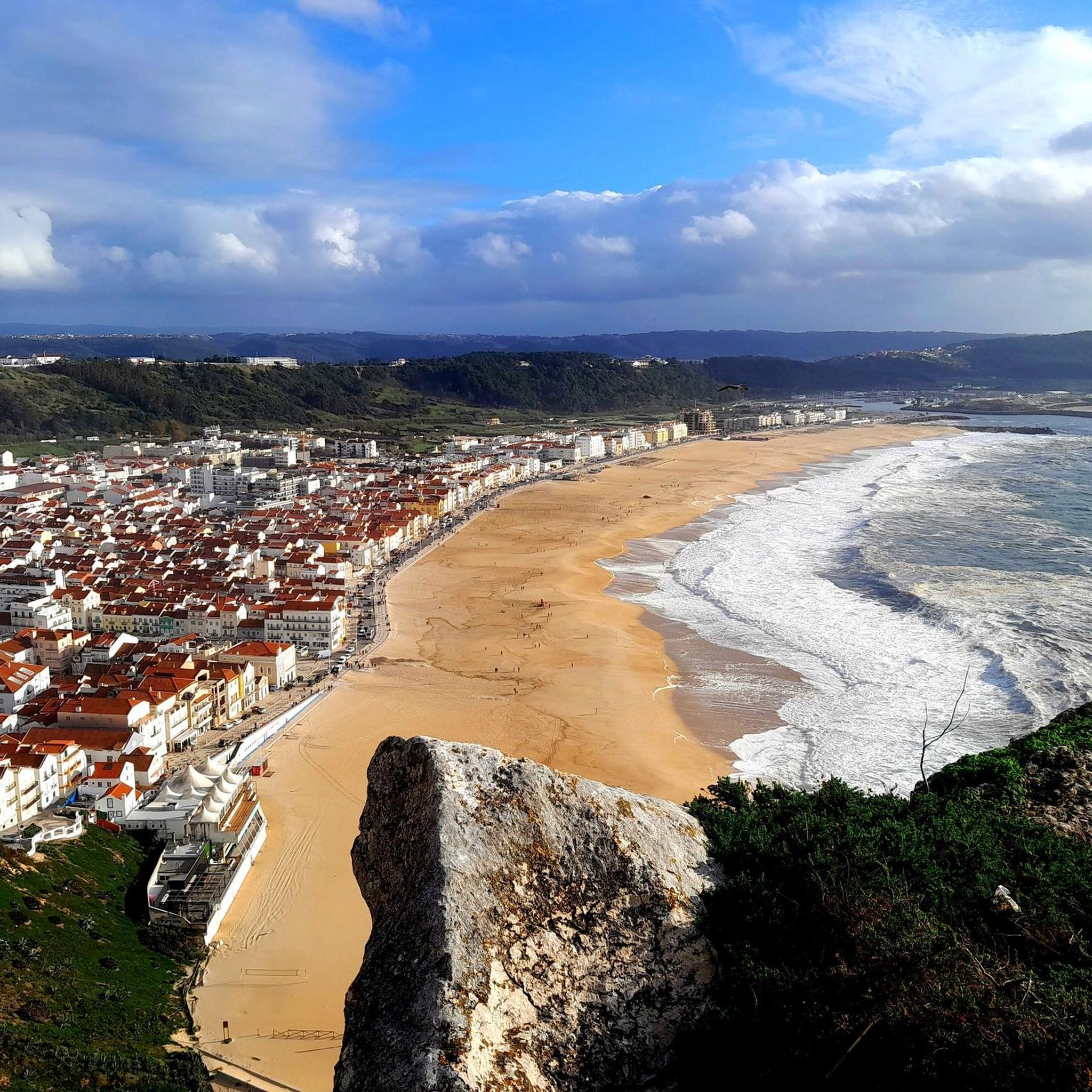
The Penedo da Saudade Lighthouse is an emblematic Portuguese lighthouse located in São Pedro de Moel, in the municipality of Marinha Grande, district of Leiria. It stands imposingly on a cliff, offering spectacular views of the Atlantic coast.
1
0
Praia Velha is a beach located in the parish of São Pedro de Moel, in the municipality of Marinha Grande, district of Leiria, in Portugal. Characteristics: It is known for its extensive sandy area and fantastic dunes with vegetation. It has wooden walkways that facilitate access and is considered a quiet beach, suitable for both swimming and relaxing walks. It is a family beach, with good conditions for children, sometimes including a stretch of freshwater with fewer waves.
1
0
"Lighthouse and Fisherman's Bay" can refer to several locations, such as the Lighthouse of Traição Bay and the local fishing community in Paraíba, Fisherman's Beach in Itanhaém, where boats gather and seafood is sold, or Fisherman's Bay in China, also known as the Penghu Islands. Lighthouse of Traição Bay (PB): The installation of the lighthouse in 1923 was requested by the local fishing community, then presided over by Manoel Ignácio, who traveled to Rio de Janeiro to request the equipment. Fisherman's Beach (Itanhaém, SP): This beach is characterized by the concentration of fishing boats and stalls selling fresh seafood. The area has a restaurant and is also a departure point for boat trips. Fisherman's Islands (Penghu, China): This is an archipelago off the west coast of Taiwan, in the Asian continent. The archipelago is composed of 90 small islands and covers an area of 141 km². Other locations: There are other places that combine "lighthouse" and fishing activities, such as the underwater fishing area near the Barra Lighthouse in Salvador, Bahia.
2
0

Frequently Asked Questions
How many road cycling routes are available in Mata Nacional Do Urso?
Mata Nacional Do Urso offers a wide selection of road cycling routes, with over 45 different tours available for exploration. These routes cater to various skill levels, from easy to challenging.
What are the typical difficulty levels for road cycling in Mata Nacional Do Urso?
The road cycling routes in Mata Nacional Do Urso range from easy to difficult. You'll find 6 easy routes, 38 moderate routes, and 4 more challenging options, ensuring there's something for every cyclist.
Are there family-friendly road cycling routes in Mata Nacional Do Urso?
Yes, Mata Nacional Do Urso is well-suited for family cycling. The region features dedicated cycling paths, including sections of the 62 km Atlantic Road Cycle Path, which are well-separated from main roads, offering a safe and enjoyable experience for various skill levels.
What can I see along the road cycling routes in Mata Nacional Do Urso?
Along the road cycling routes, you can experience a blend of expansive pine forests, unique coastal dune ecosystems, and refreshing sea breezes. Notable attractions include the serene Lagoa da Ervedeira, the Beautiful cycle path through the Mata do Urso itself, and access points to the EuroVelo 1 Atlantic Coast Route.
What is the best time of year to go road cycling in Mata Nacional Do Urso?
The region's climate, with its pine forests and Atlantic sea breezes, generally offers pleasant conditions for cycling. Spring and autumn often provide ideal temperatures, while summer can be refreshing near the coast. It's always a good idea to check local weather forecasts before your ride.
Are there any loop road cycling routes in Mata Nacional Do Urso?
Yes, many road cycling routes in Mata Nacional Do Urso are designed as loops. For example, you can explore the Praia Velha – Penedo da Saudade Lighthouse loop from Ducha, or the Baluarte de Buarcos – Omanite by Bordalo II loop from Largo da Arte Xávega.
Where can I find parking for road cycling in Mata Nacional Do Urso?
While specific parking areas for cyclists are not detailed, the cycling routes often connect to charming beaches and towns. Look for public parking facilities in these areas, especially near popular starting points or attractions, which typically accommodate visitors.
Can I reach Mata Nacional Do Urso's cycling routes by public transport with my bike?
The region's infrastructure is geared towards accessibility. While specific public transport options for bikes vary, many towns and coastal areas connected by the cycling network are served by regional transport. It's advisable to check with local transport providers for their bike carriage policies.
Are there cafes or places to stop for refreshments along the road cycling routes?
Yes, the cycling routes in Mata Nacional Do Urso often connect to charming beaches and towns. These areas typically offer various amenities, including cafes, restaurants, and other establishments where you can stop for refreshments and rest.
What do other road cyclists enjoy most about road cycling in Mata Nacional Do Urso?
The komoot community highly rates road cycling in Mata Nacional Do Urso, with an average score of 4.7 stars. Cyclists often praise the extensive network of dedicated paths, the blend of forest scenery and refreshing sea breezes, and the diverse terrain that connects charming beaches and towns.
What is the longest road cycling route available in Mata Nacional Do Urso?
One of the longer routes you can explore is the Montemor-o-Velho Castle – Omanite by Bordalo II loop from Louriçal, which spans 91.0 km. The region also features the 62 km Atlantic Road Cycle Path, offering extensive riding opportunities.
Are there any historical or cultural landmarks along the road cycling routes?
Yes, some routes lead through historical areas. For instance, the Montemor-o-Velho Castle – Omanite by Bordalo II loop from Louriçal takes you through areas with historical significance, and the region's pine forests themselves have a rich history, planted centuries ago to stabilize coastal dunes.
Most popular attractions in Mata Nacional Do Urso

Get inspired with the komoot mobile app


Explore more
Browse the best Road cycling routes in other regions.
