Forêt Domaniale De Ceüse
Forêt Domaniale De Ceüse
The best cycling routes in Forêt Domaniale De Ceüse
4.5
(232)
5,135
riders
222
rides
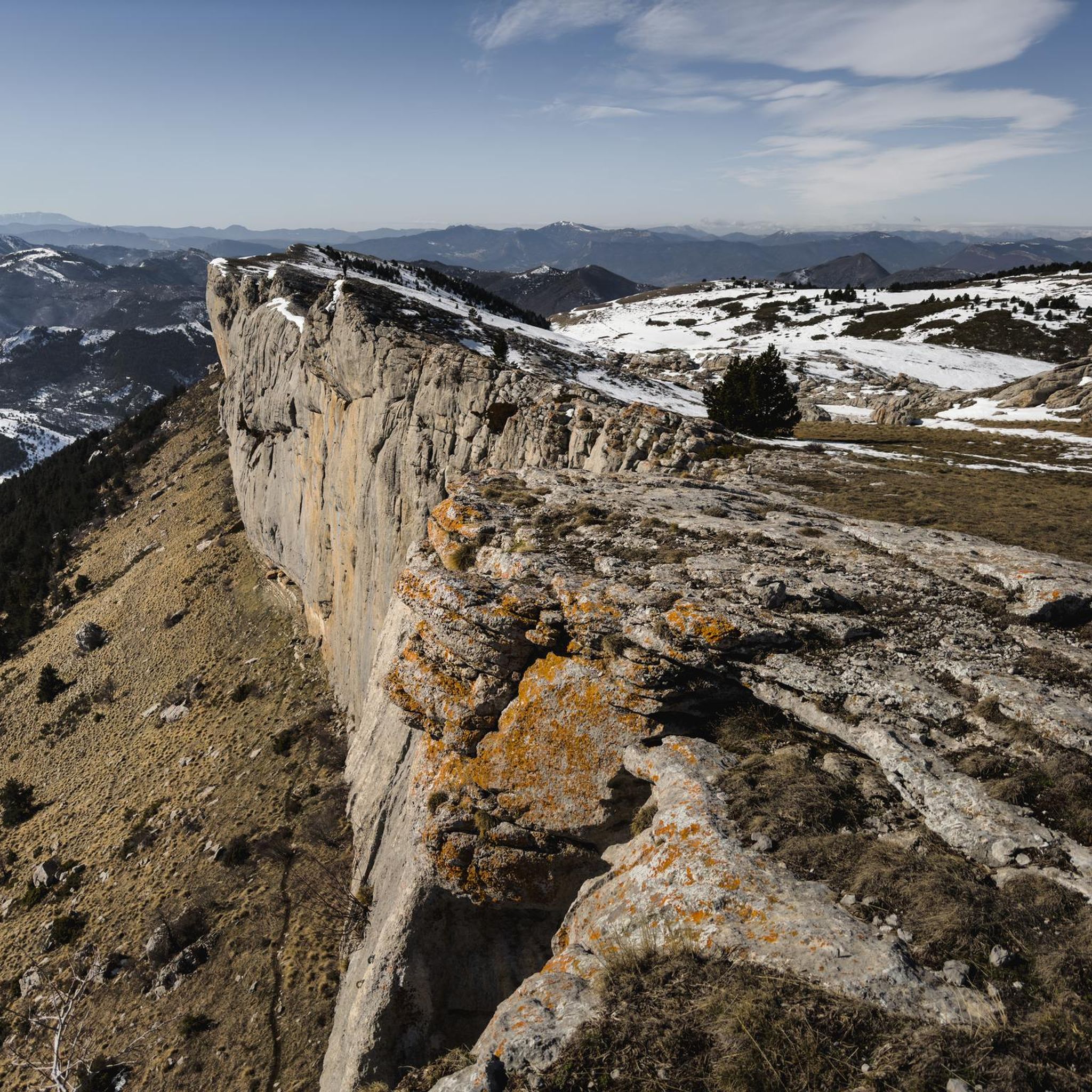
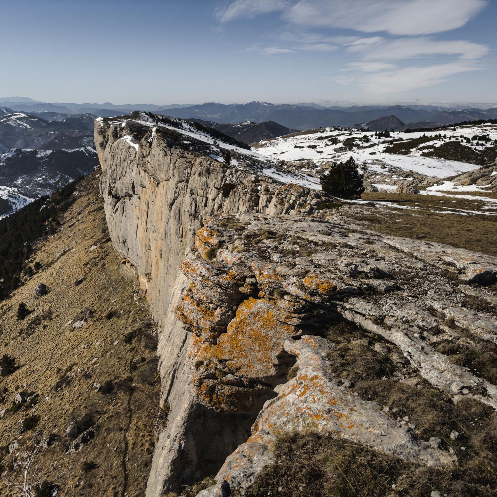
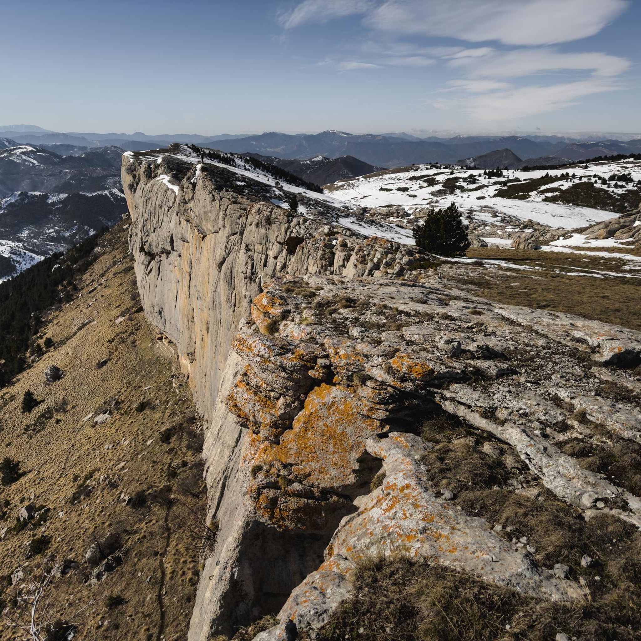
Touring cycling in Forêt Domaniale De Ceüse offers diverse landscapes within the Hautes-Alpes department of France. The region is characterized by its expansive forest, which spans between 1900 and 2080 hectares, and the prominent horseshoe-shaped Céüse Cliff. As a protected Natura 2000 zone, the area features varied terrain including valleys, plateaus, and dense woodlands, providing a rich environment for touring cyclists.
Best touring cycling routes in Forêt Domaniale De Ceüse
- The most popular touring cycling route is Espréaux Pass – Espréaux Pass loop from Pic de Céüse, a 26.5 miles (42.7 km) trail that takes about 3 hours 37 minutes to complete. This route includes a climb up Col d'Espréaux, offering a challenging ascent.
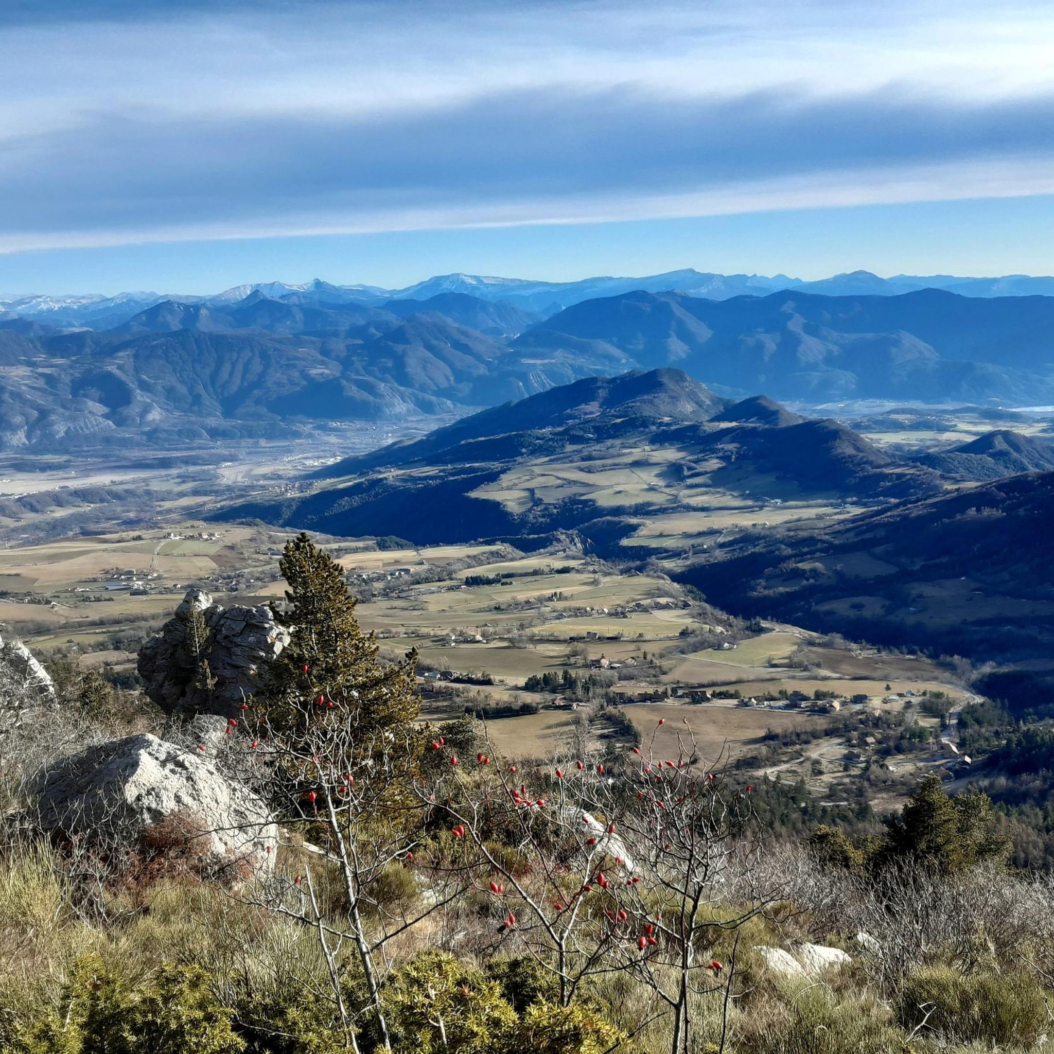
- Another top favourite among local touring cyclists is Hamlet of Fouillouise loop from Pic de Céüse, a difficult 15.7 miles (25.2 km) path. This route provides panoramic views over the Durance and Buëch valleys.
- Local touring cyclists also love the Under the Cliffs of Céüse loop from Neffes, a 9.0 miles (14.5 km) trail leading through the base of the majestic Céüse Cliff, often completed in about 1 hour 16 minutes.
- Touring cycling in Forêt Domaniale De Ceüse is defined by limestone cliffs, lush forests, and undulating plateaus. The network offers options for various ability levels, from moderate paths to more difficult routes with significant elevation gain.
- The routes in Forêt Domaniale De Ceüse are highly rated by the komoot community with an average score of 4.4 stars from over 165 reviews. More than 3600 touring cyclists have used komoot to explore Forêt Domaniale De Ceüse's varied terrain.
Last updated: June 30, 2026
4.5
(4)
14
riders
42.7km
03:38
1,130m
1,130m
Hard bike ride. Very good fitness required. Mostly paved surfaces. Suitable for all skill levels.
5.0
(2)
18
riders
24.2km
02:28
770m
770m
Hard bike ride. Very good fitness required. Mostly paved surfaces. Suitable for all skill levels.

Sign up for free
17
riders
28.1km
03:19
940m
940m
Hard bike ride. Very good fitness required. Mostly paved surfaces. Suitable for all skill levels.
5.0
(1)
18
riders
14.5km
01:16
370m
370m
Moderate bike ride. Good fitness required. Mostly paved surfaces. Suitable for all skill levels.
7
riders
25.2km
02:05
750m
750m
Hard bike ride. Very good fitness required. Mostly paved surfaces. Suitable for all skill levels.
Get access to more routes and recommendations from other explorers.
Sign up for free
Already have an account?
Our route recommendations are based on thousands of hikes, rides, and runs completed by other people on komoot.
Start today with a free account
Your next adventure awaits.
Login or Signup

Tips from the Community

The Col d'Espreaux is a climb located in the Hautes-Alpes region. This climb is 12.2 km long, with a total elevation gain of 585 m. The Col d'Espreaux has an average gradient of 4.8%.
8
0
The Col de Foureyssasse from La Saulce is a climb located in the Hautes-Alpes region. This climb is 7 km long, with a total elevation gain of 461 m. The Col de Foureyssasse from La Saulce has an average gradient of 6.6%.
6
0


A pass lost in the mountains, a very small road with very few cars and magnificent landscapes
2
0

Adélaïde mixes the 2 villages of Fouillouse, that of 05 above Tallard in the Gapençais is at an altitude of 840 m and Fouillouse, a small hamlet above Saint Paul sur Ubaye in the 04 classified as a remarkable site at an altitude of 1900 m (where the ancestors of Abbé Pierre come from).
2
0

Fantastic balcony track. At the Col des Guérins you will find a place to fill up with water, toilets and even a small bar-restaurant. The views here are quite Dantesque. Easily passable tracks in 700x40
1
0
Really pleasant ascent of the north slope. Road with little traffic and very pretty marl landscapes.
2
0

The Col d'Espréaux connects the Buëch valley and the Durance valley at an altitude of 1,160 meters. This passage offers unique and spectacular landscapes in the Southern Alps.
2
0
Frequently Asked Questions
How many touring cycling routes are available in Forêt Domaniale De Ceüse?
Forêt Domaniale De Ceüse offers a wide selection of touring cycling routes, with over 200 options available. These routes cater to various skill levels, ranging from easy paths to more challenging rides with significant elevation gains.
What kind of terrain can I expect on touring cycling routes in Forêt Domaniale De Ceüse?
The terrain in Forêt Domaniale De Ceüse is quite diverse, featuring limestone cliffs, lush forests, and undulating plateaus. While many routes offer mostly well-paved surfaces, you can also find paths with unpaved sections, providing a varied cycling experience.
Are there any circular touring cycling routes in the area?
Yes, many touring cycling routes in Forêt Domaniale De Ceüse are circular, allowing you to start and finish at the same point. An example is the challenging Guérins Pass loop from Pic de Céüse, which covers 28.1 km with over 940 meters of elevation gain.
What are some notable natural features or landmarks to see while cycling?
The region is rich in natural beauty. You can cycle past the majestic horseshoe-shaped Céüse Cliff, known as the 'queen of the cliffs,' and enjoy breathtaking panoramic views of the Oisans and Écrins massifs. The forest also features picturesque waterfalls and vast, undulating plateaus with meadows.
Are there routes suitable for beginners or those looking for a moderate challenge?
Absolutely. While many routes are classified as difficult, there are also moderate options available. For instance, the Under the Cliffs of Céüse loop from Neffes is a moderate 14.5 km trail that takes you through the base of the impressive Céüse Cliff.
What do other touring cyclists say about the routes in Forêt Domaniale De Ceüse?
The touring cycling routes in Forêt Domaniale De Ceüse are highly regarded by the komoot community, holding an average rating of 4.4 stars from over 165 reviews. Cyclists often praise the diverse landscapes, from challenging climbs to scenic descents, and the well-maintained paths that offer endless outdoor adventures.
Can I find routes that offer significant climbs and descents?
Yes, Forêt Domaniale De Ceüse is known for its challenging ascents and rewarding descents. Routes like the Espréaux Pass – Espréaux Pass loop from Pic de Céüse feature a climb up Col d'Espréaux, offering a substantial workout with over 1130 meters of elevation gain over 42.7 km.
Are there any routes that offer views over the Durance and Buëch valleys?
Many routes provide stunning vistas. The Hamlet of Fouillouise loop from Pic de Céüse, for example, is a challenging 25.2 km ride that offers panoramic views over both the Durance and Buëch valleys, showcasing the region's expansive beauty.
What is the highest point I can reach on a touring bike in the area?
While touring bikes might not reach the very summit of Pic de Céüse (2,016 meters), many routes offer high-altitude experiences and incredible views. The region's 'corniche' (ledge) provides splendid panoramas stretching from the Southern Alps to the Écrins massif, accessible via various cycling paths.
Is Forêt Domaniale De Ceüse a protected area, and what does that mean for cyclists?
Yes, the broader Céüse massif, which includes the forest, is a protected Natura 2000 zone. This designation ensures the preservation of its rich biodiversity, including diverse flora and fauna. For cyclists, it means enjoying a pristine natural environment, but also a responsibility to stay on marked paths and respect wildlife.
Are there routes that avoid busy roads?
Yes, many touring cycling routes in Forêt Domaniale De Ceüse are designed to offer a peaceful experience away from heavy traffic. The 'C07 - Le Tour de Céüse' (a general route type mentioned in region research) is noted for largely avoiding busy roads, allowing for a more serene ride through the natural landscape.
Most popular routes in Forêt Domaniale De Ceüse

Get inspired with the komoot mobile app


Explore more
Browse the best Cycling routes in other regions.
