The best road cycling routes around Contoocook
4.8
(7)
130
riders
35
rides
Road cycling around Contoocook, New Hampshire, features a diverse landscape characterized by tranquil natural settings and historical landmarks. The region offers a network of rail trails, such as the Concord-Lake Sunapee Rail Trail, which provide flat, accessible routes. The Contoocook River is a central feature, offering scenic backdrops, while dense forests and varied terrain contribute to the area's appeal for cyclists. Road cycling routes often integrate these natural features with local roads, providing varied experiences.
Best road cycling routes around…
Last updated: July 7, 2026
6
riders
42.2km
01:56
310m
310m
Cycle the Contoocook River road ride loop, a moderate 26.2-mile route through scenic New Hampshire, featuring covered bridges and river view
10
riders
Moderate road ride. Good fitness required. Some segments of this route may be unpaved and difficult to ride.

Sign up for free
9
riders
Moderate road ride. Good fitness required. Some segments of this route may be unpaved and difficult to ride.
6
riders
Easy road ride. Great for any fitness level. Mostly well-paved surfaces and easy to ride.
5
riders
24.7km
01:10
290m
290m
Easy road ride. Great for any fitness level. Mostly well-paved surfaces and easy to ride.
Get access to more routes and recommendations from other explorers.
Sign up for free
Already have an account?
Our route recommendations are based on thousands of hikes, rides, and runs completed by other people on komoot.
Start today with a free account
Your next adventure awaits.
Login or Signup



Tips from the Community

White Park, a 25-acre public park, is home to a small pond, a picnic area, a playground, restrooms, and a few trails. There is a trolley stop right at the southeast corner of the park, and the park sits right next to the picturesque University of the New Hampshire School of Law.
0
0

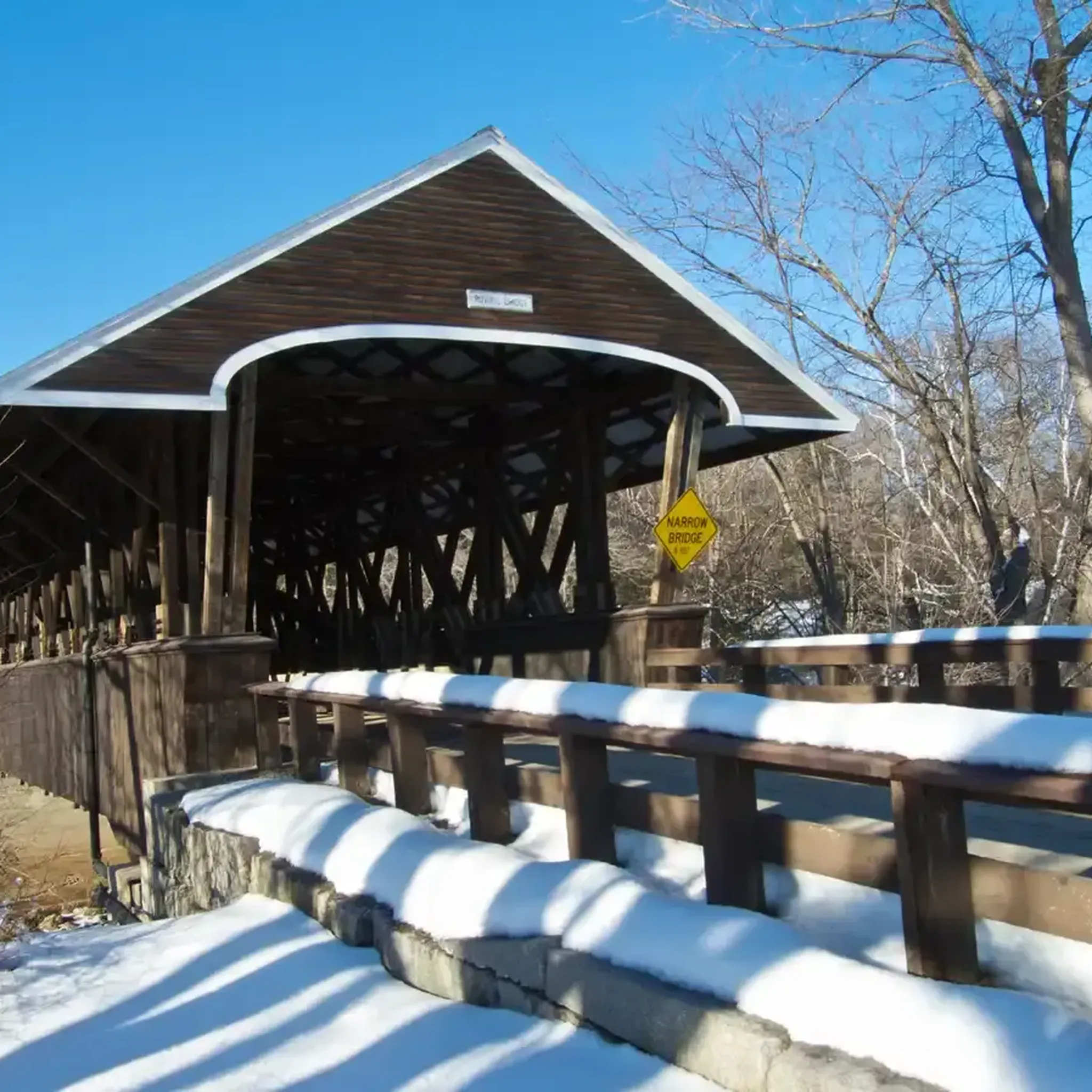
This bridge spans the Contocook river and is surrounded by a range of beautiful pine trees. It makes a lovely spot for a photo along your ride.
0
0
An interesting old covered bridge dating back many years. It makes a good photo spot along your ride.
0
0

This is a wonderful lake, offering beautiful views and access to several boat launch areas and picnic spots.
0
0

This bridge actually sees a lot of traffic from cyclists crossing back and forth over the pretty, tranquil Contoocook River — and some vehicle drivers too, of course.
0
0
This road offers a wonderfully quiet, scenic ride alongside the pretty Contoocook River.
0
0
This isn't just a spot to stop and stretch your legs - you might see people boating or fishing in this roadside pond. (Just for the record, it is considered public, not private, waters.)
0
0

Frequently Asked Questions
How many road cycling routes are available in Contoocook?
Contoocook offers a diverse selection of over 30 road cycling routes. These routes cater to various skill levels, including easy, moderate, and challenging options, ensuring there's something for every cyclist.
What kind of terrain can I expect on road cycling routes in Contoocook?
Road cycling in Contoocook features varied terrain, from relatively flat sections along former rail beds to routes with moderate elevation changes. You'll encounter quiet woodlands, scenic river views, and open roads, providing a diverse and engaging cycling experience.
Are there routes suitable for beginners or families in Contoocook?
Yes, Contoocook has several easy road cycling routes perfect for beginners or families. These often incorporate sections of local rail trails, which are known for being flat and accessible. One such route is the Contoocook Covered Bridge – Contoocook covered bridge loop from Rollins Lot, an easy 15.5-mile (24.9 km) path.
What are the difficulty levels of road cycling routes in Contoocook?
The road cycling routes in Contoocook range from easy to difficult. There are 5 easy routes, 26 moderate routes, and 1 difficult route, providing options for cyclists of all experience levels. Most routes fall into the moderate category, offering a good balance of challenge and enjoyment.
Are there any historical landmarks or scenic viewpoints along the road cycling routes?
Absolutely. Many routes in Contoocook pass by significant landmarks and offer scenic views. A notable historical landmark is the Rail Trail Bridge over Contoocook River, which is part of the historic Contoocook Railroad Bridge, the oldest extant covered railroad bridge in the United States. Routes also feature picturesque river views and tranquil woodlands.
What natural features can I expect to see while cycling in Contoocook?
While cycling in Contoocook, you can expect to see the beautiful Contoocook River, which is a central feature of the landscape. Routes often traverse dense forests, offering views of towering pines and vibrant foliage, especially in autumn. You might also encounter wetland vegetation and various ponds, adding to the natural beauty.
Where can I find parking for road cycling routes in Contoocook?
Parking is generally available at various trailheads and public access points throughout Contoocook. For routes starting near the Contoocook Covered Bridge, you can often find parking in the vicinity, such as near the Hopkinton Dam - Dike H-3 or Rollins Lot, which serve as starting points for several popular loops.
Can I combine road cycling with rail trails in Contoocook?
Yes, Contoocook is known for its excellent rail trail network, and many road cycling routes can be combined with or incorporate sections of these trails. The Concord-Lake Sunapee Rail Trail and the Contoocook River Park trails offer flat, accessible paths that can be integrated into longer road cycling loops, providing a varied and enjoyable ride.
What do other road cyclists enjoy most about cycling in Contoocook?
The road cycling routes in Contoocook are highly rated by the komoot community, with an average score of 4.6 stars from over 7 reviews. Cyclists often praise the scenic river views, the charm of historic covered bridges, and the peacefulness of the quiet woodlands. The diverse terrain and well-maintained paths are also frequently highlighted.
Are there any loop trails for road cycling in Contoocook?
Yes, Contoocook offers several excellent loop trails for road cycling. A popular choice is the Contoocook River road ride loop, a 26.2-mile (42.2 km) route that provides scenic views along the river. Another option is the Contoocook covered bridge – Contoocook Covered Bridge loop from Contoocook, a 27.7-mile (44.6 km) moderate ride.
What is the best time of year for road cycling in Contoocook?
The best time for road cycling in Contoocook is generally from spring through fall. During these seasons, the weather is most favorable, and the natural scenery, especially the fall foliage, is particularly stunning. While some rail trails may be accessible year-round, road conditions can be challenging in winter due to snow and ice.
Are there any longer or more challenging routes for experienced cyclists?
For experienced cyclists seeking a longer or more challenging ride, Contoocook offers routes with greater distances and elevation gains. For instance, the Contoocook covered bridge – Whittier Pond loop from Hopkinton Dam - Dike H-3 is a moderate 23.7-mile (38.2 km) trail with over 1,300 feet (400 meters) of elevation gain, leading through varied terrain.
Most popular attractions around Contoocook

Get inspired with the komoot mobile app


Explore more
Browse the best Road cycling routes in other regions.
