The best running trails around Alberni-Clayoquot
4.9
(37)
881
runners
25
runs
Jogging routes around Alberni-Clayoquot traverse a diverse landscape on Vancouver Island, British Columbia, characterized by a rugged coastline, freshwater lakes, and mountainous terrain. The region offers a variety of running environments, from coastal paths to trails through ancient forests. This geography provides a range of options for runners seeking different challenges and scenic backdrops.
Best jogging routes around Alberni-Clayoquot
- The most popular jogging route is Inspiration Point – Amphitrite Point Lighthouse loop from Ucluelet, a 5.7 miles (9.1 km)…
Last updated: October 8, 2026
4.1
(8)
118
runners
9.11km
00:58
70m
70m
Moderate run. Good fitness required. Mostly paved surfaces. Suitable for all skill levels.
5.0
(2)
79
runners
10.3km
01:05
80m
80m
Moderate run. Good fitness required. Mostly paved surfaces. Suitable for all skill levels.

27
runners
11.0km
01:10
60m
60m
Moderate run. Good fitness required. Mostly paved surfaces. Suitable for all skill levels.
5.0
(1)
54
runners
8.69km
00:55
60m
60m
Moderate run. Good fitness required. Mostly paved surfaces. Suitable for all skill levels.
5.0
(4)
52
runners
5.91km
00:37
40m
40m
Moderate run. Good fitness required. Mostly paved surfaces. Suitable for all skill levels.
Get access to more routes and recommendations from other explorers.
Already have an account?
Our route recommendations are based on thousands of hikes, rides, and runs completed by other people on komoot.
Start today with a free account
Your next adventure awaits.
Popular around Alberni-Clayoquot
Other adventures around Alberni-Clayoquot

Tips from the Community

Such a shame. Not every change is positive. Thanks for your update.
0
0

The Tonquin Trail Connector, opened in March 2014, has been partially widened to a gravel road. Residential construction plans are expected in the upper section; the trail is not recommended. (May 17, 2025)
0
0
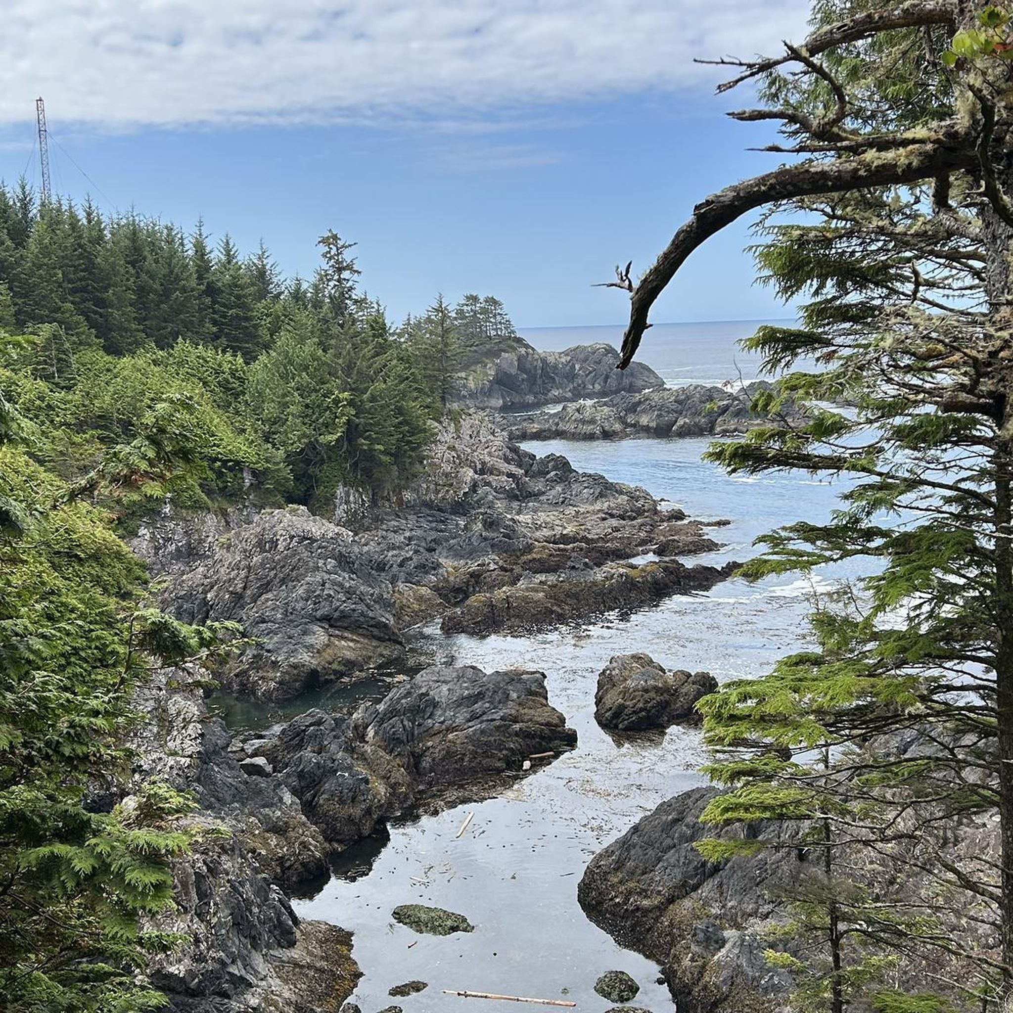
The Lighthouse Loop is a 3.1 km loop trail along the Pacific coast at the headland near Ucluelet. Highlights along the trail include the Amphitrite Point Lighthouse, Inspiration Point, and He-Tin-Kis Beach. The trail features a lush coastal forest with a variety of tree species, including old-growth red cedar, Sitka spruce, and western hemlock. https://www.wildpacifictrail.com/lighthouse.html
2
0
Inspiration Point on the Lighthouse Loop opened in May 2017. Wooden stairs lead down to three different viewpoints overlooking the rocky coast and the Pacific Ocean. https://www.westerlynews.ca/local-news/ucluelets-wild-pacific-trail-unveils-new-views-1304344
2
0
The west coast of Vancouver Island is known as the 'Graveyard of the Pacific.' Hundreds of ships lie wrecked off the coast. The wreck of the 'Pass of Melfort' lies off Amphitrite Point. The ship, en route to Puget Sound in Washington State, was blown east by a southwest gale, struck the rocks with tremendous force, and broke apart on Christmas Day 1905. The entire crew drowned. https://www.wrecksite.eu/wreck.aspx?167255
2
0
Following a tragic shipping accident on Christmas Day 1905, a wooden lighthouse tower was erected at Amphitrite Point in January 1906. The tower was destroyed by a tidal wave in early 1914 and replaced by a modern lighthouse in March 1915. In Greek mythology, Amphitrite is the sea goddess and wife of Poseidon. The point where the lighthouse stands is named after a British Royal Navy ship bearing her name. (May 16, 2025) The history of the Amphitrite Point Lighthouse is described in detail on a website: https://www.lighthousefriends.com/light.asp?ID=1104
3
0

The lighthouse, which was built in 1929, is primarily intended to guide ships through the treacherous waters of the Pacific Ocean, especially in a region known for its challenging weather conditions and rugged coastline. The Amphitrite Point Lighthouse is a structure of great importance to navigation in this area and offers panoramic views of the ocean and surrounding area, making it a popular destination for visitors. Additionally, the surrounding area is often a good place to spot marine life and enjoy scenic walks along the coast.
4
0

Be sure to take part in the Bog Challenge! Here you will learn a lot about raised bogs on the coast, can you find the carnivorous plant?
1
0
Frequently Asked Questions
How many running routes are available in Alberni-Clayoquot?
There are nearly 30 dedicated running routes available in the Alberni-Clayoquot region on komoot, offering a wide variety of terrains and distances for all skill levels.
Are there easy running routes suitable for beginners or families?
Yes, the region offers several easy options. The Kitsuksis Dyke Trail in Port Alberni is mostly paved and follows Kitsuksis Creek, ideal for a relaxed run. The Hydro Row and Scott Kenny Trails also provide gentler, multi-use paths. For a unique experience, the Rainforest Trail in Pacific Rim National Park Reserve features boardwalks through ancient forests, suitable for a leisurely jog.
What kind of scenery can I expect on the jogging trails in Alberni-Clayoquot?
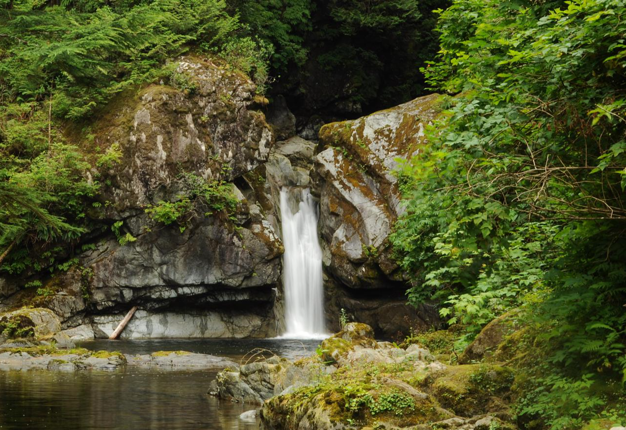
The Alberni-Clayoquot region boasts diverse scenery, from rugged coastlines and expansive beaches to ancient forests with towering trees and freshwater lakes. You can find routes that offer ocean views, serene forest paths, or trails alongside rivers like the Stamp River, known for its impressive falls.
Are there any long-distance running trails in the area?
For those seeking longer distances, the Log Train Trail stretches for 25 kilometers along the foot of the Beaufort Range, offering an extensive non-motorized path ideal for long runs. Many of the coastal routes, such as Tonquin Trail Connector loop from Tofino, also provide substantial mileage.
What do other runners enjoy most about jogging in Alberni-Clayoquot?
The running routes in Alberni-Clayoquot are highly rated by the komoot community, with an average score of 4.7 stars from over 18 reviews. Runners often praise the stunning natural beauty, the variety of terrain, and the opportunity to explore both coastal and forest environments. Over 800 runners have used komoot to explore the region's varied trails.
Are there any circular running routes available?
Yes, many of the routes in Alberni-Clayoquot are designed as loops, offering a convenient way to start and finish in the same location. Examples include the popular Inspiration Point – Amphitrite Point Lighthouse loop from Ucluelet and the Tinwis loop from Tofino.
What interesting landmarks or attractions can I see along the running routes?
You can discover several notable landmarks and natural attractions. The Inspiration Point – Amphitrite Point Lighthouse loop from Ucluelet takes you past the iconic Amphitrite Point Lighthouse and Inspiration Point. For ancient forests, consider routes near Cathedral Trail, MacMillan Park, home to magnificent Douglas firs like The Big Tree.
Are there any running routes that offer views of lakes or rivers?
Absolutely. The region is rich with freshwater lakes and streams. Sproat Lake and Great Central Lake are prominent features, and trails around these areas can offer beautiful waterside views. The Stamp River, with its impressive Stamp Falls, also provides scenic running opportunities where you might even witness salmon runs.
What is the best time of year for jogging in Alberni-Clayoquot?
The Alberni-Clayoquot Regional District benefits from a temperate climate, making it suitable for outdoor activities year-round. While summer offers warmer, drier conditions, spring and fall provide lush greenery and cooler temperatures, which many runners prefer. Winter running is also possible, though some trails might be wetter.
Are there any specific areas in Port Alberni recommended for running?
Port Alberni, as the region's commercial hub, offers several excellent running options. Besides the Kitsuksis Dyke Trail, the Log Train Trail is easily accessible from many points within the Alberni Valley. The Alberni Inlet Trail also provides additional stages for runners to explore.
Can I find routes that combine beach running with other terrains?
Yes, the rugged coastline and numerous beaches provide opportunities for varied runs. The Mushroom Island – MacKenzie Beach loop from Tofino features scenic beach sections. Long Beach in Pacific Rim National Park Reserve is also renowned for its vast sandy expanses, perfect for beach jogging.
Are there any routes that offer mountain views or elevation challenges?
The region's geography includes the Beaufort Mountain Range and 124 named mountains, providing opportunities for challenging trail runs with elevation. While specific routes are moderate, the overall mountainous backdrop ensures breathtaking vistas. For more information on peaks, you can check the Peaks around Alberni-Clayoquot guide.
Most popular attractions around Alberni-Clayoquot

Get inspired with the komoot mobile app


Explore more
Browse the best Running Trails & Routes in other regions.
