The best walks and hikes around Alberni-Clayoquot
4.6
(1743)
13,521
hikers
110
hikes
Hiking around Alberni-Clayoquot offers diverse landscapes on Vancouver Island, characterized by deep-sea fjords, vast forest-covered mountains, and a rugged Pacific coastline. The region features numerous freshwater lakes, powerful waterfalls, and ancient forests. This varied topography provides a range of hiking experiences, from coastal paths to challenging mountain ascents.
Best hiking trails around Alberni-Clayoquot
- The most popular hiking route is Wild Pacific Trail: Lighthouse Loop — Ucluelet, a 1.7 miles (2.8 km) trail that takes 44 minutes to complete. This…
Last updated: October 16, 2026
4.8
(349)
2,677
hikers
2.80km
00:45
30m
30m
Easy hike. Great for any fitness level. Easily-accessible paths. Suitable for all skill levels.
4.3
(8)
196
hikers
7.88km
03:53
880m
880m
Moderate hike. Good fitness required. Easily-accessible paths. Suitable for all skill levels.

4.0
(6)
86
hikers
9.03km
03:12
520m
520m
Moderate hike. Good fitness required. Easily-accessible paths. Suitable for all skill levels.
5.0
(1)
110
hikers
23.7km
06:34
420m
420m
Hard hike. Very good fitness required. Easily-accessible paths. Suitable for all skill levels.
5.0
(3)
33
hikers
2.69km
00:44
50m
50m
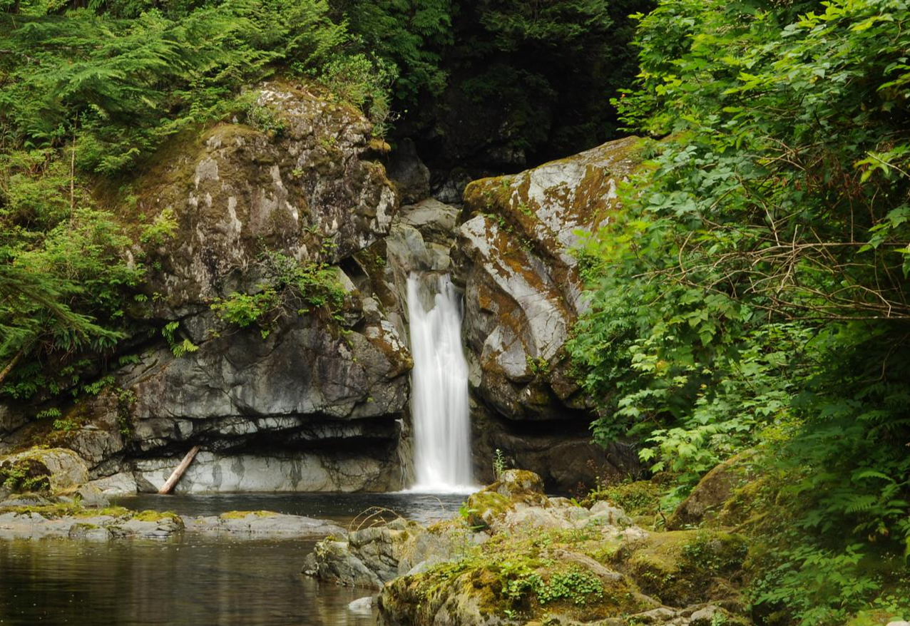
Hike the easy 1.7-mile China Creek Falls Trail near Port Alberni to discover a powerful waterfall and impossibly turquoise waters.
Get access to more routes and recommendations from other explorers.
Already have an account?
Our route recommendations are based on thousands of hikes, rides, and runs completed by other people on komoot.
Start today with a free account
Your next adventure awaits.
Other adventures around Alberni-Clayoquot

Tips from the Community


While hiking the West Coast Trail, look beyond the trees and see the red and white striped Pachena Point Lighthouse in the distance. It was built in 1907 following the sinking of the SS Valencia. It's a wooden, octagonal lighthouse, the light station and its inner grounds are currently closed to the public, but it can still be marvelled at from the main trail.
0
0
The Black River passes under the West Coast Trail on its journey out to meet the ocean. The bridge over the Black River provides a safe crossing over the swift coastal waters that flow through the dense forest. This trail is known for its gruelling obstacles, including over 100 vertical ladder systems, deep mud, and slippery boardwalks, but this bridge provides easy crossing and awesome views of the river below.
0
0

This section of the trail follows the route of a former supply road used to service the Pachena Point Lighthouse, and is one of the more manageable stretches, with relatively flat terrain and only a few gullies to navigate. The trail pulls you deep into beautiful old-growth coastal rainforest, where enormous ancient trees close in on all sides, allowing just a few peeks of the coastline. Along the way, you'll encounter the first of the trail’s iconic ladder systems, built to navigate the steep headlands and gullies where beach travel is impossible, giving you an early taste of what lies ahead further along the route.
0
0
Michigan Beach is home to the boiler of the Michigan, a 695-tonne steam schooner that wrecked here on January 21st, 1893, after being swept off course by the strong northerly current, and is the first shipwreck remains on the trail that you can see and actually touch. The campsite here is a mix of beach and forest tent spots, with an outhouse and two bear caches. It’s one of the busiest campsites on the trail, and if you are looking for a quieter night, you can push on to Darling River or Tsocowis Creek, both within easy reach along this same stretch of beach.
0
0

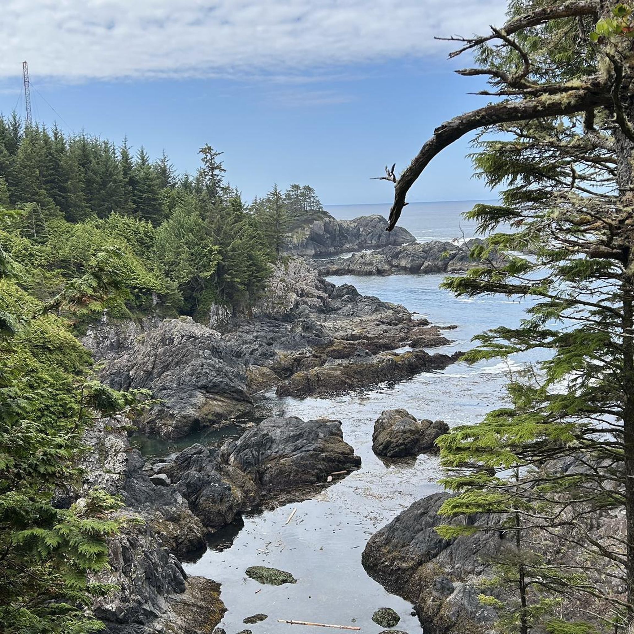
A short but steep route leads up to the Mount Ozzard radio tower from here. It's not the most exciting hike you'll ever do but getting the view from the top makes it worth it.
0
0
The way up is on a gravel road, so not the most inspiring trail. However, if you manage to reach the summit on a clear day you'll have incredible panoramic views that are worth the slog uphill.
0
0
China Creek Trailhead sits at a pull-off along Bamfield Main, identifiable by a yellow gate and a small trail sign that can be easy to miss if you’re not watching for it. Parking is limited, and there are no facilities available, so be sure to come prepared. Access is free, but the trailhead is on an active logging road, so it’s best to go on weekends when operations are paused. As you set off from the trailhead, the path quickly immerses you in a lush coastal forest, following China Creek upstream toward the falls.
1
0
Frequently Asked Questions
How many hiking trails are there in the Alberni-Clayoquot region?
The Alberni-Clayoquot Regional District offers a wide variety of hiking experiences with over 100 trails. These range from easy coastal strolls to challenging mountain ascents, catering to all skill levels.
What types of trails are available for different skill levels?
The region provides a diverse range of trails. You'll find approximately 72 easy routes, 23 moderate trails, and 5 more challenging hikes. This variety ensures options for casual walkers, families, and experienced trekkers alike.
Are there any family-friendly hiking trails in Alberni-Clayoquot?
Yes, several trails are suitable for families. The China Creek Falls Trail is an easy to moderate option leading to a powerful waterfall. Another excellent choice is the short, family-friendly walk at Stamp River Falls, especially during salmon spawning season. The Rainforest Trail in Pacific Rim National Park Reserve also offers an accessible experience on boardwalks through ancient forests.
Which trails offer stunning ocean views?
For breathtaking ocean views, the Wild Pacific Trail near Ucluelet is highly recommended. Its Lighthouse Loop section provides easy walks with endless Pacific vistas and unique, weather-beaten trees. Other parts of the Wild Pacific Trail also offer moderate hiking with expansive ocean scenery.
Can I find trails with waterfalls in the area?
Absolutely. The region is home to several impressive waterfalls. You can visit the powerful China Creek Falls via the China Creek Falls Trail, known for its impossibly turquoise waters. Stamp River Falls is another popular spot, and for more advanced hikers, Weiner Falls and the challenging overnight trek to Della Falls are options.
Are there any challenging mountain hikes for experienced trekkers?
Yes, for experienced hikers seeking a challenge, the 5040 Peak via Cobalt Lake Trail offers a demanding ascent with nearly 900 meters of elevation gain, rewarding hikers with panoramic views of Triple Peak, Cats Ear Peak, and dramatic cloud inversions. Overnight camping near Cobalt Lake is a popular option on this trail. Mount Ozzard also presents a moderate hike with significant elevation gain.
What are some notable natural landmarks or attractions to see while hiking?
The Alberni-Clayoquot region is rich in natural landmarks. You can explore ancient forests at Cathedral Grove in MacMillan Provincial Park, home to giant Douglas Firs. The Rainforest Trail in Pacific Rim National Park Reserve offers an immersive experience through old-growth forests. Don't miss the petroglyphs carved by local First Peoples at Sproat Lake, or the scenic Stamp Falls and Canyon.
What do other hikers say about the trails in Alberni-Clayoquot?
The hiking trails in Alberni-Clayoquot are highly regarded by the komoot community, holding an average rating of 4.6 stars from over 1,200 reviews. Hikers frequently praise the diverse landscapes, from rugged coastlines to ancient forests and mountain vistas, as well as the well-maintained paths.
Are there any trails that offer a glimpse into the region's history?
Yes, the Alberni Inlet Trail provides breathtaking views of the Alberni Inlet and allows hikers to explore remnants of old logging camps, connecting them to the region's historical ties with the Nuu-chah-nulth people. Additionally, the petroglyphs at Sproat Lake offer a glimpse into the ancient history of the local First Peoples.
What is the best time of year to go hiking in Alberni-Clayoquot?
The Alberni-Clayoquot region benefits from a temperate climate, making it suitable for year-round outdoor adventures. However, for the most comfortable hiking conditions, late spring, summer, and early fall generally offer the best weather with less rain and warmer temperatures, ideal for exploring both coastal and mountain trails.
Are there any circular hiking routes available?
Yes, the region offers several loop trails. A popular option is the Wild Pacific Trail: Lighthouse Loop near Ucluelet, which provides an easy circular walk with stunning ocean views. Many other trails also feature loop sections or can be combined to create circular routes.
Where can I find more information about hiking in the Alberni Valley?
For additional details and resources specifically about hiking in the Alberni Valley, you can visit the Alberni Valley Tourism website: albernivalleytourism.com.
Most popular attractions around Alberni-Clayoquot

Get inspired with the komoot mobile app


Explore more
Browse the best Hikes in other regions.
