The best walks and hikes around Étangs de Fontargente
4.6
(1085)
8,805
hikers
162
hikes
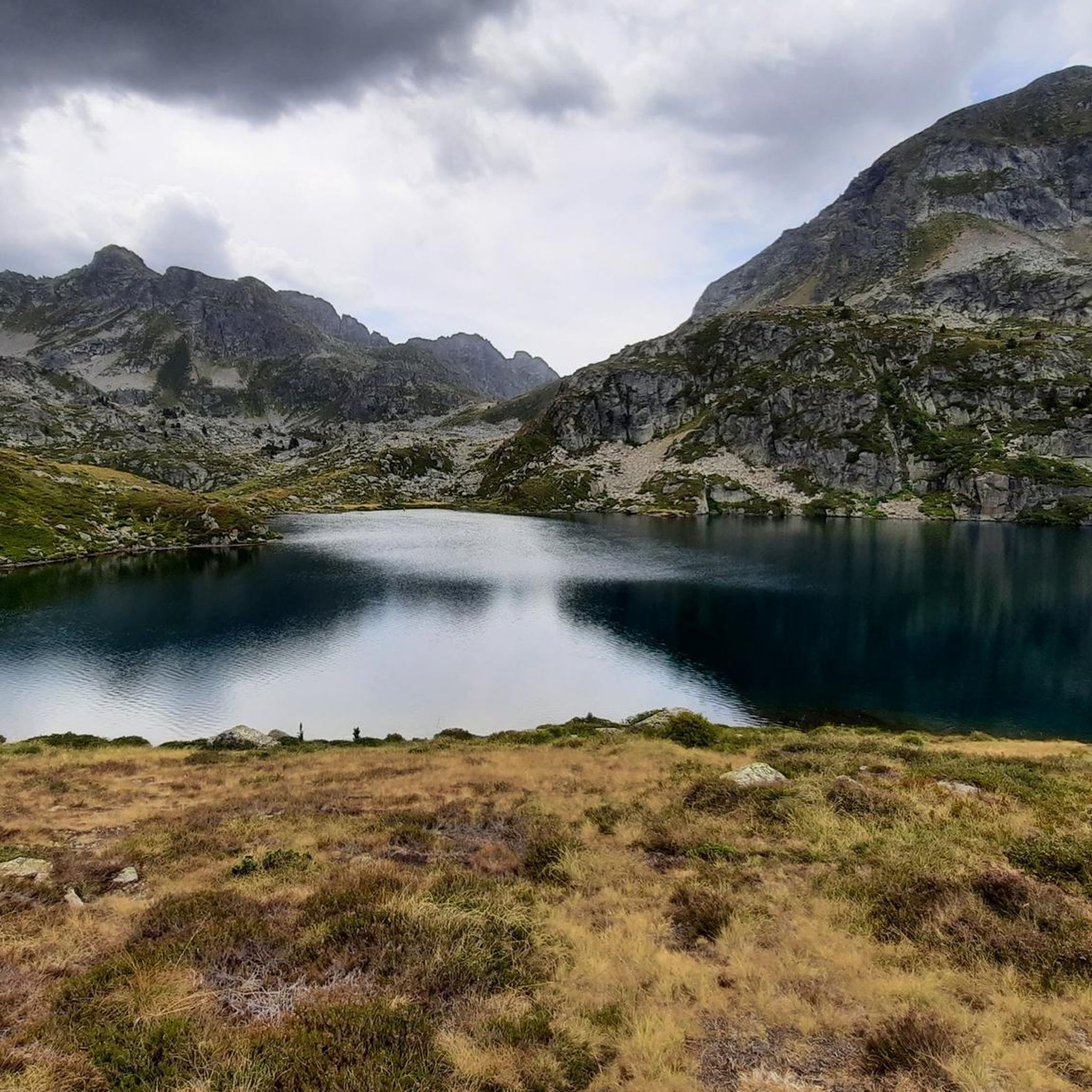
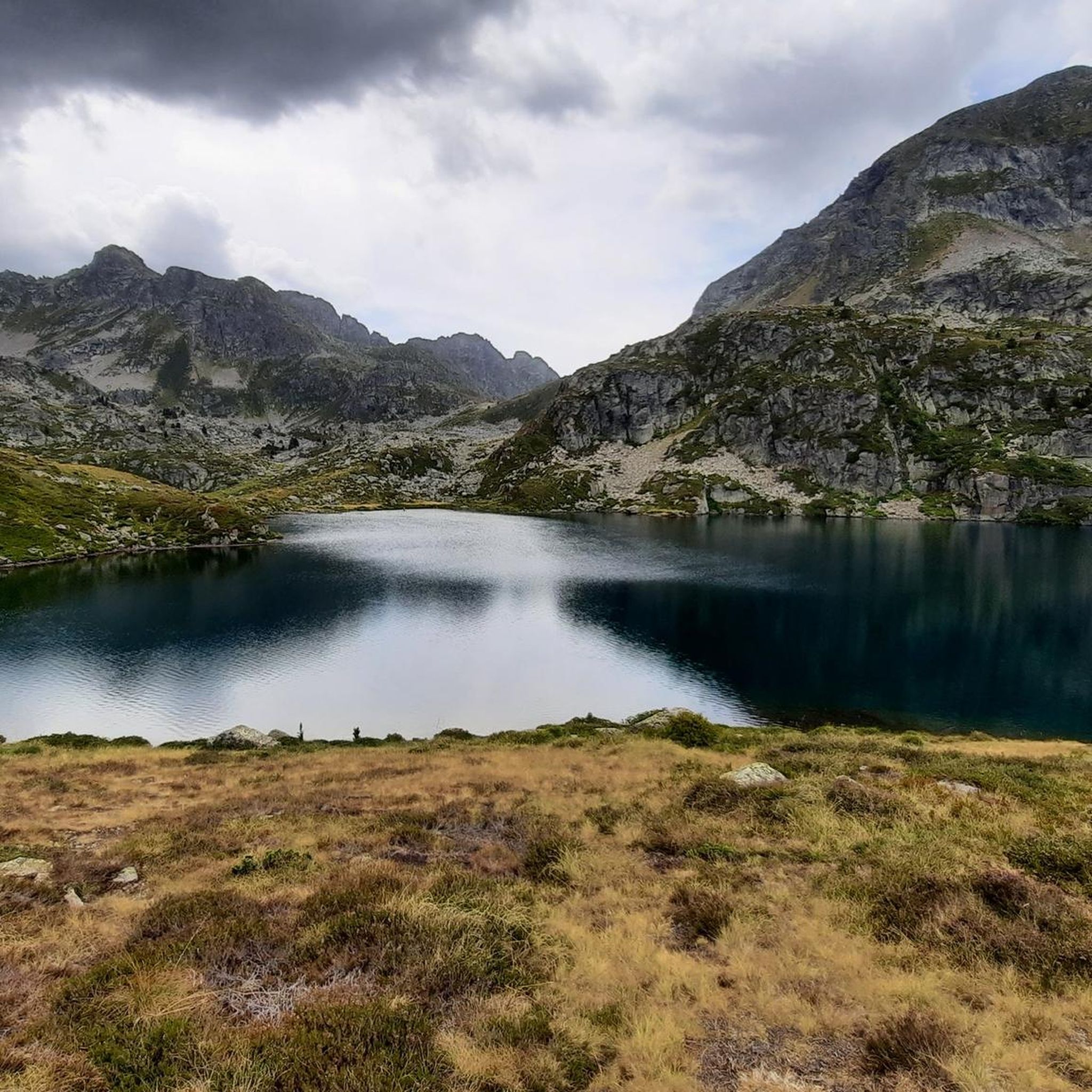
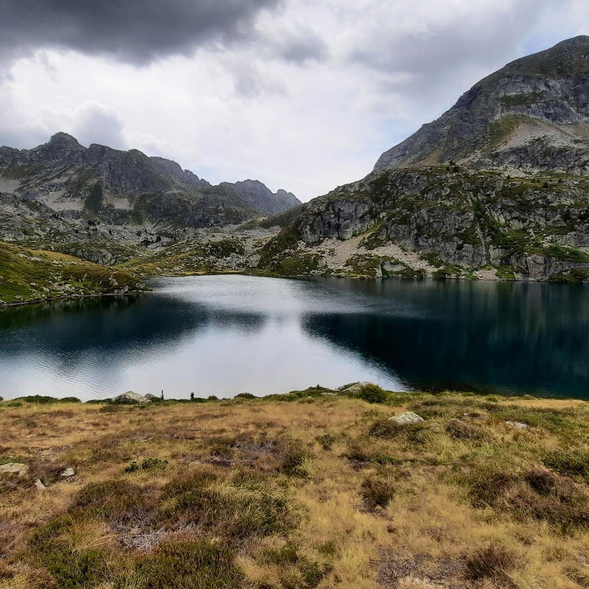
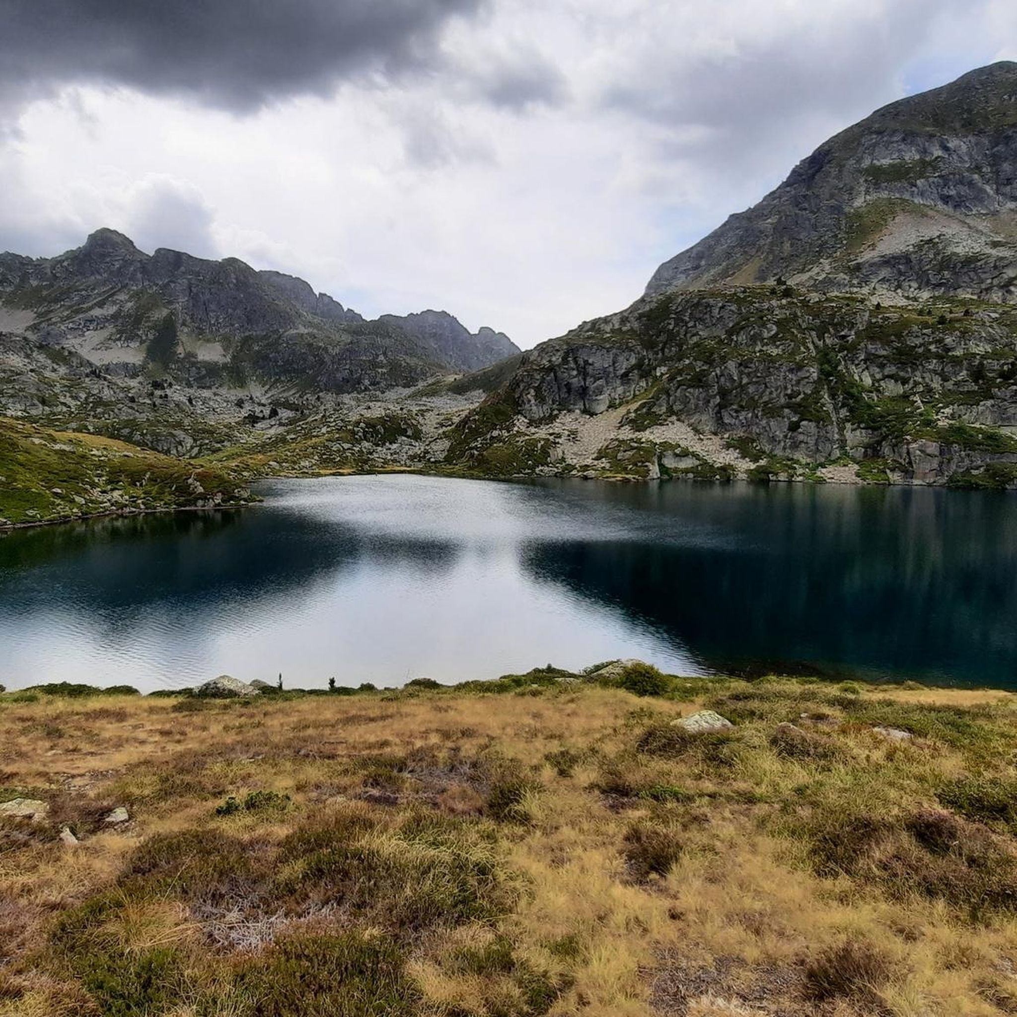
Hiking around Étangs de Fontargente offers trails through a glacial cirque in the Aston Valley of the Ariège Pyrenees. The area features three mountain lakes at an altitude of 2140 meters, surrounded by mountainous terrain. Landscapes transition from high-altitude pastures to rocky walls, providing varied hiking environments. The region's natural features include deep depressions carved by glacial activity and panoramic views of surrounding peaks.
Best hiking trails around Étangs de Fontargente
- The most popular hiking route is Etangs de Fontargente…
Last updated: October 12, 2026
6
hikers
5.87km
02:38
330m
330m
Moderate hike. Good fitness required. Mostly accessible paths. Sure-footedness required.
4.7
(39)
378
hikers
8.32km
03:34
450m
450m
Moderate hike. Good fitness required. Mostly accessible paths. Sure-footedness required.

4.8
(4)
33
hikers
15.6km
07:29
1,160m
1,160m
Hike the difficult 9.7-mile Fontargente and l'Estagnol Lakes Loop, featuring emerald lakes and Pyrenean mountain views.
4.8
(16)
167
hikers
14.4km
06:06
780m
780m
Hard hike. Very good fitness required. Mostly accessible paths. Sure-footedness required.
4.7
(13)
168
hikers
12.1km
04:59
560m
560m
Moderate hike. Good fitness required. Mostly accessible paths. Sure-footedness required.
Get access to more routes and recommendations from other explorers.
Already have an account?
Our route recommendations are based on thousands of hikes, rides, and runs completed by other people on komoot.
Start today with a free account
Your next adventure awaits.
Tips from the Community

Meadow with a parking lot from which several hiking routes depart.
0
0
Impressive mountain pass that connects Andorra with France. The ascent from both sides is somewhat technical and demanding as you have to cross several scree slopes of enormous rocks.
0
0
Beautiful lake in a lovely high mountain setting.
0
0
Access from the Pla de las Peyres parking is quite simple. From the refuge, you can access the Etangs de Fortargente and Lake l'Estagnol.
0
0

There was good vegetarian food and a delicious dessert. Hot showers are available until 6 p.m. There's no real drying room. If the hut is full and all the hikers have to dry their shoes by the fireplace, expect to have to wear wet clothes and shoes the next morning. Unfortunately, there was only one used newspaper for over 50 pairs of wet shoes 🤷
1
0


Magnificent landscapes, the climb is really worth it!! Breathtaking, we are more used to arriving in this kind of place on foot, well we can also do it by bike and we should not deprive ourselves!
0
0

We were very well received! Possibility to pitch a tent, WC available outside and hot shower at 3 euros for 4 minutes ;) you can also book to sleep inside and eat :)
1
0
Frequently Asked Questions
How many hiking trails are available in Étangs de Fontargente?
There are over 160 hiking routes documented in Étangs de Fontargente, offering a wide range of options for different skill levels and preferences. You'll find everything from moderate loops to more challenging mountaineering routes.
What kind of terrain can I expect on hikes around Étangs de Fontargente?
The terrain around Étangs de Fontargente is diverse, transitioning from high-altitude pastures to dramatic rocky walls. You'll navigate paths through a magnificent glacial cirque, often with significant elevation changes, especially on more difficult routes. The area is characterized by its pristine mountain lakes and rugged Pyrenean landscape.
Are there easy hiking options suitable for beginners or families?
While many routes involve significant elevation, there are accessible paths suitable for various skill levels. Out of the 160 available routes, 16 are classified as easy. These typically feature shorter durations and less elevation gain, making them suitable for those with good basic fitness or families looking for a more relaxed experience.
What are some challenging hikes for experienced trekkers?
For those seeking a more strenuous adventure, Étangs de Fontargente offers 59 difficult routes. A notable challenging option is the Fontargente and l'Estagnol Lakes Loop, which spans about 15.6 km and involves over 1100 meters of elevation gain, traversing rugged mountain terrain between multiple lakes. Another demanding route is the Rulhe Refuge – Juclà Refuge loop from Refuge du Rulhe, a 14.4 km trail leading through high mountain passes.
Are there any circular hiking routes around the lakes?
Yes, Étangs de Fontargente is well-known for its circular routes that allow you to fully experience the stunning lake scenery. A popular moderate loop is the Etangs de Fontargente – loop starting from the Pla de las Peyres car park, which is approximately 8.3 km long and offers beautiful views of the Fontargente lakes.
What natural features or landmarks can I see while hiking?
The central attraction of the area is the three pristine Fontargente Lakes, situated at an altitude of 2140 meters within a magnificent glacial cirque. You'll also encounter vast high-altitude pastures and dramatic rocky walls. Many trails offer splendid panoramic views of the surrounding peaks, including those extending into Andorra, with the Crête des Isards (Isards Ridge) providing a particularly impressive 360-degree vista.
What wildlife might I encounter in the Étangs de Fontargente area?
Hikers in Étangs de Fontargente might encounter a variety of local wildlife. Keep an eye out for Mérens horses and flocks of sheep grazing in the high pastures. Marmots are also common in the rocky areas. The lakes themselves are home to fish species such as fario trout, rainbow trout, and brook trout.
When is the best time of year to go hiking in Étangs de Fontargente?
The best time to hike in Étangs de Fontargente is typically from late spring to early autumn (roughly June to September) when the snow has melted, and the weather is most favorable. During these months, the trails are generally clear, and the high-altitude pastures are vibrant. Always check local weather conditions before heading out, as mountain weather can change rapidly.
Is wild swimming permitted in the Étangs de Fontargente lakes?
While the pristine mountain lakes of Fontargente are tempting, specific regulations regarding wild swimming can vary and are often subject to local environmental protection rules. It's advisable to check with local authorities or park information centers for the most current guidelines on swimming in natural bodies of water in the Ariège Pyrenees to ensure compliance and safety.
What do other hikers enjoy most about hiking in Étangs de Fontargente?
The area is highly rated by the komoot community, with an average score of 4.6 stars from over 850 reviews. Reviewers often praise the stunning natural beauty, particularly the serene lake vistas and dramatic glacial cirques. The diverse network of trails catering to various abilities and the chance to spot local wildlife also contribute to a highly enjoyable experience.
Are there options for longer, multi-day hikes in the region?
Yes, for those interested in longer adventures, some routes in Étangs de Fontargente can be connected with nearby refuges, such as the Refuge de Rulhe. This allows for longer circuits and even overnight stays, providing an opportunity to explore more of the high mountain environment. An example is the Rulhe Refuge – Pla de las Peyres loop from Plat des Peyres, which offers a substantial day hike that could be part of a longer itinerary.
Where can I park when visiting Étangs de Fontargente for a hike?
Many popular hiking routes, such as the Etangs de Fontargente – loop starting from the Pla de las Peyres car park, begin from designated parking areas like Pla de las Peyres. It's generally recommended to arrive early, especially during peak season, as parking can fill up quickly. Always check for any specific parking regulations or fees upon arrival.
Most popular routes around Étangs de Fontargente

Get inspired with the komoot mobile app


Explore more
Browse the best Hikes in other regions.
