The best walks and hikes around Réotier
4.5
(892)
7,072
hikers
15
hikes
Hiking around Réotier offers diverse alpine landscapes, ranging from larch forests and flower-filled meadows to higher altitude terrain. The region is situated at the foothills of the Ecrins National Park, providing views over the Durance valley. Altitudes vary significantly, from 871 meters to over 3000 meters, including the Tête de Vautisse summit. A notable natural feature is the Petrifying Fountain, a unique geological site.
Best hiking trails around Réotier
- The most popular hiking route is Eygliers Lake – Pietrificazione loop…
Last updated: October 12, 2026
4.7
(13)
173
hikers
8.88km
02:39
260m
260m
Moderate hike. Good fitness required. Easily-accessible paths. Suitable for all skill levels.
4.7
(10)
89
hikers
11.2km
05:24
780m
780m
Hard hike. Very good fitness required. Mostly accessible paths. Sure-footedness required.

4.7
(3)
32
hikers
19.8km
08:14
1,190m
1,190m
Hard hike. Very good fitness required. Mostly accessible paths. Sure-footedness required.
4.3
(6)
22
hikers
5.48km
01:48
250m
240m
Easy hike. Great for any fitness level. Easily-accessible paths. Suitable for all skill levels.
3.8
(4)
8
hikers
4.35km
01:19
150m
140m
Easy hike. Great for any fitness level. Easily-accessible paths. Suitable for all skill levels.
Get access to more routes and recommendations from other explorers.
Already have an account?
Our route recommendations are based on thousands of hikes, rides, and runs completed by other people on komoot.
Start today with a free account
Your next adventure awaits.

Tips from the Community

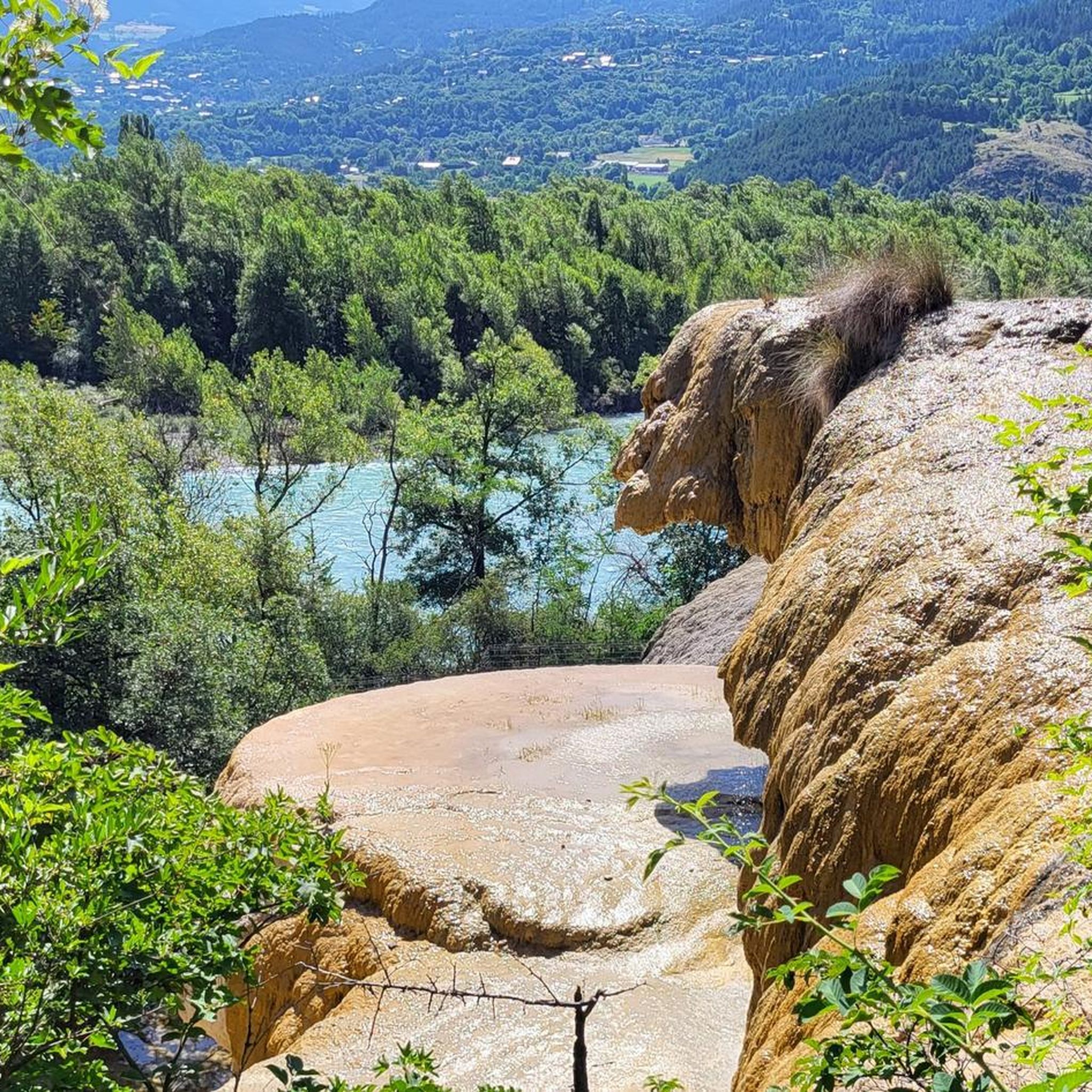
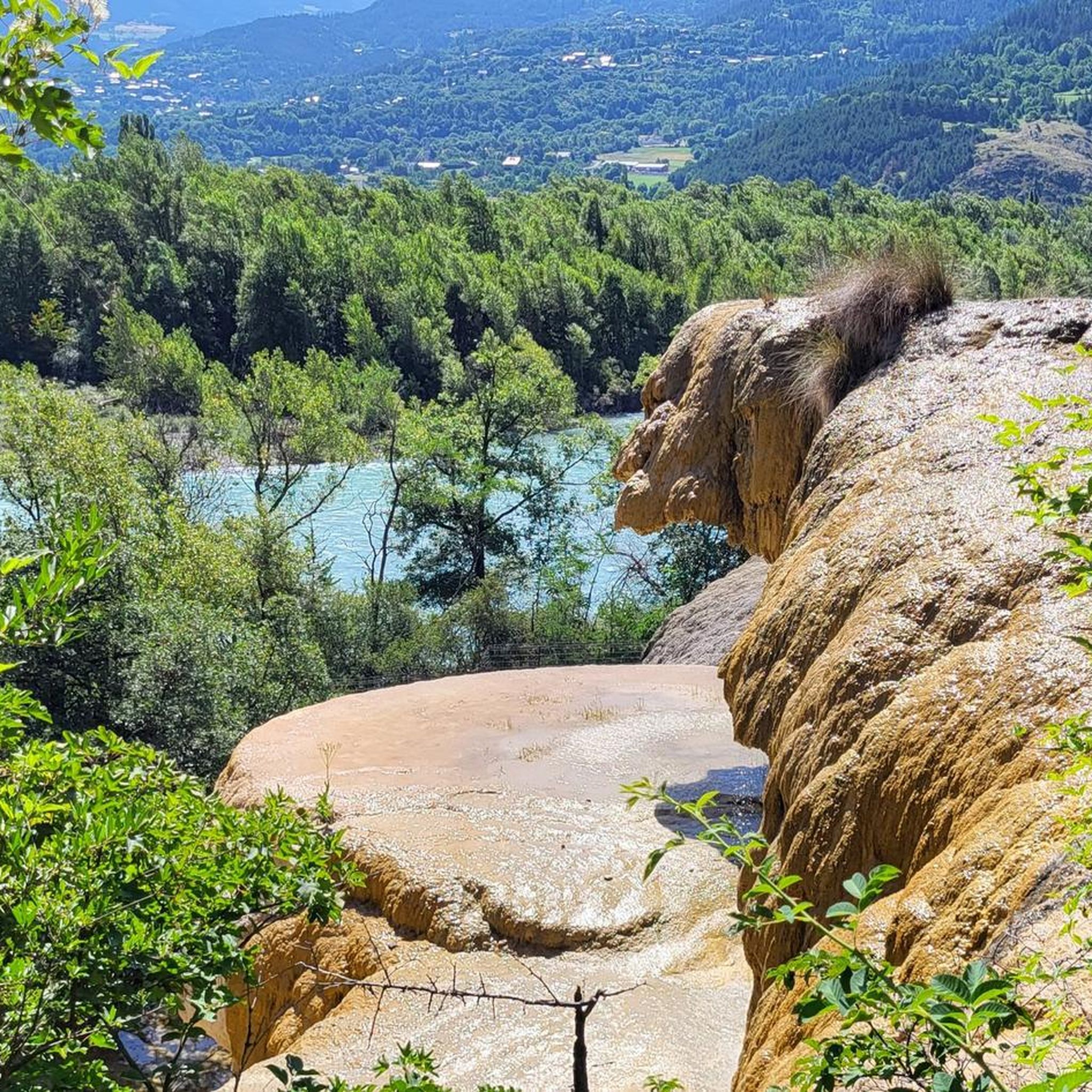
The petrified spring is a unique natural spectacle
0
0

Much prettier on the outside than on the inside.
0
0
Impose this powerful gateway with its moat.
0
0

A summit with wonderful views: from the Barre des Ecrins to the Pic de Rochebrune. Reached from Ponteil, towards Cabane de l'Alp, and a portage from 2,700 m along the NE ridge. Technical descent (S3/S4) from the SW ridge.
0
0

Beautiful landscapes on the Via Domizia
0
0

This is the Chapelle Saint-Roch, a place rich in history and reverence in the Pays des Écrins. Saint Roch himself is believed to have visited this chapel during his pilgrimage, finding solace and strength within its walls.
0
0

Frequently Asked Questions
How many hiking trails are there around Réotier?
Réotier offers a diverse network of over 18 hiking trails. These routes cater to various skill levels, ranging from easy strolls to challenging mountain ascents, ensuring there's something for every hiker.
Are there any easy or family-friendly hiking trails in Réotier?
Yes, Réotier is well-suited for families and beginners, with 9 easy routes available. A popular choice is the Eygliers Lake – Pietrificazione loop from Réotier, which is 5.2 km long and takes about 1 hour 25 minutes. This trail features the unique Petrifying Fountain and is suitable for all ages. The Plan d'Eau d'Eygliers also offers a natural body of water perfect for families.
What unique natural features can I explore on a hike in Réotier?
Réotier is home to several remarkable natural features. The most unique is the Petrifying Fountain of Réotier, a rare geological phenomenon where mineral-rich water forms fascinating concretions. You can experience this on the Eygliers Lake – Pietrificazione loop from Réotier. Additionally, the region offers stunning alpine scenery, larch forests, and views of the Durance river valley.
Are there any challenging hikes for experienced trekkers?
Absolutely. For experienced hikers seeking a challenge, the region offers 2 difficult routes. The Tête de Vautisse – Col de Rougnoux loop from Cabane de l'Alp is a demanding 11.2 km path with significant elevation gain, leading towards the Tête de Vautisse summit, which offers panoramic views extending to Mont Blanc on clear days.
What kind of landscapes will I encounter while hiking around Réotier?
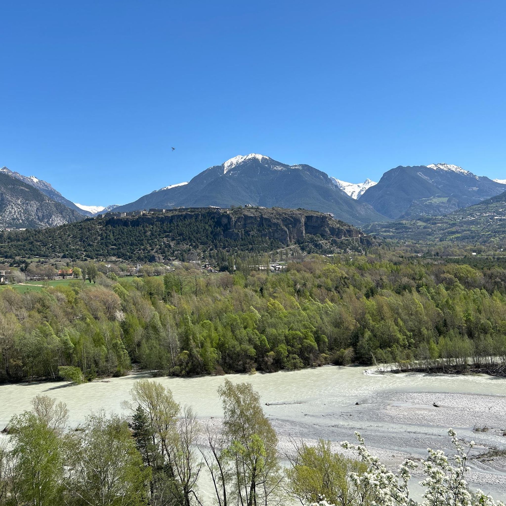
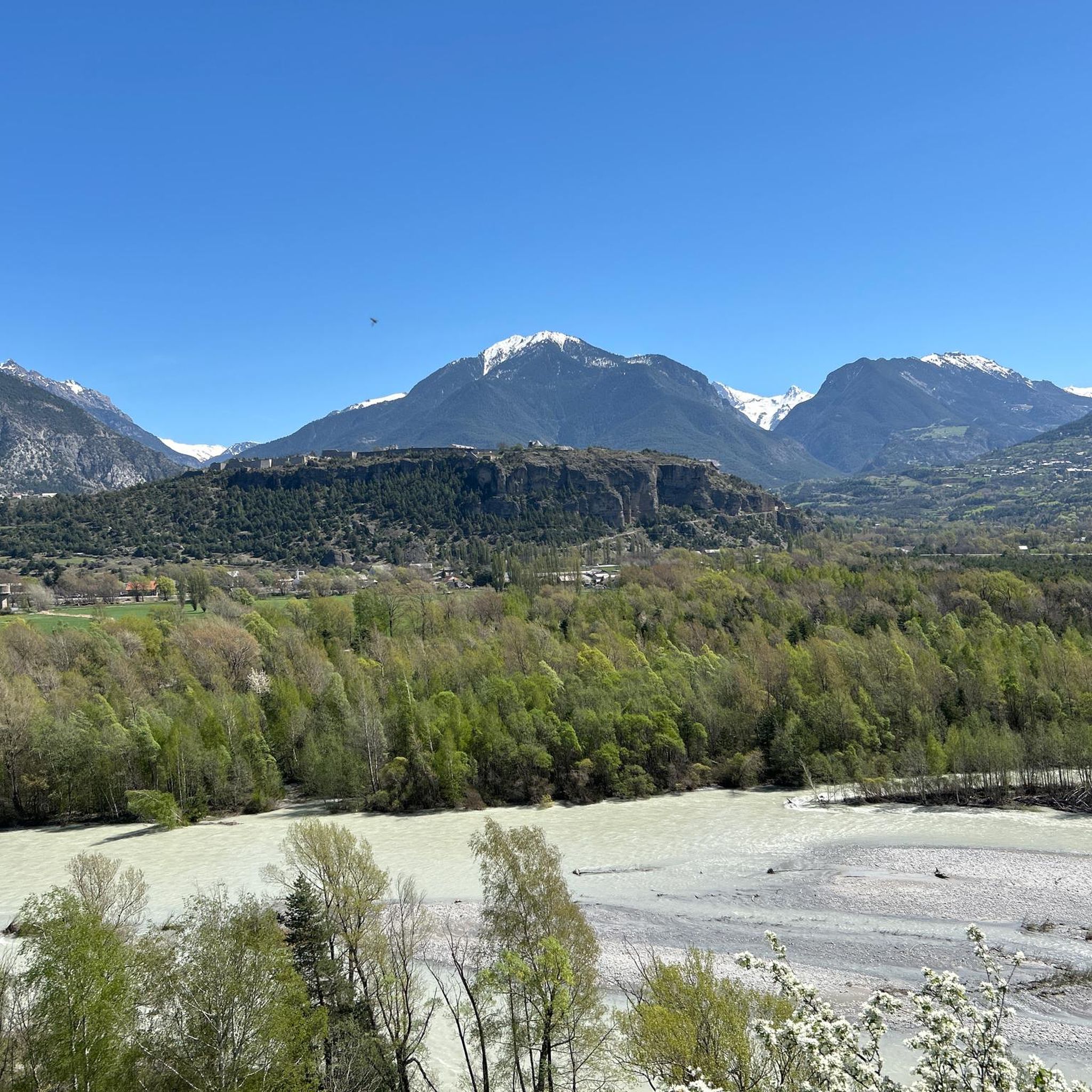
Hiking around Réotier offers a diverse range of alpine landscapes. You'll traverse larch forests, flower-filled meadows, and pastures. The altitude varies significantly, from 871m to over 3000m, providing varied terrain. The village itself is perched on a sunny mountainside, offering breathtaking views of the surrounding mountains and the Durance valley.
Are there any circular hiking routes available in Réotier?
Yes, many trails in Réotier are designed as loops, allowing you to start and end at the same point. Besides the family-friendly Eygliers Lake loop, the Saint-Roch Chapel loop from Réotier is another popular circular route, covering 5.7 km through varied terrain.
What are some notable landmarks or points of interest near the hiking trails?
Beyond the natural beauty, you can discover several points of interest. The Eygliers Lake is a beautiful spot for relaxation. For dramatic scenery, explore the Gorges du Guil or visit the Cascade de la Pisse, a stunning waterfall. The region also features cultural heritage sites like ancient churches and chapels, such as the Notre-Dame-des-Neiges chapel.
Is Réotier a good place for dog-friendly hikes?
The Hautes-Alpes region, including Réotier, generally welcomes dogs on trails, especially outside of protected areas like the core zone of Ecrins National Park where regulations might be stricter. Many local paths through forests and meadows are suitable for walks with your canine companion. Always ensure your dog is under control and check specific trail regulations if you plan to enter national park boundaries.
What do other hikers enjoy most about hiking in Réotier?
The hiking routes in Réotier are highly rated by the komoot community, with an average score of 4.5 stars from over 800 reviews. Hikers frequently praise the diverse alpine scenery, the tranquility of the trails, and the stunning views over the Durance valley. The unique Petrifying Fountain is also a highlight often mentioned.
Are there options for public transport to access hiking trails in Réotier?
While Réotier is a charming village, public transport options directly to all trailheads can be limited due to its rural setting. It's often recommended to have a car for maximum flexibility in accessing the wider network of trails and attractions in the Hautes-Alpes. However, some local bus services might connect to nearby towns like Embrun, from which you might find local connections or taxi services.
Where can I park when hiking in Réotier?
Parking is generally available in and around the village of Réotier. For specific trailheads, you'll often find designated parking areas, especially for popular routes. It's advisable to check the starting point of your chosen route on komoot for details on nearby parking facilities.
What is the best time of year to go hiking in Réotier?
The best time for hiking in Réotier is typically from late spring to early autumn (May to October). During these months, the weather is generally pleasant, meadows are in bloom, and higher-altitude trails are more accessible. Summer offers warm, sunny days, while autumn brings beautiful larch forest colors. Winter provides opportunities for snowshoeing, but many hiking trails will be covered in snow.
Most popular routes around Réotier
Most popular attractions around Réotier

Get inspired with the komoot mobile app


Explore more
Browse the best Hikes in other regions.
