The best walks and hikes in the Altiplano
4.6
(95)
627
hikers
7
hikes
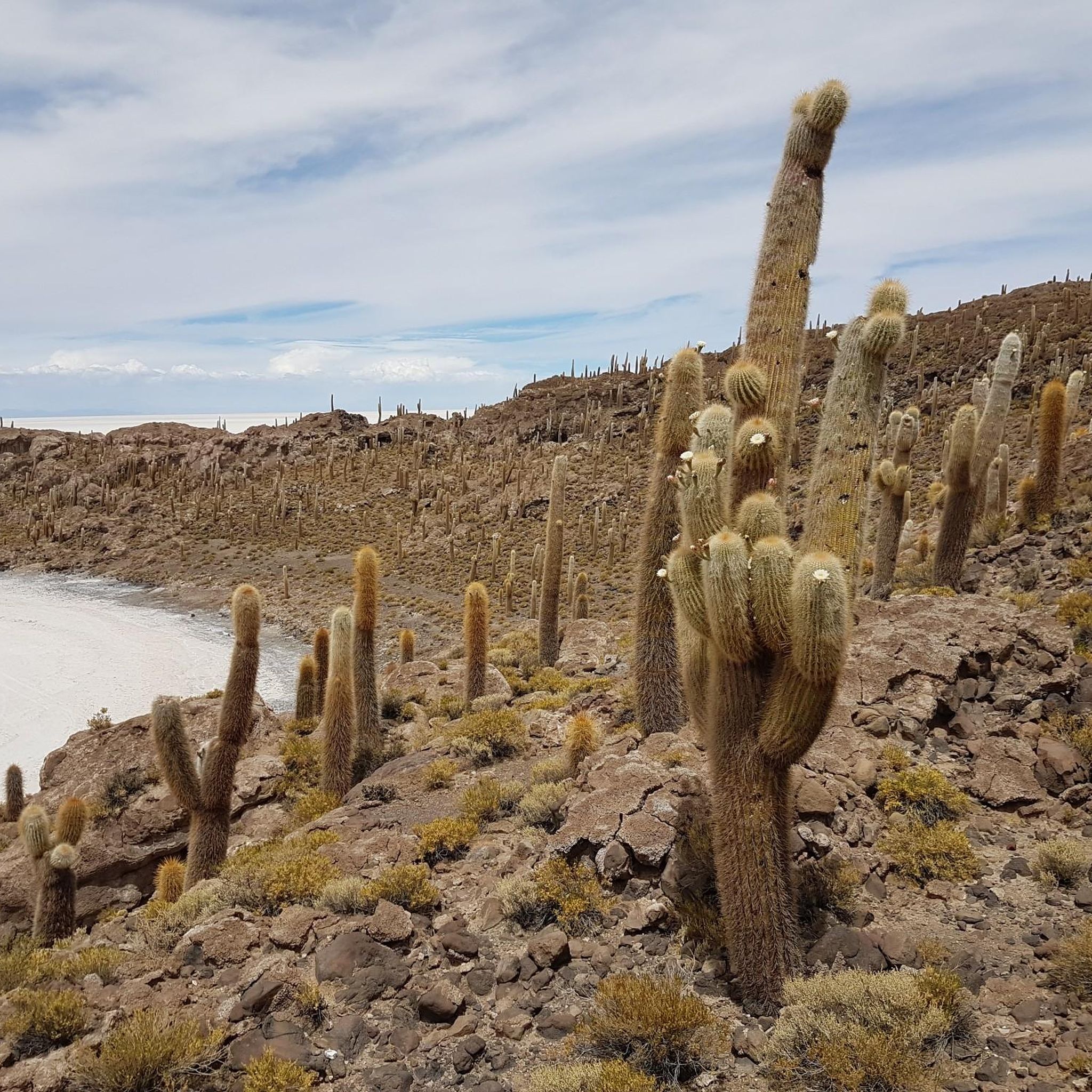
Hiking in the Altiplano offers exploration across a high-altitude plateau situated between the eastern and western Andes Mountains. The region features diverse landscapes including vast salt flats, iridescent lagoons, and ancient volcanoes. Trails often navigate through unique geological formations and provide views of Lake Titicaca, the highest navigable lake in the world. This environment presents varied terrain for outdoor activities.
Best hiking trails in the Altiplano
- The most popular hiking route is Playa de las Sirenas – Cerro Santa Barbara…
Last updated: July 10, 2026
4.9
(81)
474
hikers
Hard hike. Very good fitness required. Easily-accessible paths. Suitable for all skill levels.
5.0
(3)
69
hikers
11.4km
05:27
1,100m
1,100m
Hard hike. Very good fitness required. Sure-footedness, sturdy shoes and alpine experience required.

Sign up for free
4.4
(7)
28
hikers
9.30km
02:45
270m
270m
Moderate hike. Good fitness required. Easily-accessible paths. Suitable for all skill levels.
5.0
(2)
22
hikers
3.70km
02:21
440m
440m
Moderate hike. Good fitness required. Mostly accessible paths. Sure-footedness required.
3.0
(1)
9
hikers
Moderate hike. Good fitness required. Easily-accessible paths. Suitable for all skill levels.
15
hikers
15.8km
06:31
940m
940m
Hard hike. Very good fitness required. Mostly accessible paths. Sure-footedness required.
5.0
(1)
10
hikers
5.81km
01:51
230m
230m
Easy hike. Great for any fitness level. Easily-accessible paths. Suitable for all skill levels.
Our route recommendations are based on thousands of hikes, rides, and runs completed by other people on komoot.
Start today with a free account
Your next adventure awaits.
Login or Signup
Popular around Altiplano

Other adventures in the Altiplano

Tips from the Community


Even though the climb is quite arduous due to the unusual altitude, it's worth it. A magnificent panorama of Lake Titicaca opens up.
0
0

A beautiful path has been created on the ridge, and the turnoff with a kiosk towers over the island.
1
0
If you don't know that you are almost 4000m above sea level, you feel like you are in the Caribbean.
1
0
The Basilica of Our Lady of Copacabana is a 17th-century Spanish colonial shrine that houses the statue of the Virgen de Copacabana. The statue can be rotated; on weekends, it faces the church, and during the week, it can be seen in the Virgin's house on the first floor.
3
0
Copacabana beach is located on a crescent-shaped bay that opens to the northwest and has its own flair. The jetties that extend into the lake look anything but stable, and numerous small boats rock in the cool waters of Lake Titicaca.
3
0
The Way of the Cross was built on this hill in the 1950s when the government decided that Copacabana should have more to offer its thousands of pilgrims than just the Basilica of the Virgin Mary.
2
0

It is better not to go in rainy weather, as the slippery steps of the steep stairs can be dangerous, especially when going down.
0
0
Frequently Asked Questions
How many hiking trails are available in the Altiplano region?
The Altiplano region offers a selection of 7 hiking trails, providing diverse options for exploring its unique landscapes. These routes are highly rated by the komoot community, with an average score of 4.8 stars.
What are the typical difficulty levels for hiking trails in the Altiplano?
Hiking trails in the Altiplano range from easy to difficult, catering to various experience levels. There is 1 easy route, 3 moderate routes, and 3 difficult routes. Many trails involve high altitudes, which can add to the physical challenge.
Are there any circular hiking routes in the Altiplano?
Yes, several circular routes are available. For instance, the View of the Mountain Ridge loop from Tunupa is a moderate 3.7 km (2.3 miles) trail offering scenic views. Another option is the View of Lake Titicaca – Carus Summit Cross loop from Hospedaje casa simion, a moderate 8.5 km (5.3 miles) route.
What kind of natural attractions can I expect to see while hiking in the Altiplano?
The Altiplano is rich in unique natural attractions. You can encounter vast salt flats like the Salar de Uyuni, vibrant colored lagoons such as Laguna Colorada, and dramatic volcanic landscapes. The region also features surreal thermal hot springs and moon-like rock formations. For specific highlights, consider visiting the Sacred Rock (Titikala) or the expansive Salar de Uyuni.
Are there any historical or cultural landmarks along the hiking trails?
Yes, the Altiplano offers several historical and cultural sites. On Isla del Sol, you can explore the Chincana Ruins. Other notable sites include the Basilica of Our Lady of Copacabana and the ancient Tiwanaku Archaeological Site, offering a glimpse into the region's rich past.
What kind of wildlife can be spotted during hikes in the Altiplano?
The Altiplano is a haven for wildlife. Hikers often spot endemic creatures such as Andean condors, vicuñas, viscachas, and Andean foxes. The colorful lagoons are particularly famous for hosting large flocks of flamingos, including all three South American species.
Are there any family-friendly hiking options in the Altiplano?
For families looking for an easier experience, the Cerro Calvario – Plaza 2 de Febrero, Copacabana loop from Copacabana is an easy 5.7 km (3.5 miles) route. This trail offers accessible paths and views, making it suitable for a family outing.
What should I consider regarding high altitude when hiking in the Altiplano?
Hiking in the Altiplano often means navigating elevations of over 3700m (12,000 ft). It's crucial to acclimatize properly, stay hydrated, and be aware of symptoms of altitude sickness. Dressing in layers is recommended due to varying temperatures, and sun protection is essential at these elevations.
Are there any trails that offer views of Lake Titicaca?
Yes, several trails provide stunning views of Lake Titicaca. The Playa de las Sirenas – Cerro Santa Barbara Junction loop from Isla del Sol is a difficult 22.8 km (14.2 miles) route that offers extensive views across the lake. Another option is the moderate View of Lake Titicaca – Carus Summit Cross loop from Hospedaje casa simion.
Can I find trails that lead through traditional rural landscapes?
Absolutely. The Traditional Rural Houses – Cerro Santa Barbara Junction loop from Yumani is a moderate 9.3 km (5.8 miles) trail that guides you through traditional rural settings, offering a cultural immersion alongside natural exploration.
What do other hikers enjoy most about the Altiplano trails?
The Altiplano trails are highly rated by the komoot community, with an average score of 4.8 stars from over 80 reviews. Hikers frequently praise the breathtaking and often otherworldly landscapes, the unique geological features, and the opportunities for wildlife spotting, especially the vibrant flamingos in the lagoons.
Are there any trails offering panoramic views of volcanoes?
Yes, the Altiplano is characterized by its volcanic backdrops. The View of Tunupa Volcano loop from Khala Loma is a difficult 11.4 km (7.1 miles) path that provides panoramic views of the Tunupa Volcano and the surrounding salt flats. Another option is the difficult View of Tunupa Volcano loop from Jirira.
Most popular routes in the Altiplano
Most popular attractions in the Altiplano

Get inspired with the komoot mobile app


Explore more
Browse the best Hikes in other regions.
