The best walks and hikes around Lavilleneuve
4.0
(7)
24
hikers
8
hikes
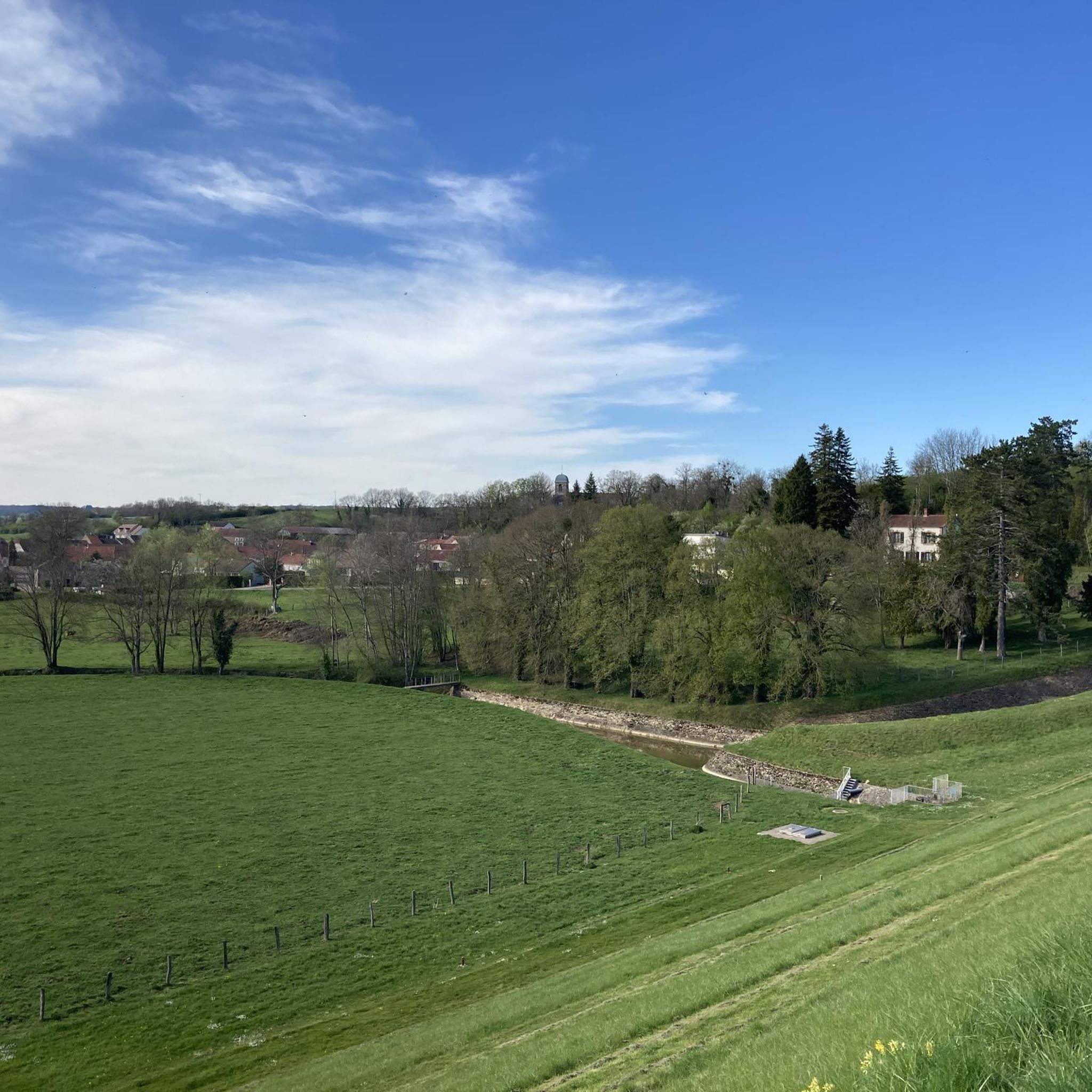
Hiking around Lavilleneuve offers trails primarily through river valleys and forested areas, characterized by gentle elevation changes. The landscape is shaped by the Meuse River, providing scenic routes along its banks. This region features a mix of open countryside and woodlands, with routes suitable for various fitness levels.
Best hiking trails around Lavilleneuve
- The most popular hiking route is Fort de Dampierre — loop from Chauffourt, a 9.3 miles (14.9 km) moderate trail that takes 4 hours 7 minutes…
Last updated: October 8, 2026
2
hikers
14.9km
04:07
260m
260m
Moderate hike. Good fitness required. Easily-accessible paths. Suitable for all skill levels.
5.0
(1)
4
hikers
12.7km
03:32
240m
240m
Moderate hike. Good fitness required. Easily-accessible paths. Suitable for all skill levels.

3.0
(1)
6
hikers
4.83km
01:20
90m
90m
Easy hike. Great for any fitness level. Easily-accessible paths. Suitable for all skill levels.
3.7
(3)
8
hikers
4.88km
01:23
110m
110m
Easy hike. Great for any fitness level. Easily-accessible paths. Suitable for all skill levels.
4.5
(2)
4
hikers
Easy hike. Great for any fitness level. Easily-accessible paths. Suitable for all skill levels.
Get access to more routes and recommendations from other explorers.
Already have an account?
Our route recommendations are based on thousands of hikes, rides, and runs completed by other people on komoot.
Start today with a free account
Your next adventure awaits.
Popular around Lavilleneuve


Tips from the Community

This parish church Sainte-Marie-Madeleine in Montigny, dating from the 13th century, was rebuilt shortly after the Wars of Religion. The single-bay choir with its ribbed vault and the transept, also featuring a ribbed vault, were renovated at the end of the 16th century by local dignitaries, who left their coats of arms on either side of the triumphal arch: the Genevans on the left and the descendants of the Saladins of Anglure on the right. The church, which lay in ruins after the French Revolution, was rebuilt in 1828 according to plans by the architect Chaussier from Chaumont. To the left of the entrance is the 18th-century wooden altar dedicated to Saint John the Baptist. Also noteworthy is the 18th-century wrought-iron choir screen. (https://www.bienvenue-hautemarne.fr/sit/montigny-le-roi-eglise-sainte-marie-madeleine-de-montigny-le-roi-pcucha052v5004ku/?)
0
0
Spacious and clean.
0
0

https://www.lesdeportesdutrainfantome.org/ville_merrey.htm Interesting website with a nice explanation, including about the Perrot family's farm in Damphal.
0
0
On August 26, 1944, 23 escapees from the ghost train were taken in by the Perrot family at this farm. Hidden under haystacks until September 12, 1944, this family protected and cared for them, risking their own lives.
0
0

A beautiful little Gothic chapel, which, unfortunately, can only be viewed from the outside.
1
0

Beautiful building, next to it is a fenced public garden with a beautiful sculpture.
21
0
CP Montigny Le Roi in Val de Meuse is located just 2 km from the motorway. In addition to campers, caravans are also welcome and there is also a tent.
15
0
Frequently Asked Questions
How many hiking trails are available around Lavilleneuve?
There are 5 hiking trails documented around Lavilleneuve on komoot, offering a variety of experiences through river valleys and forested areas.
What kind of terrain can I expect on hikes near Lavilleneuve?
Hikes around Lavilleneuve primarily feature river valleys, open fields, and woodlands. The landscape is shaped by the Meuse River, providing scenic routes along its banks with generally gentle elevation changes. You'll find a mix of open countryside and wooded sections.
Are there easy hiking options suitable for beginners in Lavilleneuve?
Yes, Lavilleneuve offers easy hiking options. Two of the five available routes are rated as easy, perfect for beginners or those looking for a relaxed stroll. An example is the Along the Meuse River – Provenchères-sur-Meuse loop from Val-de-Meuse, which is 3.5 miles (5.7 km) long.
Are there any circular hiking routes in Lavilleneuve?
Yes, all the listed hiking routes around Lavilleneuve are circular. For instance, you can explore the Fort de Dampierre — loop from Chauffourt or the Val de Meuse – City Hall loop from Val-de-Meuse.
What natural features or landmarks can I see while hiking near Lavilleneuve?
While hiking near Lavilleneuve, you can explore several interesting points. The routes often follow the scenic Along the Meuse River. You might also pass through charming settlements like Provenchères-sur-Meuse or Montigny-le-Roi, which offer glimpses into local life.
Are there any historical sites to explore on the trails?
Yes, one notable historical site is the Fort de Dampierre. The Fort de Dampierre — loop from Chauffourt trail specifically features this historical point of interest.
What do other hikers enjoy the most about hiking in Lavilleneuve?
The area is highly rated by the komoot community, with an average score of 3.8 stars from over 4 reviews. Hikers often praise the varied terrain, the peaceful river valleys, and the blend of open countryside and woodlands that define the region's trails.
Is Lavilleneuve a good destination for family-friendly hikes?
Yes, with two easy trails available, Lavilleneuve offers suitable options for families. These routes feature gentle elevation changes and pleasant scenery along the Meuse River and through woodlands, making them enjoyable for all ages.
What is the best season for hiking in Lavilleneuve?
Given the region's characteristics of river valleys and woodlands, spring and autumn are generally ideal for hiking in Lavilleneuve. The weather is usually mild, and the natural scenery is vibrant with spring blooms or autumn colors. Summer can also be pleasant, especially along the river, but always check local weather conditions.
Are there any places to eat or drink near the hiking trails in Lavilleneuve?
While specific cafes or pubs directly on the trails are not detailed, the hiking routes often pass through or near small settlements like Pouilly-en-Bassigny, Provenchères-sur-Meuse, and Montigny-le-Roi. These villages may offer local establishments where you can find refreshments or a meal.
What is the typical duration for hikes in Lavilleneuve?
Hikes in Lavilleneuve vary in duration. Easy trails, like the Along the Meuse River – Provenchères-sur-Meuse loop, can be completed in about 1 hour 29 minutes. Moderate routes, such as the Fort de Dampierre loop, typically take around 4 hours 7 minutes.
Are there any less crowded hiking options in Lavilleneuve?
With 5 trails available and a community of over 12 hikers having explored the area on komoot, Lavilleneuve generally offers a peaceful hiking experience. For potentially quieter routes, consider exploring some of the less-trafficked easy trails or visiting during off-peak hours.
Most popular attractions around Lavilleneuve

Get inspired with the komoot mobile app


Explore more
Browse the best Hikes in other regions.
