The best running trails around Weibersbrunn
4.5
(242)
2,279
runners
211
runs
Jogging around Weibersbrunn offers access to the extensive forests and varied terrain of the Spessart Nature Park in Lower Franconia, Germany. The region is characterized by its "magnificent high forests," providing a natural environment for runners. Located at an elevation of around 350 meters, Weibersbrunn features hilly topography, allowing for routes with gentle inclines or more challenging ascents. This area is known for its ancient woodlands and well-maintained trail networks, making it suitable for various running preferences.
Best jogging routes around Weibersbrunn
- The most popular jogging route is Running loop from Weibersbrunn, a 4.7 miles (7.5 km) trail that takes about 48 minutes to complete, winding through the dense Spessart forests.
- Another top favourite among local runners is Mespelbrunn Castle – Echterspfahl loop from Echterspfahl, a moderate 6.3 miles (10.1 km) path. This route offers views towards the historic Mespelbrunn Castle and passes through varied woodland scenery.
- Local runners also love the Dance floor – Young Dancing Tree loop from Weibersbrunn, a 7.0 miles (11.3 km) trail leading through ancient beech forests, often completed in about 1 hour 14 minutes.
- Jogging around Weibersbrunn is defined by ancient forests, hilly terrain, and an extensive network of trails. The region offers routes suitable for various fitness levels, from easy paths to more demanding running routes.
- The routes in Weibersbrunn are highly rated by the komoot community with an average score of 4.6 stars from over 200 reviews. More than 2,000 runners have used komoot to explore Weibersbrunn's varied terrain.
Last updated: October 4, 2026
5.0
(10)
24
runners
7.50km
00:49
120m
120m
Moderate run. Good fitness required. Mostly paved surfaces. Suitable for all skill levels.
4.5
(4)
18
runners
10.8km
01:10
180m
180m
Moderate run. Good fitness required. Mostly paved surfaces. Suitable for all skill levels.

5.0
(1)
11
runners
10.1km
01:13
270m
270m
Moderate run. Good fitness required. Mostly paved surfaces. Suitable for all skill levels.
3.5
(2)
15
runners
5.06km
00:33
80m
80m
Moderate run. Good fitness required. Mostly paved surfaces. Suitable for all skill levels.
5.0
(4)
8
runners
11.3km
01:14
200m
200m
Moderate run. Good fitness required. Mostly paved surfaces. Suitable for all skill levels.
Get access to more routes and recommendations from other explorers.
Already have an account?
Our route recommendations are based on thousands of hikes, rides, and runs completed by other people on komoot.
Start today with a free account
Your next adventure awaits.
Tips from the Community

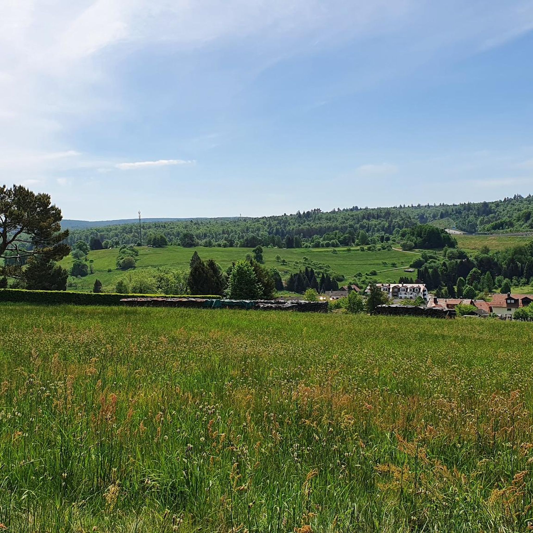
Beautiful rooted trees, nice to walk on …
0
0

Unfortunately, the Echterspfahl restaurant no longer exists. It was a nice place to stop and have a rest.
4
0

The Echterspfahl is a prominent point on the ridge of the Eselshöhe in the Spessart. Here the Eselsweg, an old trade route that is now a long-distance hiking trail, runs north-south and crosses the old east-west post road from Würzburg to Frankfurt am Main, today's state road 2312. It is historically documented that this prominent point was a meeting place for hunters and drovers of the archbishops and electors of Mainz when the forest belonged to the Electorate of Mainz. When the territory passed to the Kingdom of Bavaria, the Bavarian forestry authority set up a forestry office here. This was the border of the Bavarian state forest to the forest property of the descendants of the Echter family, today's Counts of Ingelheim. The forester at the Echterspfahl soon received a license to serve his guests food and drinks. This is how the "Echterspfahl" excursion restaurant was created, which has unfortunately been closed since the end of 2019. The name "Echterspfahl" goes back to a legend according to which three brothers of the Echter family worked as robber barons in the nearby Odenwald. Pursued by the troops of Emperor Barbarossa, they retreated to the Spessart and settled in three different places for security reasons. From time to time they met at this striking location for meetings and tied their horses to a post that was provided with three metal rings. These three rings are also said to have been the origin of the Echter family's coat of arms, which shows a white, diagonally left bar, in many depictions also diagonally right, in a blue shield, which is covered with three blue rings. The coat of arms with the three blue rings is now part of the coat of arms of the district of Aschaffenburg as well as part of the coat of arms of the municipalities of Mespelbrunn and Dammbach.
2
0
THE LEGEND OF THE ECHTERSPFAHL: THREE BROTHERS FROM THE ECHTER KNIGHTLY FAMILY LIVED IN THE CASTLE IN WECKBACH (IN THE ODENWALD). THEY HAD SUCCEEDED IN THE ROBBERY AND BECAME THE TERROR OF THE WHOLE AREA. THE EMPEROR AT THE TIME, FREDERICK THE REDBEARD, ORDERED THEM TO STOP THEIR DISHONEST TRADE; BUT THEY PAID NO MATTER AND CONTINUED TO ROBBERY. THE EMPEROR NOW DECLARED THEM AND TOOK A SMALL ARMY TO THE ODENWALD TO PUNISH THE DISOBEYED. BUT THEY FLEW FROM THEIR CASTLE INTO THE REMOTE VALLEYS OF THE SPESSART. FOR SAFETY'S PURPOSES THEY SEPARATED AND EACH BUILT A SMALL CASTLE, ONE NEAR PARTENSTEIN, THE OTHER NEAR LINDENFURT AND THE THIRD NEAR A SPRING CALLED ESPELBORN. THEY LIVED HERE IN COMPLETE SOLITUDE AND ONLY RARELY MET EACH OTHER ON THE HILL WHERE THE FORESTRY HOUSE NOW STANDS, ON THE STATE ROAD BETWEEN ASCHAFFENBURG AND WÜRZBURG. THEY TIE THEIR HORSES THERE TO A POST WITH THREE RINGS ATTACHED TO IT. WHEN THEY LATER LEARNED TO RESPECT THE LAW AGAIN AND THE EMPEROR WAS NO LONGER ANGRY WITH THEM, THEY RETURNED TO THE ODENWALD. BUT SINCE THEN THEY HAVE CARRIED A SILVER POST WITH THREE BLUE RINGS IN THEIR COAT OF ARMS TO REMEMBER THEIR STAY IN THE SPESSART. AND THE PLACE WHERE THE ECHTER BROTHERS GOT TOGETHER IS TO THIS DAY CALLED THE "ECHTER POST". RIGHT NEXT TO THE FORESTRY'S HOUSE ON THE EDGE OF THE FOREST YOU CAN STILL SEE A POST WITH THREE IRON RINGS ON IT. IT IS ALSO STORED THAT THE THREE ECHTER BROTHERS TIE THEIR HORSES TO THIS POST WHEN THEY RODE FROM MESPELBRUNN CASTLE TO HUNT IN THE WIDE SPESSART FORESTS.
2
0

The people of Rothenbuch and Weibersbrunner used to meet at the so-called “dancing tree”. There, people celebrated, danced and sang, or so the “old people” say. After the previous dancing tree, an approximately 500-year-old oak, collapsed some time ago, a new tree was planted on the initiative of the Bavarian State Forests.
0
0

Most of the northern trail is a gravel machine trail. :-(
0
0

Memorial stone with information on the donkey trail, shelter with signposts and currently beautiful wildflower planting, the poppies are blooming red ...
1
0
Frequently Asked Questions
How many running routes are available around Weibersbrunn?
Weibersbrunn offers a wide selection of running routes, with over 195 trails listed on komoot. This extensive network ensures a diverse range of options for all fitness levels, from leisurely jogs to more demanding runs through the Spessart Nature Park.
What kind of terrain can I expect on jogging trails in Weibersbrunn?
Jogging routes in Weibersbrunn primarily traverse the magnificent high forests of the Spessart Nature Park. You can expect varied terrain, from well-maintained forest paths to more natural trails. The region's hilly topography, situated at around 350 meters, means you'll find routes with gentle inclines for endurance training and more challenging ascents for a vigorous workout.
Are there easy running routes suitable for beginners in Weibersbrunn?
Yes, Weibersbrunn has several easy running routes perfect for beginners or those looking for a relaxed jog. There are 13 easy routes available. For example, the Eselsweg Memorial Stone loop from Weibersbrunn is an easy 4.9 km trail with minimal elevation gain.
Can I find challenging running trails in the Weibersbrunn area?
Absolutely. For runners seeking a more intense workout, Weibersbrunn offers 38 difficult routes. The hilly terrain of the Spessart provides excellent opportunities for challenging ascents and descents, ensuring a rewarding experience for experienced runners.
Are there circular running routes around Weibersbrunn?
Many of the running routes in Weibersbrunn are circular, offering convenient starting and ending points. A popular option is the Running loop from Weibersbrunn, a 7.5 km trail that winds through the dense Spessart forests, bringing you back to your starting point.
What natural features or landmarks can I see while running in Weibersbrunn?
The running routes in Weibersbrunn are rich in natural beauty and historical landmarks. You'll pass through ancient forests, including protected beech and oak woodlands. A notable landmark is the picturesque Mespelbrunn Castle, which can be viewed on routes like the Mespelbrunn Castle – Echterspfahl loop from Echterspfahl. You might also encounter highlights like the Eselsweg Trail or the Nebelhorn Panorama Recreation Area.
Are there any running routes that pass by places to get refreshments?
While specific cafes directly on every route are not guaranteed, the region around Weibersbrunn features rustic forest houses and lodges, such as the Sylvan Forester's Lodge in the Weihersgrund or the Hohewart-Haus (Hohe Warte). These establishments often offer refreshments and can serve as pleasant resting points during longer runs. The Forsthaus in Weihersgrund, for instance, is known for its peaceful setting.
What do other runners enjoy most about the trails in Weibersbrunn?
The running trails in Weibersbrunn are highly rated by the komoot community, with an average score of 4.6 stars from over 200 reviews. Runners often praise the serene and natural environment of the Spessart forests, the well-maintained trail networks, and the varied topography that offers both gentle and challenging sections. The fresh air and lush scenery are frequently highlighted as key attractions.
Is Weibersbrunn suitable for family-friendly jogging?
Yes, Weibersbrunn offers routes that are suitable for families. The extensive trail network includes easier paths and cultural or circular hiking trails (ranging from 2 to 8 km) that can be enjoyed at a more leisurely pace, making them ideal for family jogs. The natural forest environment provides a pleasant backdrop for outdoor activity with children.
Are dogs allowed on the running trails in Weibersbrunn?
Generally, dogs are welcome on the numerous trails within the Spessart Nature Park around Weibersbrunn. It's always recommended to keep dogs on a leash, especially in nature reserves or near wildlife, and to respect local regulations. The vast forest areas provide ample space for you and your canine companion to enjoy a run together.
What is the best time of year to go jogging in Weibersbrunn?
Weibersbrunn is excellent for jogging year-round, but each season offers a unique experience. Spring brings lush greenery and blooming flora, while autumn transforms the forests into a spectacular display of colors. Summer provides cool shade under the dense forest canopy. Even winter can be beautiful, with crisp air and potentially snow-covered trails, though some paths might be more challenging due to conditions.
Are there any specific routes that lead through ancient forests?
Yes, Weibersbrunn is renowned for its ancient woodlands. The Dance floor – Young Dancing Tree loop from Weibersbrunn, for instance, leads through ancient beech forests. Additionally, the Metzgergraben und Krone nature reserve and the Rohrberg nature preserve, both nearby, protect old-growth oak and beech trees, some dating back centuries, offering exceptionally scenic running environments.
Most popular routes around Weibersbrunn
Most popular attractions around Weibersbrunn

Get inspired with the komoot mobile app


Explore more
Browse the best Running Trails & Routes in other regions.
