Upper and Lower Shuckburgh CP
Upper and Lower Shuckburgh CP
Attractions and Places To See around Upper and Lower Shuckburgh CP - Top 20
Best attractions and places to see around Upper and Lower Shuckburgh CP include a mix of natural and historical sites. The region features a large reservoir, historical churches, and significant monuments. These locations offer insights into local history and provide opportunities for outdoor activities.
Best attractions and places to see around Upper and Lower Shuckburgh CP
- The most popular attractions is Draycote Water, a lake that functions as an artificial reservoir and leisure park. It is notable for its…
Last updated: July 2, 2026
Draycote Water
Highlight • Lake
Translated by Google •
Tip by

St Michael's Church, Bishop's Itchington
Highlight • Historical Site
Tip by

Sign up now to discover places like this
Get recommendations on the best single tracks, peaks, & plenty of other exciting outdoor places.
Sign up for free
Holy Well, Southam
Highlight • Natural Monument
Tip by

Stockton Lock No. 11 (Grand Union Canal)
Highlight • Historical Site
Tip by
Borough Hill B-17 Bomber Memorial Bench
Highlight • Monument
The Norton B-17
Tip by
Sign up for free to discover even more attractions around Upper and Lower Shuckburgh CP.
Sign up for free
Already have an account?
Start today with a free account
Your next adventure awaits.
Login or Signup
Tips from the Community

It is an unusual half-moon stone structure holding the water, with three strange heads out of whose mouths the water flows down to the river.
0
0

If you follow the beautiful trail that departs from Southam heading east and runs alongside the River Stowe, you will come across The Holy Well, believed to be the oldest recorded Holy Well in England. It has been there for over a thousand years, with its most recent renovation taking place almost twenty years ago.
1
0

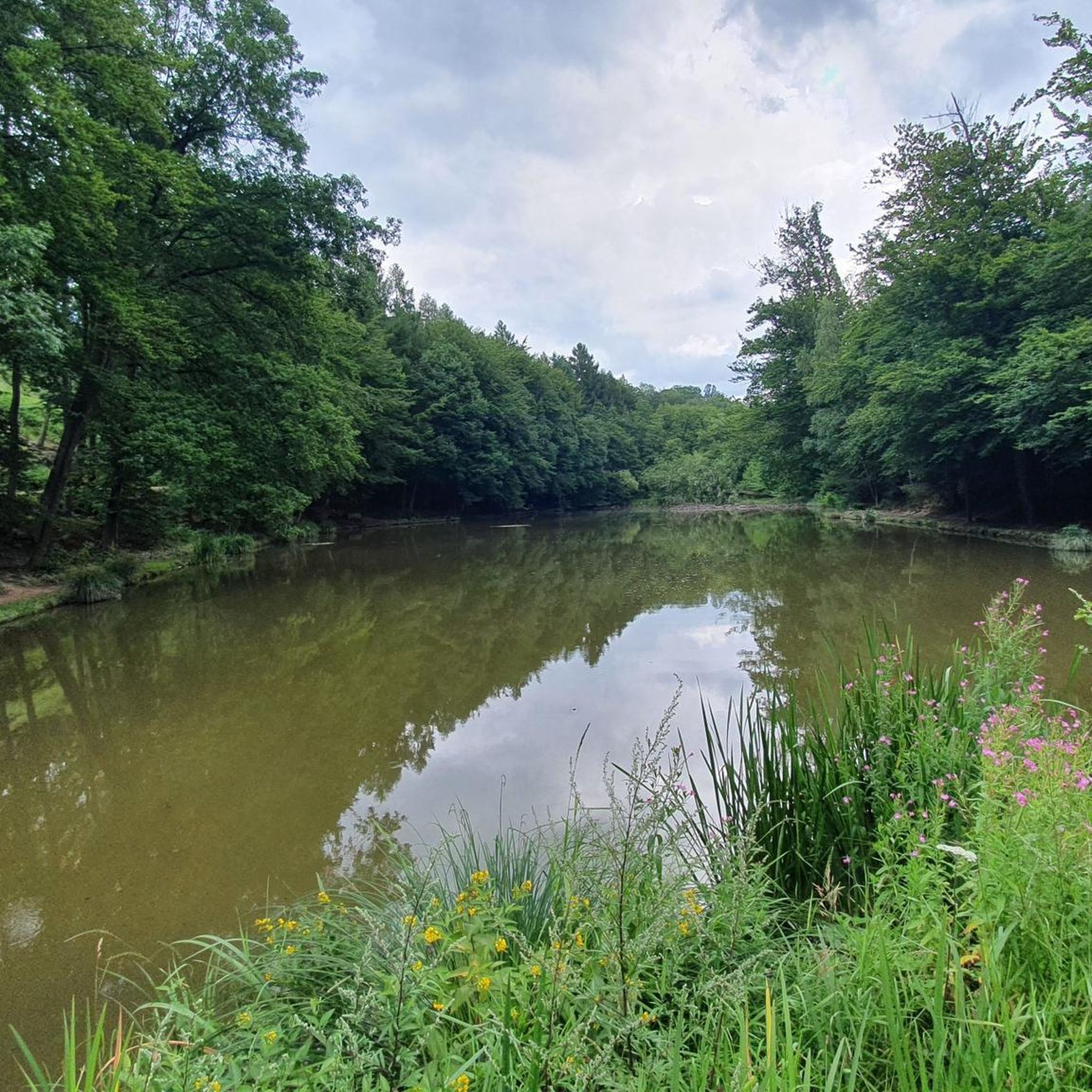
Draycote Water is an artificial reservoir (23 million m3), which was completed in 1969. In addition to its function as a water reserve, it is a leisure park u.a. for anglers, sailors, hikers. The rich bird life invites also to observations. Swimming is not allowed in the lake.
1
0


Stockton Lock No 10 is a minor waterways place on the Grand Union Canal (Warwick and Napton Canal) between Napton Junction (Junction of Grand Union and Oxford Canals) (3 miles and 3¾ furlongs and 9 locks to the east) and Budbrooke Junction (Junction of Saltisford Arm and Grand Union Main Line) (10 miles and 5 furlongs and 15 locks to the west). It is part of Stockton Locks. The nearest place in the direction of Napton Junction is Stockton Lock No 9; ½ furlongs away. The nearest place in the direction of Budbrooke Junction is Stockton Lock No 11; ½ furlongs away.
0
0
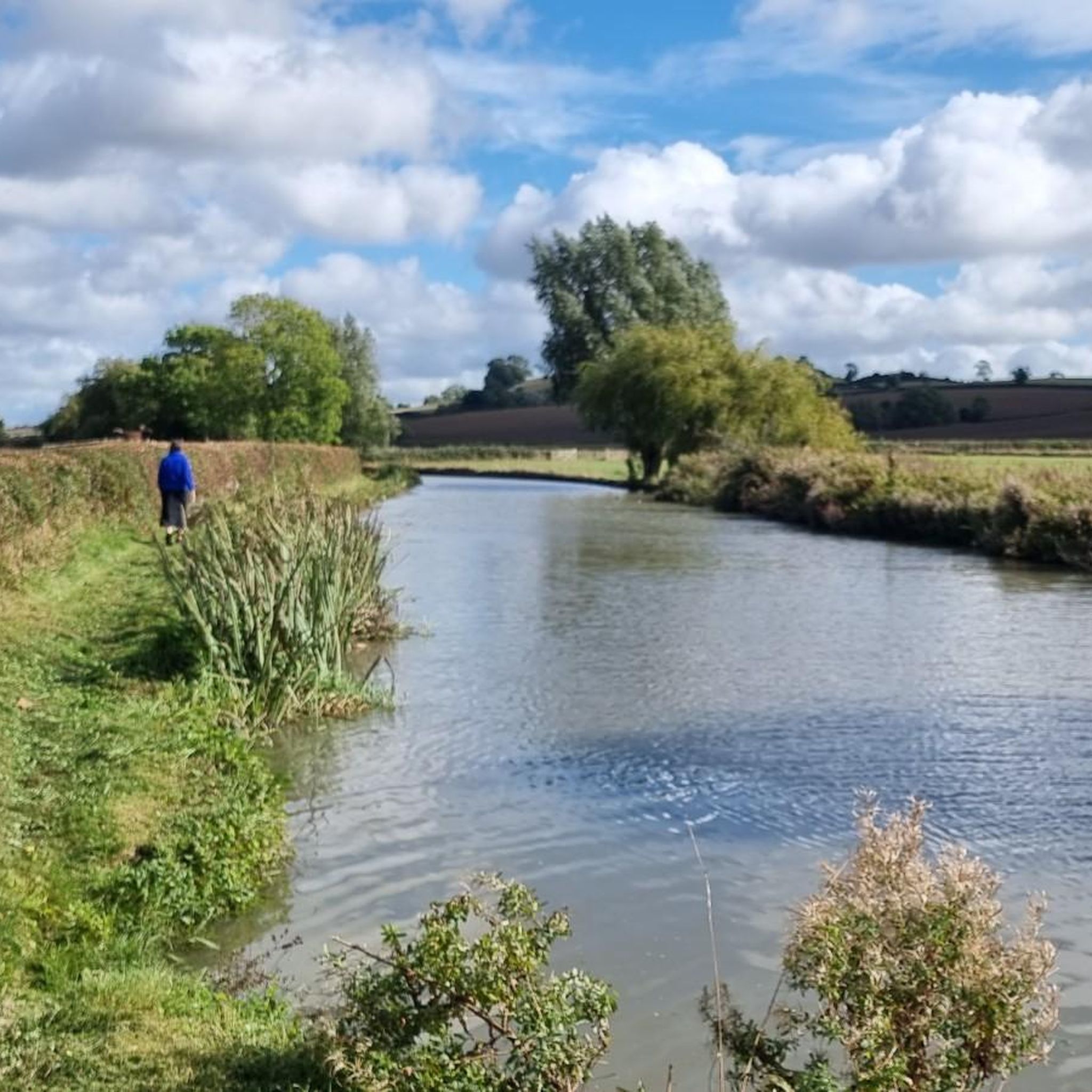
Stockton Lock No 11 is a place on the waterways on the Grand Union Canal (Warwick and Napton Canal) between Napton Junction (Junction of Grand Union and Oxford Canals) (3 miles and 4¼ furlongs and 10 locks to the east) and Budbrooke Junction (Junction of Saltisford Arm and Grand Union Main Line) (10 miles and 4½ furlongs and 14 locks to the west). It is at one end of Stockton Locks. The nearest place in the direction of Napton Junction is Stockton Lock No 10; ½ furlongs away. The nearest place in the direction of Budbrooke Junction is Stockton Lane Bridge No 23; ½ furlongs away
0
0
The site of a holy well which dates to the Medieval period, though the stone work surrounding the well dates to the Imperial period. Further restoration has taken place in the 20th century. It is situated 800m west of the church, Southam. Oldest recorded holy well in England? The first mention of the well is apparently 998, when it is mentioned in a charter to Leofwine by King Ethelred the Unready as a consequence as the term holy well per se derives from Old English halig this is probably the oldest recorded. However, it does not appear to be specifically mentioned as such. However in a Feet of Fines there is a notice in 1206 of a: “half acre land at Hallewellcul to the north” Over the next 800 years there then appear to be regular references to the well. By the 18th century there is reference to some sort of protective structure, although the date of the current structure cannot perhaps be gauged from these references. By 1701 a record notes that the Rector was exempted from keeping the well and fencing in repair: “one footway of the breadth of three feet leading from a certain stile at the bottom of an ancient enclosed ground called Bury Orchard towards Ufton by the Brook to the said well called Holy Well.” By 1760, a public footpath to the well was made permanent in an Act of Parliament and the enclosures act noting: “it is hereby further enacted and declared, That the said Well, called Holy Well, in the said Open Fields of Southam aforesaid, shall not be allotted to any of the said Proprietors, but shall be inclosed round with Posts and Rails, Three Yards at least distant from the Stone-work of the said Well, by, and at, the Expence of all the said Proprietors, and shall be kept for the Benefit of all the Inhabitants of the Parish of Southam aforesaid; and which said Posts and Rails shall, forever thereafter, be repaired and kept in Repair by, and at, the Expence of the Inhabitants of Southam aforesaid; and that the said Commissioners, or their Successors, or any three or more of them, shall assign, or lay out, a Footway from the Town of Southam aforesaid, to the said Well..” Healing eye water The main two properties, other than a possibly being better than beer, is that it was very cold but never froze and that it was good for eyes. Indeed, its powers in restoring eyes lead to a Henry Lilley-Smith establishing in 1818 an eye and ear hospital not far. Local remedies also recall how to make a tincture with the well water for eyes. The well of St Fremund? One of the possible reasons for the site being a holy well is that it was associated with the Mercian saint Fremund. The Life and Death of the Most Holy Fremund, King and Martyr by Burghard, 12th century (tr. from text in Nova Legenda Anglie ) tells how St Fremund, having been beheaded: “stood up as if nothing had happened, picked his head up off the ground, and set out with the head in his hands. The crowd were amazed at this miracle and followed in his tracks, praising God. He made his way to a spot between Itchington and Harbury, and when he got there he took a stand and thrust the point of his sword in the ground. He prayed to God for a little water to wash his head and body, and what he sought, he gained. For a spring welled up at this very spot, flowing in an unfailing stream and proving the merits of this famous martyr before all the world. He drank of its waters, he washed his wounds, he gave honour to that God in whom all live and have their being. Then turning his head to the east, he sank dead to the ground”. The Metrical Life of St Fremund by William of Ramsay, 1194×1220 (tr. from text in Pinchbeck Register 1925) repeats the story from Burghard, detailing how ‘No sooner had he wished for water than a spring appeared/ Purer than dew, clearer than crystal, finer/ Than gold, and scattering silver sands’. Later, the Life of Sts. Edmund and Fremund by John Lydgate, 1434 tells how “there sprong up a welle/ With crystal watrys the stremys gan up welle;/ And wessh away the blood that was so red,/ Which doun disttillyd from his hooly hed”. egend has it that Fremund was a son of Kind Offa of Mercia. After his death, a great battle ensued at Radford Semele against the invading Vikings in which Fremund was completely victorious. However as Fremund knelt in prayer of thanksgiving one of his own men envious of his success struck off his head. However the legend suggests that the well was not at Southam. For when his corpse stood up, picking up his head and walking away; he stopped somewhere between Harbury and Whitton, possibly Whitnash and there a miraculous well sprung up at his feet, in the water of which he washed his head then lay down and died. This would go against the view that the Southam well is the same. Well preserved fabric The first description of the site is Carlisle (1812) ‘Observations on the positions of the alien cell of Begare, and of Halywell upon Watling Street’ who describes: “a well of very fine clear water, called Holywell, or Halywell, which has always been reputed salubrious. It is… perpetually overflowing, without much variation from the seasons. It is a basin on the declivity of a rising ground. Its form is the larger section of a circle; the bottom is paved with smooth stones; and the sides are walled with the same, a little higher than the water stands, which is about two feet deep. It was formerly nearly encompassed with another wall, and upon a stone, at the mouth of the well, the words Utere, sed non abutere were inscribed.” However it was apparently in decline by the 1850s as an article written on the 6th October 1855 in the Warwickshire Advertiser describes: “on the foot road from Southam to Stoney-Thorpe, the residence of H T Chamberlain Esq., is an Ancient Well called ‘Holy Well’ now in a dilapidated condition; but even in its present state, the massive stone work, with curious and not very elegant carved head shews it to have been at one time an object of interest. Its earlier history is not clear, some asserting that it was the source from which Stoney Thorpe was supplied with water when used as a Priory ……it is a large semi-circular well about five feet deep embanked with massive stone masonry, and is supplied by a powerful spring of the Purest Water. It lies at a lower level than the Town, otherwise it might without much expense, be made most valuable for domestic and sanitary purposes. Tradition says it formally had a stone seat placed round it; was furnished with drinking vessels, and covered by an Arched Stone Roof; thus affording refreshment to the Traveller, and a pleasant resort to the health seeker. It is now proposed to restore by a public subscription, this beautiful relic of antiquity, and a considerable sum has already been promised.” This restoration is described by Freton (1890) in his The Warwickshire Feldon: a sketch of its hills and valleys, waters, famous trees, and other physical features in the Proceedings of Warwickshire Naturalists’ & Archaeologists’ Field Club, states that around 40 years ago: “I and a few enthusiastic friends undertook to clear out this old well, in the hopes that it might lead to its ultimate restoration. Our efforts as amateur navvies excited little sympathy among the rough labouring lads of the neighbourhood, who seemed to look upon us as having a slate off, and we invariably found our labour of one evening fruitless the next, so after a week’s hard work we gave it in.” Certainly when Richardson (1928) found it as: “a semicircular recess in the bank. A low retaining wall – recently renovated – prevents the bank from slipping down into it. At its foot is a flagged path along the curved margin of the semicircular well. Impounding the water in the well… is low two buttressed stonework. The stonework is much mutilated, the water flowing over the two broken and worn ends; but the central portion is higher and has three faces sculptured on it from orifices below which the water spouts out. Two flights of steps– that on the left with three steps, that on the right with four – lead down to a “trough” below the stonework”. The most curious facet of the well are the well worn, and hence presumably ancient carved heads. What is their origin? Thoughts have ranged from effigies of sun gods to the recycled remains from a priory or church. I certainly favour the later and they were probably gargoyles and incorporated in the fabric in the 18th century. This may explain why they look more worn than would be expected if was last constructed in that century. However, it seems odd to have incorporated them and it may have been an attempt to produce a folly for a local lord. Well restored However, despite Richardson’s favourable visit, not everything was positive. In 1925 the water was diverted into a reservoir and the provision of mains water artesian wells in the 1930s took their toll on the flow, an article in a local newspaper noting that: “the Holy Well itself a few yards away has been partly emptied, and no water now flows into its basin in dry weather.” By 1981, Brian Townsend noted in Southam Through the Centuries III notes it was little more than a trickle but a year after clearing out and restoration by the Community Enterprise Programme restored the flow through the heads. Yet by 1991 it was dry again, possibly as the result of quarrying and work on a by-pass. This is what it was like when I first visited…filled with rain water and polluted by crab apples. Through the 1990s restoration was planned but due to various reasons it was never attempted until the early 2000s. By 2005 the water supply was relocated and it could be restored, a Holy Well community was established an Heritage Lottery Fund money of £102,500 was successfully obtained. By 2005-7 the site was splendidly restored with seats and a palisade fence with delightful well related carvings on the posts…a fantastic return to the glory..the crowning of that glory the fact the water flows as profusely as ever. A delightful site and a holy well must.
0
0
Memorial bench with inscription "In memory of the USA AF B-17 Bomber crew who lost their lives on December 15, 1944." The Norton B-17 On the 15th of December 1944 B-17G Flying Fortress 43-38973 of the 305th Bomb Group, 422nd Bombardment Squadron based at Chelveston was returning from a bombing mission over the mashalling yards at Kassel in Germany. It had been badly damaged and one engine was out. The aircraft managed to return from the raid but once over the coast it began to have difficulty in maintaining height. The problems were compounded by a complete blanket of fog over England. Not sure of their position they flew lower and lower and eventually collided with the Air Ministry GEE mast on Borough Hill Daventry. The port wing was severed during the collision and the aircraft crashed at Norton Fields killing the crew of nine. On August the 24th 2014 Sywell Aviation Museum carried out an excavation to locate the remains of the aircraft. All artefacts recovered during this excavation may be viewed in a special display within the museum. On the 24th of August 2015 a memorial service was held at the Daventry War Memorial and a plaque was unveiled to the crew by the son and grand daughter of the ball gun turret operator Sgt. Burry. The USAF was represented at the memorial service by Lieut.Col Ford, Commander of the 422nd Medical Squadron USAF from RAF Croughton and sir Tim Boswell, Deputy Lord Lieut. of Northamptonshire representing the county.
0
0
Frequently Asked Questions
Are there family-friendly attractions around Upper and Lower Shuckburgh CP?
Yes, several attractions are suitable for families. Draycote Water offers a leisure park with a playground and opportunities for observing rich bird life. Both St Michael's Church, Bishop's Itchington and the Borough Hill B-17 Bomber Memorial Bench are also considered family-friendly historical sites.
What historical sites can I visit in the area?
The region is rich in history. You can explore St Michael's Church, Bishop's Itchington, a religious building with Medieval origins rebuilt in 1872. The Borough Hill B-17 Bomber Memorial Bench commemorates a significant 1944 incident. Additionally, the Holy Well, Southam is believed to be the oldest recorded Holy Well in England, with parts dating back to the Medieval period. You can also see Stockton Lock No. 11 on the Grand Union Canal, a historical part of the waterway system.
What natural features can I explore around Upper and Lower Shuckburgh CP?
The primary natural feature is Draycote Water, a large artificial reservoir known for its rich bird life and scenic views. The Holy Well, Southam is also a natural monument with historical significance, featuring a spring that has flowed for centuries.
Are there opportunities for wildlife observation?
Yes, Draycote Water is particularly noted for its rich bird life, making it an excellent spot for birdwatching and wildlife observations.
What outdoor activities can I do near these attractions?
The area offers various outdoor activities. You can enjoy road cycling on routes like the 'Willoughby Duck Pond – St John the Baptist Church loop' or 'Countryside Views Near Southam' (Road Cycling Routes). For hikers, there are easy trails such as the 'Napton Windmill – Napton Junction Marina loop' or 'St John the Baptist Church – Lower Shuckburgh War Memorial loop' (Easy Hikes). Running enthusiasts can find moderate trails like the 'Running loop from Napton on the Hill CP' (Running Trails).
Are there easy walks for beginners around Upper and Lower Shuckburgh CP?
Yes, there are several easy hiking trails suitable for beginners. Routes like the 'Napton Windmill – Napton Junction Marina loop' (4.5 km) and the 'St John the Baptist Church – Lower Shuckburgh War Memorial loop' (4.8 km) are good options. You can find more details and routes in the Easy Hikes around Upper and Lower Shuckburgh CP guide.
Can I go swimming in Draycote Water?
No, swimming is not permitted in Draycote Water. It functions as an artificial reservoir and leisure park, primarily for activities like angling, sailing, and hiking.
What is the significance of the Holy Well in Southam?
The Holy Well, Southam is historically significant as it is believed to be the oldest recorded Holy Well in England, with its first mention dating back to 998. It was historically known for its cold, never-freezing water and supposed healing properties, particularly for eyes.
Are there any viewpoints in the area?
Yes, Draycote Water offers scenic viewpoints across the reservoir and surrounding landscape. While not explicitly listed as a viewpoint, the Borough Hill B-17 Bomber Memorial Bench is situated on Borough Hill, which typically offers elevated views.
What kind of facilities are available at Draycote Water?
Draycote Water is a leisure park with facilities for anglers, sailors, and hikers. It also includes a children's playground and areas with BBQs and tables for public use.
What is the difficulty level of walking trails near Upper and Lower Shuckburgh CP?
Walking trails in the area vary in difficulty. For instance, many of the road cycling routes are rated 'easy', and there's a dedicated guide for Easy Hikes. Some highlights like Draycote Water and Stockton Lock No. 11 are associated with 'intermediate' level activities, suggesting a mix of terrain and challenge levels.
How long are the hiking trails in the region?
Hiking trails near Upper and Lower Shuckburgh CP vary in length. For example, easy hikes range from approximately 4.5 km (e.g., 'Napton Windmill – Napton Junction Marina loop') to 7.5 km (e.g., 'The Folly at Tatenhill – Napton Bottom Lock loop'). You can find more options and specific distances in the Easy Hikes around Upper and Lower Shuckburgh CP guide.
Most popular routes around Upper and Lower Shuckburgh CP
Most popular attractions around Upper and Lower Shuckburgh CP

Get inspired with the komoot mobile app


Explore more
Still not found the Highlight you’re looking for? See guides of the top attractions in other regions:
