The best walks and hikes in Poloniny - Op
4.7
(566)
9,632
hikers
14
hikes
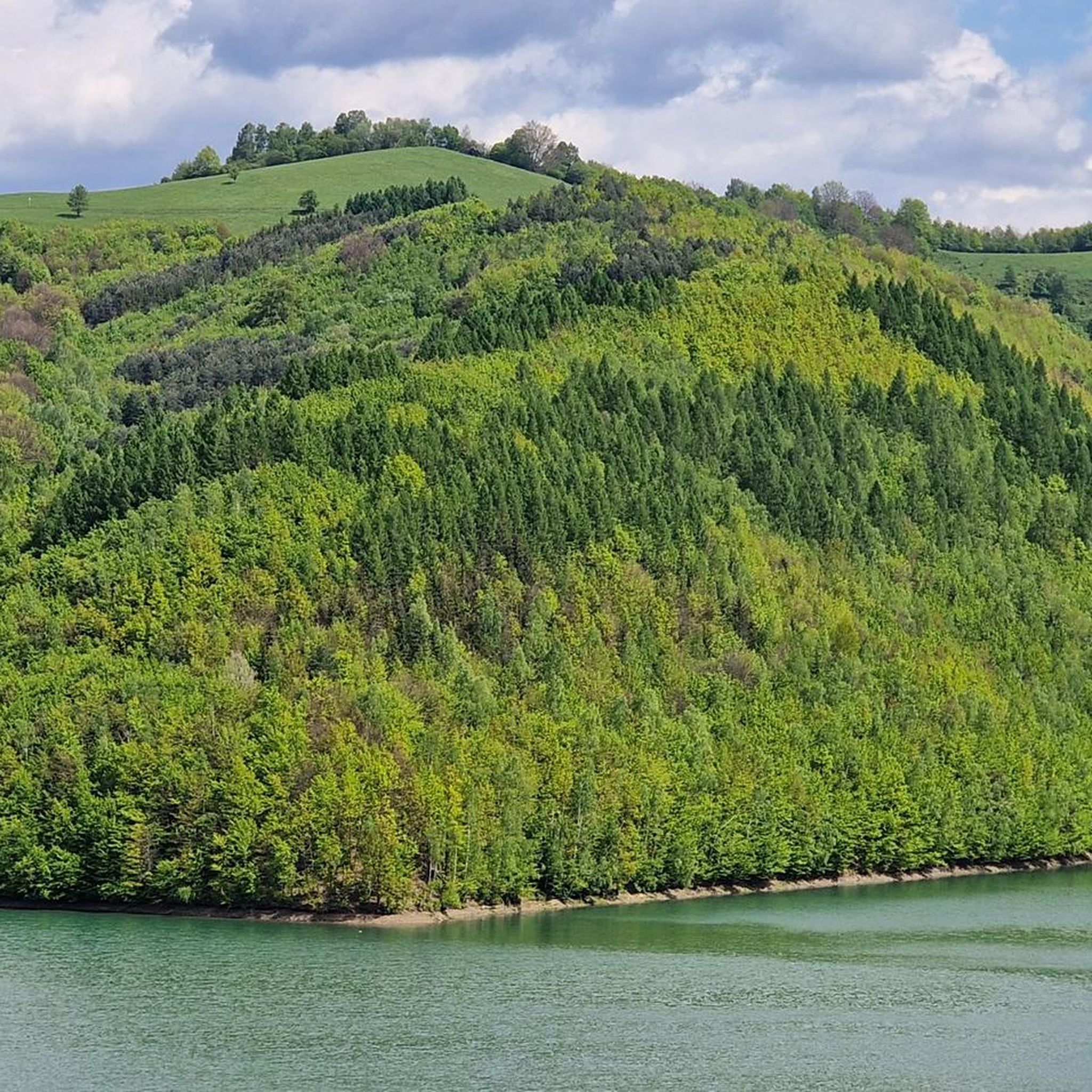
Hiking in Poloniny - Op offers a network of trails through a landscape characterized by dense Carpathian forests, rolling hills, and significant elevation changes. The region, part of the Eastern Carpathians, features prominent peaks and border areas, providing varied terrain for outdoor exploration. Hikers can expect routes that traverse woodlands, open meadows, and offer views of the surrounding natural park. This area is known for its preserved natural environment and diverse ecosystems.
Best hiking trails in Poloniny - Op
- The most popular hiking route is View of Veľký Bukovec – Krzemieniec Tri-Border Point loop from Nová Sedlica, a 12.3 miles (19.7 km) trail that takes 6 hours 45 minutes to complete, leading to a significant tri-border marker.
- Another top favourite among local hikers is Rabia Skała (1199 m) – Durkovec Summit loop from Runina, a moderate 7.5 miles (12.1 km) path. This route ascends to a summit, offering panoramic views of the surrounding mountain landscape.
- Local hikers also love the Hostinec Beskyd – View of Veľký Bukovec loop from Nová Sedlica, a 6.2 miles (10.0 km) trail leading through forested areas with viewpoints, often completed in about 3 hours 14 minutes.
- Hiking in Poloniny - Op is defined by dense woodlands, mountain summits, and borderland trails, with options ranging from moderate forest walks to challenging ascents. The network offers routes suitable for various ability levels, from beginners to experienced hikers.
- The routes in Poloniny - Op are highly rated by the komoot community with an average score of 4.8 stars from over 490 reviews. More than 9000 hikers have used komoot to explore Poloniny - Op's varied terrain.
Last updated: August 11, 2026
4.9
(8)
95
hikers
19.8km
06:46
1,010m
1,010m
Hard hike. Very good fitness required. Easily-accessible paths. Suitable for all skill levels.
5.0
(2)
12
hikers
12.1km
04:21
710m
710m
Moderate hike. Good fitness required. Easily-accessible paths. Suitable for all skill levels.

Sign up for free
4.3
(3)
10
hikers
9.99km
03:14
430m
430m
Moderate hike. Good fitness required. Easily-accessible paths. Suitable for all skill levels.
6
hikers
28.3km
09:26
1,330m
1,320m
Hard hike. Very good fitness required. Easily-accessible paths. Suitable for all skill levels.
3.0
(1)
5
hikers
9.89km
03:25
530m
530m
Moderate hike. Good fitness required. Easily-accessible paths. Suitable for all skill levels.
Get access to more routes and recommendations from other explorers.
Sign up for free
Already have an account?
Our route recommendations are based on thousands of hikes, rides, and runs completed by other people on komoot.
Start today with a free account
Your next adventure awaits.
Login or Signup
Tips from the Community

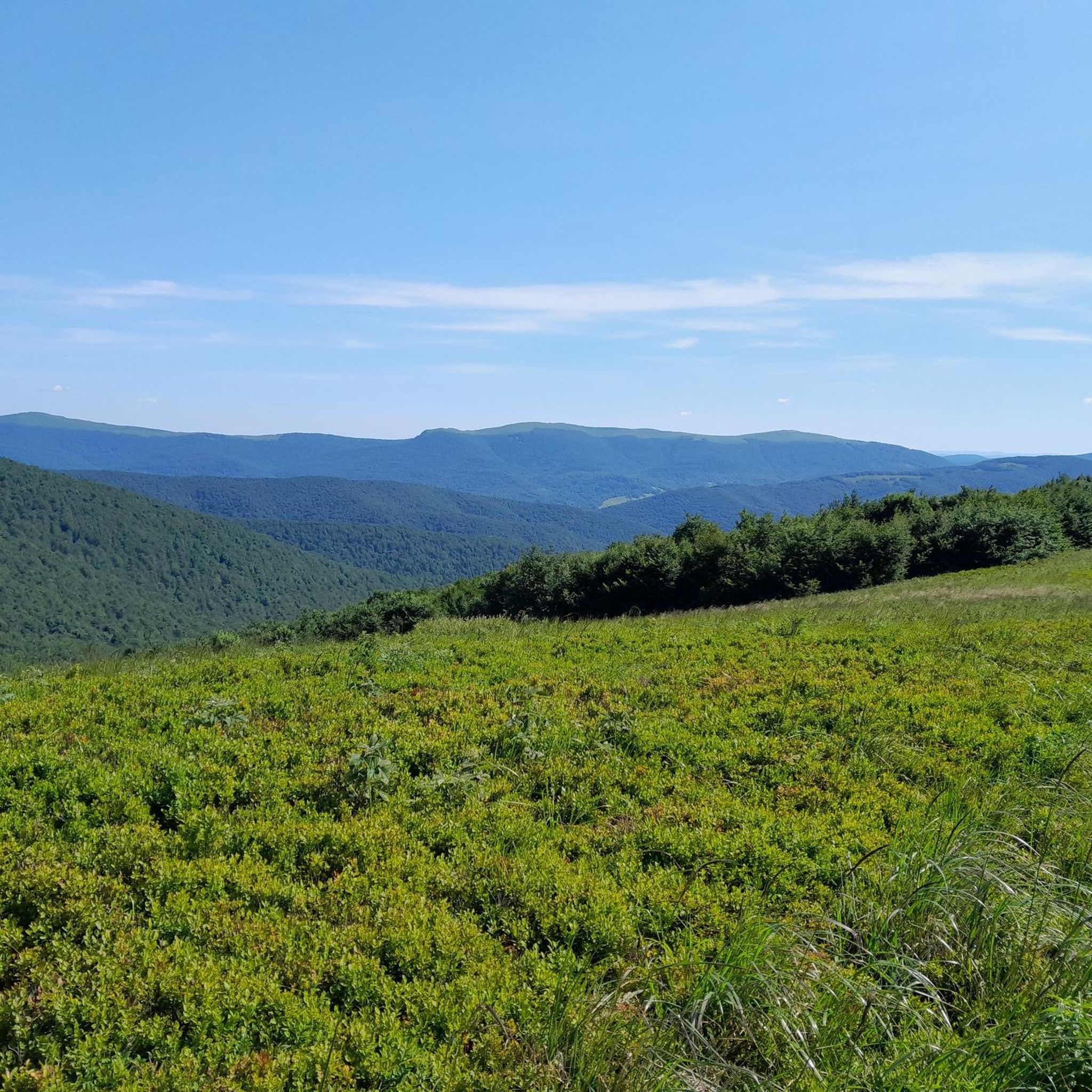
More information and photos: https://pl.wikipedia.org/wiki/Krzemieniec_(szczyt) https://goryaktywnie.pl/krzemieniec https://mapa-turystyczna.pl/node/krzemieniec#49.08803/22.56566/14 https://marcinkarpinski.pl/krzemieniec-mala-i-wielka-rawka/ https://www.info.bieszczady.pl/turystyka/szczyty/krzemieniec/
1
0
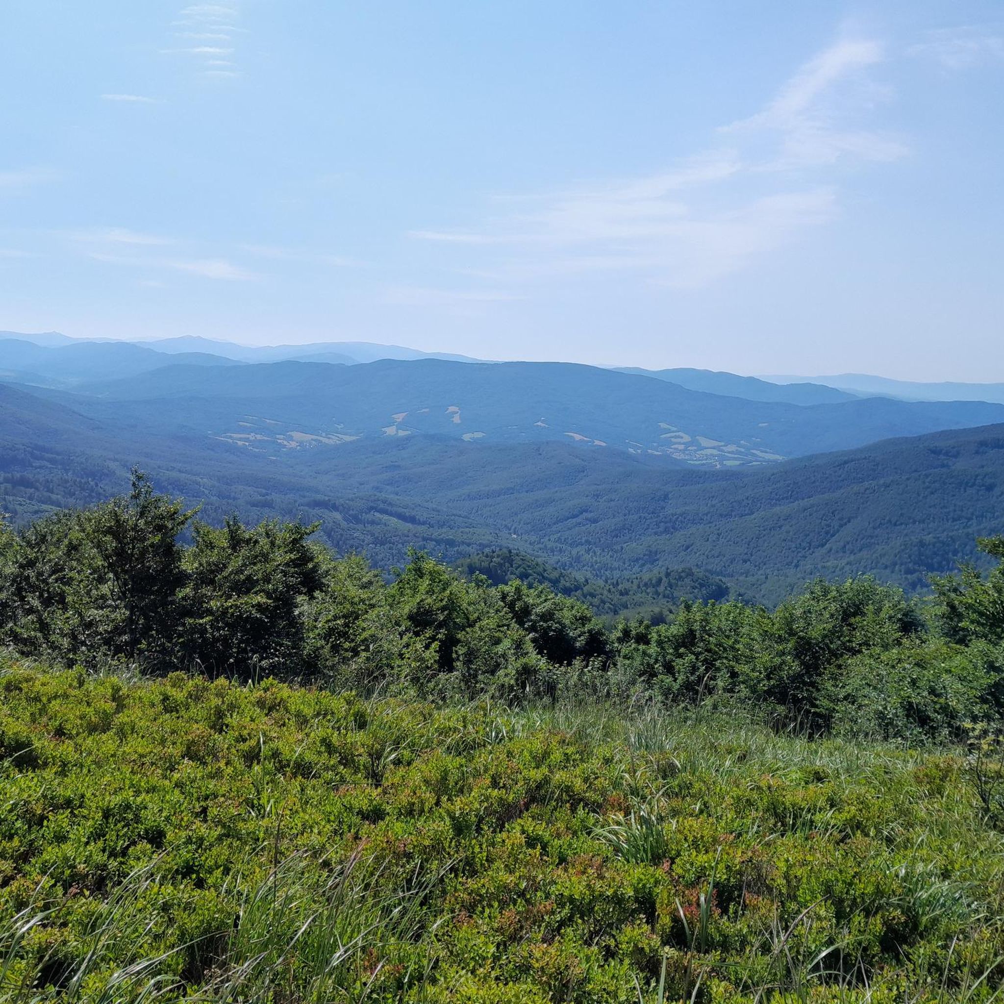
More information: https://goryaktywnie.pl/rabia-skala https://andrzej-banach.eu/w-gorach/bieszczadzkie-poloniny/rabia-skala/ https://wbieszczady.pl/szlaki-sciezki-bezdroza/bieszczady-maja-szczyt-o-ktorym-malo-kto-wie-zobacz-co-na-ciebie-czeka/ObXdATtphNa3nUtsm1wB https://www.twojebieszczady.net/piesze/koronka.php https://bieszczady.land/rabia-skala-dla-prawdziwych-wedrowcow/#google_vignette
1
0
Riaba Skała (1199 m a.s.l.) – a peak in the border range of the Western Bieszczady Mountains, on the Polish-Slovak border. The name comes from the Ukrainian word рябий – motley. In the literature, the most commonly encountered distorted name is Rabia Skała, appearing on 19th-century Austrian maps. An alternative, correct form is Raba Skała. East of the main culmination, there is a lower (1169 m a.s.l.) summit (border marker 1/15). From the highest point, a side ridge of Paportna and Jawornik branches off to the north. From the section of the ridge between the two summits, a very steep, in places precipitous slope descends to the south, above which is a small metal viewing platform. From it, a view (approx. 145° angle) opens up to the south and southeast, onto the Slovak and partly Ukrainian part of the Bieszczady Mountains (up to Pikuj). The shortest route to Riaba Skała leads from the village of Wetlina (2.55 h). The southern slopes of the Riaba Skała ridge lie within the borders of the Slovak National Park "Połoniny", and their upper parts, down to approximately the 930 m contour line, are additionally covered by the Jarabá skala nature reserve. The northern slopes, up to the side arm of Paportna and Jawornik in the west, lie within the borders of the Polish Bieszczady National Park. The northwestern slopes of the higher (western) summit of Riaba Skała, between the main ridge running towards Dziurkowiec and the arm of Paportna and Jawornik, lie within the borders of the Ciśniańsko-Wetliński Landscape Park, and their upper parts are covered by the Dziurkowiec nature reserve. Among the rare plant species in Poland, Spiraea media, Veronicastrum longifolium, and Potentilla carpatica have been found. Information source: https://pl.wikipedia.org/wiki/Riaba_Ska%C5%82a
1
0
Dziurkowiec (slov. Ďurkovec) – a peak with an altitude of 1189 m in the Western Bieszczady Mountains. It is located in the main ridge of the border range, between Płasza and Riaba Skała, on the Polish-Slovak border. On the Polish side, it is covered by the Ciśniańsko-Wetliński Landscape Park, while in Slovakia – by the Jarabá skala Nature Reserve, which is part of the „Połoniny” National Park. information source: pl.wikipedia.org/wiki/Dziurkowiec
1
0
Dziurkowiec (Slovak: Ďurkovec) – a peak with a height of 1189 m in the Western Bieszczady Mountains. It is located in the main ridge of the border range, between Płasza and Riaba Skała, on the Polish-Slovak border. On the Polish side, it is covered by the Ciśniańsko-Wetliński Landscape Park, while on the Slovak side, it is part of the Jarabá skala Nature Reserve, which is part of the "Połoniny" National Park. source of information: https://pl.wikipedia.org/wiki/Dziurkowiec
1
0

Frequently Asked Questions
What types of hiking trails can I find in Poloniny - Op?
Poloniny - Op offers a diverse range of hiking trails, from moderate forest walks to challenging ascents. The region is characterized by dense Carpathian forests, rolling hills, and significant elevation changes, providing varied terrain for all ability levels. You'll find routes traversing woodlands, open meadows, and leading to prominent peaks.
Are there any easy hikes suitable for beginners in Poloniny - Op?
Yes, Poloniny - Op has several easier routes. While specific 'easy' routes aren't detailed, the overall network includes options suitable for beginners. These typically involve less elevation gain and shorter distances, allowing you to enjoy the natural beauty without excessive challenge. There are 3 routes classified as easy in the region.
Are there challenging hikes for experienced hikers in Poloniny - Op?
Absolutely. For experienced hikers seeking a challenge, Poloniny - Op features routes with significant elevation changes and longer distances. An example is the Krzemieniec Tri-Border Point – Krzemieniec Tri-Border Point loop from Nová Sedlica, which is a difficult 28.2 km trail with over 1300 meters of elevation gain, typically taking over 9 hours to complete.
Are there any circular walks in Poloniny - Op?
Yes, many of the trails in Poloniny - Op are designed as circular routes, allowing you to start and end at the same point. For instance, the Rabia Skała (1199 m) – Durkovec Summit loop from Runina is a moderate 12.1 km circular path offering panoramic views from the summit.
What is the best season for hiking in Poloniny - Op?
The best season for hiking in Poloniny - Op is generally from late spring to early autumn (May to October). During these months, the weather is milder, trails are typically clear of snow, and the forests are vibrant. Autumn offers spectacular fall foliage, while spring brings blooming wildflowers.
What kind of wildlife might I encounter while hiking in Poloniny - Op?
Poloniny - Op is part of the Eastern Carpathians, known for its preserved natural environment and diverse ecosystems. Hikers might encounter various forest animals, including deer, wild boar, and a rich array of bird species. It's also part of a region where larger carnivores like bears and wolves are present, though sightings are rare.
Are there any interesting landmarks or attractions to see along the trails?
Yes, the region is home to several historical and cultural landmarks. You can find unique wooden churches, such as the Wooden Church of St. Michael the Archangel in Topoľa, the Greek Catholic Wooden Church of St. Michael the Archangel in Uličské Krivé, and the Church of St. Michael the Archangel in Ruský Potok. These offer a glimpse into the local heritage and are often located near hiking routes.
Is Poloniny - Op suitable for family hikes?
Yes, Poloniny - Op offers routes that can be enjoyed by families. While some trails are challenging, there are also moderate options like the Hostinec Beskyd – View of Veľký Bukovec loop from Nová Sedlica, a 10.0 km trail through forested areas with viewpoints, which can be completed in about 3 hours. When planning, look for routes with less elevation and shorter distances.
What do other hikers say about the trails in Poloniny - Op?
The trails in Poloniny - Op are highly regarded by the komoot community, with an average rating of 4.8 stars from over 490 reviews. Hikers often praise the region's untouched natural beauty, the tranquility of the dense forests, and the rewarding views from mountain summits. Many appreciate the well-maintained paths and the sense of wilderness.
Are dogs allowed on the hiking trails in Poloniny - Op?
Generally, dogs are permitted on hiking trails in Poloniny - Op, especially within the national park areas, provided they are kept on a leash. It's always recommended to check specific park regulations or signage at trailheads, as rules can vary. Ensure your dog is well-behaved and that you clean up after them to preserve the natural environment.
Where can I find parking for trailheads in Poloniny - Op?
Parking is typically available at or near the main trailheads in Poloniny - Op, particularly in villages like Nová Sedlica and Runina, which serve as common starting points for many routes. These areas often have designated parking spaces for hikers. It's advisable to arrive early during peak season to secure a spot.
Can I reach the trailheads in Poloniny - Op using public transport?
While public transport options exist, they can be limited in this remote region. Buses connect some of the larger villages, but schedules might be infrequent, especially on weekends. For direct access to many trailheads, driving is often the most convenient option. Always check local bus schedules in advance if you plan to rely on public transport.
Most popular routes in Poloniny - Op
Most popular attractions in Poloniny - Op

Get inspired with the komoot mobile app


Explore more
Browse the best Hikes in other regions.
