The best MTB trails around Oberstadtfeld
4.6
(2684)
8,691
riders
501
rides
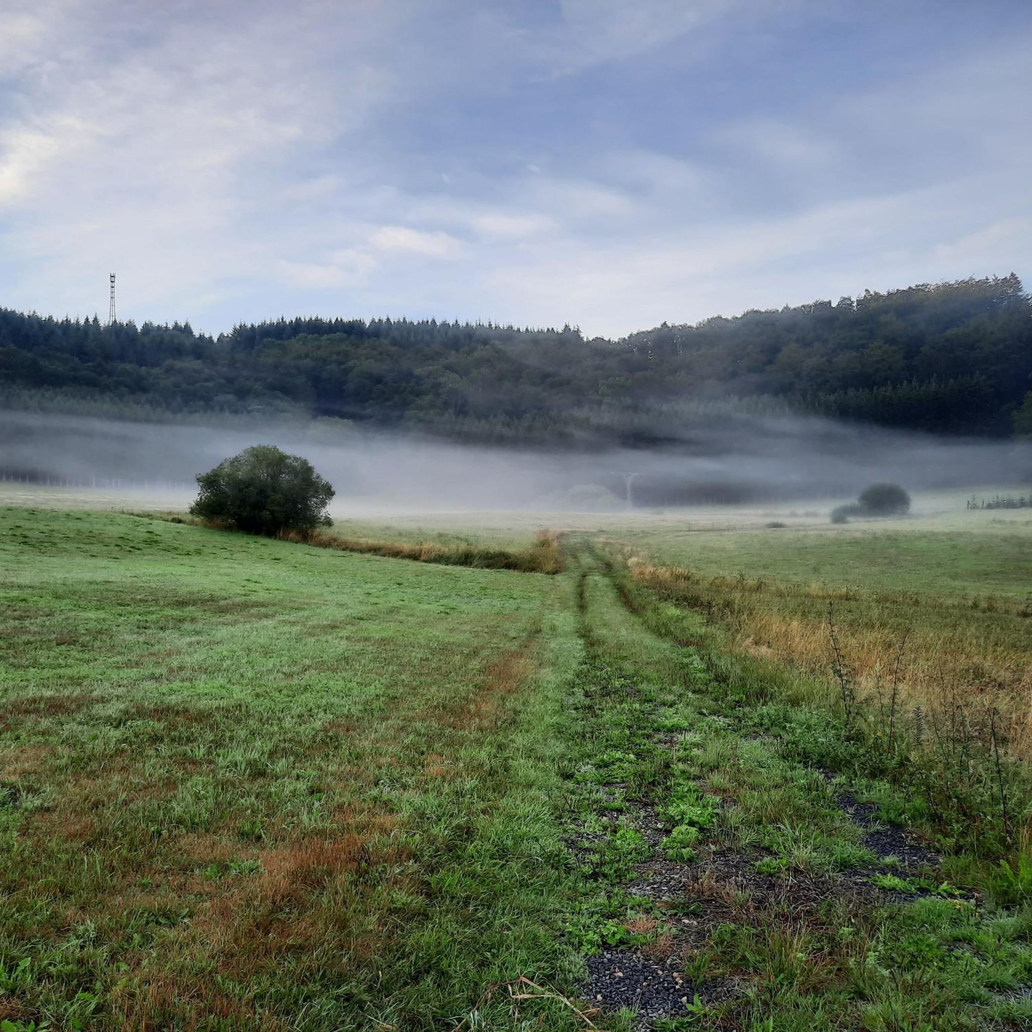
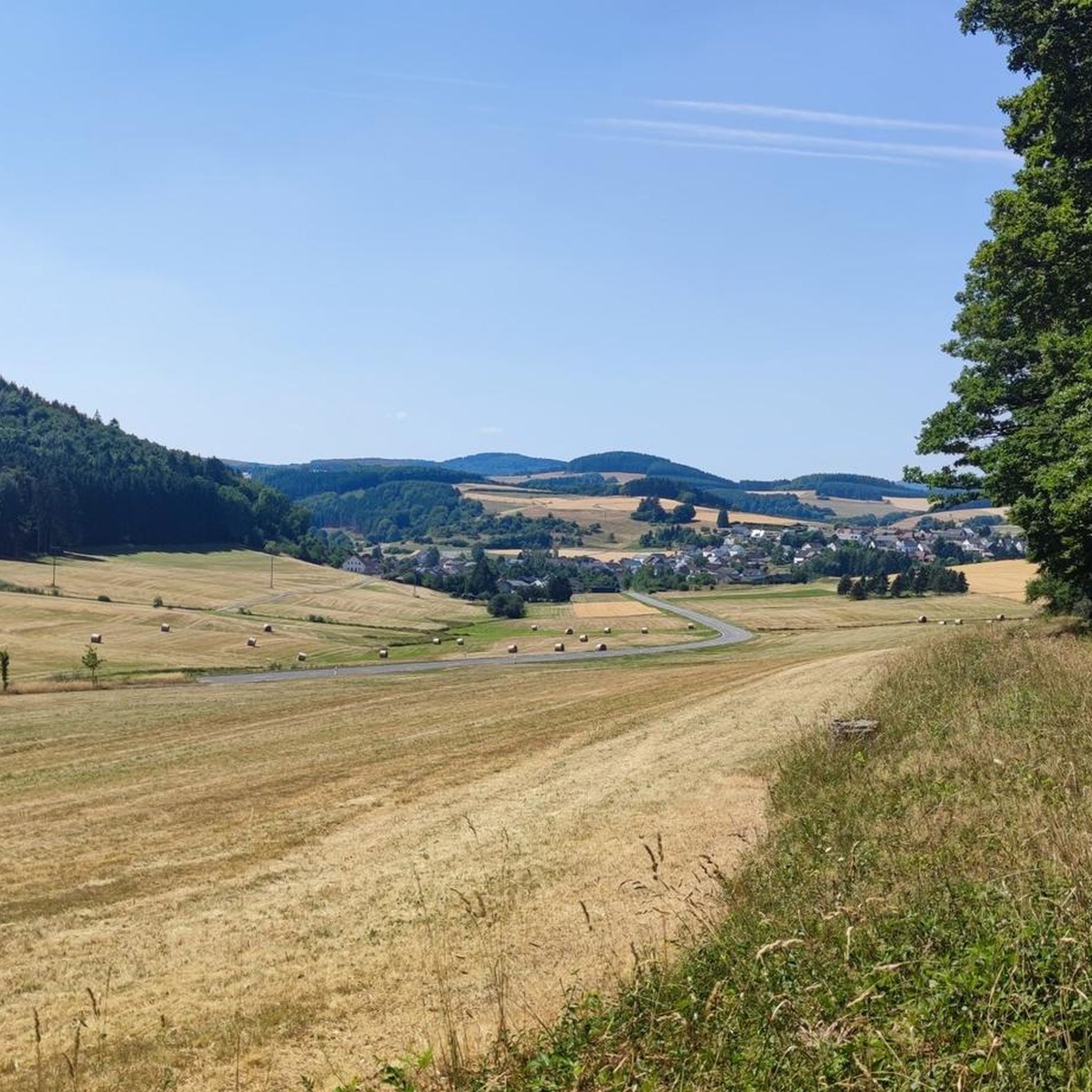
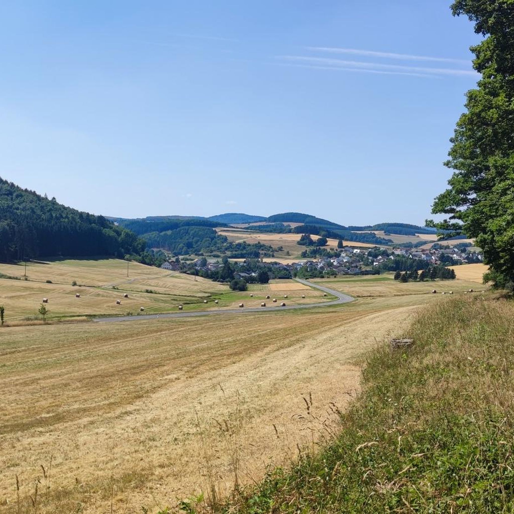
Mountain bike trails Oberstadtfeld traverse the unique volcanic landscapes of the Vulkaneifel region, characterized by ancient maars, dense forests, and rolling meadows. The terrain features varied elevations, including volcanic peaks and stream valleys, offering diverse riding experiences. This geological heritage provides a dynamic environment for mountain biking, with trails winding through explosion craters and past basalt rock formations.
Best mountain bike trails around Oberstadtfeld
- The most popular mountain bike trail is Himmerod Abbey – Meerfelder Maar loop from Niederstadtfeld,…
Last updated: October 16, 2026
4.7
(106)
673
riders
50.4km
04:35
1,060m
1,060m
Hard mountain bike ride. Very good fitness required. Advanced riding skills necessary.
3.0
(1)
7
riders
69.9km
06:18
1,460m
1,450m
Hard mountain bike ride. Very good fitness required. Advanced riding skills necessary. Some portions of the route may require you to push your bike.

4.6
(5)
18
riders
Moderate mountain bike ride. Good fitness required. Suitable for all skill levels.
3.0
(1)
5
riders
65.0km
05:21
1,140m
1,140m
Hard mountain bike ride. Very good fitness required. Suitable for all skill levels.
5.0
(3)
4
riders
36.2km
03:09
680m
680m
Moderate mountain bike ride. Good fitness required. Advanced riding skills necessary.
Get access to more routes and recommendations from other explorers.
Already have an account?
Our route recommendations are based on thousands of hikes, rides, and runs completed by other people on komoot.
Start today with a free account
Your next adventure awaits.
Tips from the Community

Perfect place to take a break and relax
4
0

Not possible to see the lake anymore in 2026 due to growth of the bushes
0
0

Hiking. Nice opportunity to rest for a bit. The hike goes over easy paths, but... the last 1.5 km is really pathfinding. Keep the map handy. Narrow steep paths with high grass, nettles and many brambles. Last 100 meters almost dangerously narrow and steep.
0
0


Steinborner Drees is mineral water with a high iron and carbon dioxide content that bubbles abundantly from a fountain in the center of Steinborn. This spring, a sodium-calcium-magnesium hydrogen carbonate spring, can produce up to 6 liters of refreshing mineral water per minute, with an average temperature of 11.6°C.
5
0

Weinfelder Maar - Impressive Evidence of Explosive Geological History The Weinfelder Maar – also known as Totenmaar – is one of the three so-called Daun Maars. It is located about 2 kilometers from our district town of Daun, near the municipality of Schalkenmehren, between the Gemünden and Schalkenmehren Maars. It has a diameter of approximately 525 meters and a depth of 51 meters, making it the deepest of the three Daun Maars. It is the youngest and, at 487 meters above sea level, the highest of the three closely adjacent maars, which formed between 20,000 and 30,000 years ago. Text / Source: Natur- und Geopark Vulkaneifel GmbH, Mainzer Str. 25, Daun https://www.geopark-vulkaneifel.de/eifel/landschaft/maare-und-kraterseen/weinfelder-maar.html
12
0
Weinfelder Maar The Weinfelder Maar, formed by volcanic activity around 20,000 to 30,000 years ago, is the highest of the three Daun Maars at 487 meters above sea level. The lake is 51 meters deep and has a diameter of 396 to 429 meters. An almost melancholic atmosphere surrounds the maar. Many legends surround the tranquil Eifel eye. A castle is said to have once stood on the site of the crater, where a count lived with his wife and only child. After returning home from a hunt, the castle had sunk as punishment for the woman's nastiness, and he found only a lake where a cradle miraculously floated his child safely to the shore. If you look at the dark surface of the water long enough, it is said that you can make out the outline of the castle. The German landscape painter Fritz von Wille was so fascinated by the Weinfelder Maar that he repeatedly immortalized it in his paintings. Among his favorite motifs was the small chapel on the north bank, dedicated to Saint Martin. It was once the parish church of the village of Weinfeld, which was ravaged by the plague in the 16th century. Anyone who rings the bells inside by pulling the ropes can make a wish. To this day, the associated cemetery is maintained and used by the local community of Schalkenmehren. This is also where its second name, Totenmaar, comes from. Donkeys and goats have been introduced to the Weinfelder Maar to regulate vegetation. The maar's unique flora and fauna are protected. Swimming and other water sports are prohibited in the Weinfelder Maar, but a nearly two-kilometer-long path makes it a wonderful place to explore on foot. Parking: Guests can park along the L64 either in the parking lot at the Weinfelder Maar or on the Maarsattel between the Weinfelder Maar and the Schalkenmehrener Maar. Text / Source: GesundLand Vulkaneifel GmbH, Leopoldstr. 9 A, 54550 Daun https://www.eifel.info/a-weinfelder-maar
12
0

highly recommended, definitely worth it
0
0
Frequently Asked Questions
How many mountain bike trails are there in Oberstadtfeld?
There are over 550 mountain bike routes around Oberstadtfeld, offering a wide range of options for different skill levels. This includes approximately 75 easy routes, 375 moderate routes, and over 100 difficult trails.
Are there easy mountain bike trails suitable for beginners in Oberstadtfeld?
Yes, Oberstadtfeld offers around 75 easy mountain bike trails, perfect for beginners or those looking for a more relaxed ride. These routes typically feature less challenging terrain and elevation changes, allowing you to enjoy the volcanic landscapes at a comfortable pace.
What are some challenging mountain bike routes in the Vulkaneifel region?
For experienced riders seeking a challenge, Oberstadtfeld has over 100 difficult mountain bike routes. An example is the Himmerod Abbey – Meerfelder Maar loop from Oberstadtfeld, a demanding 60.6 km trail with significant elevation changes through the volcanic landscape. Another challenging option is the View of the Weinfelder Maar – Dronke Tower on the Mäuseberg loop from Oberstadtfeld, covering 50.2 km with over 1000 meters of ascent.
Are there circular mountain bike routes available in Oberstadtfeld?
Many of the mountain bike routes around Oberstadtfeld are designed as loops, allowing you to start and finish in the same location. For example, the Fishing Pond Oberstadtfeld – Meerfelder Maar loop from Neroth is a moderate 38.3 km circular path offering varied forest and open terrain views.
What unique natural features can I see while mountain biking in Oberstadtfeld?
The Vulkaneifel region is famous for its unique volcanic landscapes. While mountain biking, you can encounter 'Maare' – volcanic lakes formed in explosion craters, dense forests, and rolling meadows. Routes often wind past basalt rock formations and offer panoramic views from volcanic peaks. The View of Burberg – View of the Eifel Hills loop from Oberstadtfeld provides excellent vistas of the surrounding Eifel Hills.
Are there any specific attractions or landmarks along the mountain bike trails?
Yes, several routes pass by notable landmarks and natural attractions. You might encounter viewpoints like the Dronke Tower on the Mäuseberg or the Maarkreuz with views of the Schalkenmehren Maar. Some trails also lead through the Lieser Valley, known for its scenic gorges.
Is the Vulkaneifel Trail Park accessible from Oberstadtfeld?
Oberstadtfeld is an excellent base for exploring the broader Vulkaneifel Trail Park. This extensive network boasts over 750 kilometers of signposted mountain bike trails, offering varied terrain and significant altitude changes through the volcanic landscape. Many routes starting from Oberstadtfeld will connect you to this wider network.
What do other mountain bikers say about the trails in Oberstadtfeld?
The mountain bike trails around Oberstadtfeld are highly rated by the komoot community, with an average score of 4.6 stars from over 2,500 reviews. More than 9,400 mountain bikers have explored this area using komoot, often praising the diverse terrain, the unique volcanic scenery, and the well-maintained paths.
Can I bring my dog on the mountain bike trails in Oberstadtfeld?
Many trails in the Vulkaneifel region are dog-friendly, especially those through forests and open landscapes. However, it's always recommended to check specific trail regulations or local signage, as some protected areas or private lands might have restrictions. Always keep your dog under control and clean up after them.
Are there any places to practice mountain bike skills in the area?
Yes, for riders looking to hone their skills, the Vulkaneifel region features the "Kôulshore – Mountainbike Trail-Technik-Parcours." This dedicated technique park provides specific features and obstacles to help improve your mountain biking abilities.
What is the best time of year to go mountain biking in Oberstadtfeld?
The Vulkaneifel region is generally pleasant for mountain biking from spring through autumn. Spring offers blooming meadows and moderate temperatures, while summer provides lush green forests. Autumn brings vibrant foliage and cooler air, ideal for longer rides. Winter mountain biking is possible, but trails may be muddy or icy, requiring appropriate gear and caution.
Where can I find parking for mountain bike trails in Oberstadtfeld?
While specific parking details vary by trailhead, Oberstadtfeld and surrounding villages typically offer designated parking areas near popular starting points for trails. Look for signs indicating 'Wanderparkplatz' or 'Parkplatz' in town centers or at the beginning of trail networks. It's advisable to check the route details on komoot for specific parking recommendations for your chosen trail.
Most popular routes around Oberstadtfeld
Most popular attractions around Oberstadtfeld

Get inspired with the komoot mobile app


Explore more
Browse the best MTB trails in other regions.
