The best hikes from bus stations around Park of the Cento Laghi
4.5
(2537)
12,163
hikers
3
hikes
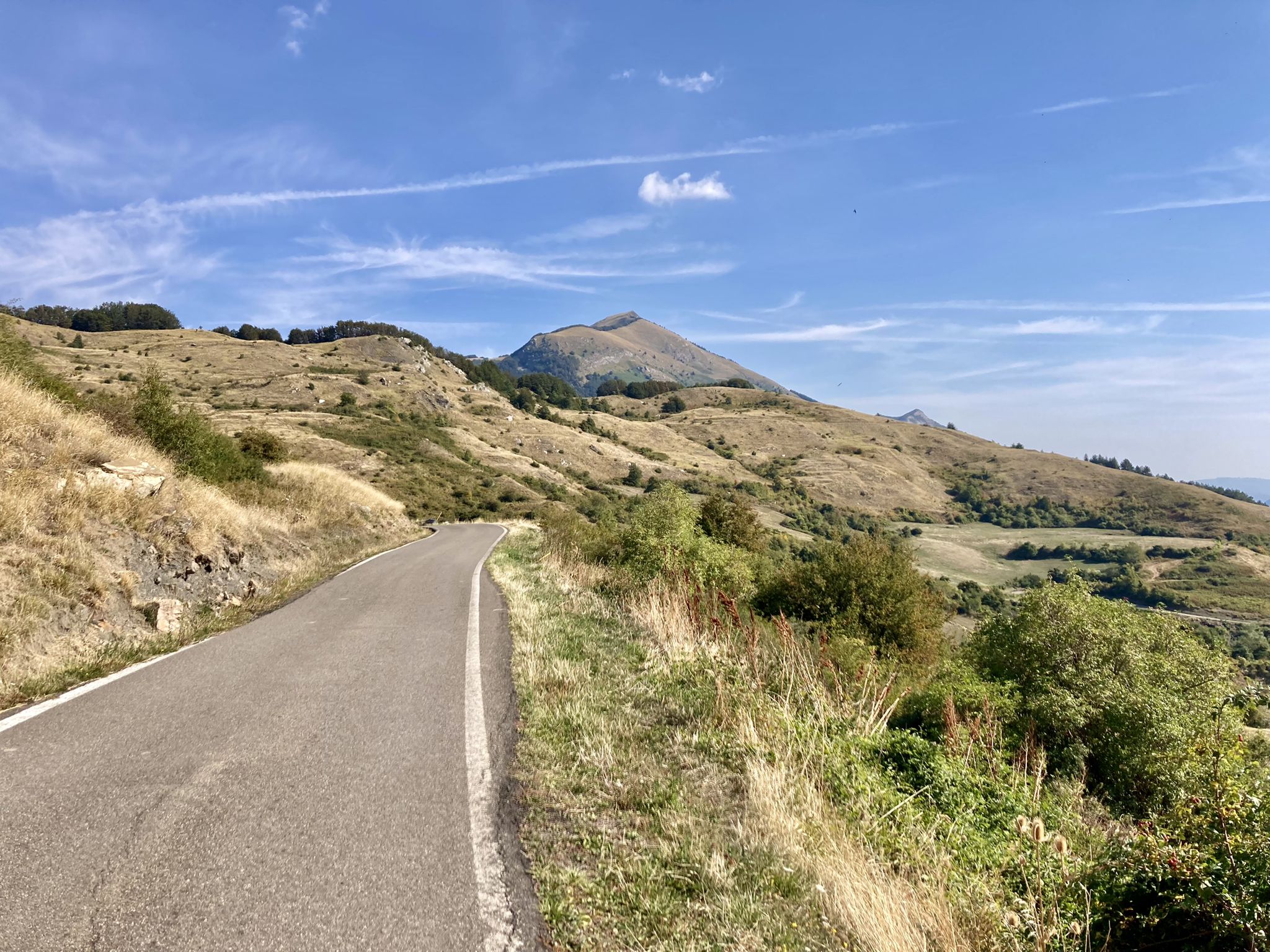
Bus station hiking trails around Park of the Cento Laghi traverse a landscape shaped by ancient glaciers, featuring 19 glacial lakes, extensive beech woods, and rocky high-altitude environments. Elevations range from approximately 400 to over 1,800 meters, supporting diverse flora and fauna. The terrain includes glacial cirques, moraine deposits, and numerous streams, with higher areas offering panoramic views from peaks like Monte Sillara (1,861m).
Best bus station hiking trails around Park of the Cento Laghi
- The most popular bus station hiking route is Lagastrello Dam – Ponte di Lagastrello loop from Miscoso, a 7.2 miles (11.6 km) trail that takes about 3 hours 30 minutes to complete, offering views of the dam and surrounding natural areas.
- Another top favourite among local hikers is Treschietto – Bagnone Natural Pool loop from Treschietto, a moderate 6.1 miles (9.8 km) path. This route explores local villages and leads to a natural pool, passing through varied forest and open terrain.
- Local hikers also love the Bivacchi Garbia – The Vico mills loop from Treschietto, a 12.7 miles (20.4 km) trail leading through challenging mountain terrain with significant elevation gain, often completed in about 8 hours 15 minutes.
- Hiking around Park of the Cento Laghi is defined by glacial lakes, extensive beech forests, and high mountain ridges. The well-marked network offers options for moderate walks through woodlands and more challenging ascents to panoramic viewpoints.
- The routes in Park of the Cento Laghi are highly rated by the komoot community with an average score of 4.5 stars from more than 2,400 reviews. More than 11,000 hikers have used komoot to explore Park of the Cento Laghi's varied terrain.
Last updated: August 31, 2026
3
hikers
11.7km
03:33
380m
380m
Moderate hike. Good fitness required. Easily-accessible paths. Suitable for all skill levels.
5.0
(1)
9
hikers
9.81km
02:47
230m
230m
Moderate hike. Good fitness required. Easily-accessible paths. Suitable for all skill levels.

Sign up for free
4.7
(3)
3
hikers
20.4km
08:18
1,360m
1,360m
Hard hike. Very good fitness required. Mostly accessible paths. Sure-footedness required.
Our route recommendations are based on thousands of hikes, rides, and runs completed by other people on komoot.
Start today with a free account
Your next adventure awaits.
Login or Signup
Popular around Park of the Cento Laghi

Other adventures around Park of the Cento Laghi

Tips from the Community

Waterfall of about twenty meters, truly beautiful. In dry periods it's not very impressive, but the pool below with the surrounding rocks is really nice. To reach it, there are a couple of points to pay attention to, but with good shoes, no problem.
0
0
Great resting point for those walking to/from the ridge. There is a spring that can dry up during periods of great summer drought.
0
0

The Diga del Lagastrello (officially called Diga di Lago Paduli) is an artificial dam located in the Tuscan-Emilian Apennines, at an altitude of about 1,157 meters in the municipality of Comano (Massa-Carrara), very close to the Passo del Lagastrello which separates Tuscany from Emilia-Romagna. Built between 1906 and 1910 for hydroelectric purposes by damming the Enza stream, it creates the Lago Paduli, an artificial basin that collects over 3 million cubic meters of water. From an engineering point of view, it is a notable example of an earth-fill dam with a central impermeable clay core. In December 1909, during the final stages of its construction, it suffered a partial and disastrous collapse that devastated the underlying Val Cedra, fortunately without causing any casualties.
0
0

Beautiful route, with a stunning summit panorama
1
0

excellent shelter in case of showers and thunderstorms
0
1

To get to the bivouac there is a small ford with a metal cable just before arriving. Be careful with the river in flood.
0
0
Medium sized bivouac just renovated with fountain and fire points outside. Inside we find a table with benches, stove, wooden cupboard with pans and canned food etc., small mezzanine with 4 inflatable mattresses. About 6 comfortable beds but at least 10 can fit in. Nearby we find beautiful waterfalls and pools for swimming in the summer (if there is water)
0
1
Waterfall of about 15 meters with spectacular pool. There are other waterfalls and pools along the river
0
0
Frequently Asked Questions
How many bus-accessible hiking trails are featured in this guide for the Park of the Cento Laghi?
This guide highlights a selection of three distinct hiking routes that are accessible via bus stations in and around the Park of the Cento Laghi. These routes offer a range of experiences, from moderate day hikes to more challenging full-day adventures.
What kind of terrain and difficulty can I expect on these bus-accessible trails?
The trails accessible from bus stations in this guide range from moderate to difficult. For example, the Lagastrello Dam – Ponte di Lagastrello loop from Miscoso is a moderate 11.6 km route, while the Bivacchi Garbia – The Vico mills loop from Treschietto is a challenging 20.4 km trek. The region itself features diverse landscapes, from extensive beech woods and streams at intermediate elevations to rocky environments and glacial lakes at higher altitudes, reflecting the ancient glacial activity that shaped the Parma Apennines.
Are there any circular routes available from bus stations?
Yes, all three routes featured in this guide are circular, allowing you to start and end your hike at the same bus-accessible point. This includes the moderate Treschietto – Bagnone Natural Pool loop from Treschietto, which is just under 10 km.
What natural features or landmarks can I see along these bus-accessible routes?
The Park of the Cento Laghi is rich in natural beauty. While specific attractions vary by route, you can expect to encounter glacial lakes, dense beech forests, and panoramic viewpoints. Notable features in the broader region include Lake Ballano, Lake Martini, and the Compione Lakes. You might also spot impressive peaks like Mount Sillara or Mount Caio, which offer sweeping views of the Apennine chain.
What is the best time of year to hike these bus-accessible trails?
The Park of the Cento Laghi is generally best for hiking from late spring through early autumn (May to October). During these months, the weather is typically mild, and the trails are clear of snow, making for pleasant conditions to explore the diverse landscapes, from blooming meadows to vibrant beech forests. Always check local weather forecasts before heading out.
Are there any family-friendly options among the bus-accessible trails?
The routes in this guide are generally moderate to difficult, with distances ranging from 9.8 km to over 20 km. While some sections might be manageable for older, experienced children, these trails are not specifically categorized as easy or family-friendly for younger children. For easier family walks, you might consider other trails in the region, such as the dedicated Lago Ballano trail mentioned in the region research, though its bus accessibility would need to be confirmed separately.
Can I bring my dog on these bus-accessible hiking trails?
Generally, dogs are permitted on trails within the Park of the Cento Laghi, provided they are kept on a leash, especially in areas with wildlife or livestock. It's always advisable to check specific park regulations or local signage for any restrictions on individual trails or protected areas before you go. Ensure your dog is well-behaved and can handle the moderate to difficult terrain and distances of these routes.
What do other hikers enjoy most about the Park of the Cento Laghi?
The Park of the Cento Laghi is highly rated by the komoot community, with an average score of 4.5 stars from over 2,400 ratings. Reviewers often praise the park's stunning glacial lakes, the tranquility of its extensive beech woods, and the panoramic views from its mountain peaks. The well-maintained trail network and the rich biodiversity are also frequently highlighted as major draws.
Are there any places to eat or drink near the bus stations or along the trails?
While specific amenities directly at bus stations for these routes are not detailed, the region has small villages and hamlets. For example, the Lago Santo Parmense itinerary (a popular lake in the park) is known to have a cafe nearby. It's recommended to carry sufficient water and snacks, especially for longer routes like the Bivacchi Garbia – The Vico mills loop, and to check for local establishments in the starting villages before your hike.
What should I pack for a hike on these bus-accessible trails?
Given the moderate to difficult nature of these trails and the varied terrain of the Apennines, it's essential to be well-prepared. Pack sturdy hiking boots, layers of clothing suitable for changing mountain weather, rain gear, sufficient water, snacks, a map or GPS device (like komoot's app), and a first-aid kit. Sun protection is also advisable. For longer routes, consider a headlamp and extra provisions.
Are there any waterfalls or natural pools to discover?
Yes, the region is known for its water features. The Treschietto – Bagnone Natural Pool loop from Treschietto specifically highlights a natural pool. Additionally, the broader Park of the Cento Laghi features numerous streams and, as mentioned in regional research, Lago Ballano is known for its impressive sandstone waterfalls, offering picturesque spots to enjoy the natural environment.
Most popular routes around Park of the Cento Laghi
Most popular attractions around Park of the Cento Laghi

Get inspired with the komoot mobile app


Explore more
Browse the best Hikes in other regions.
