The best traffic-free bike rides in Garajonay
4.2
(60)
1,466
riders
3
rides
Road cycling in Garajonay National Park offers routes through a unique landscape characterized by ancient laurisilva forests, impressive volcanic formations, and deep ravines. The terrain features extensive rolling hills and significant elevation changes, providing varied challenges for cyclists. Alto de Garajonay, the island's highest point, presents a notable climb with panoramic views. This environment creates a distinctive setting for no traffic road cycling routes.
Best no traffic road cycling routes in Garajonay
- The most popular no traffic road cycling route…
Last updated: July 9, 2026
1.0
(1)
12
riders
58.7km
03:43
1,650m
1,650m
Hard road ride. Very good fitness required. Some segments of this route may be unpaved and difficult to ride.
7
riders
44.4km
02:55
1,390m
1,390m
Hard road ride. Very good fitness required. Mostly well-paved surfaces and easy to ride.

Sign up for free
7
riders
82.3km
05:43
2,740m
2,740m
Hard road ride. Very good fitness required. Some segments of this route may be unpaved and difficult to ride.
19
riders
Easy road ride. Great for any fitness level. Mostly well-paved surfaces and easy to ride.
Our route recommendations are based on thousands of hikes, rides, and runs completed by other people on komoot.
Start today with a free account
Your next adventure awaits.
Login or Signup




Tips from the Community

Mirador de la Curva del Queso One of those spots where it's worth stopping, even if just for a minute. The road twists through ravines, and suddenly an immense panorama of La Gomera's volcanic relief appears. It's very typical to see fog rolling in and out at high speed, while below the valley remains completely clear. A perfect corner to take a breath, snap a photo, and keep cycling.
0
0

anyone looking for quite comfortable and joint-friendly paths - amidst all the steep trails of La Gomera - will find them here - and "incidentally" there is also the island's "roof"... an area for relaxation...
0
0

We stopped for a cortado because a heavy rain shower interrupted our walk.
0
0

Just before Valle Gran Rey, the valley opens up – an ideal moment for photos. It's best to stop at one of the wide bends before the road narrows.
0
0

The laurel forest is beautiful and always worth a hike. Parking is available directly on site, and there's also a restaurant there.
2
0

The black sand takes some getting used to. Very beautiful here.
3
0
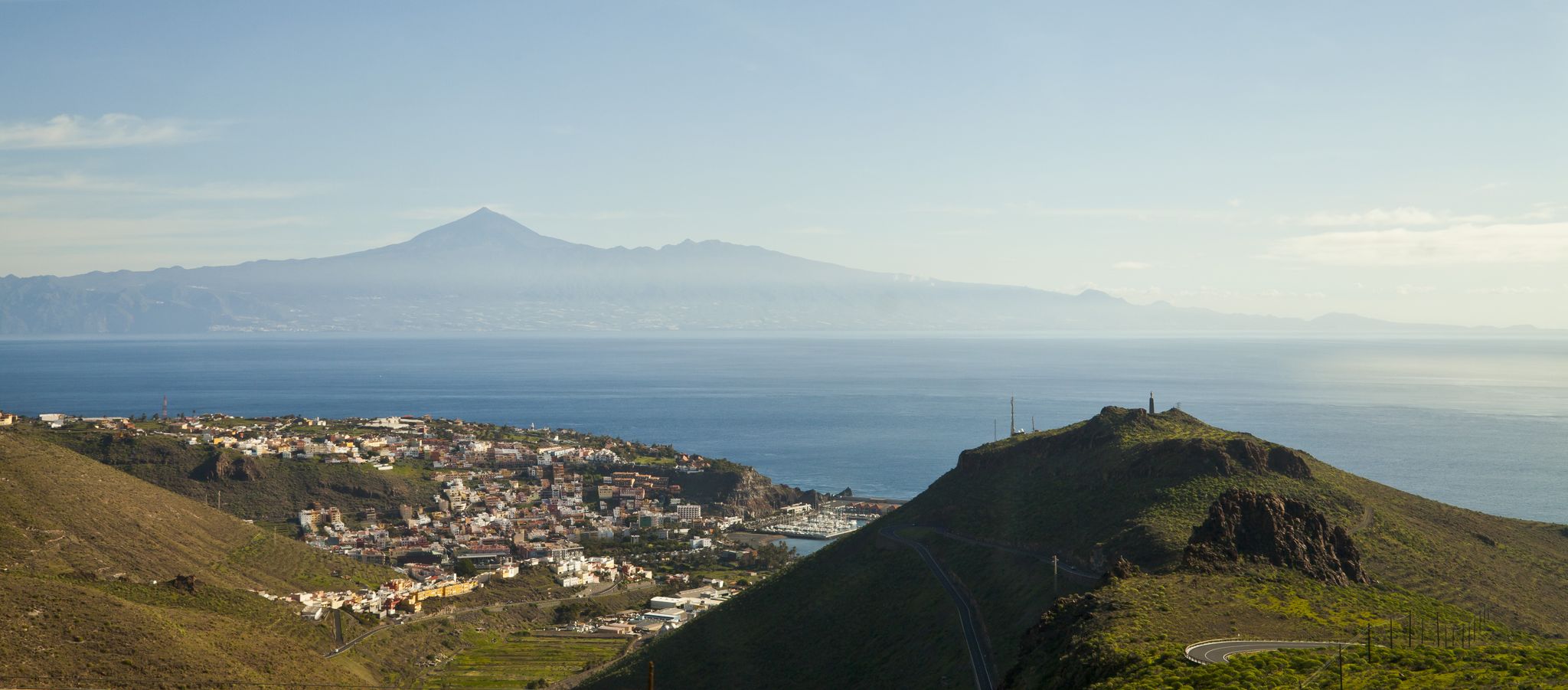
The port of San Sebastián is the gateway to the entire island. Ferry connections are available from here, among other things.
3
0
A visit to the Mirador de la Hila is particularly worthwhile for those who want to enjoy a comprehensive overview of San Sebastián de La Gomera and its coastal landscape.
4
0
Frequently Asked Questions
How many no-traffic road cycling routes are available in Garajonay?
There are 4 dedicated no-traffic road cycling routes in Garajonay National Park featured in this guide. These routes offer a range of challenging experiences through the park's unique landscapes.
What kind of terrain can I expect on the no-traffic road cycling routes in Garajonay?
Garajonay's routes are characterized by significant elevation gains and descents, winding roads, and varied terrain. You'll cycle through ancient laurisilva forests, experience deep ravines, and navigate rolling hills formed by volcanic activity. The paths are generally well-maintained and paved, suitable for road bikes.
Are there any challenging no-traffic road cycling routes in Garajonay?
Yes, the no-traffic road cycling routes in Garajonay are generally considered challenging, featuring substantial climbs and descents. For example, the Chipude Village – View of El Hierro loop from Lomo Morriña covers over 82 km with more than 2,700 meters of elevation gain, requiring very good fitness.
What are the best viewpoints along the no-traffic road cycling routes?
Garajonay offers numerous panoramic viewpoints. Notable spots include Mirador del Alto de Garajonay, Mirador del Rejo, and Miradores de Los Roques. The viewpoint at Roque de Agando also provides excellent vistas. These offer opportunities to admire the deep ravines, laurisilva-covered hillsides, and distant islands.
What is the best time of year for no-traffic road biking in Garajonay?
Garajonay National Park benefits from a unique micro-climate with mild temperatures and high humidity year-round, making it suitable for cycling in most seasons. The laurisilva forest is often shrouded in mist, contributing to a fresh atmosphere. However, checking local weather forecasts is always recommended, especially for potential fog or rain.
Can I find circular no-traffic road cycling routes in Garajonay?
Yes, several routes are designed as loops, allowing you to start and finish at the same point. Examples include the Viewpoint of La Cumbrecita – El Contadero Parking loop from Las Creces and the Viewpoint of La Cumbrecita loop from Alto de Garajonay, both offering extensive circular experiences.
What unique natural features will I encounter while cycling in Garajonay?
You'll experience the ancient laurisilva forest, a subtropical rainforest with evergreen trees and giant ferns, creating a mystical atmosphere. The park also features impressive volcanic rock formations, including massive basalt rocks and the prominent Roque de Agando. The diverse ecosystem is home to over 1,000 plant species, many endemic to the Canary Islands.
What do other road cyclists enjoy most about cycling in Garajonay?
The komoot community rates the road cycling experience in Garajonay highly, with an average score of nearly 4 out of 5 stars from 44 ratings. Reviewers often praise the challenging yet rewarding climbs, the stunning natural beauty of the laurisilva forest, and the panoramic views from the various miradores.
Are there any easy no-traffic road cycling options in Garajonay?
While most routes in Garajonay National Park are challenging, there is one easier option: the Bar La Curva – Fred Olsen Ferry to Tenerife loop from San Sebastián de la Gomera. This route is shorter, at around 9 km, with minimal elevation gain, making it suitable for a more relaxed ride.
Where can I find more information about Garajonay National Park?
For more detailed information about the natural heritage and general aspects of Garajonay National Park, you can visit the official Vallehermoso tourism website: visitvallehermoso.com. You can also find general information on Wikipedia: wikipedia.org.
Are there any specific routes that offer a deep immersion into the laurisilva forest?
Many routes traverse the heart of the laurisilva forest. The 21 km stretch from Morro de Agando to Vallehermoso, for instance, is particularly noted for its dense forest scenery, where cycling can feel like moving through a natural tunnel, offering a profound sense of immersion in this ancient ecosystem.

Get inspired with the komoot mobile app


Explore more
Browse the best Road cycling routes in other regions.
