The best hikes from bus stations around Vitigudino
4.5
(156)
1,055
hikers
13
hikes
Bus station hiking trails around Vitigudino offer access to the diverse landscapes of the Arribes del Duero Natural Park, characterized by dramatic river gorges carved by the Duero River. The region features rugged terrain, traditional dehesa ecosystems with scattered oak trees, and impressive waterfalls. Hikers can explore a network of paths that traverse these natural features, providing varied outdoor experiences.
Best bus station hiking trails around Vitigudino
- The most popular bus station hiking route is Pozo de los Humos – circular from Masueco - Parque Natural de las Arribes del Duero, a 4.3 miles (6.9 km) trail that takes 2 hours 10 minutes to complete. This difficult route leads to the impressive Pozo de los Humos waterfall.
- Another top favourite among local hikers is São Fagundo Trail (PR3), a moderate 8.8 miles (14.2 km) path. This route offers varied terrain and scenic views within the natural park.
- Local hikers also love the Senda de La Barca by the Mirador del Castillo de Vilvestre – Parque Natural de las Arribes del Duero, a 6.0 miles (9.7 km) trail leading through river canyons and past viewpoints, often completed in about 3 hours 8 minutes.
- Hiking around Vitigudino is defined by dramatic river gorges, traditional dehesa landscapes, and impressive waterfalls. The network of bus station hiking trails offers options for easy walks, moderate excursions, and more challenging routes.
- The routes in Vitigudino are highly rated by the komoot community with an average score of 4.5 stars from more than 140 reviews. Nearly 1000 hikers have used komoot to explore Vitigudino's varied terrain.
Last updated: July 7, 2026
4.2
(5)
20
hikers
Hard hike. Good fitness required. Sure-footedness, sturdy shoes and alpine experience required.
5.0
(3)
17
hikers
14.2km
04:01
310m
310m
Moderate hike. Good fitness required. Easily-accessible paths. Suitable for all skill levels.

Sign up for free
5.0
(1)
6
hikers
Moderate hike. Good fitness required. Mostly accessible paths. Sure-footedness required.
4.0
(1)
3
hikers
11.6km
03:21
300m
300m
Moderate hike. Good fitness required. Easily-accessible paths. Suitable for all skill levels.
2.0
(1)
2
hikers
20.3km
05:48
470m
470m
Hard hike. Very good fitness required. Easily-accessible paths. Suitable for all skill levels.
Get access to more routes and recommendations from other explorers.
Sign up for free
Already have an account?
Our route recommendations are based on thousands of hikes, rides, and runs completed by other people on komoot.
Start today with a free account
Your next adventure awaits.
Login or Signup
Popular around Vitigudino



Tips from the Community

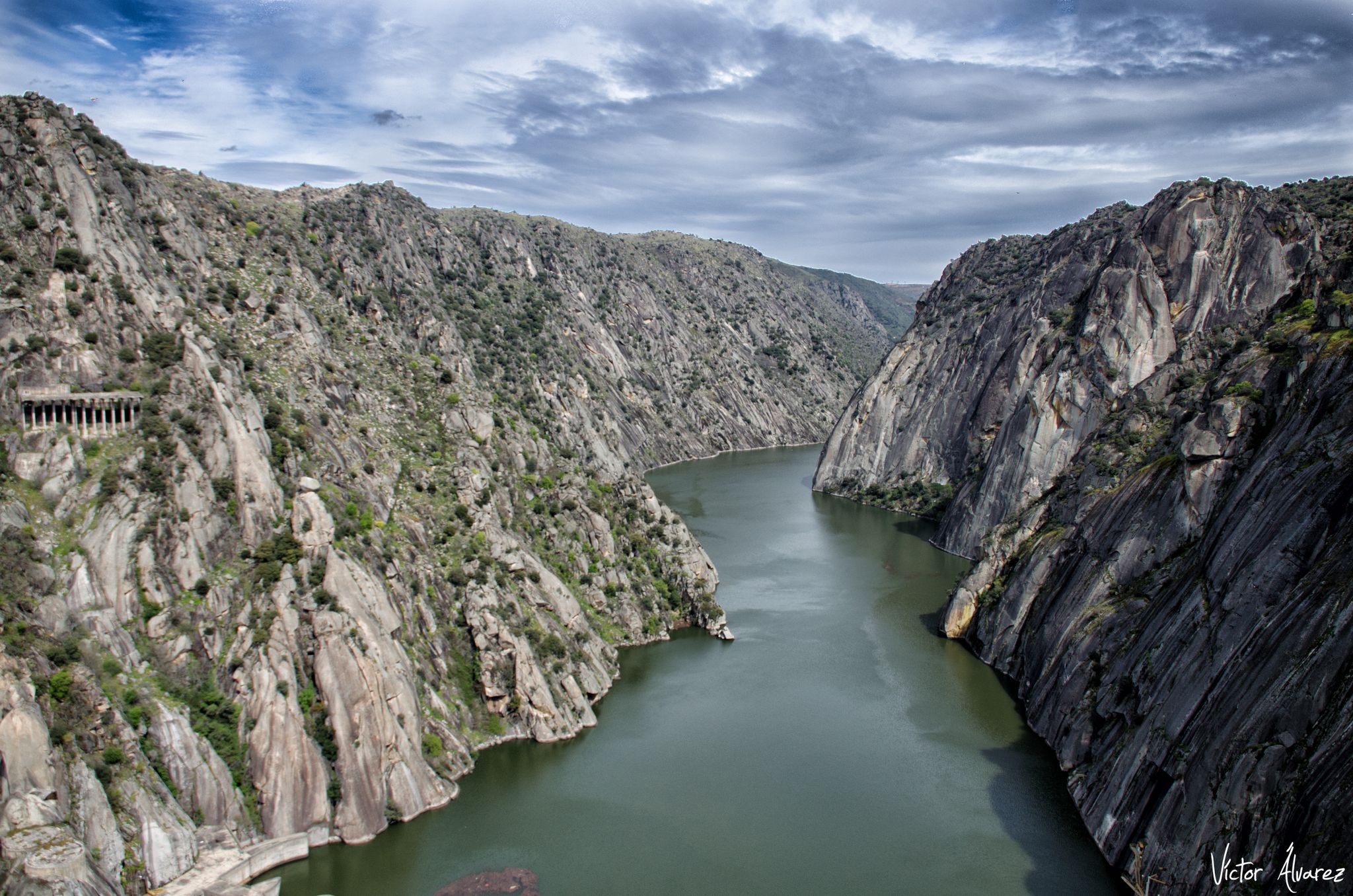
The Miradouro da Cerca, located in the village of Urrós (municipality of Mogadouro, near Miranda do Douro), is one of the most spectacular viewpoints in the Douro International Natural Park and is part of a route that many consider worthy of the title of “Europe’s Grand Canyon.” It offers stunning views of the deep and rugged valley of the Douro River, which marks the natural border between Portugal and Spain.
4
0

Near the village of Urrós, the Cerca Viewpoint awaits you with a breathtaking view. From the top of an imposing rock, you are treated to a dramatic view of the Douro River Gorge, where the steep cliffs form the natural border between the Mirandese Plateau and the Spanish mainland. A magnificent view, impossible to forget!
2
0
The Embarcadero de La Barca is located in Vilvestre, Salamanca, and is a starting point for boat trips along the Duero River. From here, the boats take routes that allow you to enjoy the impressive landscapes of the Duero Internacional and Arribes del Duero Natural Parks. These trips usually last around an hour and a half and offer the opportunity to observe the rich flora and fauna of the region, including birds of prey such as the golden eagle and the griffon vulture. In addition, the route allows you to contemplate the natural beauty of the cliffs and the Mediterranean microclimate of the area. 😊
6
0
The Pozo de los Humos is an impressive waterfall located in the province of Salamanca, in the autonomous community of Castilla y León, Spain. This waterfall is located on the Uces River and is known for its spectacular waterfall of about 50 meters high, especially impressive during the rainy season. 😊
6
0

Very interesting when cruise ships dock. There's also a restaurant and an information center for children. The ticket office for the Camino del Hierro is also located there.
2
0
It is worth taking a look at the El pozo de los Humos waterfall. There are many different views and the area near the waterfall is very nicely designed for visitors. You can also take a circular walk from Masueco: towards the car park to the Pozo and then back to the village via a narrow hiking trail.
1
0
If you decide to explore this route, you will be surrounded by nature, history and breathtaking views. Enjoy your hike! 🏞️🚶♂️🥾🚵🌞
8
0
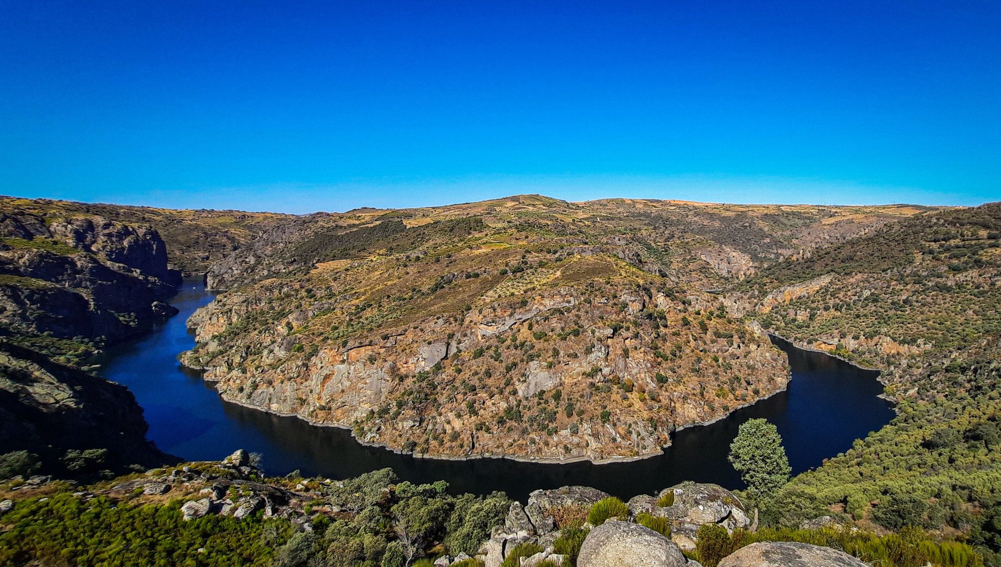
This viewpoint offers spectacular panoramic views of the mountains and surrounding landscape, making it an ideal destination for nature and photography lovers.
8
0
Frequently Asked Questions
How many hiking trails are accessible from bus stations around Vitigudino?
There are 12 hiking trails around Vitigudino that are easily accessible from bus stations, offering a variety of experiences for all skill levels. You'll find 3 easy routes, 6 moderate, and 3 more challenging options.
Are there any family-friendly hiking routes accessible by bus near Vitigudino?
Yes, several routes are suitable for families. While the guide data doesn't specify 'family-friendly' directly, easier routes like the 3.8 km trail to the Pozo de los Humos Waterfall, mentioned in regional research, offer a manageable distance and a spectacular natural reward. Always check the specific route details for elevation and terrain to ensure it suits your family's abilities.
Can I find circular hiking routes starting from bus stops in the Vitigudino area?
Absolutely. Many trails in the region are designed as circular routes, allowing you to return to your starting point without retracing your steps. An example is the challenging Pozo de los Humos – circular from Masueco, which offers stunning views of the waterfall.
Are there any hiking trails with waterfalls accessible from bus stations?
Yes, the Vitigudino area, particularly within the Arribes del Duero Natural Park, is famous for its waterfalls. The magnificent Pozo de los Humos Waterfall is a major highlight, and the Cascada de Pinero (also known as Cola de Caballo) is another beautiful option, often reached via a 6.7 km circular route through rugged terrain.
What kind of natural landscapes can I expect to see on these bus-accessible hikes?
The trails accessible from bus stations around Vitigudino primarily traverse the dramatic landscapes of the Arribes del Duero Natural Park. You'll encounter rugged river gorges carved by the Duero River, traditional dehesa ecosystems with scattered oak trees, and breathtaking panoramic viewpoints. The region's unique geology and rich biodiversity make for a diverse hiking experience.
Are there any viewpoints or scenic overlooks on the trails near bus stations?
Yes, the region is dotted with spectacular viewpoints. The Mirador de Saucelle route offers impressive vistas. Other notable viewpoints include Rupurapay Viewpoint, which provides stunning views of the Duero River canyon, and Friar's Viewpoint.
What do other hikers say about the trails around Vitigudino?
The hiking trails around Vitigudino are highly regarded by the komoot community, boasting an average rating of 4.49 out of 5 stars from 145 reviews. Hikers frequently praise the dramatic river gorges, the stunning waterfalls, and the well-maintained paths that offer a unique blend of natural beauty and historical interest.
Are there any historical or cultural points of interest along the bus station hiking trails?
Yes, the region offers a rich history. You can explore trails that pass by historical sites such as the Castle of San Felices de los Gallegos or the Vettonian Hillfort of Yecla la Vieja. The famous Iron Way (Camino de Hierro), though a longer route, showcases 19th-century civil engineering with tunnels and viaducts, blending history with nature.
Which long-distance trails can be accessed from bus stations near Vitigudino?
The GR 14 Stage 42: La Fregeneda to Vega Terrón Trail is a challenging 20.3 km route that is part of a larger long-distance path, offering an immersive experience through the Arribes del Duero landscape. This stage is accessible via public transport connections to its starting point.
Are there any moderate difficulty trails accessible from bus stations for a full day hike?
For a moderate full-day hike, consider the São Fagundo Trail (PR3). This route spans approximately 14.2 km and takes around 4 hours to complete, offering a substantial and rewarding experience through the regional landscape.
What is the best time of year to go hiking in Vitigudino?
The best time for hiking in Vitigudino is generally during spring (March to May) and autumn (September to November). During these seasons, the weather is milder, and the natural landscapes, especially the waterfalls, are at their most impressive. Spring brings lush greenery, while autumn offers vibrant colors.
Are there any trails that offer views of the Duero River?
Many trails in the Vitigudino area provide stunning views of the Duero River, particularly those within the Arribes del Duero Natural Park. Routes like the Senda de La Barca by the Mirador del Castillo de Vilvestre offer excellent vantage points over the river and its dramatic canyons.
Most popular routes around Vitigudino
Most popular attractions around Vitigudino

Get inspired with the komoot mobile app


Didn’t find what you were looking for?
Check out more Hikes throughout Vitigudino below and find the perfect route in your destination.
Explore more
Browse the best Hikes in other regions.
