The best traffic-free bike rides around Monteflavio
4.5
(16)
576
riders
15
rides
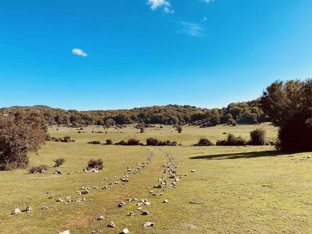
No traffic touring cycling routes around Monteflavio are situated within the Monti Lucretili Regional Nature Park, approximately 55 km from Rome. This area features a diverse landscape where the Apennine mountains transition into gentler plains, offering varied terrain for cyclists. The region is characterized by beech and conifer forests, significant climbs towards peaks like Mount Pellecchia, and unique karst features such as the Monte Gennaro Meadow. These physical features provide a dynamic environment for touring cyclists seeking both elevation gain…
Last updated: July 13, 2026
4.8
(4)
29
riders
55.3km
04:01
1,210m
1,210m
Hard bike ride. Very good fitness required. Mostly paved surfaces. Suitable for all skill levels.
11
riders
12.1km
01:50
870m
870m
Hard bike ride. Very good fitness required. Mostly paved surfaces. Suitable for all skill levels.

Sign up for free
11
riders
35.6km
02:48
890m
890m
Hard bike ride. Very good fitness required. Mostly paved surfaces. Suitable for all skill levels.
6
riders
Hard bike ride. Very good fitness required. Mostly paved surfaces. Suitable for all skill levels.
5
riders
16.5km
01:47
550m
550m
Hard bike ride. Very good fitness required. Mostly paved surfaces. Suitable for all skill levels.
Get access to more routes and recommendations from other explorers.
Sign up for free
Already have an account?
Our route recommendations are based on thousands of hikes, rides, and runs completed by other people on komoot.
Start today with a free account
Your next adventure awaits.
Login or Signup
Popular around Monteflavio

Other adventures around Monteflavio

Tips from the Community

The sanctuary of Santa Maria delle Grazie is linked to Nerola both dynastically and devotionally. It was indeed Raimondo Orsini, Duke of Gravina and Count of Nerola, who had the church and convent built for the Franciscan Amadeiti, as a sign of gratitude towards the blessed Amedeo Menezes da Silva. The venerated image of the Madonna delle Grazie came from the castle of Nerola, from where it was brought to the church in a solemn procession on Pentecost Day in 1480. Local sources report that the Madonna venerated in the sanctuary was found in the castle of Nerola, or at least kept there, and then transferred to the new conventual church of Santa Maria delle Grazie. According to the sanctuary's tradition, the blessed Amedeo found the image of the Madonna in the castle of Nerola by revelation and left the castle of Nerola in procession for its new home precisely upon the completion of the sanctuary's construction in 1480. In a later age, the image was first placed in the first side chapel and then, in 1826, on the high altar. The sources of the Via Mariana recall that the venerated image was crowned in 1779 and, after a theft, was crowned again in 2008 by Cardinal Angelo Comastri. Another record describes the image as placed above the altar, stripped after the theft and recently restored, also with the contribution of gold offered by the population. Alongside this Marian devotion, a wooden triptych commissioned by the Orsini from Antoniazzo Romano is also documented in the sanctuary, with the Madonna and Child between Saint Francis and Saint Anthony of Padua, but distinct from the miraculous image that is the object of popular worship.
0
0

Fantastic high altitude trail
0
0

Poggio Moiano is a beautiful village of medieval origin, built on a hill overlooking the surrounding woods of the Monti Lucretili regional park. In the surrounding area there are various testimonies from the Roman era even if the first news of the town is later and dates back to the year 1000 AD. Here every year, during the last week of June for the feast of the Sacred Heart, the flower display takes place with the streets of the village transformed into enormous canvases for works made with flower petals.
0
0


Picnic area with a splendid panorama of Lake Turano. Unfortunately the water fountain does not work.
1
0
Picnic area with a splendid panorama of Lake Turano. Unfortunately the water fountain does not work.
0
0

The village of Poggio Moiano stands on a hill at the foot of the mountain of the same name (990 m a.s.l.), at an altitude of 502 m a.s.l. It has very ancient origins: the first evidence dates back to the 11th century.
0
0

Beautiful dirt path between the pines.
1
0
Frequently Asked Questions
How many no-traffic touring cycling routes are available around Monteflavio?
There are over 10 dedicated no-traffic touring cycling routes around Monteflavio, offering a variety of distances and challenges within the Monti Lucretili Regional Nature Park.
What kind of terrain can I expect on these no-traffic touring routes?
The routes primarily traverse the diverse landscape of the Monti Lucretili Regional Nature Park, featuring a mix of beech and conifer forests, challenging climbs, and rewarding descents. You'll encounter both well-paved surfaces and some more technical sections, with unique natural features like karst meadows and lakes.
What is the best time of year for no-traffic touring cycling in Monteflavio?
The spring and autumn months generally offer the most pleasant conditions for touring cycling in Monteflavio, with milder temperatures and beautiful scenery. Summers can be warm, especially at lower elevations, while winters may bring colder weather and potential snow at higher altitudes.
Are there any routes suitable for less experienced touring cyclists?
While many routes in the Monteflavio area are rated as difficult due to significant elevation changes, there is at least one moderate option available. For example, the Monteflavio Pine Forest Trail loop from Monteflavio offers a challenging but rewarding experience with a distance of 16.5 km and over 550 meters of elevation gain.
What do other cyclists say about the no-traffic touring routes in Monteflavio?
The no-traffic touring cycling routes around Monteflavio are highly rated by the komoot community, with an average score of 4.6 stars from 22 reviews. Cyclists often praise the quiet, scenic roads, the challenging climbs, and the stunning panoramic views of the Monti Lucretili Regional Nature Park.
Are there any interesting natural attractions or landmarks along these routes?
Yes, the region is rich in natural beauty and historical sites. You might encounter unique karst features like the Monte Gennaro Meadow, where wild horses graze, or the splendid Lagustelli di Percile. Historical sites such as the Ruins of Stazzano Vecchio or the Castello Orsini-Cesi-Borghese are also within reach.
Can I find places to eat or drink along the no-traffic cycling routes?
While the routes themselves prioritize low traffic, they often pass through or near charming towns and villages where you can find local restaurants, cafes, and pubs. Monteflavio itself offers options, and other towns like Moricone or Palombara Sabina, which are starting points for some tours, also provide amenities.
Is it possible to access these routes using public transport?
Accessing the more remote no-traffic routes directly by public transport with a bike can be challenging. While some towns in the region have bus services, it's advisable to check local schedules and bike carriage policies in advance. Many cyclists opt to drive to a starting point with parking and begin their tour from there.
Where can I park my car to access these no-traffic touring routes?
Designated parking areas are typically available in the towns and villages that serve as starting points for these routes, such as Monteflavio, Montelibretti, or Moricone. Look for public parking facilities in these areas before you begin your ride.
Are there any long-distance no-traffic touring routes available?
Yes, for those seeking longer rides, routes like the View of Montorio Romano – Castello Orsini loop from Montelibretti offer a substantial challenge. This route covers over 55 km with more than 1200 meters of elevation gain, providing an extensive touring experience with minimal traffic.
Are there any specific challenging climbs on these routes?
The region is known for its significant climbs, particularly those leading up to higher elevations within the Monti Lucretili Park. The proximity to Mount Pellecchia (Pizzo Pellecchia) means you can expect substantial ascents, offering rewarding panoramic views from the top. Routes like the Monte Gennaro Tower – View of Palombara Sabina loop from Moricone feature nearly 1000 meters of elevation gain over 28 km.
Most popular attractions around Monteflavio

Get inspired with the komoot mobile app


Explore more
Browse the best Cycling routes in other regions.
