The best hikes from bus stations in Tamadaba
4.3
(8129)
32,824
hikers
223
hikes
Hiking in Tamadaba, a UNESCO World Heritage Site and Biosphere Reserve in Gran Canaria, offers diverse landscapes for outdoor exploration. The region is characterized by ancient Canary pine forests, dramatic cliffs, and deep ravines that descend to the sea. Its rugged terrain, formed by volcanic activity, features prominent natural landmarks like Roque Faneque and coastal areas with wild pebble beaches. This unique environment provides a network of trails accessible for various hiking experiences.
Best bus station hiking trails in Tamadaba
…Last updated: June 29, 2026
4.5
(287)
1,081
hikers
Moderate hike. Good fitness required. Easily-accessible paths. Suitable for all skill levels.
4.4
(26)
95
hikers
Hard hike. Good fitness required. Sure-footedness, sturdy shoes and alpine experience required.

Sign up for free
4.5
(24)
110
hikers
10.1km
04:18
650m
650m
Hard hike. Good fitness required. Sure-footedness, sturdy shoes and alpine experience required.
5.0
(22)
114
hikers
14.1km
05:29
890m
890m
Hard hike. Very good fitness required. Mostly accessible paths. Sure-footedness required.
4.1
(15)
187
hikers
Easy hike. Great for any fitness level. Easily-accessible paths. Suitable for all skill levels.
Get access to more routes and recommendations from other explorers.
Sign up for free
Already have an account?
Our route recommendations are based on thousands of hikes, rides, and runs completed by other people on komoot.
Start today with a free account
Your next adventure awaits.
Login or Signup


Tips from the Community

Unfortunately, the church was closed.
0
0

It's very nice to stroll along there.
0
0

The ravine is fantastic. The first two-thirds of the path are relatively easy to walk. To reach the pool at the end, there are some rocky sections to navigate. Those wearing sneakers or flip-flops are advised against attempting the final stretch.
1
0

In May 2025 unfortunately without water, but still quite nice.
0
0

Rosendo Martín García (2000) Sculpture of a waiting woman with a child, looking toward the horizon.
1
0
The first church was built in the second half of the 16th century. The church was restored due to damage caused by an earthquake in 1916. The front facade is flanked by two bell towers and topped by a triangular pediment. Inside, there is a collection of miniature ships that sailors donated to the Virgin. The Hermitage was declared a cultural asset in 1971.
1
0

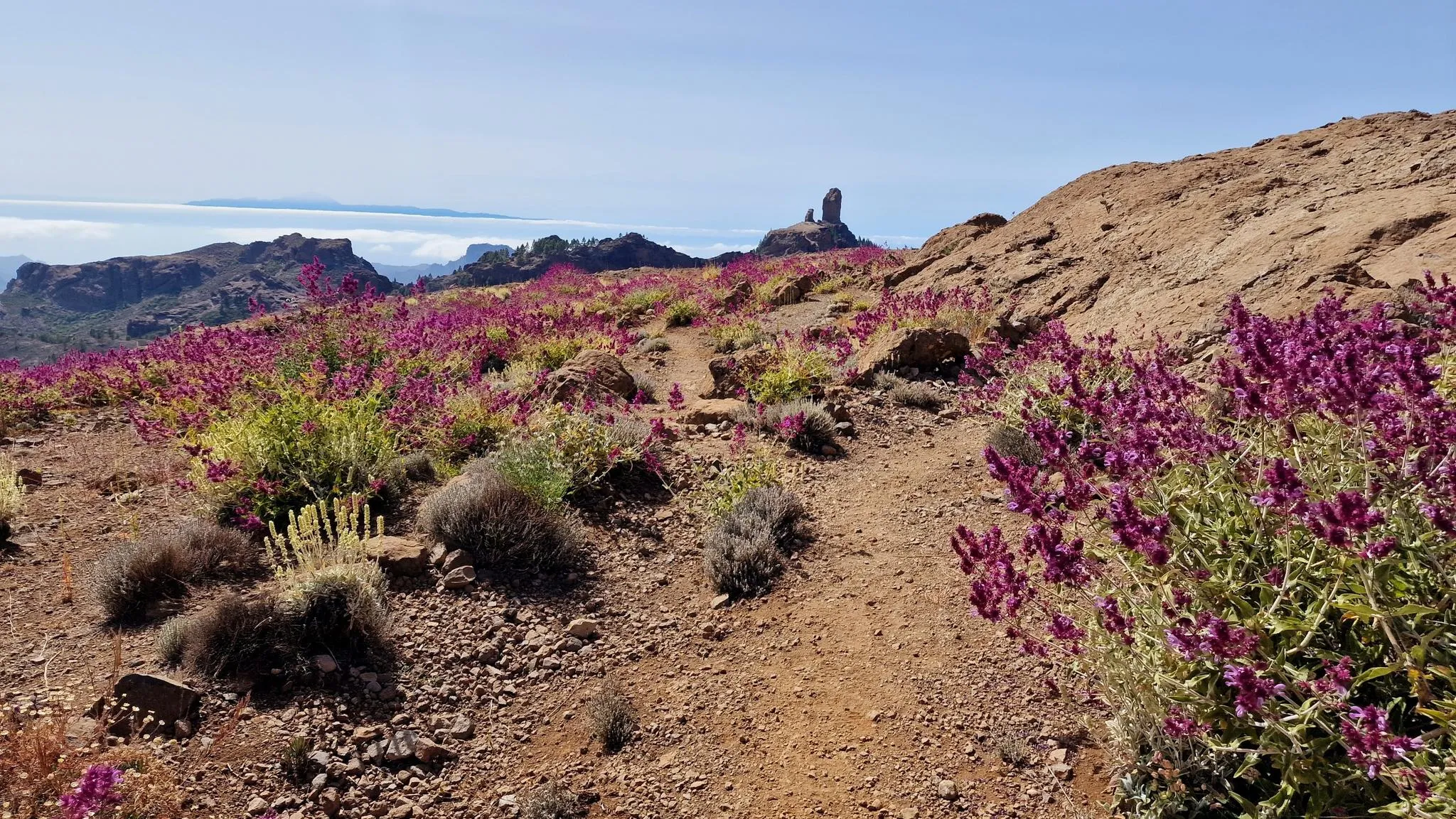
The landscape is truly impressive!
0
0
It actually looks like the path doesn't continue. With the clouds, it looks very mystical.
0
0
Frequently Asked Questions
How many bus station hiking trails are available in Tamadaba?
Tamadaba offers over 200 hiking routes accessible by bus, catering to various skill levels. You'll find 53 easy, 110 moderate, and 48 difficult trails to explore.
What kind of terrain and natural features can I expect on bus-accessible hikes in Tamadaba?
The trails in Tamadaba showcase dramatic and diverse landscapes. You'll hike through ancient Canary pine forests, experience rugged terrain with steep slopes and deep ravines, and encounter impressive cliffs that plunge to the sea. At higher elevations, you might even witness the 'sea of clouds' phenomenon, which supports a rich undergrowth of heather and ferns.
Are there any easy bus-accessible hikes suitable for beginners in Tamadaba?
Yes, there are several easy routes. For a pleasant, shorter walk, consider the Paseo de los Poetas – Puerto de las Nieves Harbor loop from Agaete, which is just over 4 km long and features minimal elevation gain.
Can I find circular hiking routes starting from bus stations in Tamadaba?
Many routes in Tamadaba are designed as loops, making them convenient for public transport users. An example of a moderate circular route is the Playa de El Puerto – View over Puerto de la Aldea loop from Sitio Etnológico Charco de la Aldea, offering diverse scenery.
What are some notable landmarks or viewpoints I can reach on bus-accessible trails?
Tamadaba is rich in stunning viewpoints and natural landmarks. You can hike to areas offering views of the impressive Risco Faneque Summit, or explore trails leading to the beautiful Blue Pool. The Tamadaba Peak itself offers expansive vistas.
Are there any trails that lead to coastal areas or beaches from a bus stop?
Absolutely. Some routes descend towards the coast, offering a contrast to the mountain landscapes. A challenging option is the Tamadaba Coastal Mountains – Playa del Barranco de Guayedra loop from Agaete, which takes you towards the wild pebble and volcanic sand beaches like Playa del Barranco de Guayedra.
What is the best time of year to hike in Tamadaba, especially when relying on public transport?
Tamadaba offers good hiking conditions year-round, but spring and autumn are particularly pleasant with milder temperatures. During these seasons, the 'sea of clouds' phenomenon is also more common, creating a unique atmosphere in the pine forests. Always check local bus schedules as they may vary seasonally.
Are there any trails featuring waterfalls or unique water features accessible by bus?
Yes, you can find routes that highlight water features. The Charco Azul Waterfall – Blue Pool loop from Parque Natural de Tamadaba is a difficult trail that leads to the scenic Blue Pool, a popular natural monument.
What do other hikers enjoy most about bus-accessible trails in Tamadaba?
The area is highly rated by the komoot community, with an average score of 4.3 stars. Reviewers often praise the pristine nature, the dramatic coastal views, the unique Canary pine forests, and the sense of tranquility found on these trails, many of which are easily reached by public transport.
Are there any longer or more challenging bus-accessible hikes for experienced hikers?
For experienced hikers seeking a challenge, routes like the Refugio El Hornillo – Los Pérez Dam loop from Los Berrazales offer significant elevation gain and distance, taking you deep into the rugged landscapes of Tamadaba.
What should I consider regarding weather when planning a bus-accessible hike in Tamadaba?
Due to Tamadaba's varied elevations, weather can change quickly. Coastal areas might be warm, while higher elevations in the pine forest can be cooler and experience the 'sea of clouds' (horizontal rain). Always pack layers and check the forecast for both your starting point and higher sections of your chosen trail.
Most popular routes in Tamadaba
Most popular attractions in Tamadaba

Get inspired with the komoot mobile app


Explore more
Browse the best Hikes in other regions.
