The best hikes from bus stations around National Park Redes
4.6
(340)
3,254
hikers
14
hikes
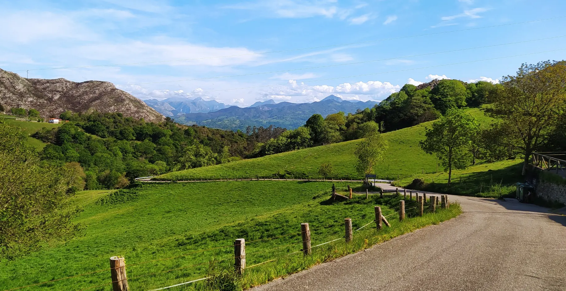
Bus station hiking trails around National Park Redes explore a landscape defined by the rugged Cantabrian mountain range in Asturias, northern Spain. The park features a karstic topography with limestone bedrock, creating deep valleys, gorges, and impressive rock formations. Extensive forests of beech, oak, and chestnut trees cover much of the terrain, while numerous rivers, streams, and waterfalls, including the Nalón River, flow through the mountainous region.
Best bus station hiking trails around National Park Redes
- The most popular bus…
Last updated: July 12, 2026
4.8
(5)
52
hikers
21.5km
06:42
810m
810m
Hard hike. Very good fitness required. Easily-accessible paths. Suitable for all skill levels.
4.8
(11)
113
hikers
8.01km
02:42
380m
380m
Moderate hike. Good fitness required. Mostly accessible paths. Sure-footedness required.

Sign up for free
4.7
(6)
36
hikers
13.8km
05:09
850m
850m
Hard hike. Very good fitness required. Mostly accessible paths. Sure-footedness required.
5.0
(1)
7
hikers
9.77km
02:47
190m
190m
Moderate hike. Good fitness required. Mostly accessible paths. Sure-footedness required.
5.0
(2)
2
hikers
25.4km
10:38
1,540m
1,540m
Hard hike. Very good fitness required. Sure-footedness, sturdy shoes and alpine experience required.
Get access to more routes and recommendations from other explorers.
Sign up for free
Already have an account?
Our route recommendations are based on thousands of hikes, rides, and runs completed by other people on komoot.
Start today with a free account
Your next adventure awaits.
Login or Signup
Popular around National Park Redes
Other adventures around National Park Redes

Tips from the Community

La Felechosa is a town steeped in mining and livestock traditions in the municipality of Aller. It is located at the gateway to the beautiful Asturian mountains, especially the Fuentes de Invierno ski resort. Its well-preserved historic center offers a varied culinary offering.
0
0

It's a beautiful place and a dreamlike landscape. What a shame the shelter isn't working. These politicians we have don't do a single thing right.
0
0

The tunnel was carved by hand through which in the past the animals had to be unloaded so that they could pass through. Now, it is somewhat wider and allows tractors etc. to pass. Without a doubt, it is the most spectacular area of the route, with impressive vertical precipices.
2
0
The viewpoint is in the heart of the Redes Natural Park. From Bezanes there is a path that leads to the braña de Brañagallones and that will allow you to approach this natural balcony, with one of the best views of the park. The masses of La Rapaona and Peña del Viento stand out.
2
0

The initial part of the route, starting from Bezanes, is the hardest part, hold out until the Crestón tunnel and the climb is yours.
0
0


To go up to the Vega there is a public service, with which we avoid walking up the 11km from the nearest town: Bezanes. In la Vega there is a shelter where you can sleep and eat. From here you can make several very beautiful hiking trails.
0
0
Frequently Asked Questions
How many bus-accessible hiking trails are available in National Park Redes?
There are 8 curated hiking routes in National Park Redes that are easily accessible from bus stations, offering a range of experiences from moderate to difficult. These trails allow you to explore the park's diverse landscapes without needing a car.
Are there any moderate bus-accessible hikes suitable for beginners or families in National Park Redes?
Yes, several moderate routes are accessible by bus. For a pleasant outing, consider the Marmartín River – Fuente Las Gavilanceras loop from Felechosa, which is about 8 km long. Another good option is the La Felechosa – Felechosa Short Route loop from Felechosa, covering nearly 10 km through varied terrain.
What kind of natural attractions can I expect to see along the bus-accessible trails?
The trails often lead through the park's stunning karstic landscapes, dense beech and oak forests, and along rivers. You might encounter impressive viewpoints like Texu la Oración Viewpoint, or pass through unique features such as the Crestón Tunnel. The park is also known for its numerous waterfalls and pristine streams.
Are there any circular hiking routes that start and end at a bus station?
Yes, many of the bus-accessible routes are circular, allowing for convenient exploration. Examples include the challenging Texu la Oración Viewpoint – Crestón Tunnel loop from Bezanes, or the moderate Marmartín River – Fuente Las Gavilanceras loop from Felechosa, both designed as loops from their starting points.
What is the best time of year to hike in National Park Redes using public transport?
National Park Redes is beautiful year-round, but autumn is particularly spectacular when the deciduous forests (beech, oak, chestnut) display vibrant colors. Spring offers lush greenery and flowing waterfalls. Summer is ideal for higher altitude routes, while winter can provide unique snowy landscapes, though some trails might be more challenging due to conditions.
Can I spot wildlife on these bus-accessible trails?
Redes Natural Park is a UNESCO Biosphere Reserve and home to significant wildlife. While sightings are never guaranteed, hikers might spot deer, wild boar, chamois, or various bird species. The park is also a habitat for the Cantabrian brown bear and Iberian wolf, though these are much rarer to encounter.
Are there any specific trails known for waterfalls that are reachable by bus?
While not directly listed in the bus-accessible routes, the region is famous for its waterfalls. The iconic Tabayón del Mongayu Waterfall is a prominent natural feature in the park, and there are trails leading to it, often starting from villages like Tarna. You would need to check local bus schedules to Tarna for access.
What do other hikers say about the bus-accessible trails in National Park Redes?
The komoot community highly rates the hiking experiences in National Park Redes, with an average score of 4.7 out of 5 stars. Reviewers often praise the stunning natural beauty, the tranquility of the forests, and the well-maintained paths that make exploring the region by bus a rewarding experience.
Are there any challenging bus-accessible routes for experienced hikers?
Absolutely. For experienced hikers seeking a challenge, routes like the Texu la Oración Viewpoint – Crestón Tunnel loop from Bezanes, spanning over 21 km with significant elevation gain, offer a demanding and rewarding experience. Other difficult options include the Felechosa Short Route – Marmartín River loop from Felechosa and the Marmartín River loop from Felechosa.
Can I find places to eat or rest near the bus-accessible trailheads?
Many of the bus-accessible trails start from or pass through small villages within the park, such as Felechosa or Bezanes. These villages often have local establishments where you can find refreshments or a meal before or after your hike. Additionally, the Brañagallones Refuge is located along one of the longer routes, offering a potential stop for rest or lodging.
What are the typical durations for bus-accessible hikes in National Park Redes?
The durations vary significantly depending on the route's difficulty and length. Moderate trails, such as the 8 km Marmartín River – Fuente Las Gavilanceras loop, can take around 2.5 to 3 hours. More difficult and longer routes, like the 21.5 km Texu la Oración Viewpoint – Crestón Tunnel loop, can easily require 6 to 7 hours or more to complete.
Most popular routes around National Park Redes
Most popular attractions around National Park Redes

Get inspired with the komoot mobile app


Explore more
Browse the best Hikes in other regions.
