The best hikes from bus stations in Espedalen Landskapsvernområde
4.7
(87)
425
hikers
12
hikes
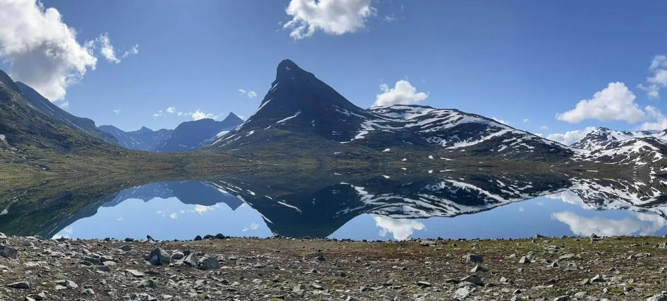
Hiking in Espedalen Landskapsvernområde offers a diverse and accessible mountain landscape, characterized by high mountains, forests, wetlands, and traditional mountain farm areas. The terrain includes both gentle paths and more challenging ascents, with Ruten, at 1,517 meters, being a prominent peak. The region's geology features unique rock types, and its varied ecosystems support rich flora and fauna.
Best bus station hiking trails in Espedalen Landskapsvernområde
- The most popular bus station hiking route is Dalseter to Bingsbu Trail, an easy 2.9 miles (4.7 km) trail that takes 1 hour 29 minutes to complete. This path offers a straightforward experience through the landscape.
- Another top favourite among local hikers is Ruten (1,516 meters) – Bingsbu loop from Ruten Fjellstue, a moderate 8.9 miles (14.35 km) path. This route provides a substantial mountain experience with significant elevation gain.
- Local hikers also love the Espedalfossen Waterfall – Elgtårnet (Moose Tower) loop from Dalseter, a 4.7 miles (7.59 km) trail leading through varied terrain including a waterfall and a wildlife observation tower, often completed in about 2 hours 16 minutes.
- Hiking in Espedalen Landskapsvernområde is defined by accessible mountain landscapes, forests, and wetlands, with trails connecting to the DNT system. The network offers options for different ability levels, from easy strolls to moderate mountain ascents.
- The routes in Espedalen Landskapsvernområde are highly rated by the komoot community with an average score of 4.7 stars from over 80 reviews. More than 400 hikers have used komoot to explore Espedalen Landskapsvernområde's varied terrain.
Last updated: July 8, 2026
4
hikers
4.71km
01:29
300m
Hike the easy 2.9-mile Dalseter to Bingsbu trail, gaining 982 feet with forest paths, mountain views, and a warming hut.
4.8
(6)
37
hikers
14.4km
04:49
690m
690m
Moderate hike. Good fitness required. Easily-accessible paths. Suitable for all skill levels.

Sign up for free
4.5
(4)
19
hikers
7.59km
02:16
230m
230m
Moderate hike. Good fitness required. Easily-accessible paths. Suitable for all skill levels.
5.0
(3)
29
hikers
11.1km
03:53
620m
620m
Moderate hike. Good fitness required. Easily-accessible paths. Suitable for all skill levels.
5.0
(1)
15
hikers
13.1km
04:27
670m
670m
Moderate hike. Good fitness required. Easily-accessible paths. Suitable for all skill levels.
Get access to more routes and recommendations from other explorers.
Sign up for free
Already have an account?
Our route recommendations are based on thousands of hikes, rides, and runs completed by other people on komoot.
Start today with a free account
Your next adventure awaits.
Login or Signup
Popular around Espedalen Landskapsvernområde
Other adventures in Espedalen Landskapsvernområde

Tips from the Community

Bingsbu is a lovely mountain hut located next to the lake Bingstjønna. There is no more peaceful environment in which to relax.
0
0
This panorama is superb. Right next to Måsåtjønna, you can see the lake, but also another larger lake, Breisjøen, as well as the surrounding mountains.
0
0
The Rythaugen forest is charming. Its sparse vegetation allows you to admire the trees while enjoying the sunshine. There is no better place for a relaxing walk.
0
0


Ruten Fjellstue is a Mjølkevegen partner accommodation at the northern end of the route.
0
0


Frequently Asked Questions
How many bus station hiking trails are available in Espedalen Landskapsvernområde?
There are 12 hiking routes accessible from bus stations in Espedalen Landskapsvernområde. These include 2 easy trails and 10 moderate options, offering a variety of experiences for different skill levels.
What is the best time of year to hike in Espedalen Landskapsvernområde?
The best time to hike in Espedalen Landskapsvernområde is typically from late spring through early autumn. May offers the blooming pasque flower, while summer and early autumn provide lush landscapes and berries. The region's 'gentle and accessible mountain landscape' makes it enjoyable across these seasons, with clear days offering panoramic views from peaks like Ruten.
What do other hikers enjoy most about the bus-accessible trails here?
The komoot community highly rates the trails in Espedalen Landskapsvernområde, with an average score of 4.7 stars from 86 ratings. Hikers often praise the diverse and accessible mountain landscapes, the rich natural features, and the stunning panoramic views from higher elevations, especially towards Jotunheimen and Rondane.
Are there easy hikes accessible from bus stops in Espedalen?
Yes, there are easy hiking options available. For instance, the Dalseter to Bingsbu Trail is an easy route, perfect for a less strenuous experience. These trails often follow old cart roads or well-trodden paths.
Can I find circular hiking routes from bus stations in Espedalen?
Yes, several circular routes are accessible. An example is the Ruten (1,516 meters) – Bingsbu loop from Ruten Fjellstue, which offers a moderate challenge and brings you back to your starting point. Another option is the Espedalfossen Waterfall – Elgtårnet (Moose Tower) loop from Dalseter.
Are there any trails with waterfalls or unique natural features?
Absolutely. The Espedalfossen Waterfall – Elgtårnet (Moose Tower) loop from Dalseter will take you past Espedalfossen. Additionally, while not directly on a bus-accessible route in this guide, the nearby Helvete Nature Park is home to Northern Europe's largest potholes, a unique geological wonder formed by glacial meltwater.
Are the bus station trails in Espedalen Landskapsvernområde suitable for families?
Many trails in Espedalen Landskapsvernområde are suitable for families, especially those seeking a 'gentle and accessible mountain landscape.' The Ruten massif, for example, is a popular peak hike suitable for both adults and children. Look for the easy and moderate graded routes for family-friendly options.
Are dogs allowed on the hiking trails accessible by bus?
Generally, dogs are welcome on hiking trails in Espedalen Landskapsvernområde. However, it is always important to keep them on a leash, especially during nesting seasons for birds and when near grazing livestock, to protect wildlife and ensure a pleasant experience for everyone.
What kind of terrain can I expect on these bus-accessible hikes?
The terrain in Espedalen Landskapsvernområde is varied, ranging from gentle paths along old cart roads to more rugged mountain trails. You can expect a mix of forests, wetlands, and open mountain landscapes (seterlandskap), with some paths leading through thick heather and moss-covered rocks, particularly on ascents to peaks like Ruten.
Are there any warming huts along the trails?
Yes, Espedalen Landskapsvernområde offers several warming huts that are open year-round and free for visitors. These include Hulderbu, Bingsbu, and Tonebu, providing convenient rest stops during longer excursions. The Dalseter to Bingsbu Trail, for instance, leads to one such hut.
What are some good viewpoints on these trails?
The summit of Ruten (1517m or 1571m) offers breathtaking panoramic views stretching towards the national parks of Jotunheimen and Rondane on clear days. Routes like the View from the Summit of Ruten – Ruten (1,516 meters) loop from Dalseter are specifically designed to showcase these vistas.
Can I see wildlife on these hikes?
Espedalen Landskapsvernområde supports diverse fauna. Hikers have opportunities to spot elk, foxes, martens, rabbits, wood grouse, falcons, and white grouse. The Elgtårnet (Moose Observation Tower), which can be part of a loop hike like the Espedalfossen Waterfall – Elgtårnet (Moose Tower) loop from Dalseter, is a distinctive attraction for observing local wildlife.
Most popular routes in Espedalen Landskapsvernområde

Get inspired with the komoot mobile app


Explore more
Browse the best Hikes in other regions.
