The best road cycling routes around Mount Vernon
5.0
(2)
149
riders
12
rides
Road cycling around Mount Vernon, Ohio, offers routes primarily characterized by the scenic Kokosing Gap Trail, a paved rail-trail. The region features a landscape of river valleys, agricultural fields, and wooded sections, providing a mix of open views and shaded paths. While generally flat, some routes incorporate gentle rolling hills, with elevations typically under 200 meters. These routes often follow the Kokosing River, connecting small towns and rural areas.
Best road cycling routes around Mount Vernon
- The most popular road cycling route is Kokosing Gap Trailhead – Bridge of Dreams loop from Mount Vernon, a 46.5 miles (74.8 km) trail that takes 3 hours 23 minutes to complete. This route features a moderate difficulty and includes a significant climb of 1274 feet (388 meters).
- Another top favourite among local road cyclists is Mount Vernon, Ohio loop from Marshall Meadow, a moderate 29.1 miles (46.9 km) path. This route offers varied terrain with 638 feet (194 meters) of ascent, winding through the local landscape.
- Local road cyclists also love the Kokosing Gap Trailhead loop from Mount Vernon, a 18.1 miles (29.2 km) trail leading through river valleys and rural scenery, often completed in about 1 hour 19 minutes.
- Road cycling around Mount Vernon is defined by river valleys, agricultural land, and wooded sections. The network offers options for different ability levels, from easy, mostly flat paths to moderate routes with rolling hills.
- The guide includes highly-rated routes that showcase the best of the region's landscape. More than 150 road cyclists have used komoot to explore Mount Vernon's varied terrain.
Last updated: July 12, 2026
36
riders
74.8km
03:23
390m
390m
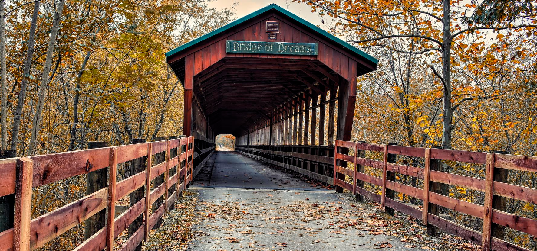
The Kokosing Gap Trailhead – Bridge of Dreams loop offers a delightful road cycling adventure through Ohio's scenic countryside. You'll pedal past charming family farms, through peaceful wooded areas, and alongside the meandering Kokosing River, often catching glimpses of local wildlife like deer and wild turkeys. The route's crown jewel is the iconic Bridge of Dreams, a historic covered bridge that provides a picturesque crossing over the Mohican River, making for a truly memorable experience.
This moderate 46.5-mile (74.8 km) loop, with its 1274 feet (388 metres) of elevation gain, typically takes about 3 hours and 23 minutes to complete. Starting from Mount Vernon, you'll find convenient parking and amenities at the trailhead. While the Kokosing Gap Trail section is mostly smooth asphalt, be aware that some parts of the Mohican Valley Trail may feature chip and seal or even rolling gravel, so plan your tire choice accordingly.
This route is a fantastic way to explore the rich railroad history of the region, with restored bridges and an old locomotive visible along the way. It seamlessly connects the Kokosing Gap Trail and the Mohican Valley Trail, both integral parts of the larger Ohio to Erie Trail system. The diverse scenery, from river valleys to agricultural fields, makes it one of the most popular cycling trails in Knox County, Ohio.
5.0
(1)
38
riders
75.7km
03:34
210m
210m
This road cycling route, named the "Start/End of Sandel Legacy Trail – Sunbury loop from Mount Vernon," offers a substantial ride through the Ohio countryside. While the name might suggest a direct connection to the Sandel Legacy Trail, the route primarily explores the roads around Sunbury and the broader Mount Vernon area, providing a diverse cycling experience. You'll encounter a mix of rural landscapes, passing through farmlands and small towns, with the potential to link up with segments of the paved Sandel Legacy Trail. It's a moderate 47.1-mile (75.7 km) journey with 676 feet (206 metres) of elevation gain, typically taking around 3 hours and 33 minutes to complete, making it ideal for cyclists seeking a longer, varied ride. Expect a blend of flat trail sections and rolling road terrain.
To tackle this extensive loop, plan to start your ride early, especially if you're cycling during the warmer seasons, to make the most of cooler temperatures and lighter traffic. While the Sandel Legacy Trail has a known trailhead in Sunbury, this longer route will involve navigating local roads, so a reliable GPS device is recommended. Ensure you carry ample water and nutrition, as services might be spread out along the rural stretches. Spring and fall offer the most pleasant conditions for this ride, with comfortable temperatures and scenic views.
This route provides a unique opportunity to explore the region's cycling potential, connecting you to parts of the ambitious Ohio to Erie Trail project via the Sandel Legacy Trail. Beyond the cycling, you might find local points of interest, such as the model railroad club near the Sunbury trailhead, offering a glimpse into local history and community. The route serves as a good test of endurance and navigation for road cyclists looking to discover the less-traveled paths and rural charm of the Mount Vernon area.

Sign up for free
13
riders
24.6km
01:40
160m
160m
Easy road ride. Great for any fitness level. Mostly well-paved surfaces and easy to ride.
5
riders
52.2km
02:44
330m
330m
The Kokosing Gap Trailhead loop from Mount Vernon offers a delightful road cycling experience, guiding you through a tapestry of Ohio's rural beauty. You'll glide along smooth asphalt, passing through serene wooded areas, expansive farmlands, and wetlands, with the Kokosing River often in view. Keep an eye out for wildlife like deer and wild turkeys, and enjoy the impressive railroad bridges that span the river, providing excellent viewpoints of the natural surroundings.
This moderate 32.4-mile (52.2 km) loop, with its 1092 feet (333 metres) of elevation gain, is typically a 2-hour and 44-minute ride, making it accessible for many cyclists. Trailheads in towns like Mount Vernon, Gambier, and Danville offer convenient parking, restrooms, and even bike repair stations. While mostly flat, some gradual inclines add a gentle challenge, and it's worth noting that a one-mile connecting section is currently under construction.
Beyond the scenic ride, the Kokosing Gap Trail is steeped in railroad history, evidenced by a restored 1940 Alco locomotive and a 1924 Chesapeake & Ohio caboose in Gambier. It's also a central part of the larger Ohio to Erie Trail, allowing for extended adventures, and is notably maintained entirely by volunteers. The trail's diverse landscape, from cornfields to the Kenyon College campus, ensures a rich and engaging journey.
11
riders
19.7km
01:14
150m
150m
This easy road cycling loop from College Township offers a delightful spin through the picturesque State College and College Township area. You'll pedal past rolling pastures and enjoy views of vast state forests, with well-paved surfaces making for a smooth and enjoyable ride. It's a great option for a quick workout or a leisurely tour, allowing you to soak in the charming local scenery.
To plan your visit, note that College Township is recognized as a Bicycle Friendly Community, indicating good cycling infrastructure. While specific parking for this loop isn't detailed, you can typically begin your ride from various points within the township. The region's extensive network of trails and bike lanes makes it easy to access and navigate, especially during the pleasant cycling seasons of spring, summer, and fall.
Centre County, which includes College Township, holds a Bronze Level Bicycle Friendly Community designation, highlighting its dedication to cycling amenities. The area is actively enhancing its infrastructure, including a new shared-use path along East College Avenue, which will further connect cyclists to Penn State campus and State College Borough, making the region increasingly accessible and enjoyable for riders.
Get access to more routes and recommendations from other explorers.
Sign up for free
Already have an account?
Our route recommendations are based on thousands of hikes, rides, and runs completed by other people on komoot.
Start today with a free account
Your next adventure awaits.
Login or Signup


Other adventures around Mount Vernon

Tips from the Community

This small display has a short write up and a few pictures going over the history and importance of Baddow Pass.
0
0
Mount Vernon, named after George Washington's famous estate, is a charming small town full of historic buildings. The Woodward Opera House is perhaps the most famous of all, as it is the oldest such Opera House in the USA. Along with the beautiful buildings and parks you'll find plenty of restaurants, shops, and accommodations that invite you to stay a while.
0
0
Take a moment at the trailhead to top up your water and have a look at the historic locomotives.
0
0
The historic stone arch was built in 1874 as a bridge over the old Cleveland, Mt. Vernon, and Delaware Railroad line. If you look closely you can see the signatures left by the masons who shaped the stones and built the bridge.
1
0
This 370-foot covered bridge began as a railroad bridge in the 1920s. It wasn't covered until 1998, at which point it became the second longest covered bridge in Ohio, and the third longest in the USA.
1
0

Sunbury is a charming place to pass by. The town features a historic town square, local dining options, and places to rest. It’s a great spot to refuel and explore during your ride.
0
0

The Heart of Ohio Trail crosses US 36 about 2 miles northeast of Centerburg, where a monument marks the highest point on the trail at 1,285 feet—also the highest point along the entire Ohio to Erie Trail. The monument, shaped as an obelisk that marks this point, is about 5 feet high. This 15.7-mile trail starts in Mount Vernon and heads southwest through Mount Liberty and Centerburg, ending at Huffman Road. For much of its route, the trail runs parallel to US-36 between Mount Vernon and Sunbury.
0
0

Frequently Asked Questions
What kind of terrain can I expect on road cycling routes around Mount Vernon, Ohio?
Road cycling routes around Mount Vernon, Ohio, are primarily characterized by the scenic Kokosing Gap Trail, a paved rail-trail. You can expect a landscape of river valleys, agricultural fields, and wooded sections, offering a mix of open views and shaded paths. While generally flat, some routes incorporate gentle rolling hills, with elevations typically under 200 meters.
How many road cycling routes are available in the Mount Vernon, Ohio area?
There are 7 road cycling routes detailed in this guide for the Mount Vernon, Ohio area. These routes cater to various skill levels, with 3 easy routes and 4 moderate routes.
Are there any challenging road cycling routes in Mount Vernon, Ohio?
While the region is generally known for its accessible, mostly flat rail-trails, some routes offer more significant climbs. For instance, the Kokosing Gap Trailhead – Bridge of Dreams loop from Mount Vernon is a moderate 46.5-mile route that includes a notable ascent of 1274 feet (388 meters), providing a good challenge.
What are some scenic highlights or natural features along the road cycling routes?
The routes often follow the Kokosing River, providing picturesque river valley views. You'll also cycle through agricultural fields and wooded sections, especially along the Kokosing Gap Trail. The Kokosing Gap Trailhead loop from Mount Vernon, for example, leads through these varied river valleys and rural scenery.
Are there any family-friendly road cycling options in Mount Vernon, Ohio?
Yes, the paved Kokosing Gap Trail forms the backbone of many routes, making it suitable for families. Several routes are classified as easy, such as the Kokosing Gap Trailhead – Mount Vernon, Ohio loop from Mount Vernon, which is 15.3 miles long with minimal elevation gain, perfect for a leisurely family ride.
What is the best time of year for road cycling in Mount Vernon, Ohio?
Spring, summer, and fall generally offer the most pleasant conditions for road cycling in Mount Vernon, Ohio. Spring brings blooming landscapes, summer offers warm weather, and fall showcases beautiful foliage. Always check local weather forecasts before heading out, as conditions can vary.
Where can I find parking for the road cycling routes in Mount Vernon, Ohio?
Many routes start from trailheads along the Kokosing Gap Trail, which typically offer designated parking areas. For routes like the Kokosing Gap Trailhead – Bridge of Dreams loop from Mount Vernon, you can usually find parking conveniently located at the Kokosing Gap Trailhead itself.
Are there any loop routes for road cycling in Mount Vernon, Ohio?
Yes, several routes are designed as loops, allowing you to start and end at the same point. Examples include the Kokosing Gap Trailhead – Bridge of Dreams loop from Mount Vernon and the Kokosing Gap Trailhead loop from Mount Vernon, which are popular choices for their convenience.
What do other road cyclists enjoy most about cycling in Mount Vernon, Ohio?
The komoot community frequently praises the accessibility and scenic beauty of the Kokosing Gap Trail. Cyclists often highlight the peaceful river valleys, agricultural landscapes, and the well-maintained paved surfaces that make for enjoyable rides. The variety of routes, from easy to moderate, also makes it appealing to a wide range of riders.
Can I find cafes or places to stop for refreshments along the routes?
The routes often connect small towns and rural areas along the Kokosing Gap Trail. While specific establishments are not detailed in the route descriptions, these towns typically offer opportunities for refreshments. Planning your route in advance and checking for amenities in towns like Mount Vernon or those along the trail is recommended.
Are there any beginner-friendly road cycling routes in Mount Vernon, Ohio?
Absolutely. The region offers several easy routes, largely due to the flat nature of the Kokosing Gap Trail. The Kokosing Gap Trailhead – Mount Vernon, Ohio loop from Mount Vernon is an excellent choice for beginners, covering 15.3 miles with minimal elevation, providing a comfortable introduction to road cycling in the area.
Most popular routes around Mount Vernon

Get inspired with the komoot mobile app


Explore more
Browse the best Road cycling routes in other regions.
