Top 6 Natural Monuments in Putre
Natural monuments in Putre provide access to the high-altitude Chilean Altiplano, a region characterized by diverse landscapes. This area features volcanoes, lakes, and unique geological formations, serving as a gateway to significant natural attractions. The elevation ranges from 3,200m to over 6,000m, supporting a variety of wildlife. These sites offer opportunities to experience the Andean ecosystem.
Best natural monuments in Putre
- The most popular natural monuments is Cerro Acotango, a summit that is a 6052m peak on the border…
Last updated: July 15, 2026
Cerro Acotango
Highlight • Summit
Translated by Google •
Tip by

Parinacota Volcano
Highlight • Volcano
Translated by Google •
Tip by
Sign up now to discover places like this
Get recommendations on the best single tracks, peaks, & plenty of other exciting outdoor places.
Sign up for free
Tapaaca Pass
Highlight • Mountain Pass
Translated by Google •
Tip by

Laguna Chungará
Highlight • Lake
Translated by Google •
Tip by

Penitentes Ice Formations on Acotango Glacier
Highlight • Natural Monument
Translated by Google •
Tip by
Lago Chungará and View of Volcán Parinacota
Highlight • Lake
Tip by

Start today with a free account
Your next adventure awaits.
Login or Signup
Popular around Putre
Tips from the Community

Hello Life in Travel :) I am travelling with my friend next week to north of Chile and will be passing close by...we will stay on a main road basically from Arica to bolivian border. I was wondering if you could share where exactly are those colourful sand dunes located on picture 1?
0
0

On the northeastern corner of Lauca National Park sits Lago Chungará. It offers fantastic views of the dormant stratovolcano, Parinacota (6,380 MASL / 20,930 ft above sea level). It is frequented by Chilean flamingos.
0
0

Parinacota is a stratovolcano with a height of 6,348 m on the border between Chile and Bolivia in the Atacama Desert area. It is located in the Lauca National Park, 145 kilometers east of Arica in the Cordillera Occidental of the central Andes. Together with the neighboring Pomerape volcano, which lies northeast of it, it forms the Payachata complex. At its feet lies Lake Chungará. His current activity is limited to fumarole activity. More general information can be found on Wikipedia. The normal route from the Bolivian side starts between the two volcanoes Parinacota and Pomerape and can only be reached with off-road vehicles. The climb goes quite directly towards the summit, although the path is usually not visible because it is covered by snow or snow. However, that's not a problem, you just go straight up until you reach the highest point. You won't be confronted with any major technical difficulties, but the climb will take longer due to the high altitude and the quite a few meters in altitude that have to be covered. Acclimatization in advance is definitely recommended. Breaking into the frozen snow cover on the surface also doesn't make the climb any easier. However, the gigantic view of the enormous crater, of the Parinacota and the Sajama, as well as the Altiplano, Acotango and much more, rewards all the effort.
2
0
At this point the Glaciar del Acotango forms a so-called penitential ice, which, however, does not have to be crossed during the ascent. The icy peaks here are sometimes up to 2 m high. Looks very impressive
1
0
At 6052, the Acotango is a fairly easy 6000m on the border of Chile and Bolivia. The normal route leads from the Bolivian side through the huge crater of the extinct volcano and offers hardly any technical difficulties, but the altitude should not be underestimated. The view of the southern Altiplano and the neighboring mountains of the Cordillera Occidental such as the Sajama, Parinacota and Pomerape, as well as Gullatiri and much more on the Chilean side are very impressive.
1
0

We did the Cerro Acotango from the Bolivian side. A great tour, both alone and above all for acclimatization for another 6000m peaks in Sajama National Park. Sajama can take you to the trailhead. At this time of year (end of April) crampons are essential.
0
1

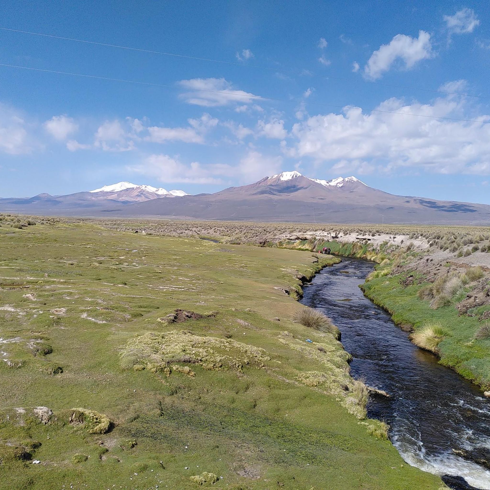
Pass at an altitude of 4800 m, at the foot of the Tapaaca volcano
1
0

The Chungará lagoon is the environmental jewel of the Lauca National Park, a mirror of the great summits of six thousand meters of altitude in this sector of the Andes of Chile and Bolivia. The road passes along the shore of the lagoon and could take your eyes off the white pyramids of Parinacota, Sajama, Acotango and the rest of the peaks that mark the Andean border of the two countries.
0
0
Frequently Asked Questions
What are the most prominent natural monuments to visit near Putre?
The region around Putre is home to several significant natural monuments. You can explore the majestic Parinacota Volcano, which forms part of the Payachata complex, or witness the stunning high-altitude lake, Lago Chungará and View of Volcán Parinacota, known for its views and flamingos. Another notable site is the Cerro Acotango, a 6052m peak on the border of Chile and Bolivia.
What kind of wildlife can I expect to see at the natural monuments in Putre?
The natural monuments in the Putre region, particularly within Lauca National Park and the Salar de Surire, are rich in biodiversity. You might spot pumas, Andean foxes, guanacos, vizcachas, and vicuñas. Birdwatchers will be delighted by over 130 species, including flamingos (Andean, James's, and Chilean), especially around Lago Chungará and View of Volcán Parinacota and the Salar de Surire.
Are there any family-friendly activities or natural monuments suitable for all ages near Putre?
While many sites involve high altitudes, some areas offer more accessible experiences. The scenic beauty of Lago Chungará and View of Volcán Parinacota provides fantastic views and birdwatching opportunities that can be enjoyed by families. The Lagunas de Cotacotani also offer opportunities for observing Andean flora and fauna, which can be a gentle activity.
What are the best times to visit the natural monuments in Putre?
The best time to visit the natural monuments in Putre is generally during the dry season, which typically runs from April to November. During these months, the weather is usually clearer, offering better visibility for the stunning landscapes and wildlife. However, be prepared for cold temperatures, especially at higher altitudes, and always check local weather forecasts.
What unique natural features can be found in the Putre area?
Putre is characterized by its high-altitude Andean ecosystem. You'll find unique features like the penitential ice formations on the Penitentes Ice Formations on Acotango Glacier, the vibrant hues of the 'colored' mountains like Cerro Milagro and Suriplaza, and the volcanic rock islets within the Lagunas de Cotacotani. The region also features thermal geysers like Geiser de Lupica.
Are there hiking trails near the natural monuments in Putre?
Yes, there are several hiking opportunities near the natural monuments in Putre. You can find trails ranging from easy to moderate difficulty. For example, there's an easy 'Piacota loop' and a moderate 'View of Parinacota loop' from Siki. For more options and detailed routes, you can explore the Hiking in Putre guide.
What should I pack when visiting the natural monuments in Putre?
Given the high altitudes and variable weather, it's essential to pack layers, including warm clothing, a windproof and waterproof jacket, and a hat and gloves. Sun protection (sunscreen, sunglasses) is crucial due to the strong UV radiation. Sturdy hiking boots are recommended, and crampons might be necessary for higher, snow-covered peaks like Cerro Acotango during certain times of the year. Don't forget plenty of water and snacks.
What is the elevation range of the natural monuments around Putre?
The natural monuments in the Putre region are situated at significant altitudes. The general elevation ranges from approximately 3,200 meters to over 6,000 meters above sea level. For instance, Cerro Acotango reaches 6052m, and Parinacota Volcano stands at 6,348m. Even the Tapaaca Pass is at 4800m.
Are there any natural monuments that are particularly challenging for experienced hikers?
Yes, several natural monuments offer challenging experiences for seasoned hikers and mountaineers. Ascending peaks like Cerro Acotango and Parinacota Volcano involves significant altitude and can be technically demanding, especially if snow and ice are present. The Penitentes Ice Formations on Acotango Glacier also indicate a challenging, high-altitude environment.
What is the Salar de Surire Natural Monument known for?
The Salar de Surire Natural Monument, located at 4,200 meters above sea level, is internationally recognized as a Wetland of International Importance. It is famous for its vast white salt flats, bright blue hot springs, and being a crucial nesting area for flamingos. It's one of the few places globally where you can observe three species of flamingos: the Andean, James's, and Chilean flamingos, coexisting.
Can I find viewpoints offering panoramic vistas of the natural monuments?
Absolutely. The region is renowned for its breathtaking panoramic views. Lago Chungará and View of Volcán Parinacota offers fantastic vistas of the dormant stratovolcano. The summit of Parinacota Volcano itself provides gigantic views of its crater, the surrounding Altiplano, and other peaks like Sajama and Acotango. The Tapaaca Pass also serves as a high-altitude viewpoint.
Are there any natural monuments with historical or cultural significance?
While the focus is primarily on natural beauty, the entire region of the Chilean Altiplano, including areas around Putre, has a rich cultural heritage tied to indigenous communities. The natural monuments themselves, with their unique geological formations and wildlife, have been significant to these cultures for centuries. Lauca National Park, for example, is a UNESCO Biosphere Reserve, acknowledging both its natural and cultural importance.
Most popular routes in Putre
Most popular attractions in Putre

Get inspired with the komoot mobile app


