Top 11 Natural Monuments around Saint-Blimont
Best natural monuments around Saint-Blimont are situated in a region known for its diverse natural habitats and coastal features. The area is characterized by its proximity to the Bay of the Somme, a significant natural wonder with extensive marshes, dunes, and reed beds. This geographic setting provides access to various natural attractions, including dramatic chalk cliffs and unique coastal ecosystems. The landscape offers opportunities to observe diverse wildlife and experience significant tidal movements.
Best natural monuments around Saint-Blimont
- The most…
Last updated: October 8, 2026
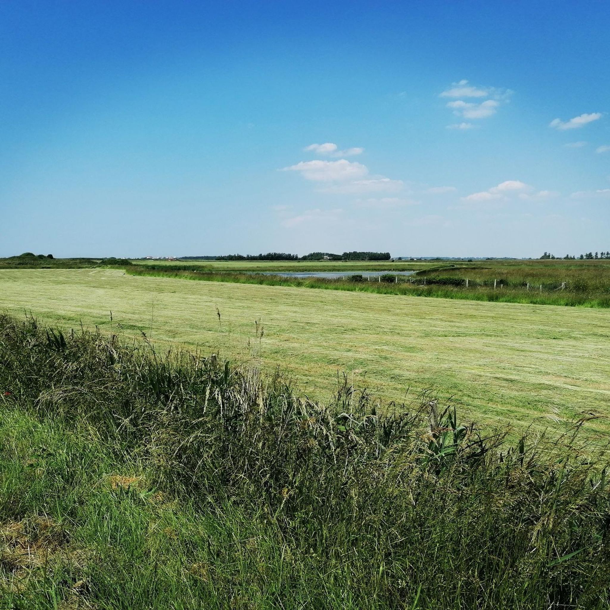
Ault Chalk Cliffs
Highlight • Natural Monument
Translated by Google •
Tip by

Cape Hornu
Highlight • Beach
The name Cap Hornu comes from the Picard word “hornu”, which means “horned” …
Tip by
Sign up now to discover places like this
Get recommendations on the best single tracks, peaks, & plenty of other exciting outdoor places.
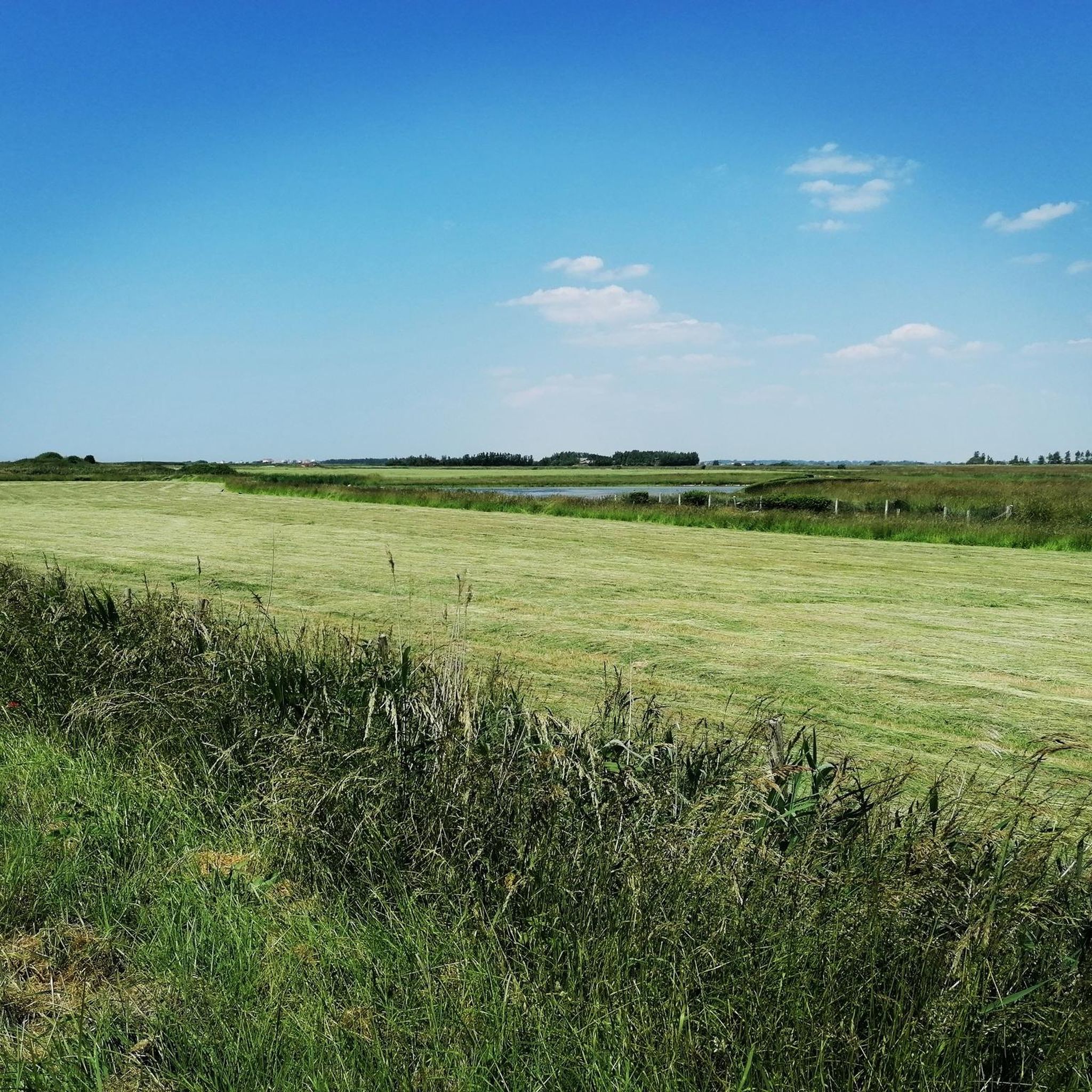
La Cise Cliff
Highlight • Natural Monument
Translated by Google •
Tip by

Cliffs of Ault
Highlight • Natural Monument
Even if the city has lost its splendor, the site is impressive, because to the north, the plain of …
Translated by Google •
Tip by

View of Onival Beach and the Ault Cliffs
Highlight • Viewpoint
Translated by Google •
Tip by

Sign up for free to discover even more natural monuments around Saint-Blimont.
Already have an account?
Start today with a free account
Your next adventure awaits.


Tips from the Community

The cliffs are made of chalk and are impressive to look at.
3
0
Here in Ault begin the chalk cliffs, which stretch all the way to Normandy and repeatedly appear as enormous cliffs.
4
0


The cliffs around the beach of Ault are composed of chalk from the Upper Cretaceous, more precisely from the Turonian and Coniacian (around 83 million years ago to 90 million years ago). They are strewn with flint nodules which highlight the subhorizontal stratification planes (the formation of flint has already been discussed in Discovery of the geology of the cliffs of Étretat, presentation of an excursion from the beach of Tilleul (Antifer) to the Porte d'Amont (Étretat Nord)). The relative proportion of chalk and flint is around 90-95% chalk to 5-10% flint. Flint horizons are stratigraphic markers. On the cliffs of Ault, the regular flint band called Seven Sisters is recognizable and characterizes the boundary between the Middle Coniacian and the Upper Coniacian (around 87 million years ago). The boundary between the lower and middle Coniacian is marked by the Shoreham 2 marl level, which is more difficult to identify. These lithostratigraphic markings allow in particular the correlation of distant deposits, such as between the Normandy and Picardy coasts, or between the French and English coasts.
3
0
The cliffs around the beach of Ault are composed of chalk from the Upper Cretaceous, more precisely from the Turonian and Coniacian (around 83 million years ago to 90 million years ago). They are strewn with flint nodules which highlight the subhorizontal stratification planes (the formation of flint has already been discussed in Discovery of the geology of the cliffs of Étretat, presentation of an excursion from the beach of Tilleul (Antifer) to the Porte d'Amont (Étretat Nord)). The relative proportion of chalk and flint is around 90-95% chalk to 5-10% flint. Flint horizons are stratigraphic markers. On the cliffs of Ault, the regular flint band called Seven Sisters is recognizable and characterizes the boundary between the Middle Coniacian and the Upper Coniacian (around 87 million years ago). The boundary between the lower and middle Coniacian is marked by the Shoreham 2 marl level, which is more difficult to identify. These lithostratigraphic markings allow in particular the correlation of distant deposits, such as between the Normandy and Picardy coasts, or between the French and English coasts.
2
0
The cliffs around the beach of Ault are composed of chalk from the Upper Cretaceous, more precisely from the Turonian and Coniacian (around 83 million years ago to 90 million years ago). They are strewn with flint nodules which highlight the subhorizontal stratification planes (the formation of flint has already been discussed in Discovery of the geology of the cliffs of Étretat, presentation of an excursion from the beach of Tilleul (Antifer) to the Porte d'Amont (Étretat Nord)). The relative proportion of chalk and flint is around 90-95% chalk to 5-10% flint. Flint horizons are stratigraphic markers. On the cliffs of Ault, the regular flint band called Seven Sisters is recognizable and characterizes the boundary between the Middle Coniacian and the Upper Coniacian (around 87 million years ago). The boundary between the lower and middle Coniacian is marked by the Shoreham 2 marl level, which is more difficult to identify. These lithostratigraphic markings allow in particular the correlation of distant deposits, such as between the Normandy and Picardy coasts, or between the French and English coasts.
3
0

Great swimming and surfing beach. Small town with lots going on.
2
0

Ault is a beautiful place. Beautifully laid out paths above and below the impressive cliffs. The town center is perfect for relaxing. There are a few cafes and bistros for when you get a little hungry. There are benches everywhere where you can sit and enjoy a few minutes of peace and the wonderful views.
1
0
Frequently Asked Questions
What are the most prominent natural features to explore near Saint-Blimont?
The region around Saint-Blimont is rich in natural beauty, primarily defined by its proximity to the Bay of the Somme. You'll find extensive marshes, dunes, and reed beds, which are vital habitats for diverse wildlife. The coastline also features dramatic chalk cliffs, such as the La Cise Cliff and the Ault Chalk Cliffs, offering impressive coastal views and unique geological formations.
Are there family-friendly natural sites around Saint-Blimont?
Yes, several natural sites are suitable for families. Cape Hornu, a beach near Saint-Valery-sur-Somme, is categorized as family-friendly and offers panoramic views of the Bay of Somme and its wildlife. The wider Bay of the Somme area itself provides opportunities for gentle walks and birdwatching, which can be enjoyable for all ages.
What kind of wildlife can I expect to see in the natural monuments area?
The Bay of the Somme, a significant natural wonder near Saint-Blimont, is a crucial stopover for thousands of migratory birds, with nearly 300 different species observed. You might also spot seal colonies and unique flora like sea asparagus and sea purslane in the salt marshes. Cape Hornu specifically offers a panoramic view of the bay and its wildlife.
What outdoor activities can I do near these natural monuments?
The area offers a variety of outdoor activities. You can explore the Bay of the Somme on foot with guides, by bicycle, or even in horse-drawn carriages. For more structured routes, there are numerous options. For cycling, consider routes like the 'Blockhaus du Hourdel – Cap Hourdel Lighthouse loop' or 'Bike loop from Brutelles'. Hikers can enjoy trails such as the 'Panoramic view – Cliffs of Ault loop' or the 'Cape Hornu loop'. You can find more details on these activities and routes in the cycling and hiking guides around Saint-Blimont.
Are there hiking trails near the natural monuments?
Yes, there are several hiking trails that allow you to experience the natural monuments up close. For instance, you can hike along the dramatic chalk cliffs, with trails offering impressive coastal views. The 'Panoramic view – Cliffs of Ault loop' and the 'Cape Hornu loop' are popular choices. You can find more hiking options in the hiking guide around Saint-Blimont.
What is the best time to visit the natural monuments around Saint-Blimont?
The Bay of the Somme is a vital stopover point for migratory birds, making spring and autumn excellent times for birdwatching. The coastal areas and cliffs can be enjoyed year-round, but pleasant weather in late spring, summer, and early autumn is ideal for walks and outdoor activities. Significant tidal movements are a constant feature, offering dynamic landscapes regardless of the season.
Are there any historical aspects linked to the natural sites?
While primarily natural, some sites have historical connections. For example, Cape Hornu, near Saint-Valery-sur-Somme, has a rich history. Saint-Valery-sur-Somme itself is a historic town from which William the Conqueror departed to invade England in 1066, and Joan of Arc was imprisoned there in 1431. Exploring this area allows you to combine natural beauty with historical insights.
What are the geological characteristics of the cliffs near Saint-Blimont?
The cliffs, such as La Cise Cliff and Ault Chalk Cliffs, are composed of chalk from the Upper Cretaceous period, specifically from the Turonian and Coniacian stages (around 83 to 90 million years ago). They are often strewn with flint nodules, which highlight the subhorizontal stratification planes. These geological features offer a striking visual impact and are part of the larger Normandy Alabaster Coast.
Can I find less crowded natural sites around Saint-Blimont?
While popular areas like the Bay of the Somme can attract visitors, the extensive nature of the region means you can often find quieter spots. Exploring the various paths and less-traveled sections of the marshes, dunes, or even some parts of the cliff trails can offer a more serene experience. Early mornings or weekdays might also provide a more peaceful visit.
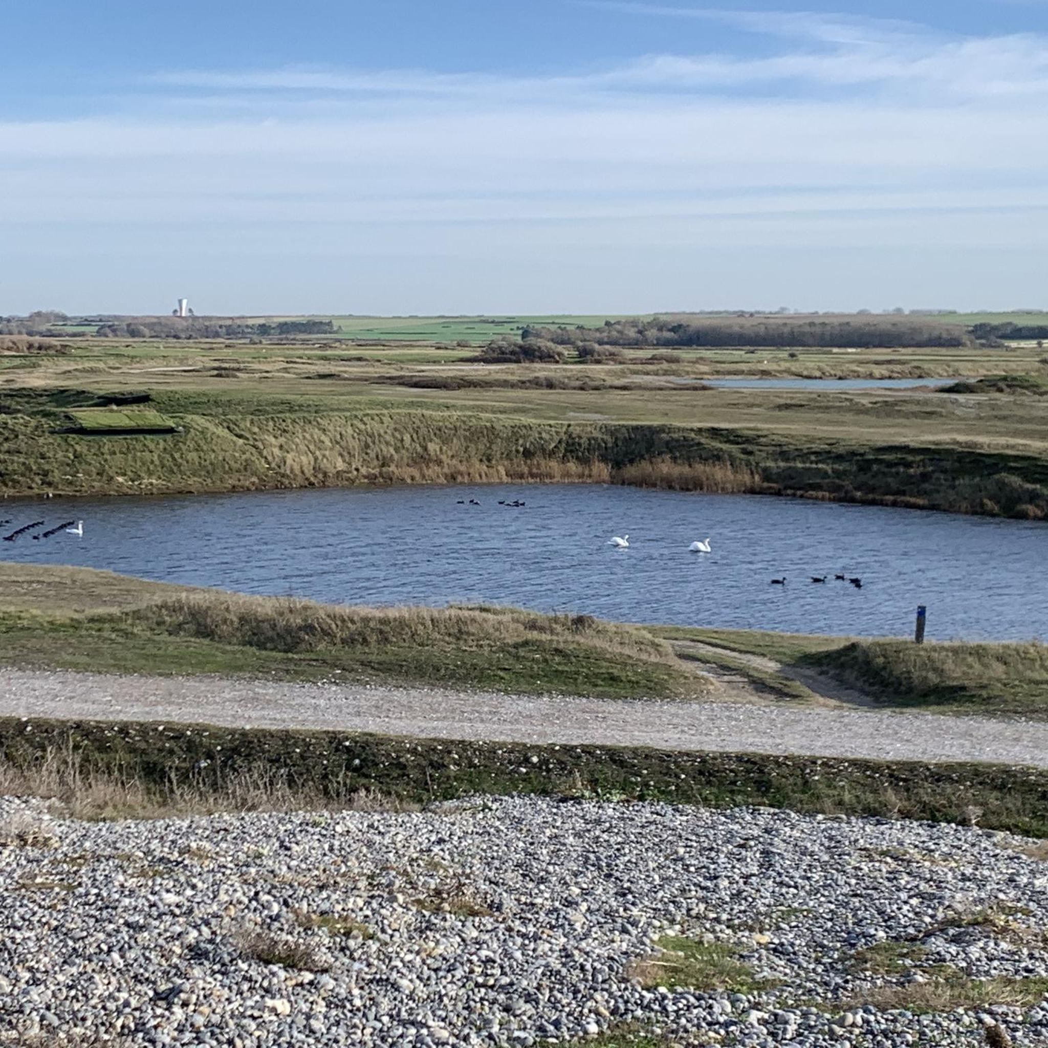
What is the Hâble d'Ault and what can I see there?
The Hâble d'Ault Route leads to a unique lowland area isolated from the sea by a bead of pebbles. This wetland is historically shaped for waterfowl hunters and is home to a diverse array of birds, including mallards, shovelers, and various waders. The pebble areas also host rare pioneer habitats and plants adapted to the absence of soil, such as the nationally protected sea cabbage. It's an excellent spot for birdwatching and observing unique coastal flora.
Are the natural monuments accessible by public transport?
While Saint-Blimont itself is a charming village, direct public transport to all specific natural monuments might be limited. The main natural attractions like the Bay of the Somme and the towns of Ault and Saint-Valery-sur-Somme are accessible, but exploring the more remote natural sites often benefits from personal transport or guided tours. It's advisable to check local transport schedules for specific destinations.
Most popular routes around Saint-Blimont
Most popular attractions around Saint-Blimont

Get inspired with the komoot mobile app


Explore more
Extend your search for the best caves by checking out these guides of the top ones around Saint-Blimont:
