The best walks and hikes around Saint-Blimont
4.4
(1684)
10,899
hikers
183
hikes
Hiking around Saint-Blimont offers routes through a coastal landscape characterized by cliffs, dunes, and estuarine areas. The region features varied terrain, from elevated viewpoints overlooking the sea to flatter paths along the coast and through natural reserves. These trails provide opportunities to explore the unique natural environment of the Picardy coast.
Best hiking trails around Saint-Blimont
- The most popular hiking route is Panoramic view – Cliffs of Ault loop from Woignarue, a 8.5 miles (13.7 km) trail that takes…
Last updated: October 12, 2026
4.6
(29)
121
hikers
13.8km
03:36
100m
100m
Moderate hike. Good fitness required. Easily-accessible paths. Suitable for all skill levels.
4.4
(12)
62
hikers
28.3km
07:11
60m
60m
Hard hike. Very good fitness required. Easily-accessible paths. Suitable for all skill levels.

4.3
(7)
33
hikers
7.33km
01:54
40m
40m
Easy hike. Great for any fitness level. Easily-accessible paths. Suitable for all skill levels.
4.4
(7)
45
hikers
Moderate hike. Good fitness required. Easily-accessible paths. Suitable for all skill levels.
3.5
(2)
8
hikers
12.7km
03:14
40m
40m
Moderate hike. Good fitness required. Easily-accessible paths. Suitable for all skill levels.
Get access to more routes and recommendations from other explorers.
Already have an account?
Our route recommendations are based on thousands of hikes, rides, and runs completed by other people on komoot.
Start today with a free account
Your next adventure awaits.


Tips from the Community

some benches along the way
0
0

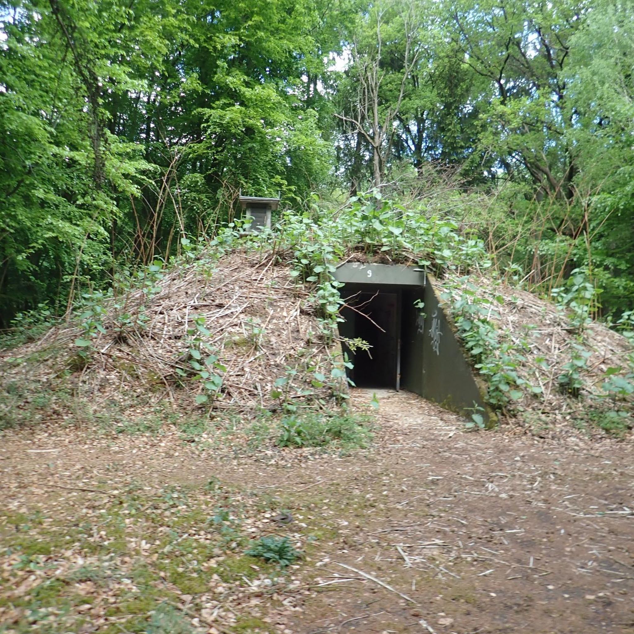
It remains a strange feeling to come across traces so long after the war.
0
0
The traces of the Second World War are still omnipresent, even after 80 years.
0
0

Hourdel Lighthouse is a lighthouse on the common Cayeux-sur-Mer, it is built on the south side of the Bay of Somme, at the end of the point of Hourdel.
4
0

Here in Ault begin the chalk cliffs, which stretch all the way to Normandy and repeatedly appear as enormous cliffs.
4
0

The cliffs around the beach of Ault are composed of chalk from the Upper Cretaceous, more precisely from the Turonian and Coniacian (around 83 million years ago to 90 million years ago). They are strewn with flint nodules which highlight the subhorizontal stratification planes (the formation of flint has already been discussed in Discovery of the geology of the cliffs of Étretat, presentation of an excursion from the beach of Tilleul (Antifer) to the Porte d'Amont (Étretat Nord)). The relative proportion of chalk and flint is around 90-95% chalk to 5-10% flint. Flint horizons are stratigraphic markers. On the cliffs of Ault, the regular flint band called Seven Sisters is recognizable and characterizes the boundary between the Middle Coniacian and the Upper Coniacian (around 87 million years ago). The boundary between the lower and middle Coniacian is marked by the Shoreham 2 marl level, which is more difficult to identify. These lithostratigraphic markings allow in particular the correlation of distant deposits, such as between the Normandy and Picardy coasts, or between the French and English coasts.
3
0
The cliffs surrounding Ault beach are made of Upper Cretaceous chalk, more precisely from the terminal Turonian and Coniacian (approximately 83 Ma to 90 Ma). They are dotted with flint nodules that highlight the sub-horizontal stratification planes (the formation of flint has already been discussed in À la découverte géologique des falaises d'Étretat, presentation of an excursion going from Tilleul beach (Antifer) to Porte d'Amont (Étretat Nord)). The relative proportion between chalk and flint is approximately 90-95% chalk for 5-10% flint. The flint horizons are stratigraphic markers. On the cliffs around Ault, the regular band of flint called Seven Sisters is recognizable and characterizes the limit between the Middle Coniacian and the Upper Coniacian (approximately 87 Ma). The boundary between the Lower and Middle Coniacian is marked by the Shoreham 2 marl level, which is more difficult to identify. These lithostratigraphic markers allow in particular the correlation of distant deposits, such as for example between the Normandy and Picardy coasts, or between the French and English coasts.
3
0
The church is built of natural stone with a characteristic pattern. It consists of two naves, separated by high arches. The baptismal chapel is still part of the original church. A church was first mentioned in the 12th century, but the current church dates back to the 13th century. The church was repeatedly destroyed during the Hundred Years' War and was set on fire in 1475, when the city defended itself against the English and Burgundian rulers. The church was rebuilt at the end of the 15th century and reconsecrated in 1500, but construction activities lasted until 1559. During the French Revolution, the furniture was sold, shrines and paintings were burned and bells were melted down. In 1845, a rectangular brick building was built next to the tower. Next to the church is the heavy tower, equipped with buttresses. In 1786, it was crowned with a tent roof.
2
0
Frequently Asked Questions
How many hiking trails are available around Saint-Blimont?
There are over 170 hiking routes in the Saint-Blimont area, offering a wide range of options from easy coastal strolls to more challenging long-distance paths. The komoot community has explored these trails over 8,700 times.
Are there any easy or beginner-friendly hiking routes in Saint-Blimont?
Yes, Saint-Blimont offers a good selection of easy hikes, with over 90 routes classified as easy. These typically feature flatter terrain along the coast or through natural reserves, suitable for beginners or those looking for a relaxed walk.
What are the typical distances and durations for hikes in this region?
Hiking routes in Saint-Blimont vary significantly in length and duration. For example, a moderate route like Panoramic view – Cliffs of Ault loop from Woignarue is about 8.5 miles (13.7 km) and takes around 3.5 hours. Longer, more difficult routes can extend up to 17 miles (28 km) or more.
Are there any circular walks around Saint-Blimont?
Many of the trails in Saint-Blimont are designed as circular routes, allowing you to start and end at the same point. An example is the Cape Hornu loop from Routhiauville, which offers coastal scenery over 8.2 miles (13.1 km).
What kind of natural landmarks or attractions can I see while hiking?
The region is rich in natural beauty. You can encounter impressive geological features like the Ault Chalk Cliffs and the Cape Hornu. Many routes also pass through dune systems and estuarine areas, offering unique coastal ecosystems to explore.
Are there any historical sites or points of interest along the trails?
Yes, hikers can discover historical elements such as the Le Hourdel Lighthouse, which is part of the Blockhaus du Hourdel – Le Hourdel Lighthouse loop from Routhiauville. The area also features remnants of wartime structures, like blockhouses, integrated into the landscape.
What is the best time of year to go hiking in Saint-Blimont?
The coastal climate of Saint-Blimont makes hiking enjoyable for much of the year. Spring and autumn offer pleasant temperatures and fewer crowds, while summer is ideal for combining hikes with beach visits. Winter walks can be invigorating, especially along the dramatic cliffs, but require appropriate gear for potentially windy and wet conditions.
Are the hiking trails in Saint-Blimont dog-friendly?
Many trails in the Saint-Blimont area are suitable for dogs, especially those along the coast and through natural areas. However, it's always recommended to keep dogs on a leash, particularly in nature reserves or near livestock, and to check local regulations for specific areas or beaches.
Are there good viewpoints along the hiking routes?
Absolutely. The coastal trails, especially those along the cliffs, offer numerous panoramic viewpoints. Routes like Panoramic view – Cliffs of Ault loop from Woignarue are specifically known for their expansive sea views and dramatic cliff scenery.
What do other hikers say about the trails in Saint-Blimont?
The hiking routes in Saint-Blimont are highly rated by the komoot community, with an average score of 4.4 stars from over 1,200 reviews. Hikers often praise the diverse coastal landscapes, the well-maintained paths, and the stunning views from the cliffs and dunes.
Is parking available at the trailheads?
Parking is generally available in the towns and villages near the trailheads, such as Woignarue or Routhiauville, which serve as starting points for many popular routes. Specific parking information can often be found on individual route pages or local tourism websites.
Are there any routes that explore the dune landscapes?
Yes, the region's unique dune systems are a highlight for many hikers. The Dunes – Blockhaus du Hourdel loop from Pendé is an excellent example, taking you through these distinctive coastal habitats.
Most popular routes around Saint-Blimont
Most popular attractions around Saint-Blimont

Get inspired with the komoot mobile app


Explore more
Browse the best Hikes in other regions.
