Top 5 Mountain Passes around Cañada De Benatanduz
Best mountain passes around Cañada De Benatanduz are characterized by significant mountainous terrain and high-altitude routes. The region, situated at an elevation of over 1400 meters, offers impressive vistas and diverse hiking terrain. This area provides an authentic mountain crossing experience with notable elevation gain on its trails, featuring panoramic viewpoints near Cañada De Benatanduz. The landscape includes gorge-filled peaks and pine forests, contributing to its natural appeal.
Best mountain passes around Cañada De Benatanduz
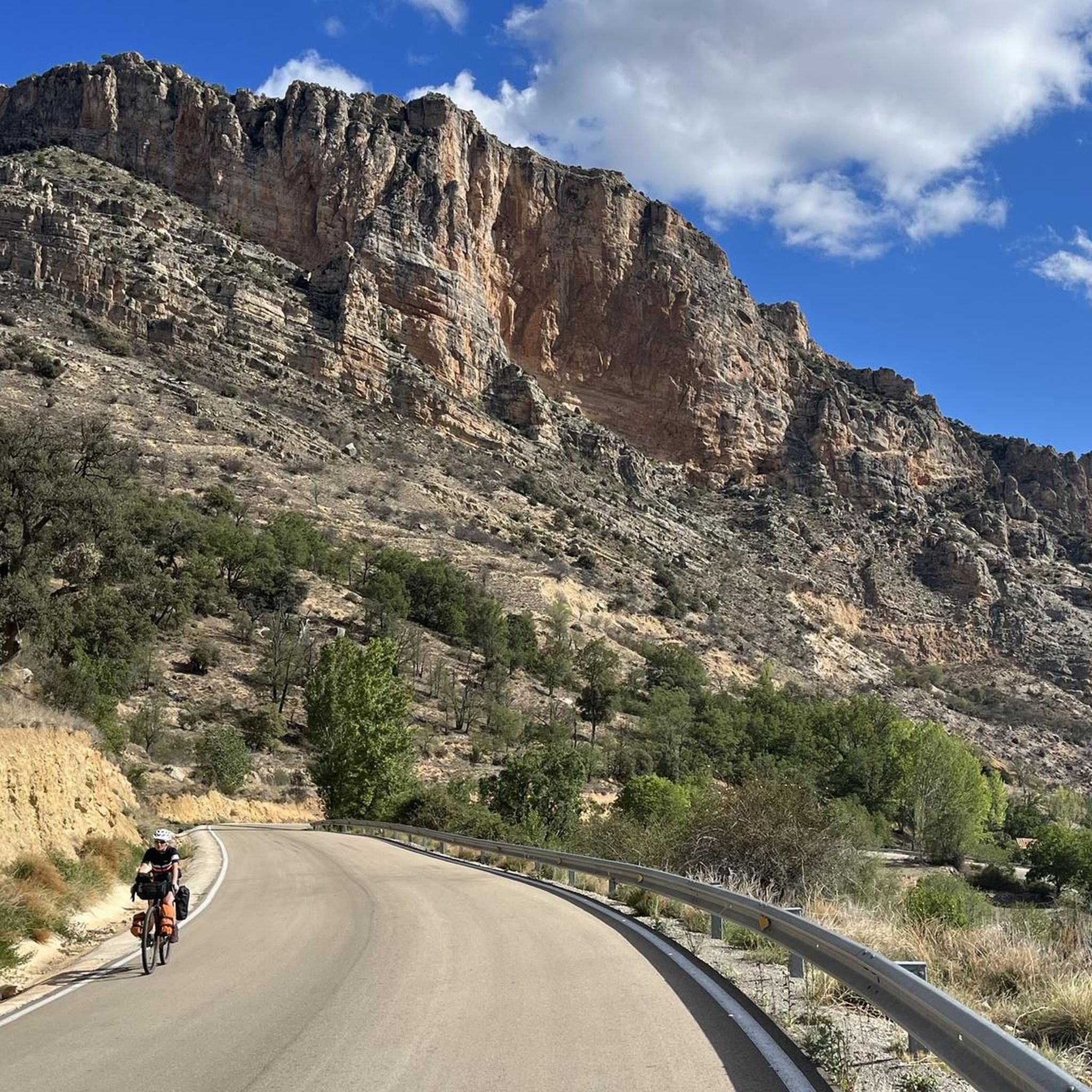
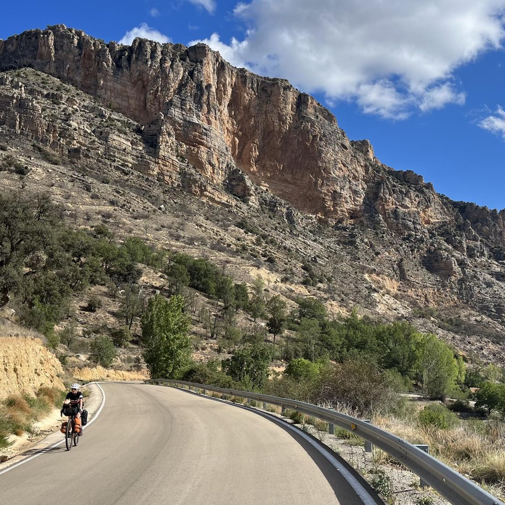
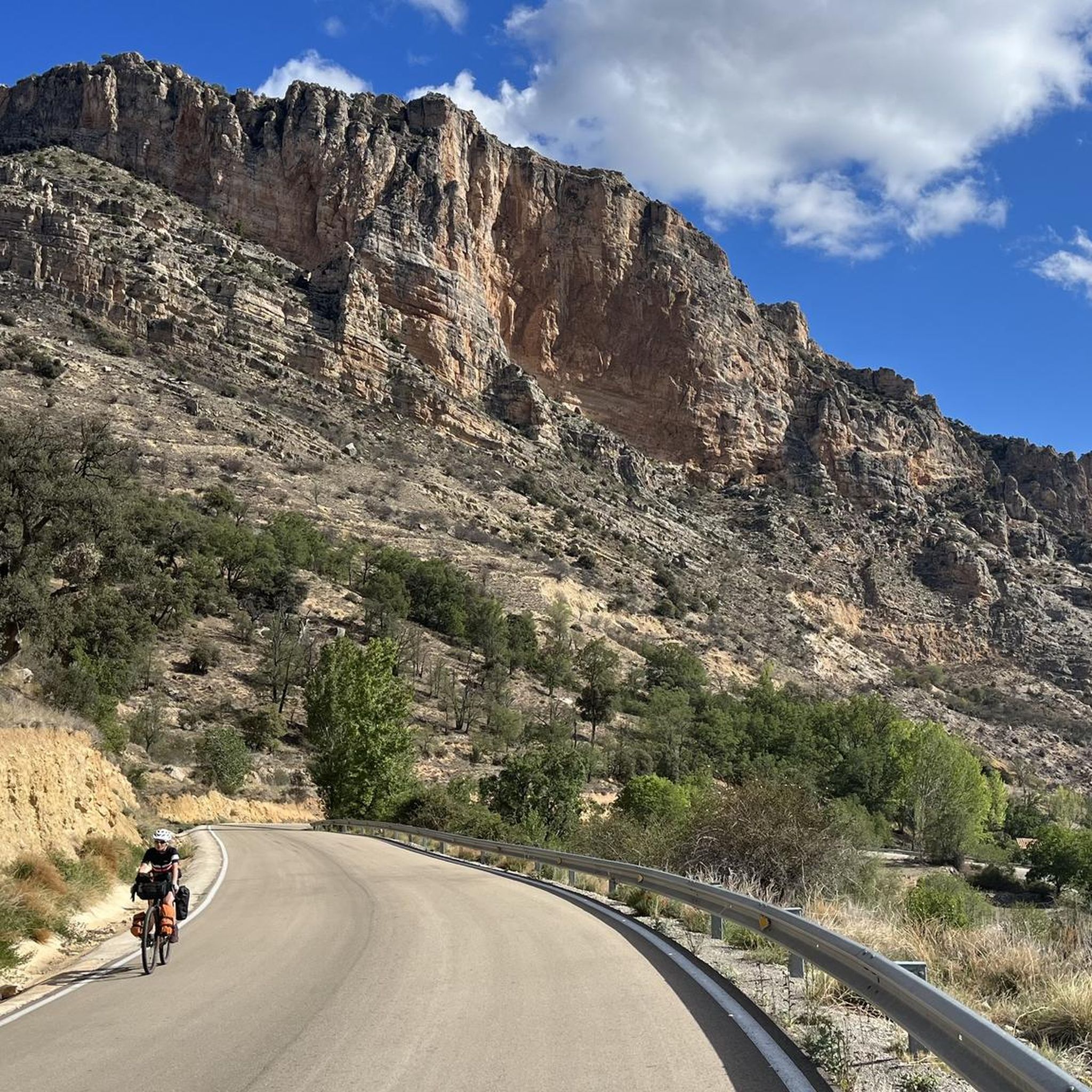
- The most popular mountain passes is San Cristóbal Pass, a mountain pass that is considered one of the hardest climbs in Aragon. It features a 7.59 km ascent with a mean gradient of 7.48% and reaches a maximum altitude of 1458 meters.
- Another must-see spot is Col sign! 😁, an intermediate mountain pass and viewpoint. This pass separates the Sierra de Gúdar, offering magnificent views of the town of Villarroya de los Pinares.
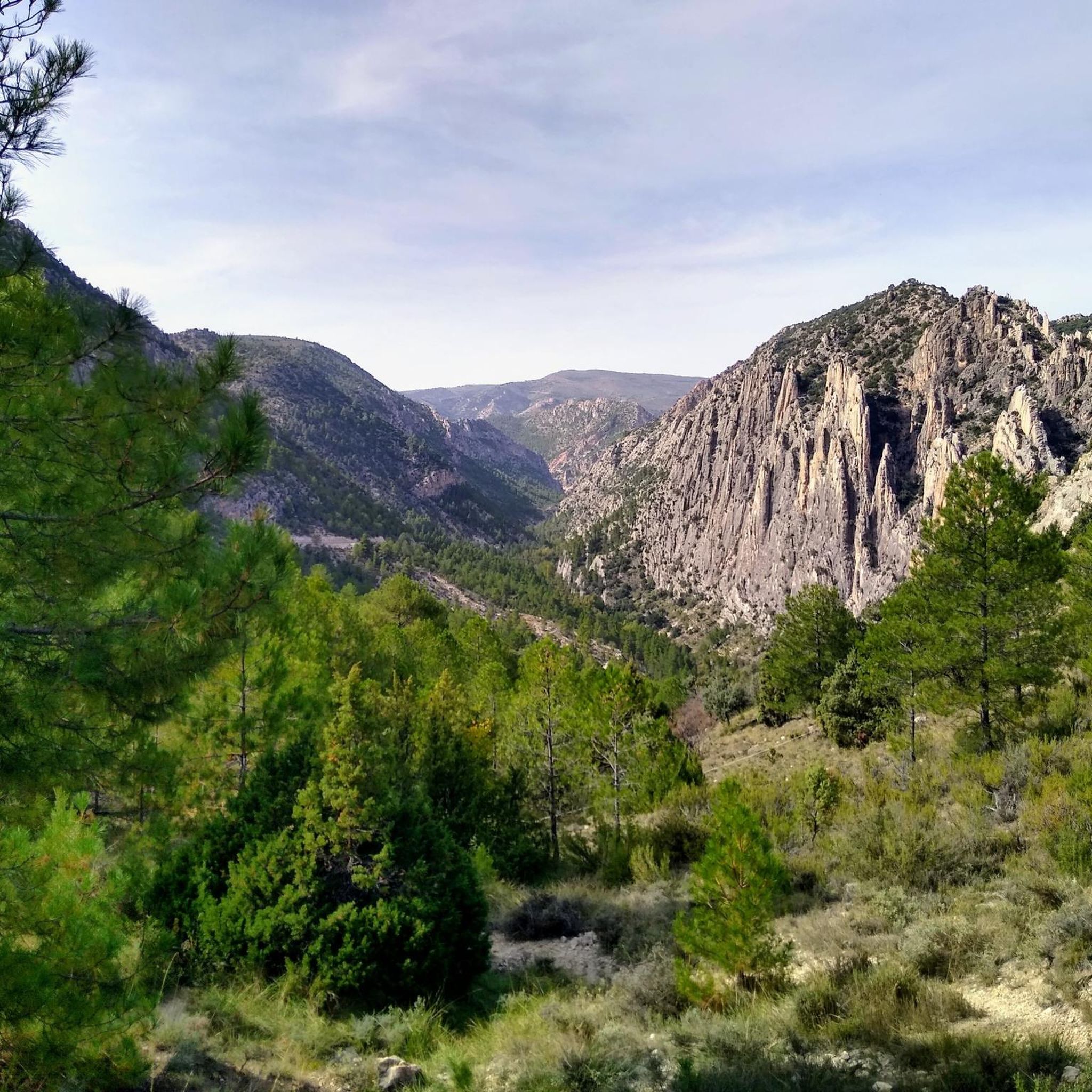
- Visitors also love Los Órganos de Montoro Pass, an intermediate mountain pass and natural monument. This route provides an easy climb with views of the Organs of Montoro, a natural monument, and includes a viewpoint with explanatory panels at the summit.
- Cañada De Benatanduz is known for challenging climbs, scenic viewpoints, and intermediate cycle routes. The area offers a variety of mountain passes to see and explore, catering to different activity levels.
- The mountain passes around Cañada De Benatanduz are appreciated by the komoot community, with 5 upvotes and 6 photos shared by users.
Last updated: October 18, 2026
San Cristóbal Pass
Highlight (Segment) • Mountain Pass
DISTANCE: 7.59km
GRADE: 568m
PEND MEAN: 7.48%
MPA COEFFICIENT: 155
CATEGORY: 1st cat
START ALTITUDE: 890m
MAX ALTITUDE GPS: 1458m
Translated by Google •
Tip by

Puerto de Villarroya
Highlight • Mountain Pass
Translated by Google •
Tip by

Sign up now to discover places like this
Get recommendations on the best single tracks, peaks, & plenty of other exciting outdoor places.
Cuarto Pelado Pass
Highlight • Mountain Pass
Translated by Google •
Tip by

Los Órganos de Montoro Pass
Highlight (Segment) • Mountain Pass
Translated by Google •
Tip by
Start today with a free account
Your next adventure awaits.

Tips from the Community

Tough climb but with beautiful hairpin bends
0
0

The port of Villarroya separates the Sierra de Gúdar. From the Villarroya viewpoint we will have magnificent views of the town of Villarroya de los Pinares.
1
0

Mountain port that circles the Sierra de Rocha between the towns of Fortanete and Cantavieja. This port is reached from four roads that come from different towns: two from Cantaviejo, one from Fortanete and the other from Cañada de Benatanduz.
0
0
This port separates the areas of the Sierra de Gúdar, where the mountains at the end of the Iberian System rise. From this pass you can see the views of the town of Villarroya de los Pinares.
0
0

Good to know what you have in front of you (or is ignorance bliss?)
0
0

Perhaps the hardest port in Aragon. DISTANCE: 7.59km GRADE: 568m PEND MEAN: 7.48% MPA COEFFICIENT: 155 CATEGORY: 1st cat START ALTITUDE: 890m MAX ALTITUDE GPS: 1458m
0
0
Easy and friendly climb with views of the Organs of Montoro, a natural monument worth visiting. It is included in The Silence Route that runs along the A-1702 road. At the end of the port there is a viewpoint and explanatory panels.
0
0
Frequently Asked Questions
What are some challenging mountain passes in the Cañada De Benatanduz area?
For a significant challenge, consider San Cristóbal Pass. It's known as one of the hardest climbs in Aragon, featuring a 7.59 km ascent with a mean gradient of 7.48% and reaching a maximum altitude of 1458 meters.
Which mountain passes offer the best panoramic views?
The region is renowned for its spectacular vistas. Col sign! 😁 provides magnificent views of Villarroya de los Pinares and separates the Sierra de Gúdar. Additionally, Los Órganos de Montoro Pass includes a viewpoint with explanatory panels at its summit, offering great perspectives of the natural monument.
What kind of natural attractions can I expect to see near these mountain passes?
The area boasts rich biodiversity and stunning natural features. You'll encounter dense pine forests, gorge-filled peaks, and high mountain pastures. A notable geological formation is the Organs of Montoro, a natural monument visible from Los Órganos de Montoro Pass. The region is also vital for local wildlife, including royal eagles, peregrine falcons, river crabs, and otters.
Are there intermediate mountain passes suitable for cycling?
Yes, there are several intermediate options popular with cyclists. Col sign! 😁 is an intermediate cycle route that separates the Sierra de Gúdar. Another intermediate option is Cuarto Pelado Pass, which circles the Sierra de Rocha and is accessible from various towns, making it a versatile cycling route.
What outdoor activities can I do near the mountain passes of Cañada De Benatanduz?
The mountainous terrain around Cañada De Benatanduz is perfect for various outdoor activities. You can explore numerous hiking trails, enjoy scenic cycling routes, or tackle challenging mountain biking trails. The GR 8.1 long-distance hiking trail also offers a significant mountain crossing experience.
What is the best time of year to visit the mountain passes around Cañada De Benatanduz?
The best time to visit is generally from late spring through early autumn (May to October) when the weather is most favorable for outdoor activities. During these months, you can fully appreciate the panoramic views and diverse landscapes. While winter hiking is possible, conditions can be challenging due to snow and lower temperatures at this high-altitude location.
Are there family-friendly options among the mountain passes?
While many passes offer intermediate challenges, Los Órganos de Montoro Pass is described as an easy and friendly climb, making it a good option for families. It provides views of the Organs of Montoro natural monument and has explanatory panels at the summit, adding an educational element.
Where can I find hiking trails near these mountain passes?
There are many excellent hiking opportunities in the vicinity. For a comprehensive list of routes, you can explore the Hiking around Cañada De Benatanduz guide. Notable trails include the Nacimiento del Río Pitarque Trail and sections of the Maestrazgo Trail.
What are the typical hiking conditions in winter around Cañada De Benatanduz mountain passes?
Given the region's high elevation (1400-1422 meters), winter conditions can be severe. Expect cold temperatures, potential snow cover, and icy patches on trails. It's crucial to be well-prepared with appropriate winter gear, including warm clothing, waterproof layers, and sturdy footwear. Some routes may become inaccessible or require specialized equipment during heavy snowfall.
How can I access the mountain passes, particularly regarding parking?
Access to many mountain passes in the region is typically by car, with parking available near trailheads or at designated viewpoints. For specific passes like Los Órganos de Montoro Pass, there are often viewpoints with parking facilities. It's advisable to check local signage upon arrival for the most current parking information.
What do visitors enjoy most about the mountain passes in this region?
Visitors highly appreciate the stunning panoramic views of the Aragonese territory, the tranquility of the natural environment, and the diverse range of outdoor activities available. The challenging climbs, scenic viewpoints, and unique natural monuments like the Organs of Montoro are frequently highlighted by the komoot community, with many users sharing photos and upvoting their experiences.
Are there options for longer, more strenuous routes that incorporate mountain passes?
Absolutely. Beyond individual passes, the region offers longer routes that traverse significant mountainous terrain. The GR 8.1 long-distance hiking trail, for instance, includes a section connecting Cañada de Benatanduz with Fortanete that involves gaining altitude rapidly to reach a 'mountain range divide,' offering a substantial and rewarding hiking experience.
Most popular attractions around Cañada De Benatanduz

Get inspired with the komoot mobile app


Explore more
See even more epic mountain passes by checking out these guides around Cañada De Benatanduz:
