Top 10 Natural Monuments around Gussage St. Michael
Best natural monuments around Gussage St. Michael are found within the Cranborne Chase Area of Outstanding Natural Beauty, characterized by rolling chalk downlands, high hills, and woodlands. This region offers a landscape where ancient human imprints, such as earthworks and burial mounds, are deeply integrated into the natural environment. The area provides diverse terrain for walking and hiking, offering tranquility and scenic vistas. It is a destination for those seeking to explore natural beauty alongside significant historical and archaeological features.
…Last updated: July 1, 2026
Win Green Summit
Highlight • Historical Site
Tip by

Badbury Rings Iron Age hillfort
Highlight • Viewpoint
Tip by

Sign up now to discover places like this
Get recommendations on the best single tracks, peaks, & plenty of other exciting outdoor places.
Sign up for free
Bokerley Dyke
Highlight • Trail
Tip by

Knowle Hill
Highlight (Segment) • Natural Monument
Tip by

Bluebell Woodland
Highlight • Natural Monument
Tip by
Sign up for free to discover even more natural monuments around Gussage St. Michael.
Sign up for free
Already have an account?
Start today with a free account
Your next adventure awaits.
Login or Signup
Tips from the Community

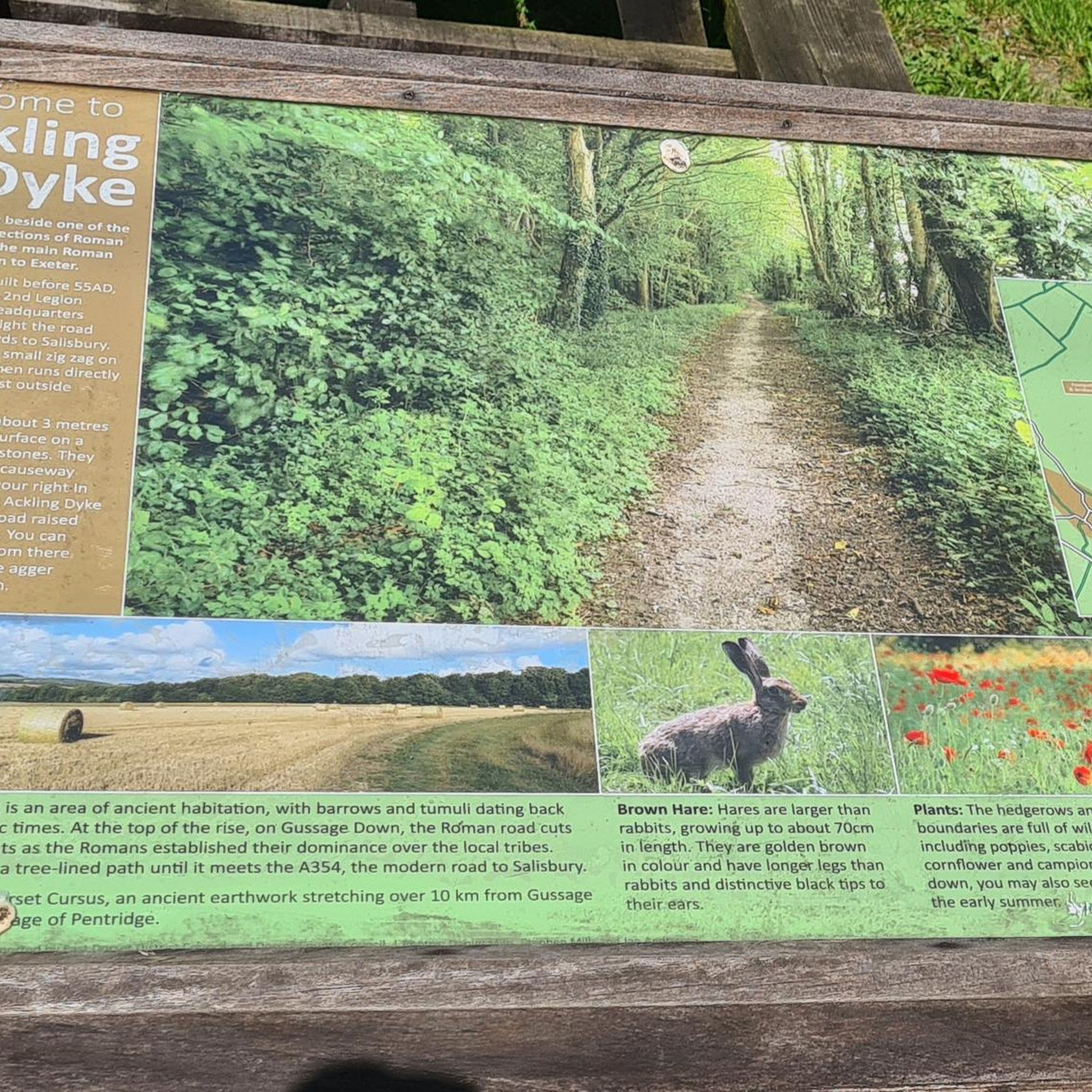
Bokerley Dyke is a substantial linear earthwork, approximately 5.75 kilometers (3.6 miles) long, located on Cranborne Chase. It runs along part of the border between Dorset and Hampshire, specifically between Woodyates and Martin. It is part of a larger Scheduled Monument that also includes Grim's Ditch and other earthworks. The dyke has a multi-period history. It is believed to have originated in the Bronze Age or Early Iron Age as an important political and cultural boundary. In the 1st century, it was cut through by a Roman road, Ackling Dyke, which ran between Old Sarum and Badbury Rings. In the 4th century, the dyke was remodeled and brought back into use. During this period, the Roman road was blocked. A coin of Valens found during excavations dates this activity to shortly after 364 AD, with some sources suggesting it was built between 367-368 AD. This remodeling may have been a defensive measure against attacks on Britain by Picts, Scots, and Saxons. The Roman road was eventually reopened, but the dyke may have continued to be used as a boundary after the Roman administration ended. Today, it still forms part of the border between the counties of Dorset and Hampshire.
0
0

Beautiful snowdrops in February highly recommend these gardens
1
0
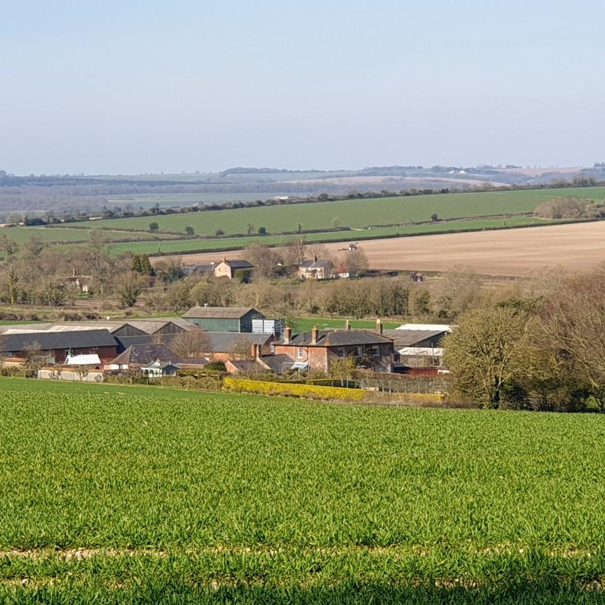
One of the most beautiful places in the south of England 🏴 and amazing views of Wiltshire and Dorset 🤩
0
0
Badbury Rings is an Iron Age hill fort and Scheduled Monument in east Dorset, England. In the Roman era a temple was located immediately west of the fort, and there was a Romano-British town known as Vindocladia ( Known today as Shapwick ) a short distance to the south-west. It sits over 300 feet above sea level, and there are two main phases of construction; the first covered 18 acres and was defended by multiple ditches, while the second was more than twice the size, covering 41 acres and defended by a single ditch and rampart. These ramparts make for great walking, but imagine the terror of trying to scale one whilst under attack from the occupants. Once you'd scaled one, there were more waiting for you. No wonder it was the last fort to be sacked by the Romans. Wonder just how many soldiers died trying to take it. Until 1983 Badbury Rings was privately owned as part of the Kingston Lacy estate, and the owners discouraged investigation of the site.[2] The site now belongs to the National Trust.[2] A survey of the hillfort by the RCHME was begun in 1993. The summit area was cleared of undergrowth by the National Trust in 1997 and the conifer plantation was thinned out. A survey in 1998, which recorded 28 potential hut sites within the ramparts, although some depressions are probably caused by uprooted trees. The first excavations, led by Martin Papworth, took place in 2004, when three evaluation trenches were dug. Almost all of the pottery found was dated to the Late Iron Age. The current evidence does not suggest that the hillfort was a principal settlement in the Early Iron Age. It seems likely that the hillfort became depopulated towards the end of the Late Iron Age, perhaps as the Vindocladia settlement near Shapwick developed.
1
0

Win Green at 277 m is the highest point on Cranbourne Chase. The tree topped summit also has a Bronze Age hill barrow, topography stone and trig point. Lots of great running loops from here as well as easy parking close by.
0
0
Bradbury Rings is an Iron Age hill fort. The Romans built a temple here and there was a Romano-British town known as Vindocladia nearby. Today, you can run the earthworks and around the edge, it's fun and fascinating. The National Trust own and manage the site but it's open access to all.
0
0
Win Green hill at 277m is the highest point on Cranborne Chase. The trig point affords panoramic views apart from the bit blocked by the little clump of trees on the summit. The beech trees are growing on a Bronze Age bowl barrow. It's managed by the National Trust and is often busy because it's close to a car park. Still very nice though!
0
0
Frequently Asked Questions
What natural features define the landscape around Gussage St. Michael?
The landscape around Gussage St. Michael is primarily characterized by rolling chalk downlands, high chalk hills, and pockets of woodland, all nestled within the Cranborne Chase Area of Outstanding Natural Beauty (AONB). This area offers serene beauty, diverse habitats, and a quintessential English rural experience.
Where can I find expansive views of the Cranborne Chase?
For breathtaking panoramic views, visit Win Green Summit, the highest point in the Cranborne Chase. It offers views over Blackmore Vale and Salisbury Plain, and on clear days, even to the Isle of Wight. Knowle Hill also provides excellent views across the Chase, and Badbury Rings Iron Age hillfort offers wonderful views of the surroundings from its elevated position.
Are there specific nature reserves to visit for wildlife spotting?
Yes, Sovell Down Nature Reserve, located about half a mile from Gussage St. Michael, is a small oasis of flower-rich grassland and scrub. It's a vital spot for wildlife, including grizzled skipper and marbled white butterflies, bullfinches, and yellowhammers, offering a chance to observe local flora and fauna.
What kind of terrain can I expect on trails around Gussage St. Michael's natural monuments?
You can expect varied terrain, primarily consisting of rolling chalk downlands and hills. Trails often involve gentle to moderate climbs, such as the ascent to Knowle Hill, and paths along ancient earthworks like Bokerley Dyke. The natural undulations and open spaces provide diverse walking and hiking experiences.
Are there ancient historical sites integrated with the natural landscape?
Absolutely. The natural environment of Gussage St. Michael is rich with ancient human history. You can explore the vast Neolithic Dorset Cursus, Bronze Age burial mounds and tumuli on Gussage Hill, and the Roman Ackling Dyke, which runs through the landscape. Additionally, Badbury Rings Iron Age hillfort and Bokerley Dyke are significant earthworks that blend into the natural contours of the area.
What outdoor activities can I do near the natural monuments in Gussage St. Michael?
The area offers excellent opportunities for both hiking and cycling. You can find various routes, including moderate and difficult cycling loops like the 'Gussage Hill and Knowlton Henge loop' or the 'Church Farm Campsite – Ox Drove Gravel Road loop'. For hiking, there are options ranging from easy to moderate, such as the 'Hiking loop from Gussage All Saints' or the 'Gussage Hill Trig Point loop'. You can explore more options in the Hiking around Gussage St. Michael and Cycling around Gussage St. Michael guides.
Are there easy walking trails suitable for all abilities?
Yes, there are several easy walking trails available. For instance, the 'Witchampton Mill – Crichel House Gate and Arch loop' and the 'Hiking loop from Gussage All Saints' are considered easy. These routes allow you to enjoy the natural beauty without strenuous effort. More easy options can be found in the Easy hikes around Gussage St. Michael guide.
Can I find circular walking routes around the natural monuments?
Yes, many of the hiking and cycling routes in the area are circular, allowing you to start and end at the same point. Examples include the 'Gussage Hill Trig Point loop from Gussage St. Michael' for hiking, and various cycling loops like the 'Gussage All Saints Church loop from Witchampton'. These are great for exploring the natural monuments and surrounding countryside.
Are the natural monuments around Gussage St. Michael suitable for families?
Many natural monuments in the area are family-friendly. Win Green Summit and Badbury Rings Iron Age hillfort are both noted as suitable for families, offering open spaces for exploration and impressive views. The Bluebell Woodland is also a lovely, accessible spot for families, especially during spring.
What is the best time of year to visit the natural monuments?
The Cranborne Chase AONB is beautiful year-round. Spring (April-May) is ideal for seeing wildflowers, including bluebells in the Bluebell Woodland, and for pleasant walking temperatures. Autumn (September-October) offers stunning foliage and comfortable hiking conditions. Even winter walks can be rewarding, especially on clear days, providing crisp views across the downlands.
Are there any dog-friendly walks among the natural monuments?
Yes, many of the trails and natural monuments are dog-friendly. For example, the walk around Win Green Summit is great for dogs, though they may need to be kept on a lead in certain areas due to livestock. Always ensure dogs are under control and follow local signage regarding leads, especially in nature reserves or near grazing animals.
What do visitors enjoy most about the natural monuments in Gussage St. Michael?
Visitors particularly appreciate the breathtaking panoramic views from spots like Win Green Summit and the opportunity to explore ancient historical sites like Badbury Rings Iron Age hillfort, which are deeply integrated into the natural landscape. The diverse terrain for walking and hiking, combined with the tranquility of the Cranborne Chase, also makes the area highly enjoyable.
Most popular routes around Gussage St. Michael
Most popular attractions around Gussage St. Michael

Get inspired with the komoot mobile app


Explore more
Extend your search for the best caves by checking out these guides of the top ones around Gussage St. Michael:
