Top 18 Natural Monuments around Chiricahura Peak
Best natural monuments around Chiricahura Peak are characterized by unique geological formations, including towering stone spires, balancing rocks, and hoodoos. This landscape was sculpted over millions of years by volcanic activity and erosion, creating a distinctive environment. The area is recognized as a "sky island," an isolated mountain range rising from the surrounding desert. These natural features offer opportunities for exploration and observation of the region's geology.
Best natural monuments around Chiricahura Peak
- The most popular natural monuments is Echo…
Last updated: July 10, 2026
Ed Riggs Trail
Highlight (Segment) • Trail
Tip by

Echo Canyon Trail
Highlight • Trail
Tip by
Sign up now to discover places like this
Get recommendations on the best single tracks, peaks, & plenty of other exciting outdoor places.
Sign up for free
Massai Point
Highlight • Viewpoint
Tip by
Big Balanced Rock Trail
Highlight (Segment) • Natural Monument
Tip by
Chiricahua National Monument Visitor Center
Highlight • Rest Area
Tip by
Sarah Deming Trail
Highlight (Segment) • Trail
Tip by
Upper Sarah Demming Trail
Highlight • Trail
Tip by
Upper Rhyolite Canyon Trail
Highlight (Segment) • Trail
Tip by
Sugarloaf Mountain Lookout
Highlight • Viewpoint
Tip by

Mushroom Rock
Highlight • Natural Monument
Tip by
Sign up for free to discover even more natural monuments around Chiricahura Peak.
Sign up for free
Already have an account?
Start today with a free account
Your next adventure awaits.
Login or Signup
Popular around Chiricahura Peak
Tips from the Community

The visitor center, on the right 3.5 miles on Bonita Canyon Dr after the West entrance, is open from 8:30 am to 4:30 pm. It has an information desk, museum, park film, and gift shop. It provides free maps, junior ranger booklets, and information. The museum area includes geology, biodiversity, and human history exhibits. Its architecture showcases Civilian Conservation Corps rock work and "Mission 66" architecture. The park store offers shirts, books, stickers, magnets and other collectibles to remember your visit.
0
0

This historic Fire Lookout has the best far views in the monument. I parked and locked my bike at the trailhead and hiked this. Many people were congregated at the end of the park road at Massai Point, but I was the only human up here. www.cyclepass.com/t_paz_Massai_Point.html
0
0

Certainly the busiest place in the Park, but well worth it.
0
0
Superb view, and possible departure from this point to do the small or large loop allowing you to discover the entire park and its magnificent landscapes. The parking lot is not very big so arrive early. There are dry toilets.
0
0

Sugarloaf Mountain is one of the least traveled mountains in the area, but it is definitely worth the effort, offering a peaceful journey and stunning panoramic views at the summit.
0
0

Open from 8:30 AM to 4:30 PM MST. They hold exhibits about geology, natural history, archaeology, and cultural history at the visitor center. There is also a bookstore with a great variety of topics ranging from Apache history to children's books. Closed on Thanksgiving and Christmas Day.
2
0

Good place to take info and water and start hiking up the Canyon 3.5 miles to the Heart of Rock loop
2
0
Frequently Asked Questions
What are some popular hiking trails to experience the natural monuments?
For an immersive experience, the Echo Canyon Trail is highly recommended, weaving directly between towering rock pinnacles and hoodoos. Another popular choice is the Ed Riggs Trail, which offers views of spires and the coolness of the forest as it descends into the valley.
Are there easy hiking trails suitable for all skill levels?
Yes, Chiricahua National Monument offers trails for various skill levels. For easier options, you can explore routes like the Massai Point Nature Trail or the Echo Canyon Grottoes Trail. You can find more details on easy hikes in the area on the Easy hikes around Chiricahura Peak guide.
What options are available for more challenging hikes?
For those seeking a more challenging experience, the Heart of Rocks Loop offers a comprehensive journey through diverse landscapes, including towering canyons and a wide array of rock formations. This loop is part of the larger 'Big Loop' which showcases much of the monument's natural beauty.
What unique rock formations can I expect to see?
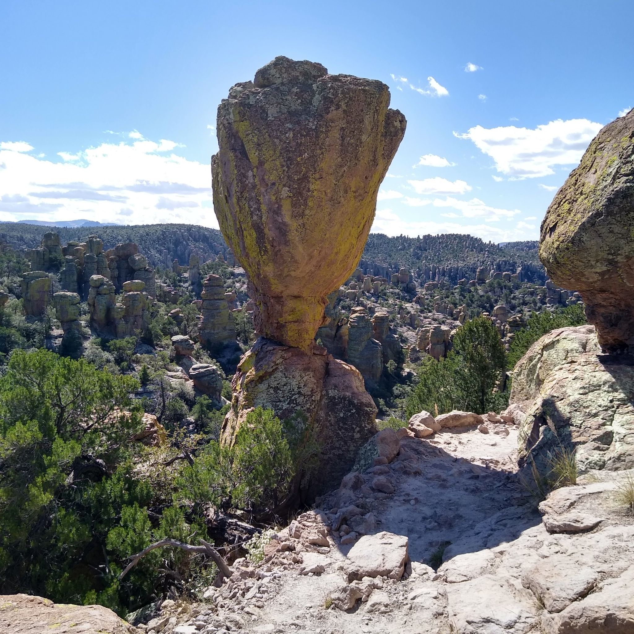
The area is famous for its extraordinary rock formations, often called hoodoos, spires, and balanced rocks. You'll encounter formations like the massive Big Balanced Rock, which appears to defy gravity, and the distinctive Mushroom Rock. Other notable formations include Duck on a Rock, Sea Captain, China Boy, and the Organ Pipe Formation.
What is the best time to visit Chiricahua National Monument?
Chiricahua National Monument is a 'sky island,' meaning its elevation provides cooler temperatures than the surrounding desert. Spring and fall generally offer the most pleasant weather for hiking and exploring. Summers can be hot, but the higher elevations and shaded trails provide some relief. Winters are typically mild, though occasional snow can occur.
Are there family-friendly options for experiencing the natural monuments?
Absolutely. Massai Point is easily accessible by car and offers panoramic views, making it great for all ages. The Chiricahua National Monument Visitor Center is also family-friendly and provides an introduction to the park's geology and history.
How can I get around Chiricahua National Monument?
The monument features an 8-mile scenic drive along Bonita Canyon Road, which provides access to many viewpoints and trailheads, including Massai Point. This allows visitors to explore the area by car and then access various hiking trails.
Where can I find parking and access trailheads?
Parking is available at key locations such as Massai Point, which serves as a trailhead for several popular routes. The Echo Canyon Trail also has dedicated parking. It's advisable to arrive early during peak times as parking lots can fill up.
What outdoor activities can I do near these natural monuments?
The area is ideal for hiking, with over 17 miles of trails catering to various difficulty levels. You can find numerous hiking routes, including moderate and easy options, detailed in the Hiking around Chiricahura Peak guide.
What wildlife might I encounter in Chiricahua National Monument?
As a 'sky island,' Chiricahua National Monument supports diverse wildlife. You might spot various bird species, including hummingbirds and raptors, as well as mammals like deer, javelina, and coatimundi. Always observe wildlife from a distance and do not feed animals.
Is Chiricahua National Monument accessible for visitors with mobility challenges?
The Chiricahua National Monument Visitor Center is wheelchair accessible. While many trails involve uneven terrain, the scenic drive and viewpoints like Massai Point offer accessible ways to enjoy the monument's beauty.
Are there any historical or cultural sites within the monument?
While primarily known for its natural geology, the monument also has a rich cultural history. The Civilian Conservation Corps (CCC) played a significant role in developing the park's infrastructure, including impressive rock work on trails like the Upper Sarah Demming Trail in the 1930s.
Do I need a permit to hike the trails in Chiricahua National Monument?
Generally, permits are not required for day hiking on the established trails within Chiricahua National Monument. However, it's always a good idea to check the official National Park Service website for the most current regulations and any specific requirements, especially for backcountry or overnight stays. You can find more information at nps.gov/chir.
Most popular routes around Chiricahura Peak
Most popular attractions around Chiricahura Peak

Get inspired with the komoot mobile app


Explore more
Extend your search for the best caves by checking out these guides of the top ones around Chiricahura Peak:
