The 5 Most Amazing Peaks around Soutomaior
Best mountain peaks around Soutomaior are characterized by a hilly landscape with elevated areas offering scenic views. The region features low mountain ranges, generally below 1,000 meters, rather than sharp, towering peaks. These elevated points provide historical context, recreational opportunities, and panoramic views of the Galician countryside. Soutomaior's terrain makes it suitable for exploring natural features and viewpoints.
Best mountain peaks around Soutomaior
- The most popular mountain peaks is Viewpoint of Monte A Peneda, a viewpoint that is elevated…
Last updated: October 7, 2026
Alto de Galleiro
Highlight • Summit
Translated by Google •
Tip by

Viewpoint of Monte A Peneda
Highlight • Viewpoint
The chapel of Nosa …
Translated by Google •
Tip by

Sign up now to discover places like this
Get recommendations on the best single tracks, peaks, & plenty of other exciting outdoor places.
Monte Monzón
Highlight • Summit
Translated by Google •
Tip by

View of Marín and the Ría de Pontevedra from Monte Penizas
Highlight • Viewpoint
Translated by Google •
Tip by
View from Pico San Vicente
Highlight • Viewpoint
Translated by Google •
Tip by
Start today with a free account
Your next adventure awaits.

Other adventures around Soutomaior

Tips from the Community

Monte O Galleiro (748 m), located in the municipality of Mos, near Vigo, is a popular destination for hiking due to its well-marked routes and its impressive panoramic views of the Vigo Estuary and the surrounding area. It is part of the Serra do Galleiro and is surrounded by native vegetation, pine forests and eucalyptus trees. It is ideal for outdoor activities and enjoying Galician nature.
1
0

Summit Monte Penizas to obtain a spectacular view over Marín and the Ría de Pontevedra. Forest trails lead to the top.
0
0
At 750 meters above sea level One of the highest points in the province of Pontevedra and the highest near the coast, from where you can have spectacular panoramic views of the surrounding landscape.
0
0
At 472 m above sea level, the Monźon peak is the highest point in the municipality of Soutomaior. Spectacular views of the Ría de Vigo to the west and the surrounding mountains to the east. Great hiking trails through the woods.
1
0
Pico San Vicente, at 488 m above sea level, is the highest point of the Vixiador del Monte forest park. It is the Parque Forestal Larges in Vigo that covers an area of almost 185,000 m². Public access recruit park, in Candeán, with trails for jogging, hiking and mountain biking
1
0

Elevated, with a unique shape and visible from much of the region, Mount A Peneda is one of the most unique places around the Vigo estuary. The chapel of Nosa Señora das Neves or Virxe da Peneda, dating from the 17th century, presides over the top of this peak of 329 meters and very steep slopes. The building occupies the site of the A Peneda fort, a settlement that took advantage of the easy strategic defense and the breadth of views. From the A Peneda viewpoint, next to its old cork oak, you can see the Vigo estuary, from its formation at the mouth of the Verdugo River to Rande, with the Cíes Islands in the background.
2
0
Frequently Asked Questions
What are the highest or most significant peaks directly within the Soutomaior municipality?
Within the municipality of Soutomaior, Monte Monzón stands out as the highest point at 472 meters. It offers spectacular panoramic views of the Ría de Vigo. Another significant elevated area is Mount Viso, home to the historic Soutomaior Castle. While not a high peak, its strategic location and the castle's botanical gardens make it a key landmark. Outeiro Grande (Monte de Baltar) is also a notable elevated point at 277 meters.
Are there historical or cultural sites located on or near these mountain peaks?
Yes, several peaks offer historical and cultural significance. The historic Soutomaior Castle is situated on Mount Viso, offering a unique architectural and historical experience within a significant botanical park. Additionally, the Viewpoint of Monte A Peneda features the 17th-century chapel of Nosa Señora das Neves, built on the site of an ancient fort.
What kind of views can I expect from the mountain peaks around Soutomaior?
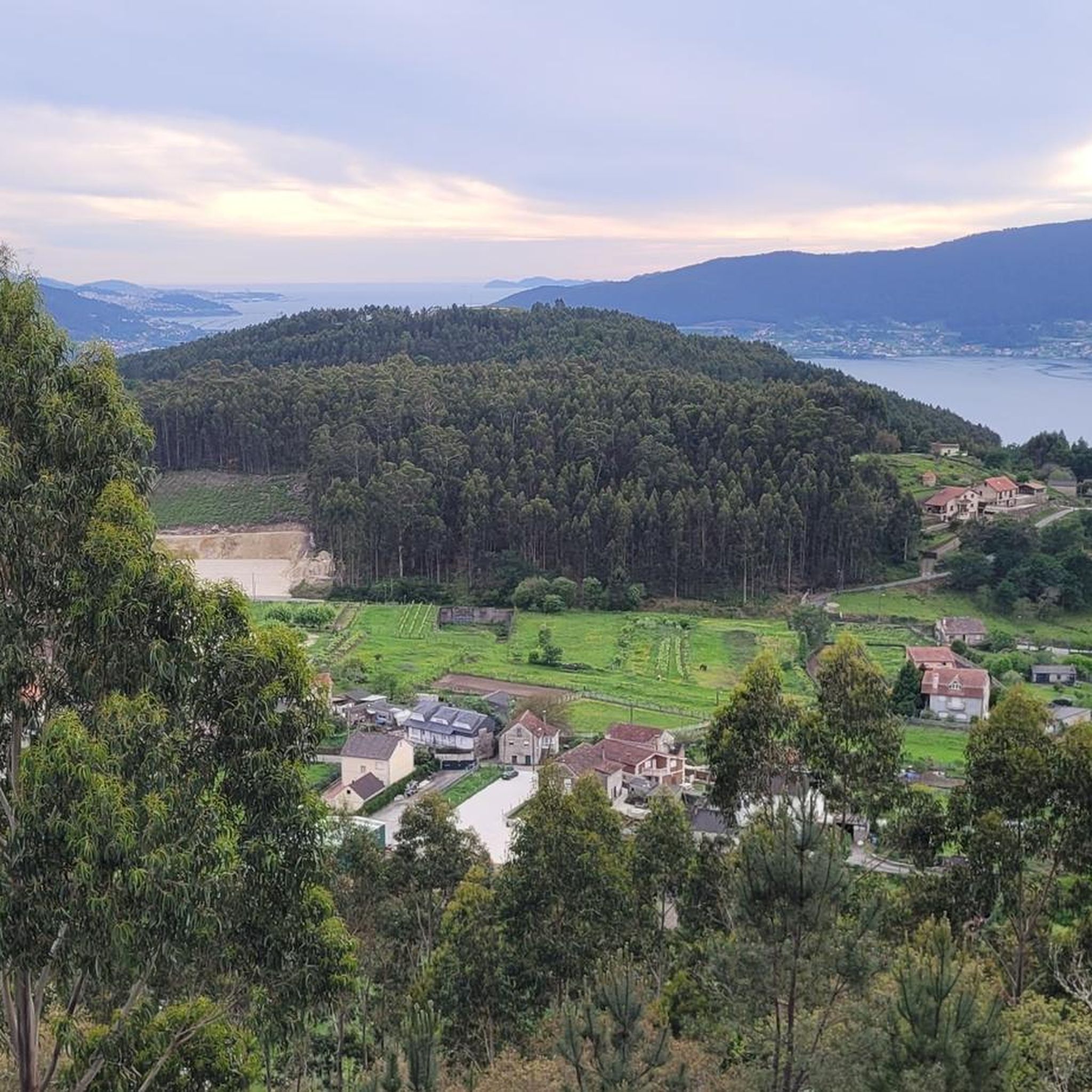
The peaks around Soutomaior offer diverse and expansive views. From Monte Monzón, you can see the Ría de Vigo to the west and surrounding mountains to the east. The Viewpoint of Monte A Peneda provides vistas of the Vigo estuary, extending to Rande and the Cíes Islands. From Alto de Galleiro, one of the highest points near the coast, you get impressive panoramic views of the Vigo Estuary and the surrounding landscape. Monte Penizas offers a spectacular view over Marín and the Ría de Pontevedra.
What outdoor activities can I do near the mountain peaks of Soutomaior?
The area around Soutomaior's peaks is excellent for various outdoor activities. You can find numerous routes for hiking, cycling, and running. For hiking, consider the 'Soutomaior Castle and Monte Monzón Loop' or the 'Croa Trail'. Cyclists might enjoy routes like 'Ponte Sampaio Bridge – Forest Café Stop loop from Arcade'. Runners have options such as the 'Running loop from Fonte Laiseda'. You can explore more options in the dedicated guides for Hiking around Soutomaior, Cycling around Soutomaior, and Running Trails around Soutomaior.
Are there family-friendly hiking options around Soutomaior's peaks?
While many trails around Soutomaior's peaks are rated intermediate, some options can be suitable for families. The 'Croa Trail' is an easy hiking route. Exploring the grounds of Soutomaior Castle on Mount Viso offers a pleasant walk through botanical gardens, which can be enjoyable for families. Always check the specific route details for distance and elevation to ensure it matches your family's capabilities.
What is the best time of year to visit the mountain peaks in Soutomaior for hiking?
The region generally experiences a mild climate, making hiking enjoyable for much of the year. Spring and autumn are often ideal, with pleasant temperatures and lush landscapes. Summer can also be good, especially in the mornings or late afternoons, though it can be warmer. Winter hiking is possible, but be prepared for cooler, potentially wetter conditions, especially at higher elevations.
Are there any circular mountain walks available near Soutomaior?
Yes, there are several circular routes that allow you to experience the area's peaks and natural beauty. A popular option is the 'Soutomaior Castle and Monte Monzón Loop', which offers scenic trails and river bridges. Another is 'El Monte Monzón from Castillo de Soutomayor — circular'. These routes provide a comprehensive experience of the local landscape.
What natural features can I expect to see on the trails around Soutomaior's peaks?
The trails around Soutomaior's peaks traverse diverse natural environments. You'll encounter forested areas, especially around Monte Monzón and Monte Penizas. The region is characterized by native vegetation, pine forests, and eucalyptus trees, particularly around Alto de Galleiro. The botanical park at Soutomaior Castle features hundreds of camellia varieties and ancient trees. You'll also find river valleys and estuaries, contributing to the picturesque scenery.
Is there public transport or parking available for accessing these mountain peaks?
While specific public transport routes directly to all trailheads might be limited, Soutomaior is generally accessible. For driving, parking facilities are often available near popular starting points for trails, such as those leading to Soutomaior Castle or the base of Monte Monzón. It's advisable to check local information for the most up-to-date details on parking and public transport options for your chosen route.
What makes <a href="https://www.komoot.com/highlight/5301815" target="_blank" rel="noopener">Pico San Vicente</a> a notable viewpoint?
Pico San Vicente, at 488 meters above sea level, is the highest point of the Vixiador del Monte forest park. This park, covering almost 185,000 m² in Candeán, Vigo, offers trails for jogging, hiking, and mountain biking. The summit provides excellent views over the surrounding forest and landscape, making it a popular spot for outdoor enthusiasts.
What should I wear when hiking the peaks around Soutomaior?
When hiking the peaks around Soutomaior, it's best to wear comfortable, layered clothing suitable for outdoor activity. Sturdy hiking shoes with good grip are essential, especially on varied terrain. Depending on the season, bring a waterproof jacket, sun protection (hat, sunscreen), and plenty of water. Even on moderate days, conditions can change, so being prepared for different weather is always a good idea.
Most popular routes around Soutomaior
Most popular attractions around Soutomaior

Get inspired with the komoot mobile app


Explore more
See even more amazing summits around Soutomaior with these guides:
