The 6 Most Amazing Peaks around Sankt Oswald bei Haslach
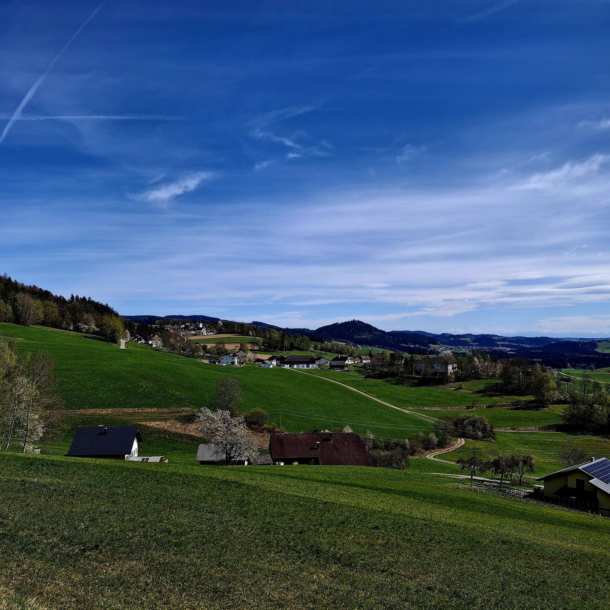
Best mountain peaks around Sankt Oswald bei Haslach are characterized by gently rolling hills, dense forests, and granite rock formations, typical of the Mühlviertel region. The main town of Sankt Oswald bei Haslach itself lies at an elevation of 658 meters, with the highest point within the municipality reaching 750 meters above sea level. While not traditional alpine peaks, the surrounding Mühlviertel region offers numerous elevations and extensive hiking opportunities. This area is known for its diverse landscapes, featuring a mosaic of forests, meadows, and unique granite formations.
Best mountain peaks around Sankt Oswald bei Haslach
- The most popular mountain peaks is Bärenstein Summit and Rock Formations, a summit that offers terrific panoramic views, extending as far as the Alps on clear days. The ascent to its imposing summit cross requires surefootedness in certain sections.
- Another must-see spot is Günterreiter-Fös'n summit cross, a summit and natural monument. This location marks the highest point in the municipality of Sankt Oswald bei Haslach, situated directly on the Czech border, featuring a beautiful wooden cross and a summit book.
- Visitors also love Hochbühel Summit (877 m), an intermediate summit within a forest. This summit, while lacking an official trail or summit cross, is adorned with a few cairns in its summit area.
- Sankt Oswald bei Haslach is known for its forested summits, granite rock formations, and viewpoints. The region offers a variety of mountain peaks to see and explore, ranging from gentle hills to more challenging elevations.
- The mountain peaks around Sankt Oswald bei Haslach are appreciated by the komoot community, with 249 upvotes and 202 photos shared by visitors.
Last updated: October 13, 2026
Bärenstein Summit and Rock Formations
Highlight • Summit
Translated by Google •
Tip by

Cooling stone
Highlight • Viewpoint
A beautiful hike from all sides and a fantastic view
Translated by Google •
Tip by

Sign up now to discover places like this
Get recommendations on the best single tracks, peaks, & plenty of other exciting outdoor places.
Moldaublick Observation Tower
Highlight • Viewpoint
Translated by Google •
Tip by

Günterreiter-Fös'n summit cross
Highlight • Summit
A beautiful wooden cross with iron decoration is on the rock and there is also a summit book.
Translated by Google •
Tip by
Bärenstein Summit and Start of Rupertiweg 10
Highlight • Summit
Translated by Google •
Tip by
Sign up for free to discover even more peaks around Sankt Oswald bei Haslach.
Already have an account?
Start today with a free account
Your next adventure awaits.
Popular around Sankt Oswald bei Haslach
Tips from the Community

It is known for its natural location and panoramic views
5
0

This can be easily combined with the Bavarian floodplain hike: https://www.komoot.com/de-de/tour/2797886630
0
0

Beautiful viewpoint and wonderful rest area just below!👍
3
0

Highest point in the municipality of Sankt Oswald near Haslach, directly on the Czech border. A beautiful wooden cross with iron decoration is on the rock and there is also a summit book.
3
0

By the way, not a via ferrata, but shorter sport climbing routes.
3
0
The Kühstein 710m The Kühstein, located between Oberpeilstein and Meisingeröd, has become a beautiful destination. Several hiking trails also meet here. The somewhat grim face on the southeast side doesn't stop climbers from practicing on the rocks. Nevertheless, this rock castle has retained its old historical grandeur. Our prehistoric ancestors used the large bowl on the summit for sacrifice. They also came here to select their bards. Five pines adorn the summit level, they are about 140 years old. To the northeast you have a good view of the small Mühltal valley, and you can also enjoy the sunrise. Two ramparts testify to an early castle around 1300 and around 1600 there was a wooden chapel at the foot of the rock. The Kühstein is energetically connected to the nearby Bründlstein. (https://www.muehlviertel.at/oesterreich-poi/detail/430015314/kuehstein.html)
3
0

Beautiful hike to the Kühstein suitable for all age groups.
1
0
Frequently Asked Questions
What kind of mountain peaks can I expect to find around Sankt Oswald bei Haslach?
The region around Sankt Oswald bei Haslach, part of the Mühlviertel, is characterized by gently rolling hills, dense forests, and unique granite rock formations, rather than traditional towering alpine peaks. While the main town is at 658 meters, the highest point within the municipality reaches 750 meters. The broader Mühlviertel offers higher elevations and extensive hiking opportunities.
Which are the most popular mountain peaks or elevated points to visit in the area?
Among the most popular elevated points is Bärenstein Summit and Rock Formations, an excursion mountain at 1,077 meters offering terrific panoramic views. Another significant spot is Günterreiter-Fös'n summit cross, which marks the highest point in the municipality of Sankt Oswald bei Haslach, directly on the Czech border.
Are there any challenging mountain climbs or hikes near Sankt Oswald bei Haslach?
While the region is not known for alpine climbing, the ascent to the Bärenstein Summit and Rock Formations requires surefootedness in certain sections due to its imposing summit cross and rock formations. The Mühlviertel region generally offers a variety of trails, some of which can be quite demanding, especially over longer distances or in varied terrain.
What natural features can I see from the mountain peaks in this region?
From elevated points like Bärenstein Summit and Rock Formations, you can enjoy terrific panoramic views that, on a clear day, can extend as far south as the Alps. The region itself is known for its diverse landscapes, including dense forests, expansive meadows, and unique granite formations. You'll also encounter idyllic scenery along rivers like the Kleine, Große, and Steinerne Mühl.
Are there family-friendly hiking options around the peaks of Sankt Oswald bei Haslach?
Yes, the Mühlviertel region is a paradise for hiking enthusiasts and offers many trails suitable for families. The landscape of rolling hills and forests provides a pleasant environment for walks. While specific family-friendly highlights aren't detailed for peaks, the general character of the region's trails caters to various difficulty levels, making many accessible for families.
What is the best time of year to visit the mountain peaks and go hiking?
The Mühlviertel region is worth visiting at any time of the year, with the Bärenstein Summit and Rock Formations being an experience in every season. Spring and autumn offer pleasant temperatures and beautiful foliage, while summer is ideal for longer hikes. Winter hiking is also possible on designated trails, offering a different, tranquil experience.
What outdoor activities can I do near these mountain peaks?
Beyond hiking, the area around Sankt Oswald bei Haslach is excellent for other outdoor activities. You can explore numerous running trails, such as the 'Bayrische Au loop' or 'Stiftergarten – Schlägler Pond loop'. Cycling is also popular, with routes like the 'View of the Lipno Reservoir – View of Frymburk loop' or road cycling options like the 'Lipno Dam – Horní Planá Cycle Path loop'. You can find more details on these activities on the Running Trails around Sankt Oswald bei Haslach, Cycling around Sankt Oswald bei Haslach, and Road Cycling Routes around Sankt Oswald bei Haslach guide pages.
Are there any cultural or historical routes that incorporate the elevated areas?
Yes, the region is home to paths like parts of the Way of St. James (Jakobsweg), which includes a section from St. Oswald bei Haslach to Aigen-Schlägl. These routes combine natural beauty with spiritual and historical significance. You can also find detours along historic features like the steep section of the Schwarzenbergisches Schwemmkanal (a historic timber canal).
What do visitors enjoy most about the mountain peaks and elevated points in Sankt Oswald bei Haslach?
Visitors particularly appreciate the terrific panoramic views from summits like Bärenstein Summit and Rock Formations. The unique granite rock formations and the sense of peace and quiet found on the trails are also highly valued. Many enjoy the diverse landscapes of dense forests and expansive meadows, making it a true paradise for hiking enthusiasts.
Is there an easily accessible elevated point for a quick visit or a short walk?
The Günterreiter-Fös'n summit cross, marking the highest point in the municipality of Sankt Oswald bei Haslach, offers a beautiful wooden cross and a summit book. While it's an elevated point, the overall terrain in the immediate vicinity of Sankt Oswald bei Haslach consists of gently rolling hills, making many areas suitable for shorter, less strenuous walks.
Are there any hidden gem elevated spots or viewpoints worth discovering?
While not a traditional 'hidden gem' in the sense of being unknown, the Hochbühel Summit (877 m) is an intermediate summit within a forest. It lacks an official trail or summit cross but is adorned with a few cairns, offering a more secluded experience for those who enjoy exploring off the beaten path.
What is the highest point in the broader Mühlviertel region?
The highest point in the broader Mühlviertel region is the Plöckenstein, which reaches an elevation of 1,379 meters. It is a prominent feature of the Bohemian Forest Ridge and is known for its positive forest climate and diverse trails.
Most popular routes around Sankt Oswald bei Haslach
Most popular attractions around Sankt Oswald bei Haslach

Get inspired with the komoot mobile app


Explore more
See even more amazing summits around Sankt Oswald bei Haslach with these guides:
