The 3 Most Amazing Peaks in Parque Natural Do Fogo
Best mountain peaks in Parque Natural Do Fogo are characterized by dramatic volcanic landscapes and unique geological formations. The region is dominated by the active stratovolcano Pico do Fogo, which is the highest peak in Cape Verde. Visitors can explore extensive lava fields and the large semi-circular rock basin known as Chã das Caldeiras. This area offers a blend of natural beauty and geological significance, shaped by historical and recent volcanic activity.
Best mountain peaks in Parque Natural Do Fogo
- The most popular mountain peaks is Pico do Fogo, a volcano that offers a spectacular climb up to its crater rim at over 2700 meters. The ascent provides magnificent panoramic views from above the clouds.
- Another must-see spot is Pico Pequeno Crater, a volcano formed during the 1995 eruption of Pico do Fogo. Footprints lead to a saddle with views into the crater, offering a direct encounter with recent volcanic activity.
- Visitors also love Pico do Fogo, a stratovolcanic cone rising about 1200 meters above the Chã das Caldeiras. This peak is the highest in the Cape Verde Islands, standing at 2829 meters, and offers a challenging but rewarding hike.
- Parque Natural Do Fogo is known for volcanoes, summits, and natural monuments. The region features active stratovolcanoes and subsidiary craters, showcasing a variety of volcanic formations to see and explore.
- The mountain peaks in Parque Natural Do Fogo are appreciated by the komoot community, with 71 upvotes and 8 photos shared across 5 highlights.
Last updated: July 8, 2026
Pico do Fogo
Highlight • Volcano
Translated by Google •
Tip by

Pico do Fogo
Highlight • Volcano
A massive eruption from the main crater of the Pico in 1680 gave the island, then called "São Filipe", the name Fogo (English: "fire"), which it still uses today. Further eruptions followed in 1785, 1799, 1847, 1852, 1857 and 1951.
During the eruption on April 2, 1995, the lava flow of which was limited to the interior of the Chã das Caldeiras, a small secondary volcano (Pico Pequeno 1950 m) was formed at the western foot of the Pico. After the eruption of Pico Pequeno, large parts of the cultural landscape in the Caldeira were destroyed, and the 2000 inhabitants were temporarily evacuated.
On the morning of November 23, 2014, there was another eruption with ash and lava ejection at the same location as the 1995 eruption. The ongoing eruption destroyed the southern and central part of Portela and about 70% of the neighboring municipality of Bangaeira by December 7, 2014. The eruption increased in intensity and covered most of the hamlet of Portela with a lava flow that destroyed all the inhabitants' belongings. On February 8, 2015, the volcano stopped erupting again after 77 days.
Living conditions are still not easy, there is no public water or electricity supply. Emerging tourism and small-scale viticulture are the main sources of income. Pico is part of a nature reserve. For the strenuous but not particularly difficult hike to the summit, it is not necessary to be accompanied by a mountain guide. The town of Chã das Caldeiras is connected to São Filipe, the main town on the island of Fogo, by a road via Salto and Monte Largo and can be reached by taxi, car and shared taxis ("aluguer", once a day). Coffee, beans, oranges, bananas and corn, among other crops, are grown on the northeast slopes of the island. The eastern slope of Pico is not accessible. A road runs along the coastline past the volcano to Mosteiros through a very barren landscape. The volcano is clearly visible almost the entire way.
Translated by Google •
Tip by

Sign up now to discover places like this
Get recommendations on the best single tracks, peaks, & plenty of other exciting outdoor places.
Sign up for free
Pico Pequeno Crater
Highlight (Segment) • Volcano
Translated by Google •
Tip by
Pico do Fogo
Highlight • Volcano
Translated by Google •
Tip by
Ascent of Pico do Fogo
Highlight (Segment) • Volcano
We were with a guide but you can also do the climb without.
The fastest climb so far was 56 minutes by an athlete from the island. Our guide told us that some people have taken 6 hours to get to the top.
Translated by Google •
Tip by
Start today with a free account
Your next adventure awaits.
Login or Signup
Popular around Parque Natural Do Fogo
Tips from the Community

The climb is definitely worth it. And in the crater, there's smoke and a sulphurous smell.
0
0

Wire rope installed by Mustafa (Casa Marisa) with really nice brackets (hand-twisted)
1
0

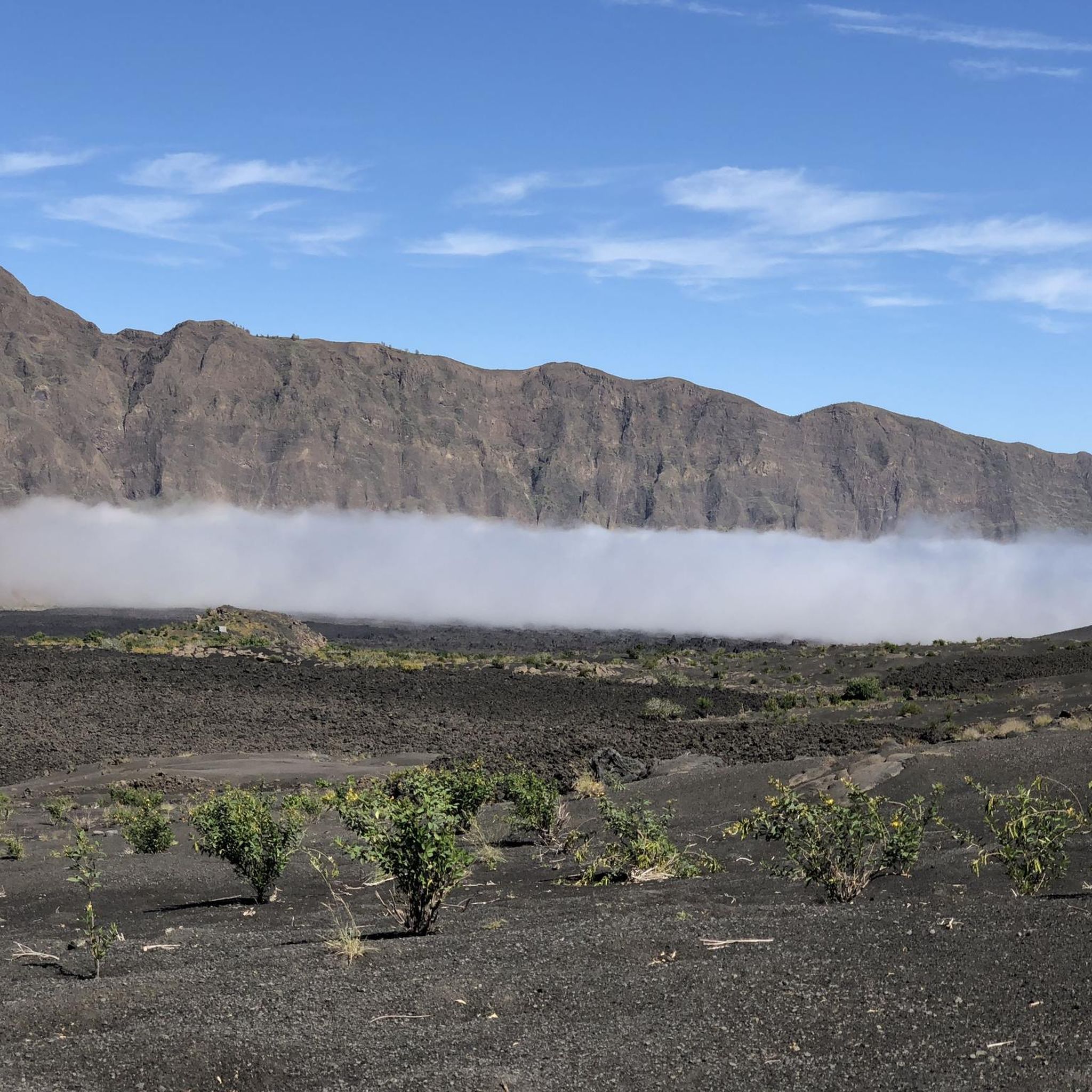
The Pico do Fogo is a stratovolcanic cone that rises about 1200 m above the east side of the Chã das Caldeiras. The Chã das Caldeiras is a semicircular rock basin at a height of between 1600 m and 1700 m above sea level with a diameter of about 9 km. The Chã das Caldeiras is not a classic collapse crater, but was created by an enormous landslide. After that, the Pico do Fogo was built up on the east side. To the south and west, the Chã das Caldeiras is dominated by almost vertical, 1000 m high rock walls, the Bordeira de Fogo. A massive eruption from the main crater of the Pico in 1680 gave the island, then called "São Filipe", the name Fogo (English: "fire"), which it still uses today. Further eruptions followed in 1785, 1799, 1847, 1852, 1857 and 1951. During the eruption on April 2, 1995, the lava flow of which was limited to the interior of the Chã das Caldeiras, a small secondary volcano (Pico Pequeno 1950 m) was formed at the western foot of the Pico. After the eruption of Pico Pequeno, large parts of the cultural landscape in the Caldeira were destroyed, and the 2000 inhabitants were temporarily evacuated. On the morning of November 23, 2014, there was another eruption with ash and lava ejection at the same location as the 1995 eruption. The ongoing eruption destroyed the southern and central part of Portela and about 70% of the neighboring municipality of Bangaeira by December 7, 2014. The eruption increased in intensity and covered most of the hamlet of Portela with a lava flow that destroyed all the inhabitants' belongings. On February 8, 2015, the volcano stopped erupting again after 77 days. Living conditions are still not easy, there is no public water or electricity supply. Emerging tourism and small-scale viticulture are the main sources of income. Pico is part of a nature reserve. For the strenuous but not particularly difficult hike to the summit, it is not necessary to be accompanied by a mountain guide. The town of Chã das Caldeiras is connected to São Filipe, the main town on the island of Fogo, by a road via Salto and Monte Largo and can be reached by taxi, car and shared taxis ("aluguer", once a day). Coffee, beans, oranges, bananas and corn, among other crops, are grown on the northeast slopes of the island. The eastern slope of Pico is not accessible. A road runs along the coastline past the volcano to Mosteiros through a very barren landscape. The volcano is clearly visible almost the entire way.
3
1
The climb has a few challenging sections, I really only recommend it to people who like mountain hiking and who don't mind climbing on loose scree and in narrow places. We were with a guide but you can also do the climb without. The fastest climb so far was 56 minutes by an athlete from the island. Our guide told us that some people have taken 6 hours to get to the top.
4
0

Sublime hike. The trace matches perfectly. Take a guide, it’s really important for them and to protect the natural park. In addition you will have the history of the Caldera. The ascent of the pico is now equipped with a via ferratta but remains impressive for those who are not used to climbing. Be careful, the beginning of the descent is a more dangerous part because there are a lot of unstable stones that can roll down on people below and the path is not very clear.
2
2

The ascent of this picture-perfect volcano is highly recommended for those in good physical condition from guided tours. Above all, the view of the Caldeira is fantastic. The descent over ash fields is fun (more of a slide).
6
1

The ascent of the Pico do Fogo is a must for every Cape Verde visitor. Challenging, but as a reward, there is a magnificent panoramic view from over 2800 m.
2
0

Spectacular climb up to the crater rim of Pico do Fogo at 2770 meters. The actual summit is considered brittle and is not climbed on the guided tours. Officially, however, the crater rim is considered an ascent of the Pico do Fogo.
5
0
Frequently Asked Questions
What are the most prominent mountain peaks to explore in Parque Natural do Fogo?
The most prominent and highest peak is Pico do Fogo, an active stratovolcano towering at 2,829 meters. Other significant formations include the more recent Pico Pequeno Crater and Pico Novo, which formed during the 1995 and 2014-2015 eruptions, respectively.
What makes climbing Pico do Fogo a unique experience?
Climbing Pico do Fogo offers spectacular panoramic views from over 2,800 meters, often above the clouds. It's considered one of Cape Verde's most challenging yet rewarding hikes, traversing unique volcanic terrain. A highlight for many is the fun descent by "ash surfing" down the ash fields.
Can I experience recent volcanic activity up close in Parque Natural do Fogo?
Yes, you can. A circular route around the Pico Pequeno Crater and Pico Novo provides a direct encounter with very recent volcanic activity. These craters formed during the 1995 and 2014-2015 eruptions, and in some spots, you can still find active fumaroles venting hot gases, with the ground remaining noticeably warm.
What kind of views can I expect from the mountain peaks in Parque Natural do Fogo?
From the summit of Pico do Fogo, you can expect magnificent panoramic views, often seeing other islands on clear days. The hike itself offers stunning vistas of the Chã das Caldeiras, a large semi-circular rock basin, and the dramatic 1,000-meter-high Bordeira rock walls.
What is the best time of year to visit the mountain peaks in Parque Natural do Fogo?
The dry season, typically from November to June, is generally considered the best time to visit. During these months, the weather is more stable, with less rain and clearer skies, which is ideal for hiking and enjoying the panoramic views from the peaks.
Are there any easy or moderate hiking trails near the mountain peaks for less experienced hikers?
While the ascent of Pico do Fogo is challenging, a circular route around the Pico Pequeno Crater and Pico Novo is considered moderate in difficulty and suitable for most fitness levels. For other options, you can explore easy hikes in Parque Natural Do Fogo, which include routes like the Portela Village – View of Pico do Fogo loop.
Do I need a guide to hike the mountain peaks in Parque Natural do Fogo?
While it's not strictly necessary to be accompanied by a mountain guide for the strenuous but not particularly difficult hike to the summit of Pico do Fogo, it is highly recommended. Guides provide valuable insights into the caldera's history and ensure safety, especially on challenging sections with loose scree or a via ferrata.
What kind of terrain should I expect when hiking the peaks?
You should expect varied volcanic terrain, including ash fields, petrified lava flows, and loose scree. The ascent of Pico do Fogo can involve challenging sections and narrow places, sometimes requiring climbing on unstable stones. The landscape is unique, haunting, and geologically significant.
Are there any specific permits or fees required to hike the mountain peaks?
The Pico do Fogo is part of a nature reserve. While the provided information doesn't explicitly state a permit fee for hiking, it's advisable to check with local authorities or your guide regarding any park entrance fees or regulations before your visit.
What other outdoor activities can I do near the mountain peaks in Parque Natural do Fogo?
Beyond peak ascents, the region offers various hiking opportunities. You can find routes like the Fogo Peak – Peak of Hell loop or the Pico Pequeno Crater – Portela Village loop. For more options, explore hiking in Parque Natural Do Fogo, which includes trails of varying difficulty.
What is the elevation of Pico do Fogo and how does it compare to other peaks?
Pico do Fogo is the highest peak in Cape Verde, standing at 2,829 meters (9,281 feet) above sea level. It is also the fourth highest in the North Atlantic, after Pico del Teide, Pico Sur, and Pico Basile.
Are there any cultural or historical aspects related to the mountain peaks?
The island itself was renamed Fogo (meaning "fire") after a massive eruption from Pico do Fogo in 1680. The communities in Chã das Caldeiras, living within the caldera, have a resilient culture, cultivating wine and coffee in the fertile volcanic soil, showcasing a unique blend of adventure, natural beauty, and cultural insight.
Most popular routes in Parque Natural Do Fogo
Most popular attractions in Parque Natural Do Fogo

Get inspired with the komoot mobile app


