The best running trails in Lago Titicaca
5.0
(3)
24
runners
3
runs
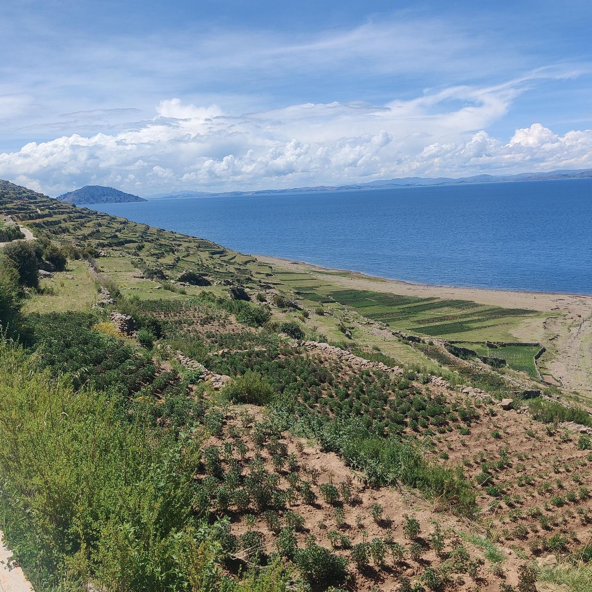
Jogging in Lago Titicaca offers a unique high-altitude experience, with routes situated at over 3,800 meters (12,500 feet) above sea level. The region is characterized by expansive lake views, varied terrain including dirt roads and hilly paths, and trails that traverse ancient agricultural terraces and island landscapes. Runners can expect a challenging environment set against the backdrop of the Andes Mountains.
Best jogging routes in Lago Titicaca
- The most popular jogging route is View of Lake Titicaca loop from Copacabana…
Last updated: July 6, 2026
5.0
(2)
10
runners
10.7km
01:23
200m
200m
Moderate run. Good fitness required. Mostly accessible paths. Some sure footedness required.
5.0
(1)
12
runners
7.14km
01:01
320m
320m
Hard run. Very good fitness required. Mostly paved surfaces. Suitable for all skill levels.

Sign up for free
2
runners
6.14km
00:49
270m
280m
Moderate run. Good fitness required. Mostly paved surfaces. Suitable for all skill levels.
Our route recommendations are based on thousands of hikes, rides, and runs completed by other people on komoot.
Start today with a free account
Your next adventure awaits.
Login or Signup
Popular around Lago Titicaca
Frequently Asked Questions
What is the typical terrain like for running around Lake Titicaca?
The region offers a varied terrain, from relatively flat dirt roads along the lake shore to hilly paths and trails that ascend to viewpoints. You'll find paths weaving through ancient agricultural terraces and connecting small villages, providing a mix of surfaces and experiences. The high altitude, over 3,800 meters (12,500 feet) above sea level, adds an extra challenge to any run.
How challenging is running at Lake Titicaca due to its elevation?
Running at Lake Titicaca presents a significant high-altitude challenge, as routes are situated at over 3,800 meters (12,500 feet) above sea level. Acclimatization is crucial for runners, but successfully completing a run here offers an unparalleled sense of accomplishment and can improve cardiovascular fitness. The routes range from moderate to difficult, with climbs offering rewarding panoramic views.
Are there any easy or beginner-friendly running routes in the Lake Titicaca region?
While many routes involve elevation, there are options that can be considered more moderate. For instance, the View of Lake Titicaca loop from Copacabana is a moderate 6.7-mile (10.7 km) trail that offers panoramic views without extreme difficulty, making it a good option for those looking for a less strenuous run after acclimatization.
What kind of scenic views or landmarks can I expect to see while running?
Runners can enjoy breathtaking, expansive views of the deep blue lake, often against a backdrop of clear skies and the snow-capped peaks of the Andes Mountains. Trails often pass through ancient agricultural terraces and offer glimpses into traditional Andean life. Specific routes, like the Cerro Ceroka loop from Copacabana, ascend to viewpoints above Copacabana, providing stunning vistas of the surrounding area. On Amantani Island, the Pachatata loop from Amantaní leads to the Pachatata peak, offering incredible lake views.
Are there any cultural sites or attractions near the running paths?
Yes, the region is rich in cultural attractions. Many trails weave through traditional villages and past ancient sites. For example, on Amantani Island, you can run near the Pachatata (Father Earth) and Pachamama Peak. The Taquile Island and Llachón Community also offer trails with cultural immersion. While not directly on running paths, the unique Uros Floating Islands are a major cultural attraction nearby.
Are there family-friendly running paths suitable for all ages?
While the high altitude requires caution for all, some of the more moderate lakeside paths or shorter loops can be suitable for families who are already acclimatized and accustomed to physical activity. Always consider the elevation and the fitness level of all family members before embarking on a run.
Can I bring my dog on the running trails in Lake Titicaca?
The general practice for bringing dogs on trails in the Lake Titicaca region can vary. While many rural paths might be accessible, it's always best to check local regulations, especially in protected areas or on island trails where local communities or wildlife might be present. Always ensure your dog is leashed and that you clean up after them.
How can I access the running routes, and is parking available?
Access to routes often depends on their location. For routes starting from towns like Copacabana, you can typically reach the trailheads by walking or taking local transport. Parking availability varies; in towns, you might find designated parking areas, while more remote trailheads may have limited or informal parking. For island trails, access is primarily by boat from mainland ports like Puno or Copacabana.
Is public transport an option to reach the running trails?
Yes, public transport is a common way to access different areas around Lake Titicaca. Buses and colectivos (shared taxis) connect major towns like Puno and Copacabana, and from there, local transport or walking can get you to many trailheads. To reach island trails, regular boat services operate from these main ports.
Are there amenities like cafes or places to rest near the running routes?
In towns like Copacabana or Puno, you'll find plenty of cafes, restaurants, and accommodation options. Near some popular trailheads, especially those close to villages or tourist areas like Amantani Island, you might find small local eateries or shops. However, on more remote sections of trails, amenities will be scarce, so it's always advisable to carry your own water and snacks.
What is the best time of year to go running in Lake Titicaca?
The dry season, typically from May to October, is generally considered the best time for running in Lake Titicaca. During these months, you can expect clearer skies, less rain, and more stable weather conditions, which are ideal for enjoying the panoramic views and navigating the trails. However, even during the dry season, temperatures can vary significantly between day and night, and the sun at high altitude is intense.
What are the typical weather conditions for running in the region?
Lake Titicaca experiences a high-altitude climate. Days can be sunny and mild, but temperatures drop significantly at night. The air is thin and dry. Expect strong sun exposure due to the altitude, so sunscreen and hats are essential. While the dry season (May-October) offers more stable weather, sudden changes can occur, so layering clothing is always recommended.
Are there circular running routes available?
Yes, several circular running routes are available in the Lake Titicaca region. For example, the View of Lake Titicaca loop from Copacabana is a popular 6.7-mile loop offering panoramic views. Another option is the Pachatata loop from Amantaní, a 3.8-mile trail on Amantani Island that takes you through its mountainous peaks.
Most popular routes in Lago Titicaca
Most popular attractions in Lago Titicaca

Get inspired with the komoot mobile app


Explore more
Browse the best Running Trails & Routes in other regions.
