The best walks and hikes in Lago Titicaca
4.3
(83)
493
hikers
3
hikes
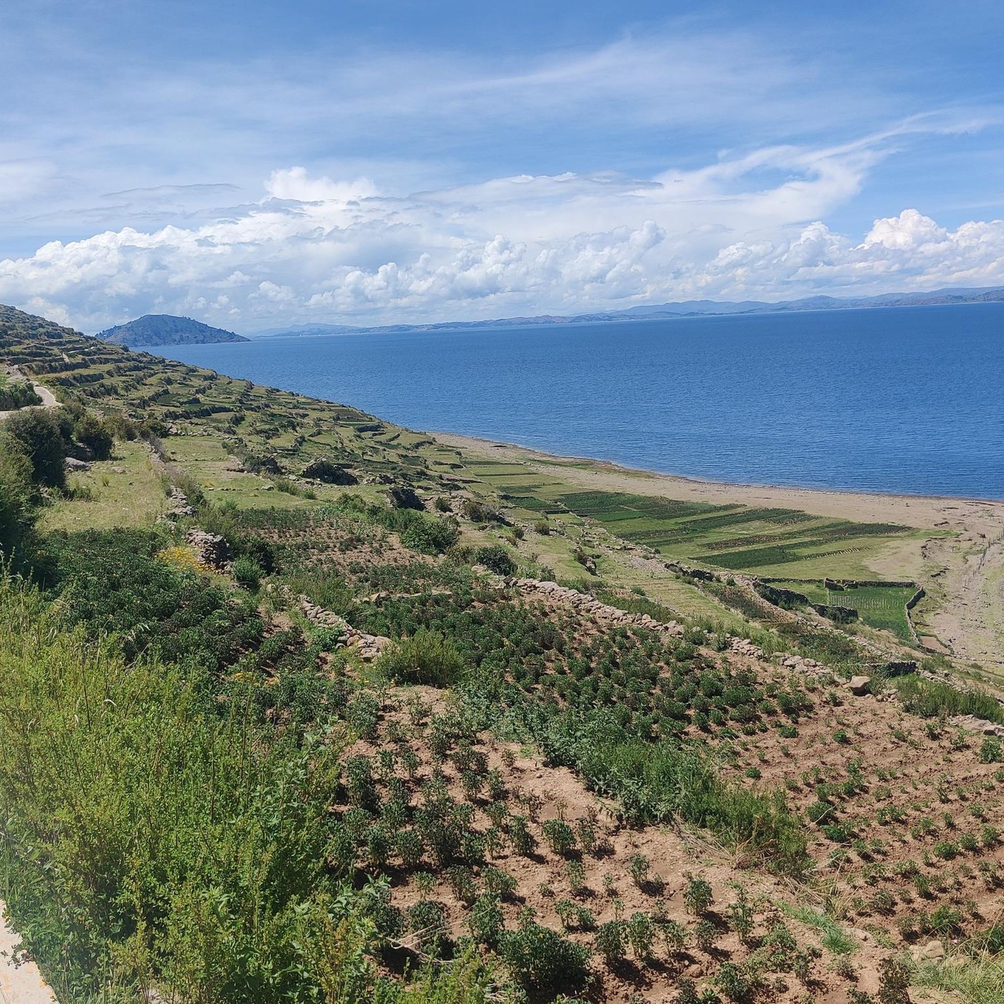
Hiking in Lago Titicaca offers routes across high-altitude Andean landscapes, characterized by the vast expanse of the lake and surrounding hills. The region features diverse terrain, including islands like Isla del Sol and Taquile, with trails winding through ancient agricultural terraces and traditional villages. Hikers can expect panoramic views of the lake and distant peaks.
Best hiking trails in Lago Titicaca
- The most popular hiking route is Playa de las Sirenas – Cerro Santa Barbara Junction loop from Isla del Sol, a 14.2 miles (22.8 km) trail that takes 6 hours 41 minutes to complete. This difficult route features significant elevation gain and traverses the northern part of Isla del Sol.
- Another top favourite among local hikers is View of Lake Titicaca – Carus Summit Cross loop from Hospedaje casa simion, a moderate 5.3 miles (8.5 km) path. This trail offers expansive views of Lake Titicaca and leads to a summit cross.
- Local hikers also love the Cerro Calvario – Plaza 2 de Febrero, Copacabana loop from Copacabana, a 3.6 miles (5.7 km) trail leading through the hills above Copacabana, often completed in about 1 hour 50 minutes.
- Hiking in Lago Titicaca is defined by high-altitude lake views, island trails, and cultural sites. The network offers options for easy walks to more challenging full-day excursions.
- The routes in Lago Titicaca are highly rated by the komoot community with an average score of 4.9 stars from over 70 reviews. More than 400 hikers have used komoot to explore Lago Titicaca's varied terrain.
Last updated: July 10, 2026
4.9
(81)
474
hikers
Hard hike. Very good fitness required. Easily-accessible paths. Suitable for all skill levels.
3.0
(1)
9
hikers
Moderate hike. Good fitness required. Easily-accessible paths. Suitable for all skill levels.

Sign up for free
5.0
(1)
10
hikers
5.81km
01:51
230m
230m
Easy hike. Great for any fitness level. Easily-accessible paths. Suitable for all skill levels.
Our route recommendations are based on thousands of hikes, rides, and runs completed by other people on komoot.
Start today with a free account
Your next adventure awaits.
Login or Signup
Popular around Lago Titicaca
Tips from the Community


Even though the climb is quite arduous due to the unusual altitude, it's worth it. A magnificent panorama of Lake Titicaca opens up.
0
0

A beautiful path has been created on the ridge, and the turnoff with a kiosk towers over the island.
1
0
If you don't know that you are almost 4000m above sea level, you feel like you are in the Caribbean.
1
0
The Basilica of Our Lady of Copacabana is a 17th-century Spanish colonial shrine that houses the statue of the Virgen de Copacabana. The statue can be rotated; on weekends, it faces the church, and during the week, it can be seen in the Virgin's house on the first floor.
3
0
Copacabana beach is located on a crescent-shaped bay that opens to the northwest and has its own flair. The jetties that extend into the lake look anything but stable, and numerous small boats rock in the cool waters of Lake Titicaca.
3
0
The Way of the Cross was built on this hill in the 1950s when the government decided that Copacabana should have more to offer its thousands of pilgrims than just the Basilica of the Virgin Mary.
2
0

It is better not to go in rainy weather, as the slippery steps of the steep stairs can be dangerous, especially when going down.
0
0
Frequently Asked Questions
How many hiking trails are there in Lago Titicaca?
Komoot features a selection of 3 curated hiking routes in Lago Titicaca, ranging from easy to difficult. These routes have been explored by over 400 hikers from the komoot community, who have collectively left over 70 reviews.
What are the typical landscapes and natural features I'll encounter while hiking around Lake Titicaca?
Hiking around Lake Titicaca offers a unique high-altitude experience, with trails winding through dramatic Andean landscapes. You'll find diverse terrain including mountains, valleys, and ancient agricultural terraces. The deep blue of the lake provides stunning panoramic views, often with snow-tipped peaks in the distance. Many routes explore the lake's islands, offering distinct natural beauty and cultural insights.
Are there any family-friendly hiking options in Lago Titicaca?
Yes, there are options suitable for families. The Cerro Calvario – Plaza 2 de Febrero, Copacabana loop from Copacabana is an easy 3.6-mile (5.7 km) trail that can be completed in under two hours. It offers stunning views of Copacabana and the lake, making it a great shorter option for families.
Can I hike on the islands of Lake Titicaca?
Absolutely. The islands are central to the hiking experience in Lake Titicaca. Taquile Island and Amantani Island on the Peruvian side, and Isla del Sol on the Bolivian side, all offer trails. These routes often lead through ancient ruins, agricultural terraces, and local communities, providing both natural beauty and cultural immersion. The Playa de las Sirenas – Cerro Santa Barbara Junction loop from Isla del Sol is a notable example, traversing the northern part of Isla del Sol.
What kind of cultural experiences can I expect on a hike in Lago Titicaca?
Hiking in Lago Titicaca is deeply intertwined with cultural immersion. Many trails pass through indigenous communities on islands like Taquile and Isla del Sol, offering opportunities to interact with locals and observe traditional ways of life. You'll encounter ancient Inca ruins, such as those on Isla del Sol, and witness unique traditions like the UNESCO-recognized textile weaving on Taquile Island. The Uros Floating Islands, while primarily visited by boat, also offer a fascinating cultural insight into the Uros people.
Are there any challenging hikes for experienced trekkers?
Yes, for experienced trekkers seeking a challenge, the Playa de las Sirenas – Cerro Santa Barbara Junction loop from Isla del Sol is a difficult 14.2-mile (22.8 km) route. It features significant elevation gain and takes approximately 6 hours 41 minutes to complete, offering a demanding yet rewarding experience across the island.
Is it possible to do circular hikes in Lago Titicaca?
Yes, several routes in Lago Titicaca are designed as loops. For example, the View of Lake Titicaca – Carus Summit Cross loop from Hospedaje casa simion is a moderate 5.3-mile (8.5 km) path that offers expansive views and leads to a summit cross. Another loop option is the Cerro Calvario – Plaza 2 de Febrero, Copacabana loop from Copacabana, which is an easier, shorter circular trail.
What about parking for hiking trails around Lake Titicaca?
Parking availability varies depending on your starting point. In towns like Puno and Copacabana, you can typically find parking facilities, especially if you're taking a boat to the islands. For trails directly accessible from the mainland, such as the Cerro Calvario hike in Copacabana, parking is generally available within the town. On the islands, vehicles are often not permitted, so you would park on the mainland before taking a boat.
How can I reach the hiking trails using public transport?
Public transportation is a common way to access the Lake Titicaca region. Buses connect major cities like Puno (Peru) and La Paz (Bolivia) to lakeside towns such as Copacabana. From these towns, local boats are the primary mode of transport to the islands like Isla del Sol, Taquile, and Amantani, where many of the hiking trails are located. Once on the islands, trails are typically accessible on foot from the docks.
Are there specific permits required for hiking on the islands like Isla del Sol or Taquile?
Yes, for hiking on the islands, particularly Isla del Sol and Taquile, local community fees or entrance tickets are often required. These fees contribute to the maintenance of the trails and support the local communities. You typically purchase these upon arrival at the island's port or at designated checkpoints along the trails. It's advisable to carry local currency (Peruvian Soles or Bolivian Bolivianos) for these payments.
What is the best time of year to go hiking in Lago Titicaca?
The dry season, from May to October, is generally considered the best time for hiking in Lago Titicaca. During these months, you can expect clearer skies, less rain, and more stable weather conditions, which are ideal for enjoying the panoramic views and high-altitude trails. While days are sunny, temperatures can drop significantly at night due to the elevation, so layering is recommended.
What nearby attractions or landmarks can I visit in Lago Titicaca?
Beyond the trails, Lake Titicaca offers several notable attractions. You can visit the unique Uros Floating Islands, explore the traditional communities on Taquile Island and Amantani Island, or discover ancient Inca sites like Pachatata (Father Earth) on Amantani. The Pachamama Peak on Amantani Island also offers stunning views.
Can I bring my dog on the hiking trails in Lago Titicaca?
While specific regulations for dogs on trails can vary, it's generally advisable to be cautious. Many trails pass through agricultural areas or local communities where dogs might not be welcomed, or local animals could be present. On the islands, local communities often have their own rules regarding pets. It's best to inquire locally or consider leaving your dog at your accommodation if you plan to hike extensively on the islands or through villages.
Where can I find amenities like accommodation or food near the hiking areas?
Major towns like Puno (Peru) and Copacabana (Bolivia) offer a wide range of accommodation, restaurants, and shops. On the islands, such as Isla del Sol, Taquile, and Amantani, you'll find more rustic guesthouses (hospedajes) and local eateries, often run by the island communities. These provide a more authentic experience, but amenities are simpler than in the larger towns. It's recommended to carry some snacks and water, especially for longer hikes.
What do other hikers say about the trails in Lago Titicaca?
The trails in Lago Titicaca are highly rated by the komoot community, with an average score of 4.9 stars from over 70 reviews. Hikers often praise the breathtaking high-altitude lake views, the unique cultural experiences on the islands, and the diverse terrain that ranges from easy walks to challenging full-day excursions.
Most popular routes in Lago Titicaca
Most popular attractions in Lago Titicaca

Get inspired with the komoot mobile app


Explore more
Browse the best Hikes in other regions.
