The best mountain hikes around Pleschinger Lake
35
hikers
11
hikes
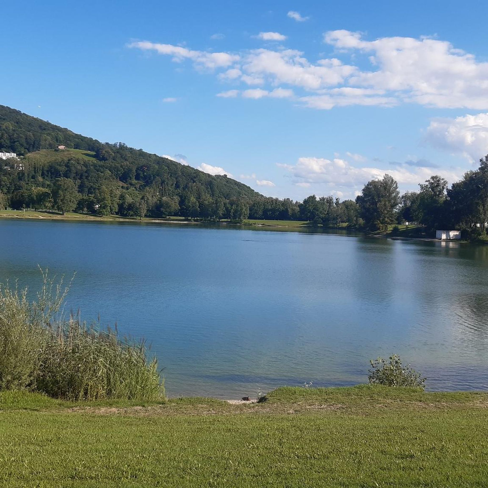
Mountaineering routes around Pleschinger Lake traverse a landscape characterized by rolling hills, dense woodlands, and scenic viewpoints overlooking the lake and surrounding areas. The region features varied terrain, including paths leading to summit crosses and through forested valleys. Elevation gains are moderate to significant, offering diverse challenges for mountaineers.
Best mountaineering routes around Pleschinger Lake
- The most popular mountaineering route is Pfenningberg Summit Cross – Finstergrabenbach Bike Route loop from Johannes Kepler University Linz, a 5.8 miles (9.3 km)…
Last updated: June 25, 2026
6
hikers
Moderate mountaineering route. Good fitness required. Easily-accessible paths. Suitable for all skill levels.
14
hikers
16.6km
05:11
660m
660m
Hard mountaineering route. Very good fitness required. Easily-accessible paths. Suitable for all skill levels.

Sign up for free
4
hikers
8.93km
02:51
360m
360m
Moderate mountaineering route. Good fitness required. Easily-accessible paths. Suitable for all skill levels.
3
hikers
9.10km
02:53
370m
370m
Moderate mountaineering route. Good fitness required. Easily-accessible paths. Suitable for all skill levels.
8
hikers
14.2km
04:15
350m
350m
Moderate mountaineering route. Good fitness required. Mostly accessible paths. Sure-footedness required.
Get access to more routes and recommendations from other explorers.
Sign up for free
Already have an account?
Our route recommendations are based on thousands of hikes, rides, and runs completed by other people on komoot.
Start today with a free account
Your next adventure awaits.
Login or Signup
Tips from the Community

Built in 1856, the Giselawarte is located at 927m above sea level.
0
0
Hiking trail above the Danube
1
0

Not far from the summit cross, right next to the path, colourfully decorated....
0
0
Modern summit cross in a beautiful clearing.
0
0

The trail doesn't lead to Steyr, of course, but towards Steyregg 🤪
0
0

The pilgrim's cross is easily accessible from the Kürnbergerwald parking lot. Today the path was a bit slippery in places due to the frozen and melted snow – hiking poles are advisable at the moment. But the panorama of the winter landscape is simply magnificent! 🤩 Definitely worth a hike.
0
0

A metallic cross on a stone base.
2
0
Frequently Asked Questions
What are the typical difficulty levels for mountaineering routes around Pleschinger Lake?
The mountaineering routes around Pleschinger Lake offer a range of difficulties. You'll find options from moderate ascents, such as the Pfenningberg Summit Cross – Finstergrabenbach Bike Route loop from Johannes Kepler University Linz, to more difficult climbs like the Gis Transmitter and Rest Area – Giselawarte loop from St. Magdalena. Overall, the region features varied terrain suitable for different experience levels.
Are there any family-friendly mountaineering routes near Pleschinger Lake?
While specific 'family-friendly' designations aren't always clear-cut, routes with moderate difficulty and shorter distances are generally more suitable. For instance, the Three Beeches Cross – Pfenningberg Summit Cross loop from Steyregg is a moderate 5.5-mile (8.9 km) trail that takes about 2 hours 50 minutes, offering a pleasant experience through forested hills.
What kind of views can I expect on mountaineering trails around Pleschinger Lake?
Mountaineering routes in this region are known for their scenic viewpoints. Many trails lead to summit crosses or elevated points, providing expansive vistas of Pleschinger Lake and the surrounding landscape. For example, the Pfenningberg Summit Cross – Finstergrabenbach Bike Route loop offers rewarding views from its summit cross.
Are there any circular mountaineering routes available?
Yes, many of the mountaineering routes around Pleschinger Lake are designed as loops, allowing you to start and end at the same point. Examples include the Pfenningberg Summit Cross – Finstergrabenbach Bike Route loop and the Three Beeches Cross – Pfenningberg Summit Cross loop, both offering a complete circuit.
How long do mountaineering trails typically take to complete in this area?
The duration of mountaineering trails varies depending on their length and difficulty. You can find routes that take around 2 hours 50 minutes, such as the Three Beeches Cross – Pfenningberg Summit Cross loop (5.5 miles / 8.9 km), up to longer, more challenging options like the Gis Transmitter and Rest Area – Giselawarte loop, which is 10.2 miles (16.5 km) and can take significantly longer.
What is the best time of year for mountaineering around Pleschinger Lake?
The region around Pleschinger Lake is generally enjoyable for mountaineering from spring through autumn, when the weather is milder and trails are clear. While some routes might be accessible in winter, conditions can be challenging due to snow and ice, requiring appropriate gear and caution.
Are there any hidden gems or less-trafficked routes for mountaineering near Pleschinger Lake?
While specific 'hidden gems' are often discovered by local exploration, routes like the Prinzenweg viewing point – Kürnbergkreuz loop from Leonding, a moderate 8.8-mile (14.2 km) trail, might offer a quieter experience compared to the most popular options, leading through varied terrain to a viewing point and cross.
What should I wear for mountaineering around Pleschinger Lake?
Given the varied terrain, including forested hills and moderate to significant elevation gains, it's advisable to wear sturdy hiking boots with good ankle support. Layered clothing is recommended to adapt to changing weather conditions, and bringing rain gear is always a good idea, especially in mountainous areas. Don't forget water, snacks, and sun protection.
How many mountaineering routes are available in the Pleschinger Lake area?
There are over 10 mountaineering routes documented around Pleschinger Lake on komoot, offering a diverse range of experiences for hikers. These include 2 easy, 10 moderate, and 2 difficult trails, catering to various skill levels.
What do other mountaineers enjoy most about the routes near Pleschinger Lake?
The komoot community frequently praises the varied terrain, which includes rolling hills and dense woodlands, as well as the rewarding views from summit crosses and elevated points. The network of trails offers options for different ability levels, making it a versatile destination for mountaineers.
Are there options for beginner mountaineers around Pleschinger Lake?
Yes, there are routes suitable for beginners. While most routes are classified as moderate, there are 2 easy routes available. These trails typically feature less elevation gain and shorter distances, providing a good introduction to mountaineering in the region.
What kind of terrain can I expect on these mountaineering routes?
The terrain around Pleschinger Lake is characterized by rolling hills, dense woodlands, and paths leading to summit crosses. You'll encounter varied surfaces, from forest paths to more open sections, with elevation gains ranging from moderate to significant, offering a diverse hiking experience.
Most popular routes around Pleschinger Lake

Get inspired with the komoot mobile app


Explore more
Browse the best Mountain Hikes & Routes in other regions.
