Easy hikes and walks around Weitersfelden
4.6
(2031)
10,869
hikers
456
hikes
Easy hiking trails around Weitersfelden traverse a landscape characterized by rolling hills and green forests, situated at an elevation of 733 meters within the Mühlviertler Alm region. The area features the confluence of the White and Black Aist rivers, offering scenic spots. Numerous natural monuments, including unique rock formations like "Lochsteine" and "Pechölsteine," are present throughout the municipal area, which is approximately 70% covered by forests.
Best easy hiking trails around Weitersfelden
- The most popular easy hiking route is Ursprung…
Last updated: October 17, 2026
3.8
(6)
23
hikers
6.13km
01:46
160m
160m
Easy hike. Great for any fitness level. Easily-accessible paths. Suitable for all skill levels.
3.0
(2)
22
hikers
5.99km
01:43
140m
140m
Easy hike. Great for any fitness level. Easily-accessible paths. Suitable for all skill levels.

4.5
(2)
10
hikers
5.45km
01:35
150m
150m
Easy hike. Great for any fitness level. Easily-accessible paths. Suitable for all skill levels.
5.0
(2)
14
hikers
2.45km
00:42
60m
60m
Easy hike. Great for any fitness level. Easily-accessible paths. Suitable for all skill levels.
5.0
(2)
7
hikers
Easy hike. Great for any fitness level. Easily-accessible paths. Suitable for all skill levels.
Get access to more routes and recommendations from other explorers.
Already have an account?
Our route recommendations are based on thousands of hikes, rides, and runs completed by other people on komoot.
Start today with a free account
Your next adventure awaits.
Popular around Weitersfelden
Other adventures around Weitersfelden

Tips from the Community


Beautifully converted hayloft with modern and rustic features & excellent food
0
0
From the plateau, there's a beautiful view of the west side—mostly nature, with a few houses/settlements. The "bridges" over the cracks between the rocks are sturdy, but don't trust the wooden railing.
0
0

Great view!! A great place to enjoy everything
0
0
Because this is simply a great idea and the drinks for 2 euros + 0.20 cents (deposit) are also cool!
0
0

The Johannesweg always offers amazing views of the towns along the way. Just like this "photo frame" shows the town of Weitersfelden. The "benches" invite you to linger and enjoy.😍 Really very well done.👌🏼
1
0

The meadow path uphill from Langfirling is a very beautiful section with a view of the stage destination.
1
0

There is also a phallus stone near St. Thomas am Blasestein --> https://www.komoot.de/highlight/4227824 One can argue about which of the two is more like a phallus. I think neither of them. ;-) But if I had to choose, it would be this one.
6
0
Frequently Asked Questions
How many easy hiking trails are available around Weitersfelden?
Weitersfelden offers a wide selection of easy hiking trails, with nearly 200 routes specifically categorized as easy. These trails traverse rolling hills and green forests, providing accessible options for various fitness levels.
What kind of natural features can I expect to see on easy hikes in Weitersfelden?
The region is rich in natural beauty, featuring diverse landscapes and geological curiosities. You can encounter unique rock formations such as "Lochsteine," "Pechölsteine," and "Schüssel- oder Schalensteine." The confluence of the White and Black Aist rivers, known as the "Zwischenstromwies'n," also offers scenic spots. For example, the Pechölstein Natural Monument – Rehberg Summit Viewpoint loop leads through forested areas to one of these natural monuments.
Are there any easy circular walks in Weitersfelden?
Yes, many of the easy hiking trails in Weitersfelden are circular routes, perfect for a relaxed day out. A popular option is the Weitersfelden Town Center loop from Weitersfelden, which is an easy 6.0 km path exploring the village and its surroundings.
Are the easy hiking trails in Weitersfelden suitable for families with children?
Absolutely. The easy trails in Weitersfelden are generally well-suited for families. The gentle terrain and numerous interesting natural monuments, like the unique rock formations, provide engaging points of interest for younger hikers. Consider routes that pass by attractions such as the Herrgottssitz Rock Formation for an added element of discovery.
Can I bring my dog on the easy hikes around Weitersfelden?
Yes, dogs are generally welcome on the easy hiking trails in Weitersfelden. The extensive forest cover provides plenty of shade, which can be pleasant for pets. Please ensure your dog is kept on a leash and that you clean up after them to preserve the natural environment for everyone.
What do other hikers enjoy most about hiking in Weitersfelden?
The hiking routes in Weitersfelden are highly rated by the komoot community, with an average score of 4.5 stars from over 600 reviews. Hikers often praise the unobtrusive beauty of the landscape, the quiet woodlands, and the well-maintained paths that lead to unique natural monuments and scenic viewpoints.
Are there any viewpoints or scenic spots on the easy trails?
Yes, several easy trails offer rewarding viewpoints. For instance, the Rehberg Viewpoint – Rehberg Summit Viewpoint loop from Langfirling is an easy 5.4 km route that takes you to scenic spots. The region's rolling hills also naturally provide many elevated positions for panoramic views.
What is the best time of year to go on an easy hike in Weitersfelden?
Weitersfelden is beautiful throughout the warmer months. Spring and autumn offer pleasant temperatures and vibrant colors, while summer provides ample shade from the region's extensive forests, which cover about 70% of the municipal area. Even on warm days, you can find comfortable hiking conditions.
Are there any historical or cultural landmarks accessible via easy hikes?
While many easy hikes focus on natural features, the region also has cultural significance. The village itself features the Late Gothic Parish Church of St. Ulrich and a historical Pranger (pillory). Some longer, more reflective paths like the Johannesweg, which has a Kneipp Water Treading Spot, also pass through the area, though not all sections are categorized as easy.
Where can I find refreshment stops or places to rest near the easy trails?
While specific refreshment stops directly on every easy trail might vary, the village of Weitersfelden and surrounding areas offer options. The Wollness Trail (Wollnessweg Nr. 54), for example, is known to have refreshment stops like the "Wollstub'n." For a broader selection, you can find cafes and pubs in the main village center.
Are there any specific easy trails that lead to water features like springs or ponds?
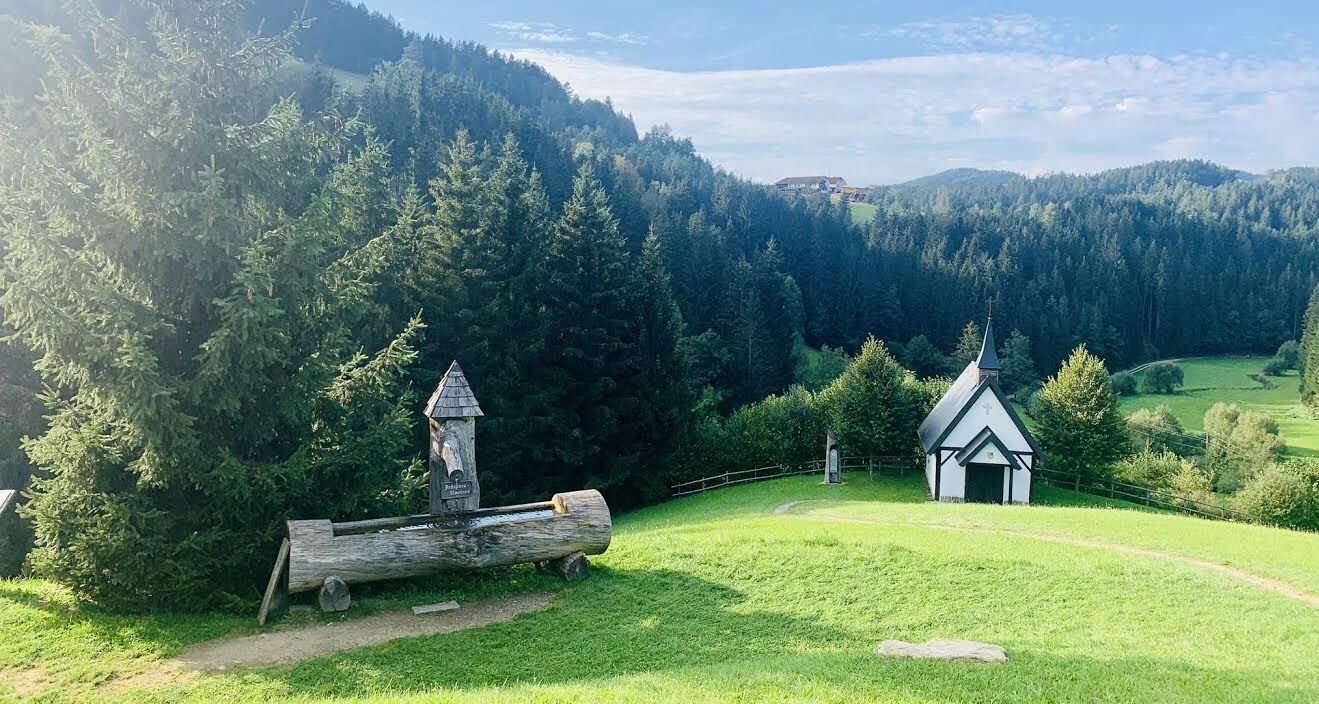
Yes, you can find easy trails that incorporate water features. The Ursprung Chapel – The Augenbründl Spring loop from Kaltenberg is a 6.1 km easy route that connects a chapel with a natural spring, offering a refreshing stop along the way.
What is the typical duration for an easy hike in Weitersfelden?
Most easy hikes in Weitersfelden can be completed within 1.5 to 2 hours. For example, the The Augenbründl Spring – Ursprung Chapel loop from Kaltenberg is a shorter easy route, taking approximately 40 minutes to complete, making it ideal for a quick stroll.
Most popular routes around Weitersfelden
Most popular attractions around Weitersfelden

Get inspired with the komoot mobile app


Explore more
Browse the best Hikes in other regions.
