The best MTB trails around Poncey-Sur-L'Ignon
5.0
(2)
32
riders
18
rides
Mountain biking around Poncey-Sur-L'Ignon offers diverse landscapes, from deciduous forests and coniferous stands to open farmland and river valleys. The region is characterized by varied terrain, including paths along cliff edges and through meadows, providing a range of experiences for mountain bikers. Notable natural features like the Sources de l'Ignon, a Natura 2000 site, contribute to the ecological richness and scenic routes. The area also features the Source of the Seine, surrounded by expansive meadows.
Best mountain bike trails around…
Last updated: July 1, 2026
5.0
(2)
18
riders
40.2km
03:23
550m
550m
Moderate mountain bike ride. Good fitness required. Advanced riding skills necessary.
3
riders
33.7km
02:27
470m
470m
Moderate mountain bike ride. Good fitness required. Suitable for all skill levels.

Sign up for free
3
riders
25.2km
02:00
230m
230m
Moderate mountain bike ride. Great for any fitness level. Advanced riding skills necessary.
7
riders
24.9km
02:03
250m
250m
Moderate mountain bike ride. Good fitness required. Suitable for all skill levels.
2
riders
26.6km
01:35
220m
220m
Easy mountain bike ride. Great for any fitness level. Suitable for all skill levels.
Get access to more routes and recommendations from other explorers.
Sign up for free
Already have an account?
Our route recommendations are based on thousands of hikes, rides, and runs completed by other people on komoot.
Start today with a free account
Your next adventure awaits.
Login or Signup
Tips from the Community

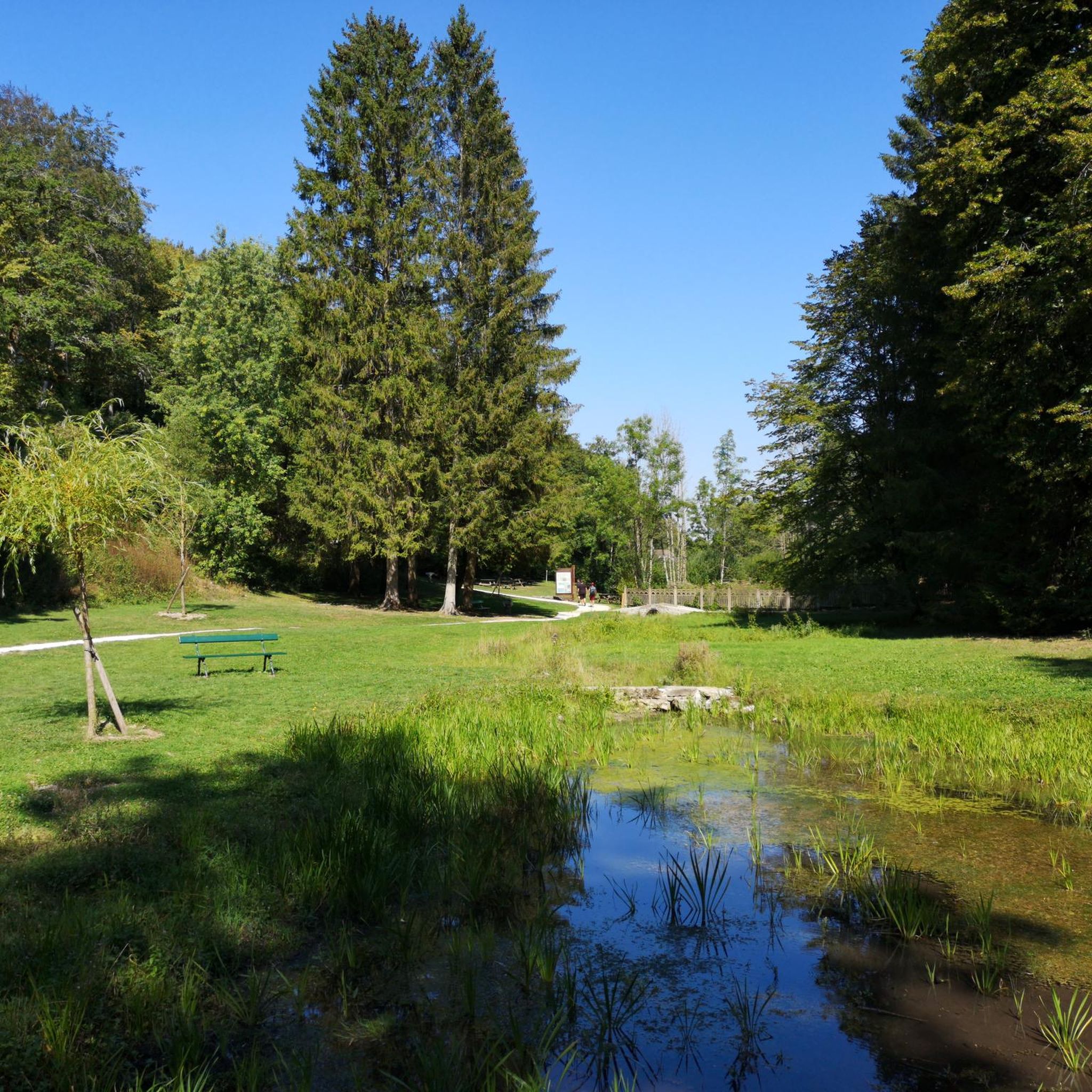
A bucolic, clean, well-maintained, and shaded spot, with tables and trash cans for picnicking. It's officially a Paris commune, but it looks nothing like Paris.
0
0

There's a signposted and very beautiful circular trail that includes the source of the Seine. Learn more on the official website here: https://www.cotedor-randonnee.com/
1
0

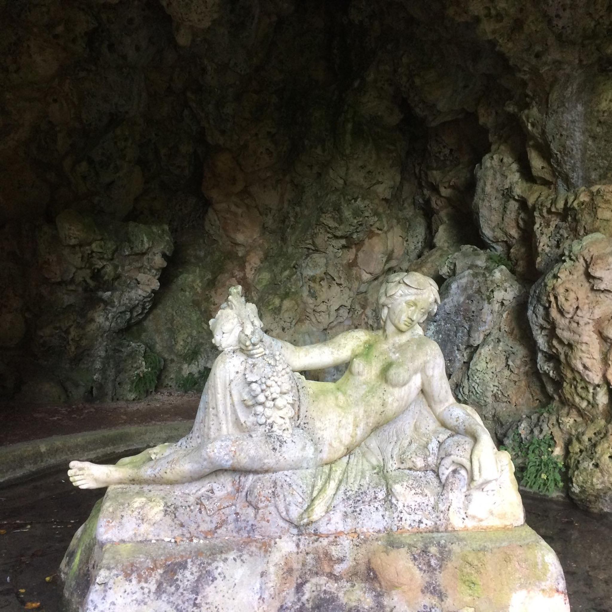
Wikipedia reports: "The source of the Seine is located on the plateau of Langres, 25 km north-west of Dijon in the Côte-d'Or department in the Bourgogne-Franche-Comté region, 470 m above sea level. A special feature is that the sources of the Seine were the property of the city of Paris from 1864 onwards. An artificial grotto was built a year later to protect the main source and a statue of a nymph was erected to symbolize the river. Paris has since returned the property to the region. Near the source are the remains of a Gallo-Roman temple in which a Dea Sequana (Latin goddess of the Seine) was worshipped. The archaeological finds from this are now in the archaeological department of the Musée des Beaux-Arts in Dijon."
2
1

The Seine is a river 777 km long and flows into the English Channel.
4
0

Here we find a clearing with a cave and a sculpture around the source of the Seine. The large lawn near the grotto is ideal for playing Frisbee or having a picnic. Wooden tables are also available.
0
0

This is where one of France's most famous rivers begins. With its meadows and picnic benches, it is a perfect stopover for your race.
2
0

This is where the source of the Seine rises in a stone grotto. Surrounded by a small but very well-kept outdoor area, with hiking trails, benches, statues and information boards.
3
2

This is an original activity... shared in KOMOOT. What a discovery that there is an underground world in the region?!... Impressive photos of experienced speleologists! Thank you for sharing, we want more!!!
2
1
Frequently Asked Questions
How many mountain bike trails are available in Poncey-Sur-L'Ignon?
There are 16 mountain bike trails around Poncey-Sur-L'Ignon, offering a variety of experiences for different skill levels. You'll find a mix of easy and moderate routes to explore the diverse landscapes.
Are there easy mountain bike trails suitable for beginners or families?
Yes, Poncey-Sur-L'Ignon offers 3 easy mountain bike trails perfect for beginners or families. An example is the Source of the Seine loop from Bligny-le-Sec, which is 15.1 miles long and leads through woodlands and alongside the river's source.
What kind of terrain can I expect on mountain bike trails around Poncey-Sur-L'Ignon?
The terrain around Poncey-Sur-L'Ignon is quite varied, featuring deciduous forests, coniferous stands, open farmland, and river valleys. You can expect paths along cliff edges near Hauteroche, through meadows, and alongside natural features like the Sources de l'Ignon, a Natura 2000 site.
Are there any notable natural attractions or landmarks to see along the trails?
Absolutely. Many trails pass by significant natural attractions. You can visit the Source of the Seine, the origin of France's famous river, which is surrounded by a spacious meadow. Another notable site is the Gouffre de la Combe aux Prêtres, a cave system with a 25-meter deep shaft.
Can I find mountain bike trails that are loop routes?
Yes, many of the mountain bike trails in Poncey-Sur-L'Ignon are designed as loops, allowing you to start and finish at the same point. Examples include the Le Haut des Lavières – Source of the Seine loop from Côte-d'Or and the Source of the Seine – Thenissey Castle loop from Boux-sous-Salmaise.
What is the typical elevation gain on mountain bike trails in this area?
Elevation gain varies depending on the trail's difficulty. Easy routes like the Thenissey Castle loop from Boux-sous-Salmaise have around 220 meters of elevation gain. More moderate trails, such as the Source of the River Seine – Thenissey Castle loop from Bligny-le-Sec, can feature over 620 meters of ascent.
What do other mountain bikers say about the trails in Poncey-Sur-L'Ignon?
The trails in Poncey-Sur-L'Ignon are highly rated by the komoot community, with an average score of 5.0 stars. Mountain bikers often praise the varied terrain, from quiet woodlands to open fields, and the scenic routes that connect natural and historical points.
Is Poncey-Sur-L'Ignon suitable for advanced mountain bikers looking for a challenge?
While there are no trails explicitly rated as 'difficult' in our current selection, the region offers 13 moderate routes that provide a good challenge with significant elevation changes and varied terrain. The broader Burgundy region is also known for its diverse MTB itineraries, including cross-country options.
What is the best time of year to go mountain biking in Poncey-Sur-L'Ignon?
Poncey-Sur-L'Ignon is enjoyable for mountain biking throughout much of the year. Spring and autumn offer pleasant temperatures and beautiful scenery with changing foliage. Summer is also suitable, though it can be warmer, and winter can be an option depending on snow conditions, especially in forested areas.
Are there any historical sites or points of interest accessible by mountain bike?
Yes, several routes incorporate historical elements. For instance, the Source of the Seine – Thenissey Castle loop from Boux-sous-Salmaise connects historical points. You can also find the Pont Paul Lamarche, the first bridge spanning the Seine, near the river's source.
Are there options for longer mountain bike rides in the region?
Yes, there are several longer routes available. The Source of the River Seine – Thenissey Castle loop from Bligny-le-Sec is one of the longest, covering 41.7 kilometers (25.9 miles) and typically taking around 3 hours 18 minutes to complete.
Where can I find more information about mountain biking in the broader Burgundy region?
For more comprehensive information about mountain biking itineraries and trails across the wider Burgundy region, you can visit the official Burgundy Tourism website: Burgundy Tourism MTB Itineraries.
Most popular attractions around Poncey-Sur-L'Ignon

Get inspired with the komoot mobile app


Explore more
Browse the best MTB trails in other regions.
