The best waterfall hikes and walks in Rheinhänge Von Burg Gutenfels Bis Zur Loreley
4.6
(22912)
79,018
hikers
27
hikes
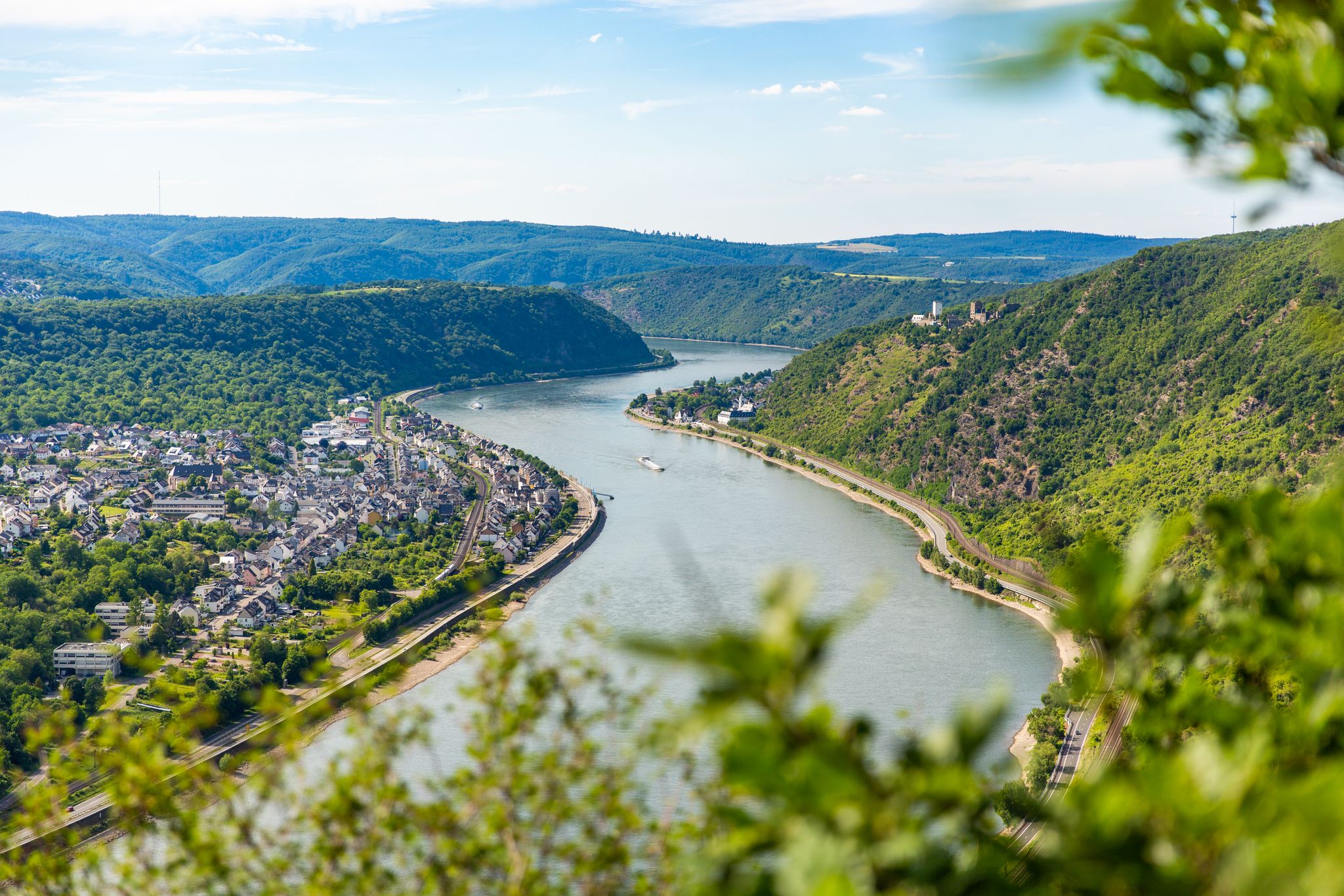
Waterfall hiking trails in Rheinhänge Von Burg Gutenfels Bis Zur Loreley traverse a landscape shaped by the Rhine River, featuring steep slopes, historic castles, and prominent rock formations. The region is characterized by its dramatic river valleys and forested hillsides, offering varied elevation changes. Hikers can expect paths that wind through dense woodlands and open viewpoints overlooking the river. This area provides a diverse natural environment for exploring waterfall hiking trails.
Best waterfall hiking trails in Rheinhänge Von Burg Gutenfels…
Last updated: October 12, 2026
4.7
(506)
1,719
hikers
17.6km
05:16
490m
490m
Hard hike. Very good fitness required. Sure-footedness, sturdy shoes and alpine experience required.
4.7
(136)
417
hikers
6.37km
01:55
190m
190m
Easy hike. Great for any fitness level. Easily-accessible paths. Suitable for all skill levels.

4.9
(66)
237
hikers
Hard hike. Very good fitness required. Sure-footedness, sturdy shoes and alpine experience required.
4.7
(47)
148
hikers
11.0km
03:18
330m
330m
Moderate hike. Good fitness required. Easily-accessible paths. Suitable for all skill levels.
4.7
(56)
183
hikers
11.7km
03:29
340m
350m
Moderate hike. Good fitness required. Easily-accessible paths. Suitable for all skill levels.
Get access to more routes and recommendations from other explorers.
Already have an account?
Our route recommendations are based on thousands of hikes, rides, and runs completed by other people on komoot.
Start today with a free account
Your next adventure awaits.
Popular around Rheinhänge Von Burg Gutenfels Bis Zur Loreley
Other adventures in Rheinhänge Von Burg Gutenfels Bis Zur Loreley

Tips from the Community

The castle is currently under renovation, unfortunately only partially accessible for visits, but still worth it, 6 euros well spent
0
0

Phenomenal viewpoint above the Middle Rhine Valley! Grandiose view of the Rhine, Oberwesel and the surrounding castles. Perfect photo stop directly on the RheinBurgenWeg – a real highlight of the region.
2
0

Viewpoint at Werlau with rest area and barbecue hut and view of Maus Castle. https://www.romantischer-rhein.de/a-aussichtspunkt-hartenberg
0
0

The valley is a natural, narrow valley with a gurgling stream in the center; this is the most beautiful section of the trail.
0
0
Hiking the Erzweg trail, the viewpoints along the Werlau Heights, at the edge of the slope overlooking the Rhine Valley, are strung together like pearls on a necklace. And they truly are pearls.
0
0
It sits imposingly above the valley and is always worth a visit.
0
0

The legend of the Seven Virgins of Oberwesel – in detail: https://www.der-rheinreisende.de/sagenhafte-sagen/die-sieben-jungfrauen-von-oberwesel/ or here – in brief: https://www.regionalgeschichte.net/mittelrhein/oberwesel/kulturdenkmaeler/die-sieben-jungfrauen.html
0
0

Maus Castle is a hilltop castle dating from the second half of the 14th century, belonging to the Electorate of Trier, located in the Middle Rhine Valley near Sankt Goarshausen in Rhineland-Palatinate. It lies at an elevation of 197.3 meters above sea level, overlooking the village of Wellmich, and has been part of the UNESCO World Heritage Site Upper Middle Rhine Valley since 2002.
1
0
Frequently Asked Questions
How many waterfall hiking trails are available in Rheinhänge Von Burg Gutenfels Bis Zur Loreley?
There are over 30 waterfall hiking trails in the Rheinhänge Von Burg Gutenfels Bis Zur Loreley region. These routes vary in difficulty and length, offering options for different preferences.
What is the general difficulty level of waterfall hikes in this region?
The waterfall hikes in Rheinhänge Von Burg Gutenfels Bis Zur Loreley offer a range of difficulties. You'll find 7 easy trails, 16 moderate routes, and 7 more challenging difficult hikes, ensuring there's something for every fitness level.
Are there any family-friendly waterfall hikes in Rheinhänge Von Burg Gutenfels Bis Zur Loreley?
Yes, there are several family-friendly options. For an accessible experience, consider the View of the Loreley Rock – View of Burg Katz loop from Sankt Goar, an easy 4.0-mile path that provides scenic riverside views suitable for most families.
What kind of views can I expect on waterfall hiking trails in Rheinhänge Von Burg Gutenfels Bis Zur Loreley?
The trails offer stunning views of the Rhine River, historic castles, and dramatic rock formations. You'll often find paths winding through dense woodlands with open viewpoints overlooking the river valley, such as the Felsenkanzel Viewpoint Overlooking the Rhine and the Loreley.
Are there any circular waterfall walks in the Rheinhänge Von Burg Gutenfels Bis Zur Loreley area?
Many of the trails in the region are designed as circular routes. An example is the View of Burg Katz – View of the Loreley Rock loop from Oberwesel, a challenging 9.3-mile loop offering panoramic views.
What do other hikers say about the trails in Rheinhänge Von Burg Gutenfels Bis Zur Loreley?
The komoot community highly rates the trails in this region, with an average score of 4.6 stars from over 4,600 reviews. Hikers frequently praise the diverse natural environment, the stunning river views, and the well-maintained paths that lead to iconic landmarks.
What are some notable landmarks or attractions near the waterfall hiking trails?
Beyond the waterfalls themselves, the region is rich in history and natural beauty. You can explore historic sites like Gutenfels Castle or visit natural highlights such as the Loreley Statue and the Loreley Cultural and Landscape Park.
What is a good moderate waterfall hike to consider?
For a moderate challenge, the View of Burg Katz – View of the Loreley Rock loop from St. Goar is an excellent choice. This 6.8-mile (10.9 km) route offers beautiful scenery without being overly strenuous.
What is the typical duration for a longer waterfall hike in this region?
Longer waterfall hikes can take several hours. For instance, the Spitzenstein Observation Tower – View of the Loreley Rock loop from Oberwesel is an 11.4-mile trail that typically takes around 5 hours and 37 minutes to complete.
Are there any trails that combine waterfall views with observation towers?
Yes, some routes offer both. The View of the Loreley Rock – Spitzenstein Observation Tower loop from St. Goar is a moderate 8.2-mile trail that leads to the Spitzenstein Observation Tower, providing elevated views of the landscape.
Most popular routes in Rheinhänge Von Burg Gutenfels Bis Zur Loreley
Most popular attractions in Rheinhänge Von Burg Gutenfels Bis Zur Loreley

Get inspired with the komoot mobile app


Explore more
Browse the best Hikes in other regions.
